Ticker for August 5, 2013
MESONET TICKER ... MESONET TICKER ... MESONET TICKER ... MESONET TICKER ...
August 5, 2013 August 5, 2013 August 5, 2013 August 5, 2013
Yeah, it's still summer
Despite the cool weather during July, it's still summer, and it can obviously
still get hot. All it takes is for that heat dome to slide back over the area,
which it has over the last few days. Now we're faced with not only the normal heat
from that area of high pressure, but also the added moisture the sun has been
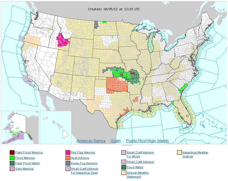
working on evaporating since the rain. Almost the entire state is under a heat
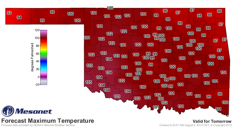
advisory with actual air temperatures expected in the 100-105 degrees range, and
heat indices in the 105-110 degrees range.
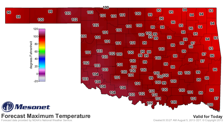
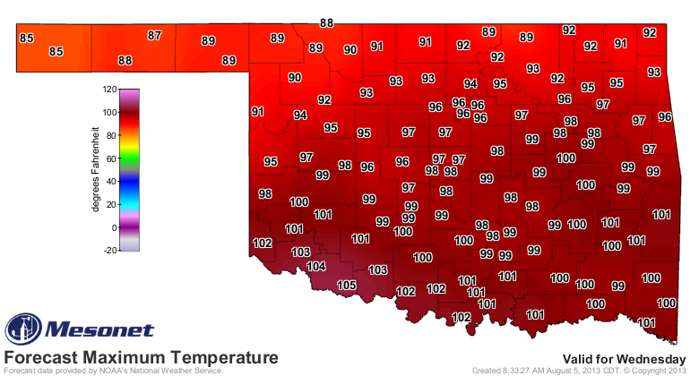
It will stay hot for the next couple of days before a cool front sags into the
state around Wednesday, bringing another chance of rain to mainly northern
Oklahoma.
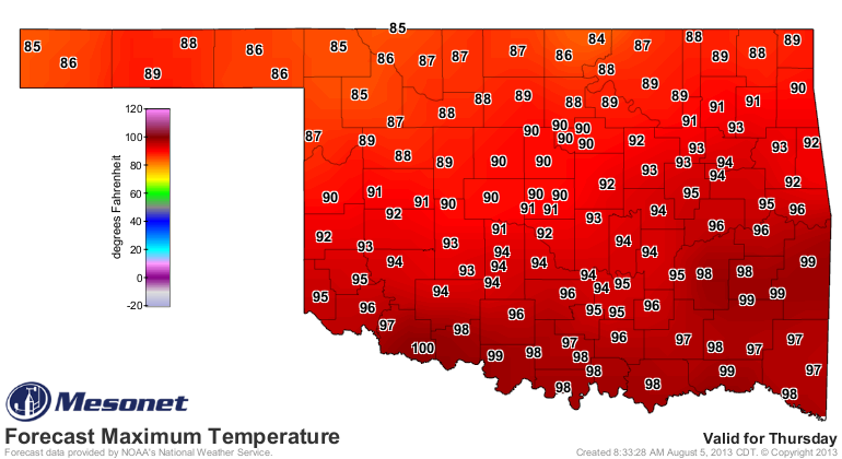
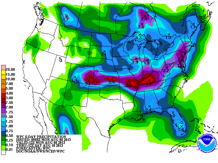
Notice the 5-day rain forecast still has the Panhandle painted in the 2-3 inch
category. It's gonna be close because it drops off pretty quickly to the south!
And let's not forget it has rained a bit across northern Oklahoma the last
couple of days, especially in the northeast (hence the flood warnings on the
NWS advisories map).
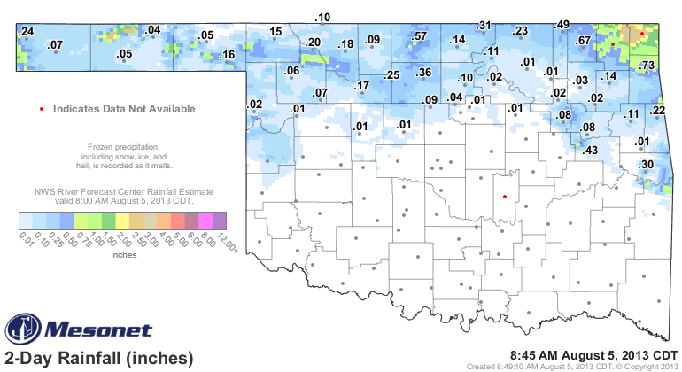
More drought relief where it wasn't really needed, but hopefully we can see
that spread to the west (how many times have I said that this year???).
Gary McManus
Associate State Climatologist
Oklahoma Climatological Survey
(405) 325-2253
gmcmanus@mesonet.org
August 5 in Mesonet History
| Record | Value | Station | Year |
|---|---|---|---|
| Maximum Temperature | 113°F | KIN2 | 2011 |
| Minimum Temperature | 52°F | KENT | 2021 |
| Maximum Rainfall | 4.57″ | NEWK | 2017 |
Mesonet records begin in 1994.
Search by Date
If you're a bit off, don't worry, because just like horseshoes, “almost” counts on the Ticker website!