Ticker for August 1, 2013
MESONET TICKER ... MESONET TICKER ... MESONET TICKER ... MESONET TICKER ...
August 1, 2013 August 1, 2013 August 1, 2013 August 1, 2013
An Uncommon July Brings Drought Relief
It was not the wettest July on record in Oklahoma, at least not on a statewide
basis. That mark belongs to 1950's statewide average of 9.26 inches. Nor was it
the coolest. That title is held by 1906's statewide average of 75.9 degrees.
Nevertheless, this July will be remembered as one of the wettest and mildest in
recent memory, especially compared to the blast furnace versions of the last few
summers. It featured a July 4th holiday with highs in the 80s and lows in the
50s, and enough rain to kick drought to the curb across much of the state.
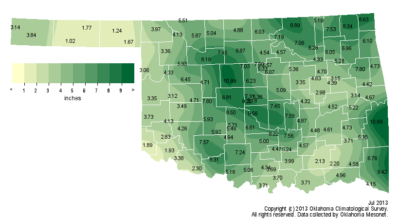
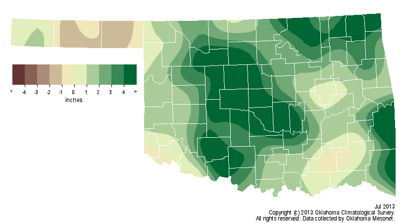
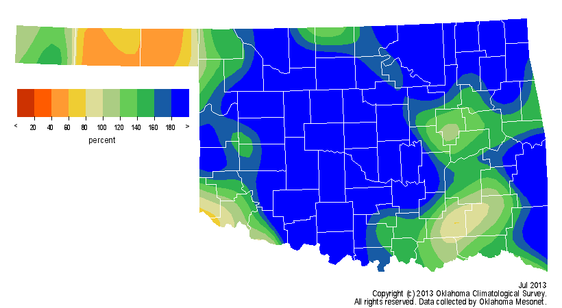
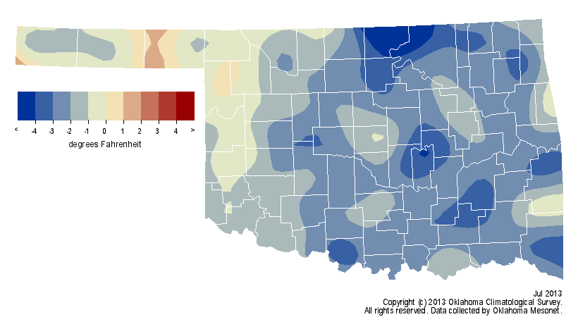
According to preliminary data from the Oklahoma Mesonet, July's statewide average
precipitation total was 5.11 inches, a surplus of 2.37 inches and ranked as the
15th wettest since records began in 1895.
The statewide average temperature was a very pleasant 79.6 degrees, 2 degrees
below normal and the 28th coolest July on record.
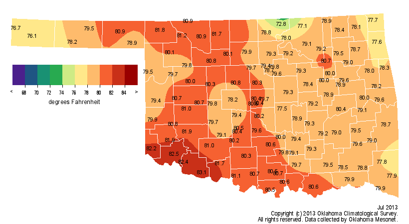
The highest temperature recorded during the month was 107 degrees at Alva,
Buffalo and Freedom on the ninth, and again at Grandfield on the 11th. The
lowest temperature reported was an unseasonably chilly 49 degrees at Seiling
on July 2.
While nearly all areas of the state received beneficial rain, a wide
discrepancy existed between locations. The Mesonet's Kingfisher site led the
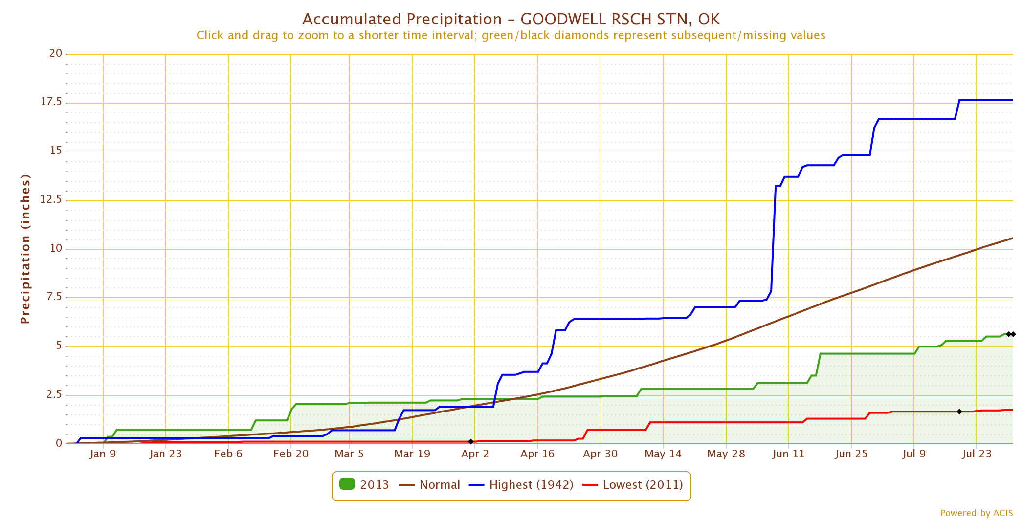
state with 10.99 inches of rainfall during July while Goodwell brought up the
rear at 1.02 inches. Oklahoma City's total of 9.84 inches, 6.91 inches above
normal, ranked this July as its second wettest on record, bested only by 1996's
11.9 inches.

That also keeps Oklahoma City on pace to have its wettest calendar year on
record with a January-July total of 41.69 inches, more than 3 inches ahead of
2007's total of 38.15 inches over the same period.

The calendar year record for Oklahoma City currently stands at 56.95 inches
from that same year of 2007. Records for Oklahoma City date back to 1891. On
the other side of the moisture spectrum, the Mesonet site at Goodwell has
recorded a meager 5.2 inches of rain since the first of the year. That's the
third driest January-July for that area since 1910. Not surprisingly, 2011
earned the driest mark for Goodwell with 1.73 inches.
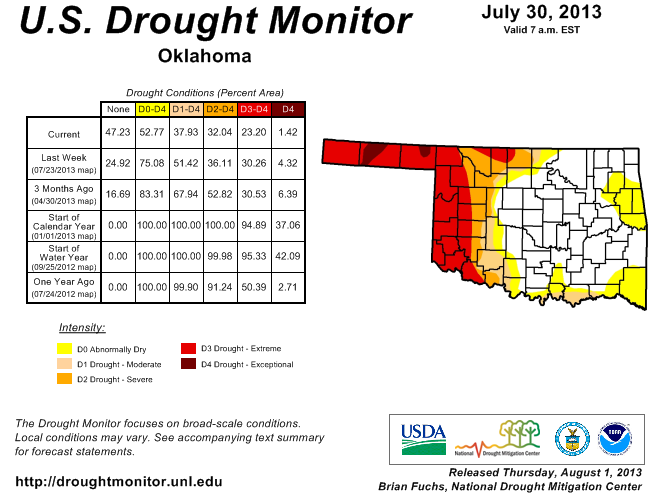
The latest U.S. Drought Monitor report reflects the abundant July rainfall,
especially across the eastern two-thirds of the state. Only 1.4 percent of the
state is labeled within exceptional drought. That is a reduction from 8.7
percent at the end of May. Over 62 percent of the state is now drought free,
primarily from central through eastern Oklahoma. Only 41 percent of the state
was free from drought at the end of May, according to the Drought Monitor.
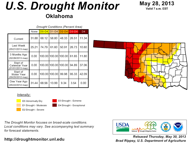
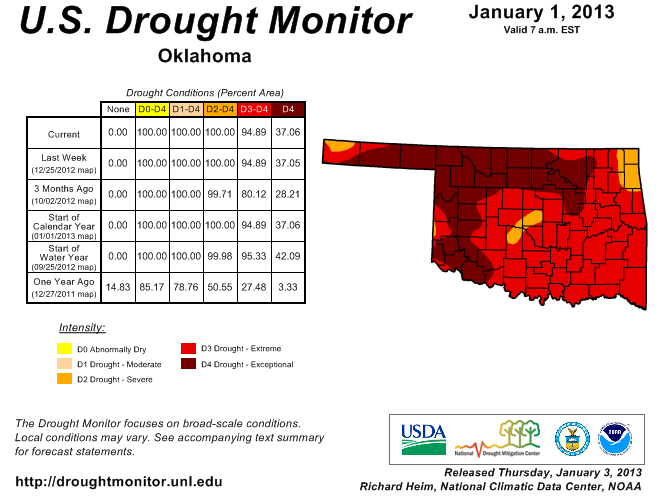
The entire state was labeled in some intensity of drought at the beginning of
the year, including 37 percent of the state in the exceptional category.
The far western edge, including the Panhandle, remains in drought categorized
as being at least in the extreme category. The Drought Monitor?s intensity
scale slides from moderate-severe-extreme-exceptional, with exceptional being
the worst category.
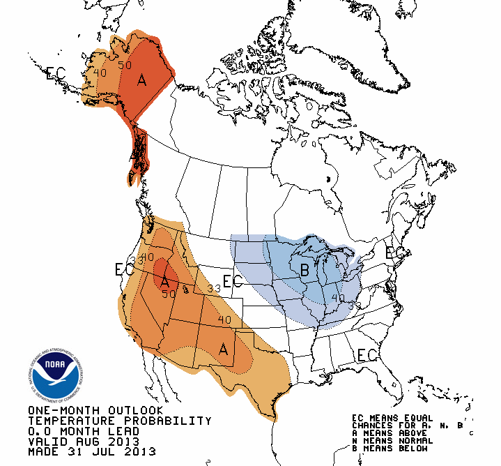
The monthly outlooks for August from the National Weather Service's Climate
Prediction Center indicate an increased chance for above normal temperatures
across southwestern Oklahoma and the Panhandle, but no indications of above-,
below- or near-normal precipitation across the state.

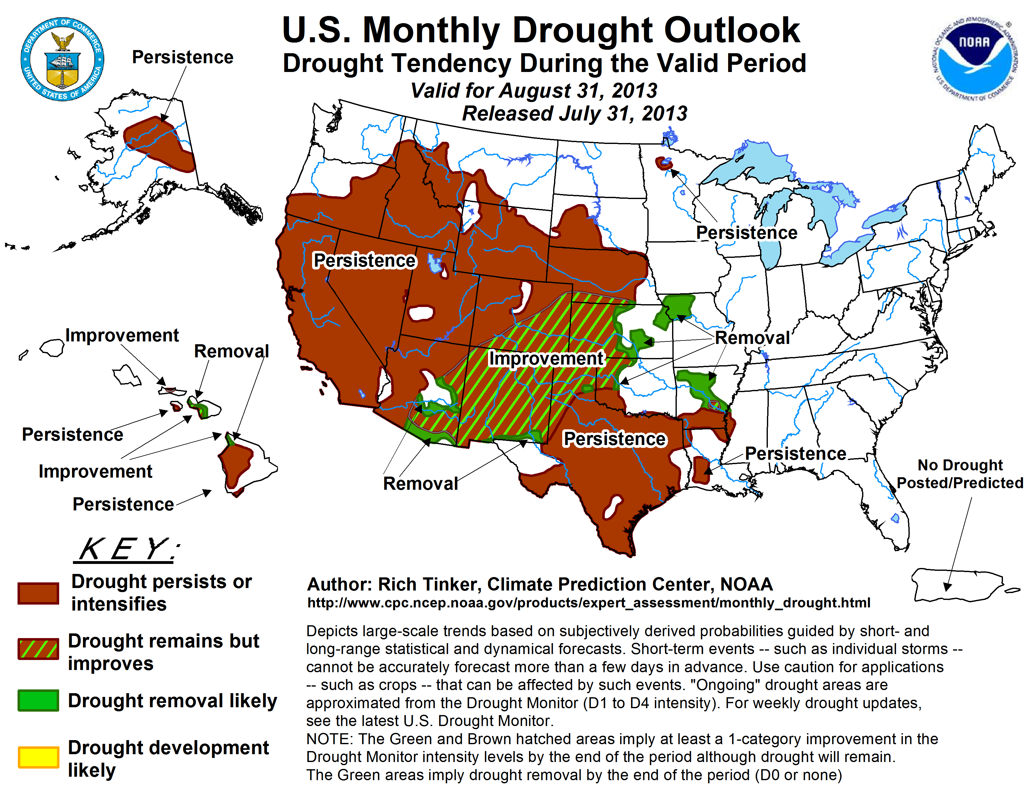
The U.S. Monthly Drought Outlook for August has drought improving across the
northwestern quarter of the state, along with the Panhandle areas of Oklahoma
and Texas. Drought is expected to persist across southwestern Oklahoma. No
development of drought is expected across the eastern two-thirds of the state
through the end of August.
Gary McManus
Associate State Climatologist
Oklahoma Climatological Survey
(405) 325-2253
gmcmanus@mesonet.org
August 1 in Mesonet History
| Record | Value | Station | Year |
|---|---|---|---|
| Maximum Temperature | 115°F | KIN2 | 2012 |
| Minimum Temperature | 53°F | KENT | 2018 |
| Maximum Rainfall | 5.04 inches | NOWA | 1995 |
Mesonet records begin in 1994.
Search by Date
If you're a bit off, don't worry, because just like horseshoes, “almost” counts on the Ticker website!