Ticker for July 29, 2013
MESONET TICKER ... MESONET TICKER ... MESONET TICKER ... MESONET TICKER ...
July 29, 2013 July 29, 2013 July 29, 2013 July 29, 2013
It ain't over yet!
Three days left in an already very wet July, and it appears it could be getting
wetter before it's all over. The statewide average through the morning of July
29th stands at 4.43 inches, about 1.9 inches above normal. That would be good for
the 21st wettest July on record already.
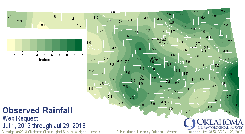
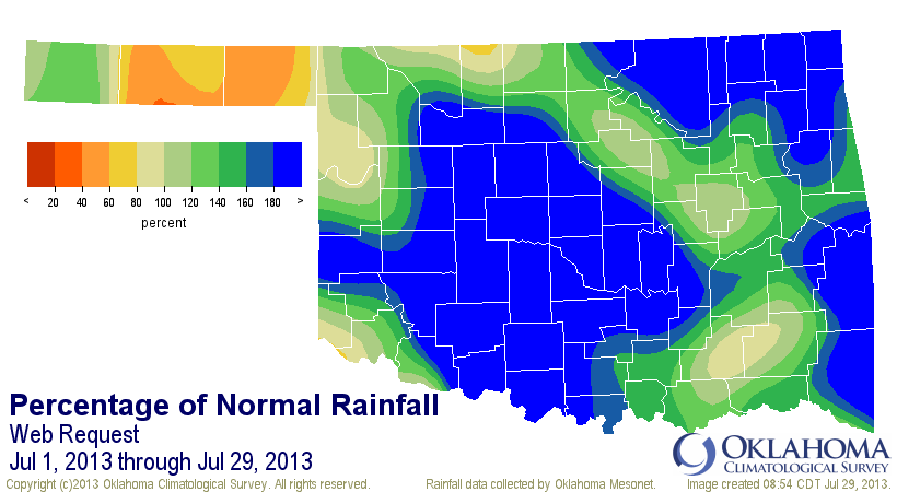
As you can see from that last map, there are parts of the state that aren't
contributing just yet (yeah, we're talking to you, Panhandle!). But that might
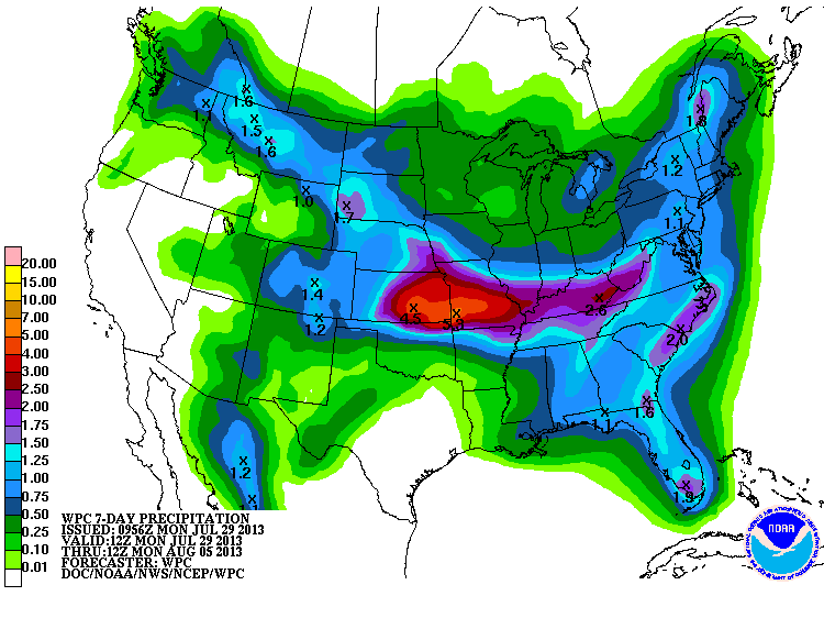
change after tonight. It appears another good soaking is possible for northern
Oklahoma. Not quite as far south as the previous rains last week, but still there
are parts of northern Oklahoma that are looking at over 3 inches of rain,
possibly. Take the totals out to 7 days and even the Panhandle looks wet! We'll
see if that one come to pass or not.
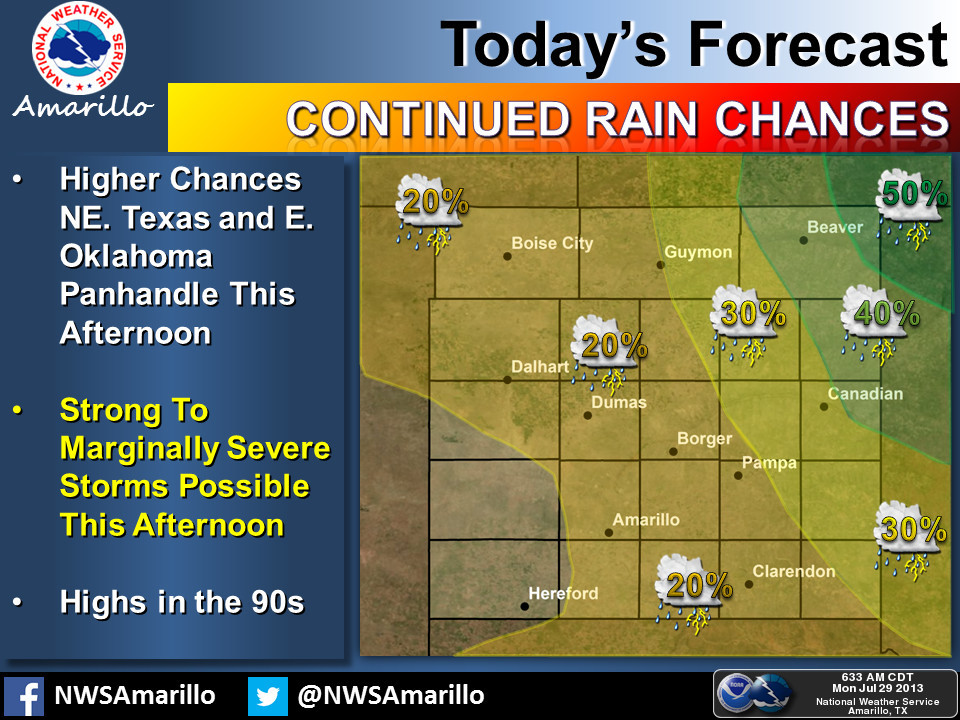
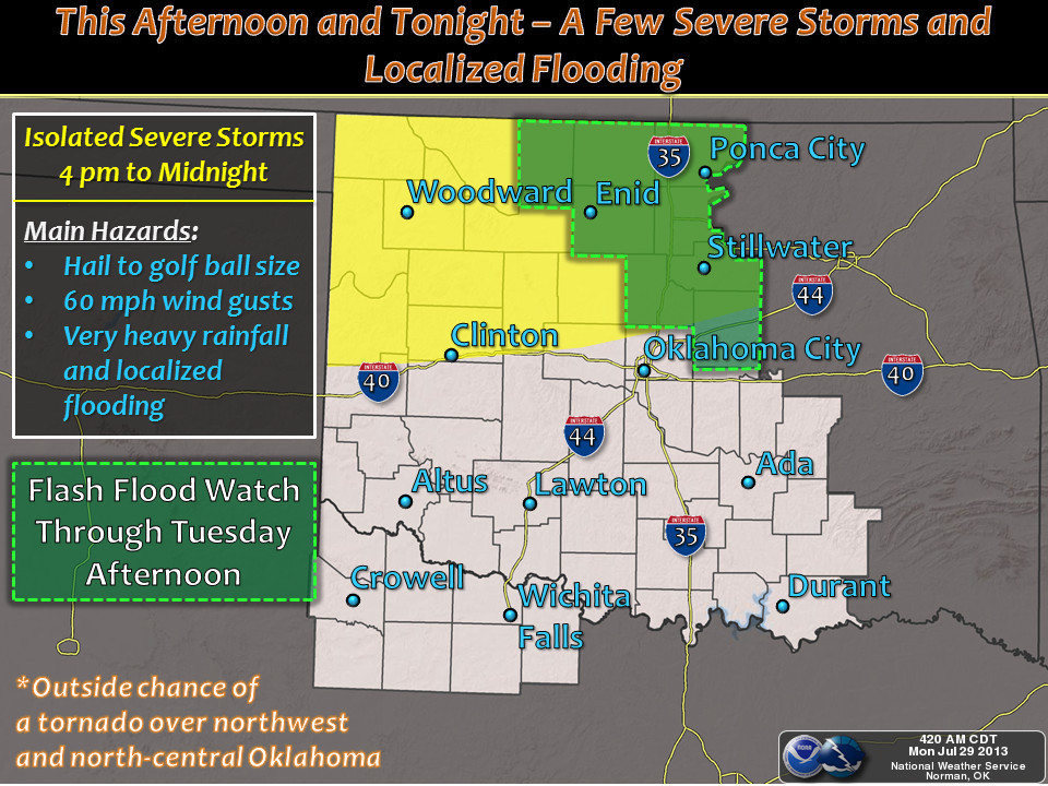
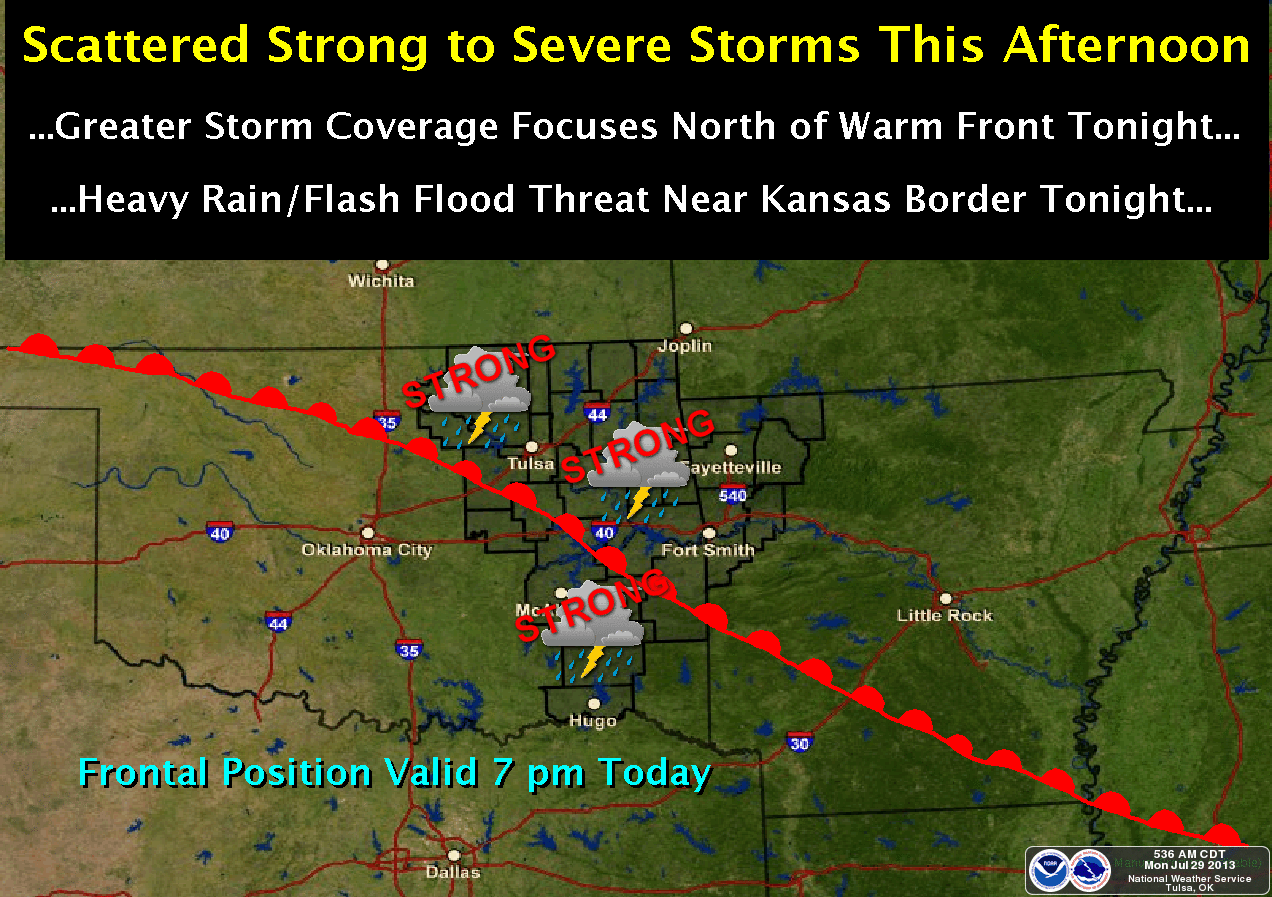
Now tonight's weather could come with the severe stuff along with it (i.e., hail,
strong winds), not to mention lots of rain falling on already moistened soils.
Here's a look at how the local NWS offices see the hazards.
After all that excitement, it appears the area might go under the influence
of our normal-type high pressure again, so summer will probably return. In the
dry areas, that might mean upper 90s or low 100s. For the moist areas, get ready
for some steamy weather.
Gary McManus
Associate State Climatologist
Oklahoma Climatological Survey
(405) 325-2253
gmcmanus@mesonet.org
July 29 in Mesonet History
| Record | Value | Station | Year |
|---|---|---|---|
| Maximum Temperature | 110°F | INOL | 2012 |
| Minimum Temperature | 51°F | BEAV | 2005 |
| Maximum Rainfall | 4.67 inches | OKMU | 2020 |
Mesonet records begin in 1994.
Search by Date
If you're a bit off, don't worry, because just like horseshoes, “almost” counts on the Ticker website!