Ticker for July 25, 2013
MESONET TICKER ... MESONET TICKER ... MESONET TICKER ... MESONET TICKER ...
July 25, 2013 July 25, 2013 July 25, 2013 July 25, 2013
Pay no attention to the map behind the curtain
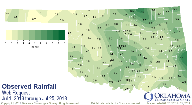
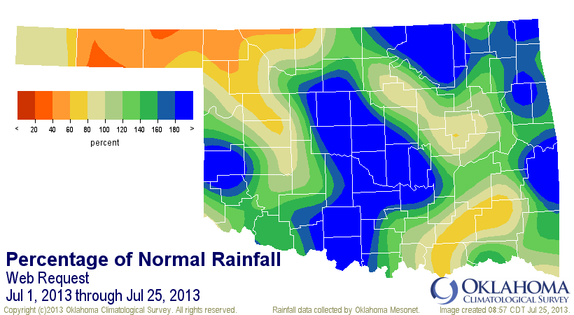
To say this week's new U.S. Drought Monitor map will not be like next week's is
a bit of an understatement, especially if the rains forecast for tonight and
tomorrow become reality. Let's go right into this morning's new map and remember
it fondly (or un-fondly) as the downpours begin today.

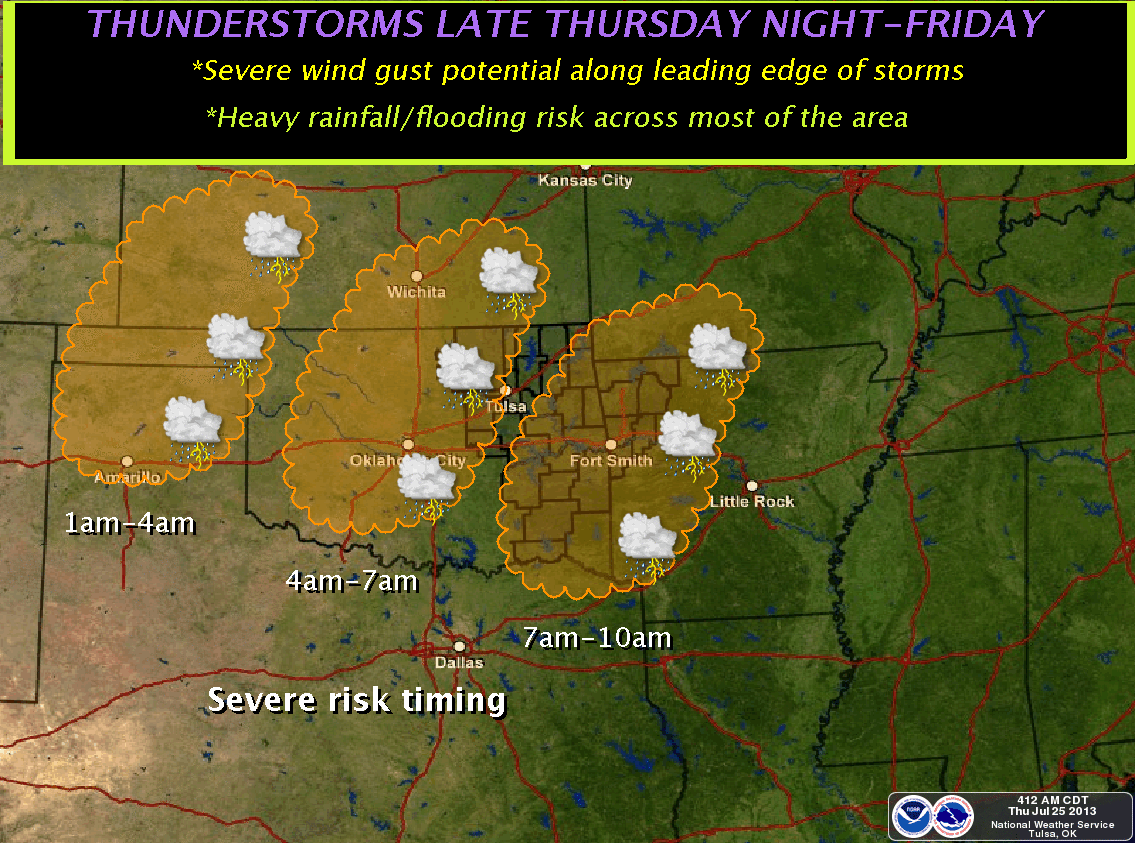
Keep in mind once again that this only accounts for rains through 7 a.m. Tuesday,
so the moisture from the storms of the last two days is not reflected in this map.
That includes the rains from the monster bow echo storm that tore through Tulsa
with winds of up to 100 mph that left 100,000 customers without power.

Those rains alone will make big changes in that area of burgeoning drought across
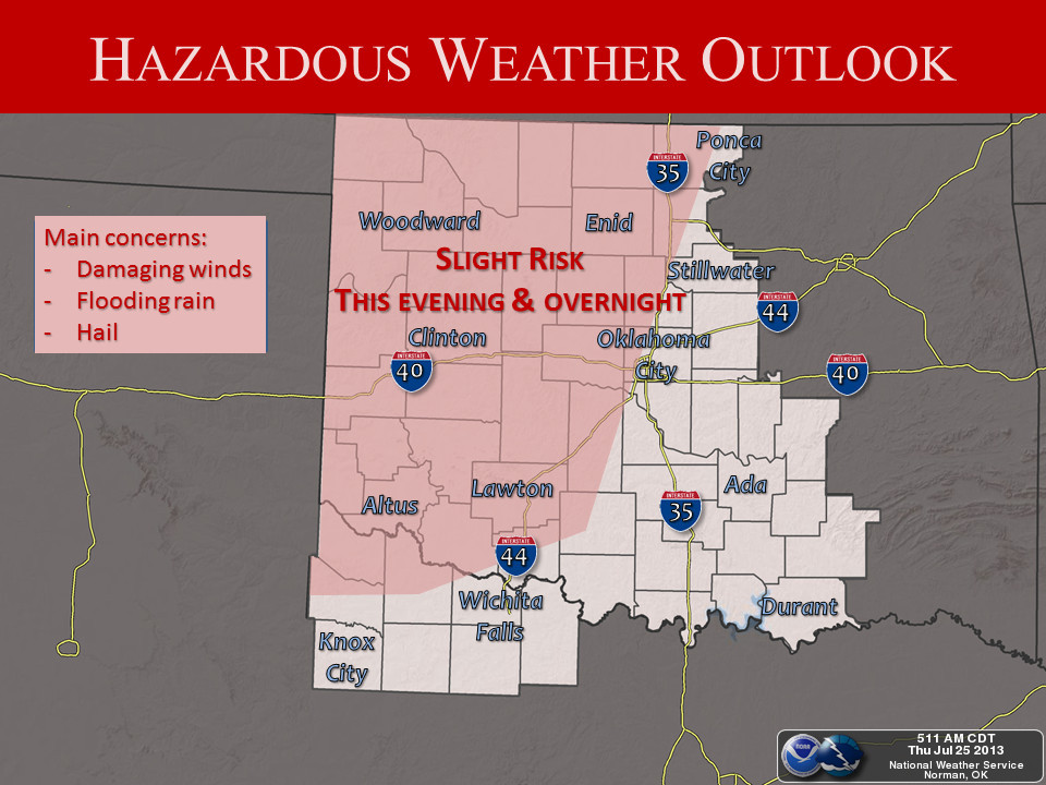
far eastern Oklahoma. And check out the forecast for tonight and tomorrow. A
ton of rain is possible across northwestern Oklahoma, right where they need it.
Now if only some of that can make it down to southwestern Oklahoma, we'll kill
two drought areas with one stone.

The trouble there is that another 2-3 inches is possible across eastern and
central Oklahoma, an area already saturated with recent rains (in general). And
that's the reason for the flash flood watch over the northeastern quarter of
the state.
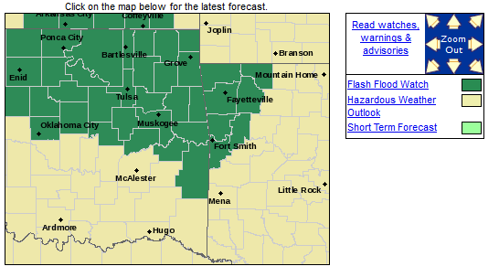
Here's how the various NWS offices see the unfolding situation:

Quite the exciting July weather this year, as opposed to the previous two years.
With a statewide average through this morning of 3 inches, this July is now up
to the 52nd wettest on record. I really expected that to rank higher, but it
should zoom up the rankings after this weekend. #1 is 1950's 9.26 inches. I
think that record is still safe. But as I said, much better than the previous
two Julys, which were the 4th driest (2011) and 15th driest (2012) on record
(dating back to 1895).
2013 thus far
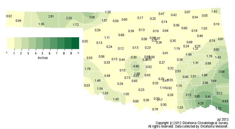
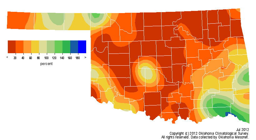
2012
2011
Let me add that the last two Julys, with significant drought either in place
(2011) or building (2012), the temperatures were quite severe as well. July
2011 is now infamous for not only being the warmest month in Oklahoma history
with a statewide average of 89.3 degrees, that is also the warmest month for
ANY STATE on record, dating back to 1895 (also part of the warmest summer for
any state on record). And again, July 2012 was no slouch at 86 degrees, the
5th warmest July on record.
This July is going to end up quite cool. The statewide average from the
Oklahoma Mesonet for July thus far is 80.2 degrees, about 1.1 degrees below
normal. That would be about the 30th coolest July on record if the month
finished out that way. With more cool weather the next few days, then normal-ish
July type weather next week, we could end up even cooler. But that's how summer
months work in Oklahoma ... the temperatures are very much correlated with how
much rain falls.
Well, with a state of emergency declared by the Governor and a gully-washer of
a storm set to arrive, the only advice I can give is get those lawns mowed and
batten down the hatches.
Or hatten down the batches, if you are so inclined. Whatever works for you.
Gary McManus
Associate State Climatologist
Oklahoma Climatological Survey
(405) 325-2253
gmcmanus@mesonet.org
July 25 in Mesonet History
| Record | Value | Station | Year |
|---|---|---|---|
| Maximum Temperature | 110°F | GRA2 | 2011 |
| Minimum Temperature | 55°F | BOIS | 2004 |
| Maximum Rainfall | 3.16 inches | SHAW | 2016 |
Mesonet records begin in 1994.
Search by Date
If you're a bit off, don't worry, because just like horseshoes, “almost” counts on the Ticker website!