Ticker for July 15, 2013
MESONET TICKER ... MESONET TICKER ... MESONET TICKER ... MESONET TICKER ...
July 15, 2013 July 15, 2013 July 15, 2013 July 15, 2013
What do we want??
Rain!
When do we want it?
Well, for the next few days!
Where do we want it?
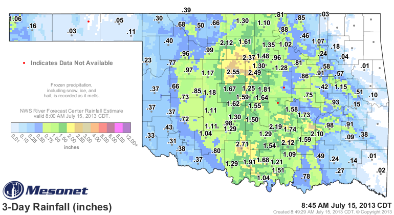
Farther to the west and the east would be nice. But as it has occurred so far,
the unusual-for-July weather pattern has dumped an incredible amount of rain
across central Oklahoma. Mesonet rainfall/radar estimated maps show from 1-3
inches common up and down the I35 corridor, with rain continuing to fall.
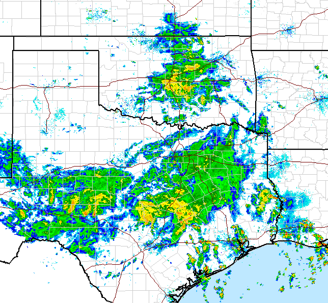
For a really nice loop so you can see the upper-level low spinning over our area,
bringing the recurrent rainshowers, check out this link.
http://radar.weather.gov/Conus/full_loop.php
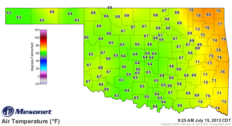
Pretty cool. No, literally, I mean, pretty cool for this time of year. Highs
yesterday were officially in the 80s, and a few 90s, but keep in mind most of
those came soon after midnight before the upper-level low moved over the area.
Actual daytime highs hovered in the 70s in the rainy areas, with 80s on the
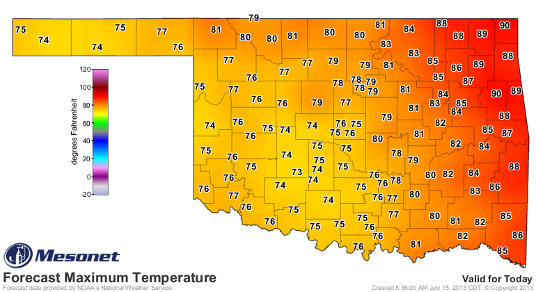
boundaries. Check out the current temperatures. And these might not get much
higher than about another 10 degrees, near record levels for lowest maximum
temps for this time of year. I've followed that with the map of those record
low maximum temps for today, and the NWS forecast.
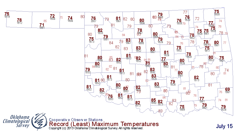
CLEARLY this has the potential to be one of, if not the coolest July 15th since
records began. The lowest maximum temperature ever recorded on this date was
68 degrees from Kiamichi Tower in 1961 (Smithville was 69 that day). We'll have
to watch the rain and see if it can keep somebody below that level today.
So as we enjoy yet another weather/climate oddity here in Oklahoma, remember
that folks along the western and eastern edges of the state need some of that
rain! The potential is still there according to the WPC, especially for
southwestern Oklahoma.

This will without a doubt be a drought-denter in some areas, and a drought-
preventer in others. Where, exactly, is in some cases still to be determined.
Gary McManus
Associate State Climatologist
Oklahoma Climatological Survey
(405) 325-2253
gmcmanus@mesonet.org
July 15 in Mesonet History
| Record | Value | Station | Year |
|---|---|---|---|
| Maximum Temperature | 111°F | FREE | 2011 |
| Minimum Temperature | 52°F | FORA | 2014 |
| Maximum Rainfall | 3.28 inches | KENT | 2017 |
Mesonet records begin in 1994.
Search by Date
If you're a bit off, don't worry, because just like horseshoes, “almost” counts on the Ticker website!