Ticker for July 16, 2013
MESONET TICKER ... MESONET TICKER ... MESONET TICKER ... MESONET TICKER ...
July 16, 2013 July 16, 2013 July 16, 2013 July 16, 2013
And the southwest gets theirs
I have famously (or non-famously, since only about 20 people pay attention to
me) said that you don't go into the summer expecting drought relief. Usually if
you are entering the summer with drought in place or developing, you might as
well schedule your next hope for relief in September or October. Well, I was
right before I was wrong! But I am glad to be wrong. I was a bit worried the
southwest might miss out again on these rains, but the upper-level low spinning
to our south finally brought enough wrap-around moisture with some storms to
give them a good 1-2 inches of rain.
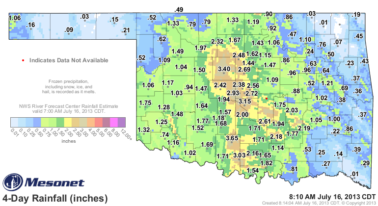
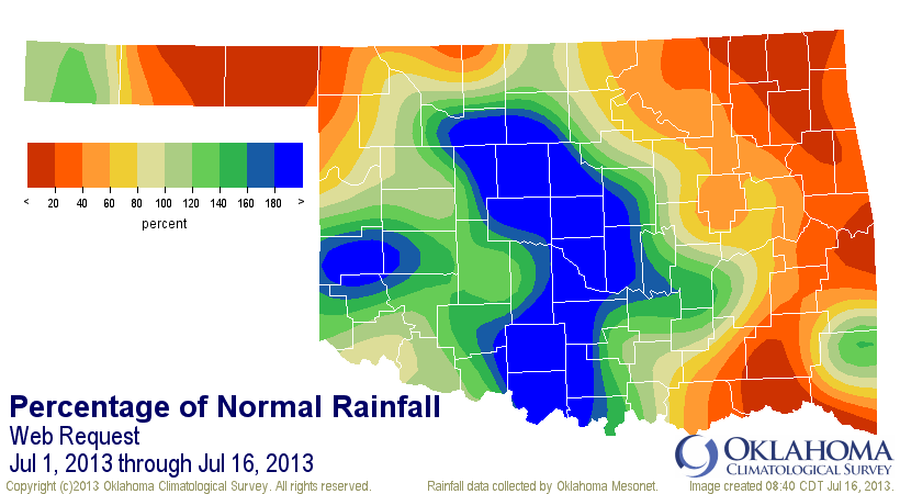
Notice that there are still have-nots on the map, in particular far eastern
Oklahoma and the northwest. The northeastern and southeastern corners really
missed out on the good moisture. The inch or two down in the southwest is not
a drought ender, but it's certainly welcome and will soften up that ground down
a bit more down that way. And the best part is, it's still raining and spinning
more moisture that way. Even the Panhandle looks to get a dose here in a bit.
http://radar.weather.gov/ridge/Conus/full_loop.php
Our friends at the NWS office in Norman think another inch or so is possible in
the southwest corner, and that radar image looks like that is a pretty good
bet. This map is good for now through Wednesday.
So we're back to the haves and have-nots again, as it has been occurring for
most of the year. We just seem to be rotating the areas that fall into each
category. So maybe at least the reds can get their dose today and change to
blue.
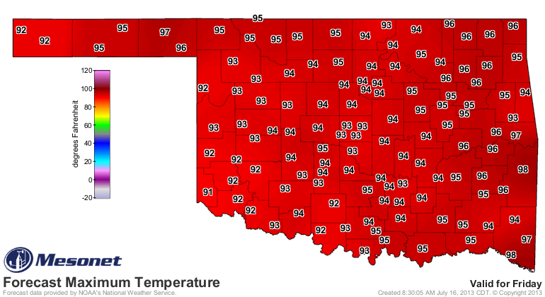
It will get hot again. It is summer, after all. But these highs on Friday in
the low- to mid-90s look much better than low- to mid-100s. The rain has helped
us in that area, because the rest of the country is staring a major heat wave
in the face this week.
As for our current temperatures, it's tough to believe it's actually July.
Yesterday's maximum temps broke records in many locations on the cool side.

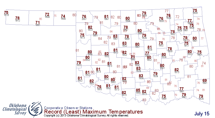
A bit toasty over in eastern Oklahoma, relatively speaking, but again they've
missed out on the rain as the upper-level low spins away from them. Down across
the Red River, Wichita Falls had its coolest maximum temperature ever recorded
during July at 70 degrees, and those records date back to 1923.
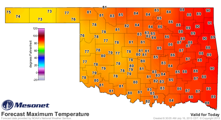
Today will be a bit warmer as the storm pulls away and we get a bit more sun
through the clouds, but still deliciously awesome for mid-July.
Gary McManus
Associate State Climatologist
Oklahoma Climatological Survey
(405) 325-2253
gmcmanus@mesonet.org
July 16 in Mesonet History
| Record | Value | Station | Year |
|---|---|---|---|
| Maximum Temperature | 109°F | HOLL | 2001 |
| Minimum Temperature | 51°F | JAYX | 2014 |
| Maximum Rainfall | 3.82 inches | ALTU | 2014 |
Mesonet records begin in 1994.
Search by Date
If you're a bit off, don't worry, because just like horseshoes, “almost” counts on the Ticker website!