Ticker for July 1, 2013
MESONET TICKER ... MESONET TICKER ... MESONET TICKER ... MESONET TICKER ...
July 1, 2013 July 1, 2013 July 1, 2013 July 1, 2013
June Weather Follows Script
June followed its normal script almost to the letter with a rainy and stormy first
half of the month that gave way to the beginnings of a long hot stretch of
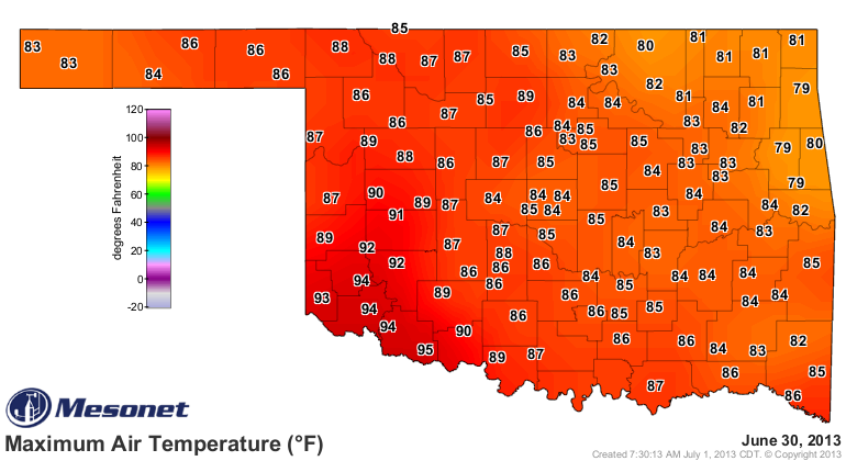
Oklahoma summer. Mother Nature did manage to throw in a nice improvisation at the
end of the month with a cool front dropping temperatures into the 80s over much
of the state.
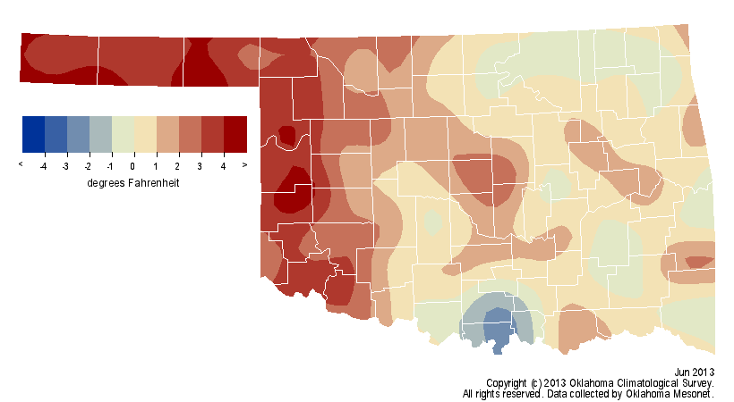
The previous heat was enough to end the state's streak of below normal months at
four, however. According to data from the Oklahoma Mesonet, the statewide average
temperature came in at 77.9 degrees, 1.4 degrees above normal to rank as the 34th
warmest June since records began in 1895.

Temperatures climbed into the triple-digits as early as May 3, but really got
started at that level on the 10th. Freedom reached the month's highest
temperature of 111 degrees on the 27th.
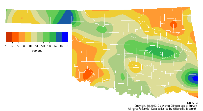
While the average statewide rainfall total fell 0.6 inches below normal at 3.69
inches ? the 56th driest June on record ? there were still parts of the state
that had some hefty rainfall totals for the month.
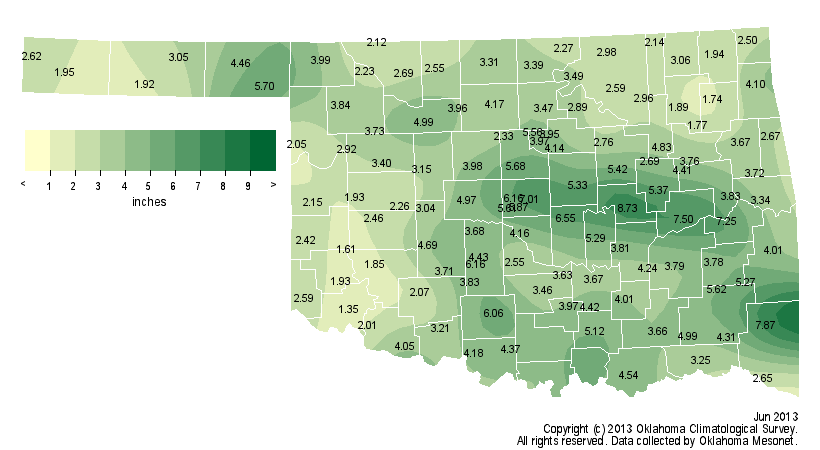
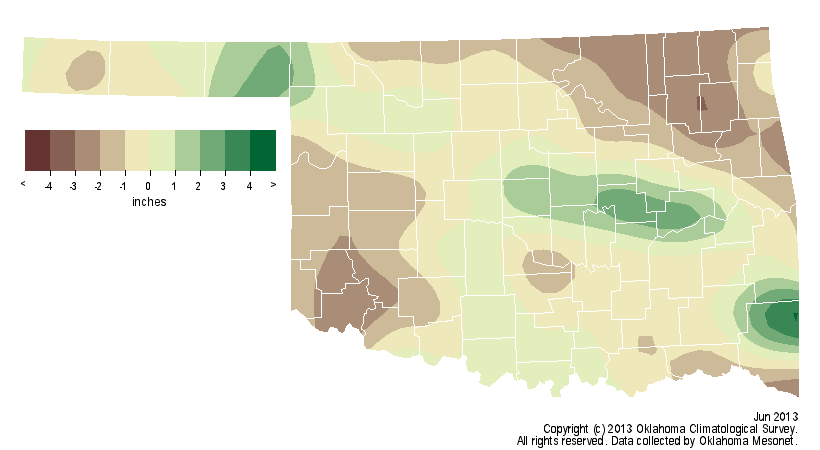
Probably the biggest surprise was the small Panhandle town of Slapout and its
5.7 inches. Okemah led the state with 8.73 inches. Other areas of the state did
not fare so well. A large part of southwestern Oklahoma had less than 2 inches
for the month. Northeastern Oklahoma and the western Panhandle were also
particularly dry during the month. June's first day was merely a continuation
of the tumultuous end of May. The tornadoes thankfully ended on May 31, but the
flooding rains from those storms continued into June. More than 6 inches fell
across parts of east central Oklahoma with more generalized amounts from 2-4
inches. Rain fell somewhere in the state on almost every day through the ninth,
and again from the 15th through the 19th.
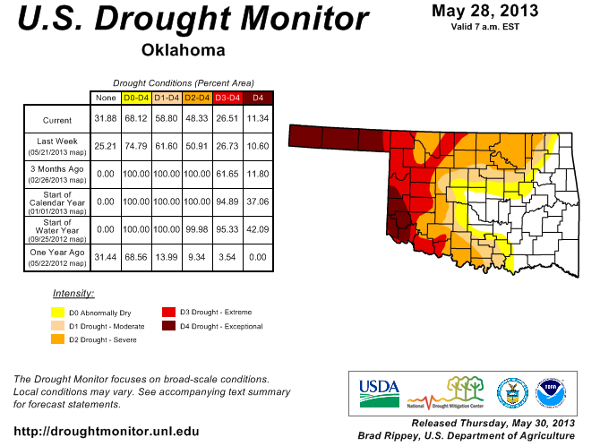
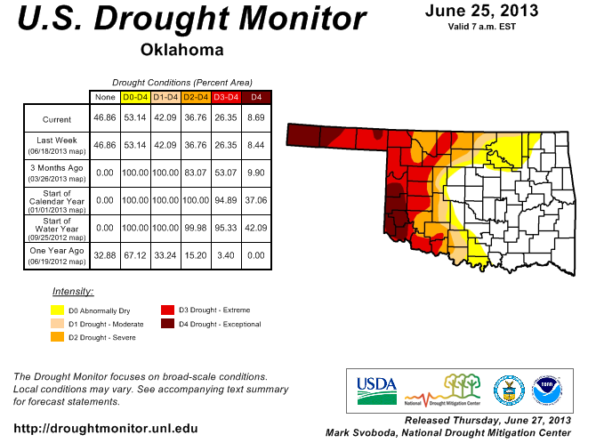
The rains throughout the first couple of weeks allowed further reduction of
drought according to the U.S. Drought Monitor report. Nearly 59 percent of the
state was covered by some intensity of drought on the May 28 Drought Monitor,
but that number dropped to 53 percent on the June 25 map. The percentage of
extreme-to-exceptional drought, the Monitor's two worst categories, remained
virtually unchanged at 26 percent. Severe-to-exceptional drought still covers
much of the western one-third of the state, and also parts of north central and
south central Oklahoma.
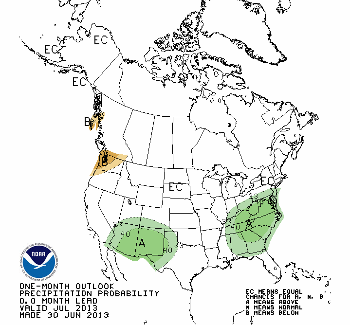
The July temperature outlook from the Climate Prediction Center (CPC) indicates
equal odds of above-, below- and near-normal temperatures for Oklahoma. So no
real clear temperature signal is showing up at this time. The precipitation
outlook does show increased odds of above normal rainfall across the western
Panhandle, an area that desperately needs moisture.

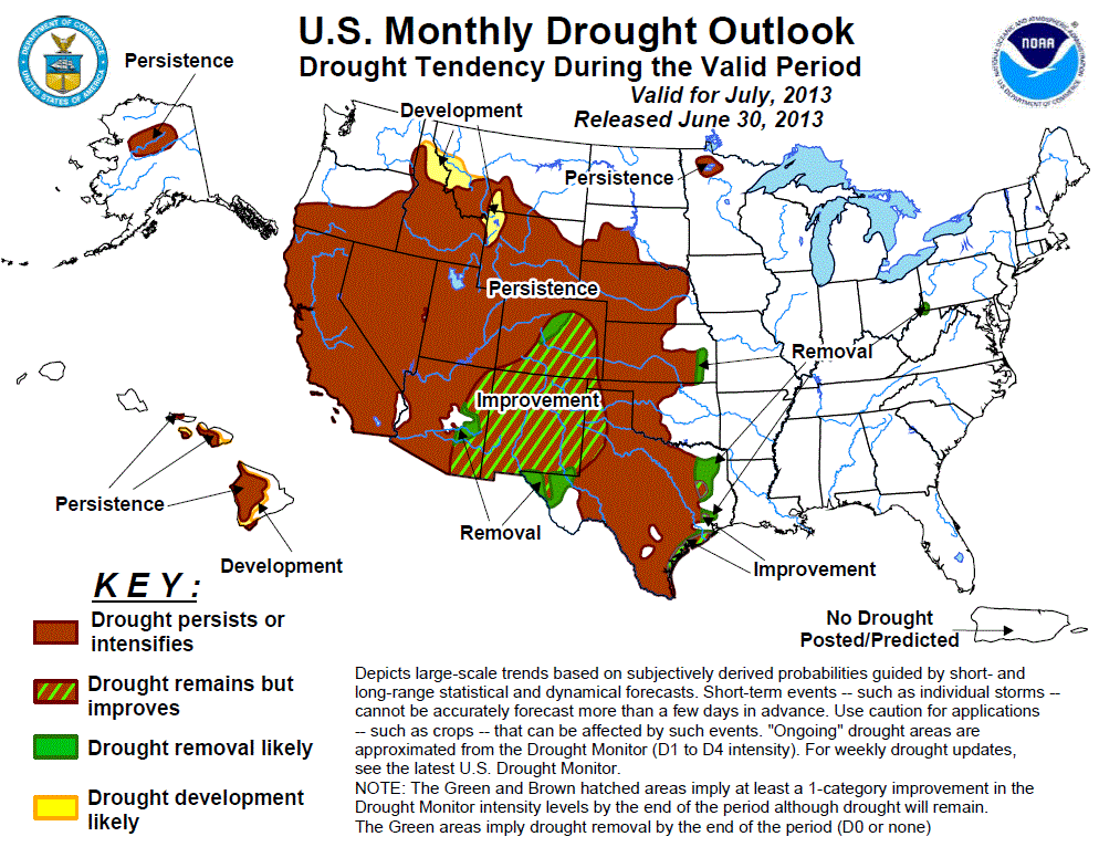
The CPC U.S. monthly Drought Outlook for July shows drought persisting or
intensifying across the western third of Oklahoma, including much of the
Panhandle. There is some limited improvement possible in the far western
Panhandle. Those areas not in drought across central and eastern Oklahoma are
expected to remain drought free, at least through July.
Gary McManus
Associate State Climatologist
Oklahoma Climatological Survey
(405) 325-2253
gmcmanus@mesonet.org
July 1 in Mesonet History
| Record | Value | Station | Year |
|---|---|---|---|
| Maximum Temperature | 110°F | ALVA | 1997 |
| Minimum Temperature | 50°F | EVAX | 2017 |
| Maximum Rainfall | 5.82 inches | PAWN | 2016 |
Mesonet records begin in 1994.
Search by Date
If you're a bit off, don't worry, because just like horseshoes, “almost” counts on the Ticker website!