Ticker for June 18, 2013
MESONET TICKER ... MESONET TICKER ... MESONET TICKER ... MESONET TICKER ...
June 18, 2013 June 18, 2013 June 18, 2013 June 18, 2013
Well that's odd!
It didn't really rain anywhere last night other than a few showers here and
there. I was getting kind of used to it, and the recent cooldown.
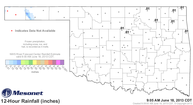
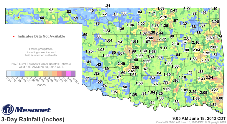
So we didn't add too much to these glorious totals.
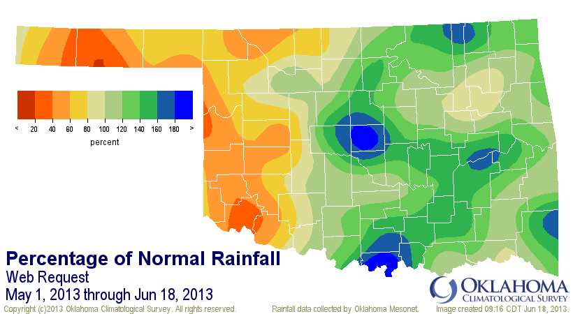
And while it got a bit out of hand in some areas, the totals from the last 30
days look pretty good across some parts of western Oklahoma.
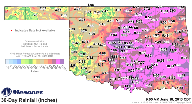
But, we can still see where some of those totals are lacking, especially across
the southwest and the Panhandle.
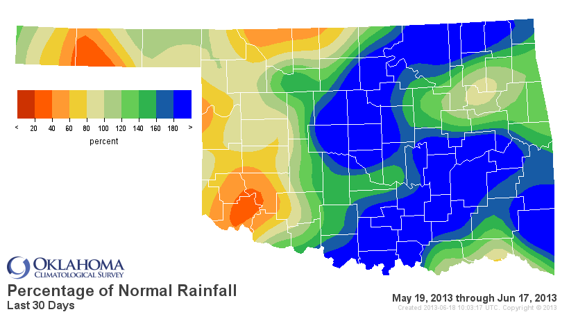
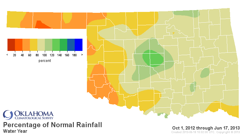
It's in the longer term where we can see why, despite some recent decent (Dr.
Seuss, eat your heart out!) rains, significant drought remains in place as the
heart of summer approacheth (Shakespeare ... nah, that's pushing it).
Rainfall since May 1

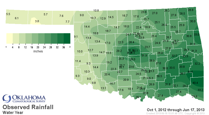
Rainfall since October 1, 2012
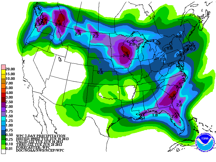
Nevertheless, we have seen more short-term drought improvement in the last week
with some of those rains. While the heavy rain appears over for awhile, this
indication of another quarter-inch to half-inch across the Panhandle would do
wonders for those folks.
Gary McManus
Associate State Climatologist
Oklahoma Climatological Survey
(405) 325-2253
gmcmanus@mesonet.org
June 18 in Mesonet History
| Record | Value | Station | Year |
|---|---|---|---|
| Maximum Temperature | 110°F | GRA2 | 2011 |
| Minimum Temperature | 42°F | KENT | 1998 |
| Maximum Rainfall | 5.74 inches | HOOK | 2024 |
Mesonet records begin in 1994.
Search by Date
If you're a bit off, don't worry, because just like horseshoes, “almost” counts on the Ticker website!