Ticker for June 13, 2013
MESONET TICKER ... MESONET TICKER ... MESONET TICKER ... MESONET TICKER ...
June 13, 2013 June 13, 2013 June 13, 2013 June 13, 2013
Drought takes a pause
The calm before the storm, or just another week in June? Hard to say with the
current drought situation. The heat and winds have taken their toll on western
Oklahoma, while the sun has made the eastern two-thirds into a swampy mess. The
rains of the last week at least brought some more improvements, so we do have that
happy news to show.
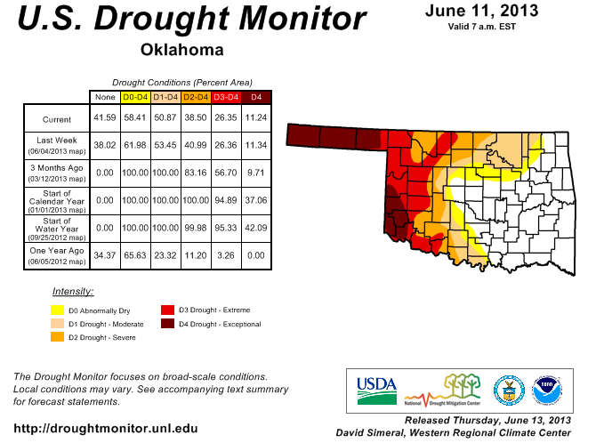
The area without any type of designation (D-Nada) increased from 38% to 42%, but
the area from D0-D4 went from 62% to 58%. So piddling changes for this week. Most
of these changes were down across south central Oklahoma, in response to the
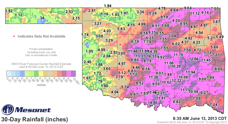
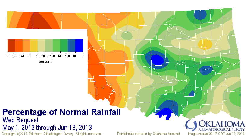
aforementioned moisture. And the big totals still show up on the 30-day maps
from the Mesonet. A lot of that rain started with the big severe weather events
from May 19th forward.
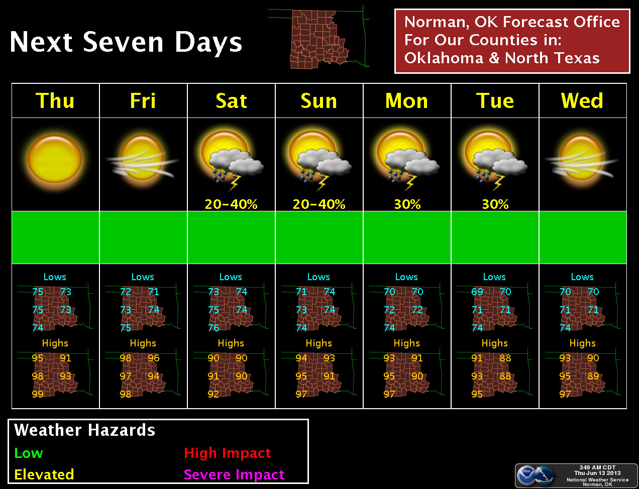
At least there is some rainfall in the forecast. It's not a drought-breaker, but
perhaps a drought-delayer? Only time will tell.
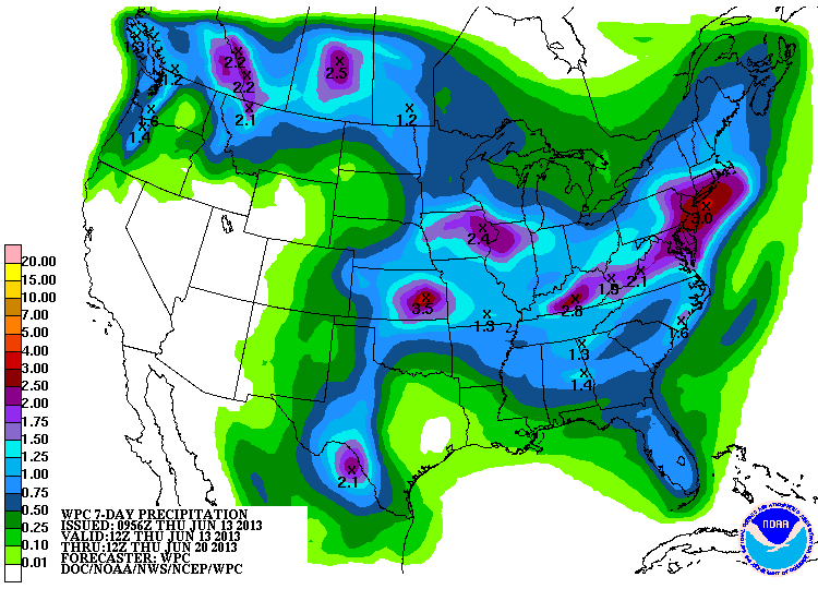
Those quarter-inch to 1.5 inch amounts across western Oklahoma would certainly
be sweet, and welcomed. I'll believe it when I see it, but the Norman NWS
office, for instance, does show us a chance of showers in a few days and into
next week.
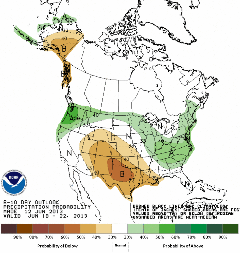
The CPC has bad news in their 6-10 and 8-14 day outlooks, with increased odds
of below normal rainfall and above normal temperatures for the June 18-26
period.
6-10 day outlooks

8-14 day outlooks
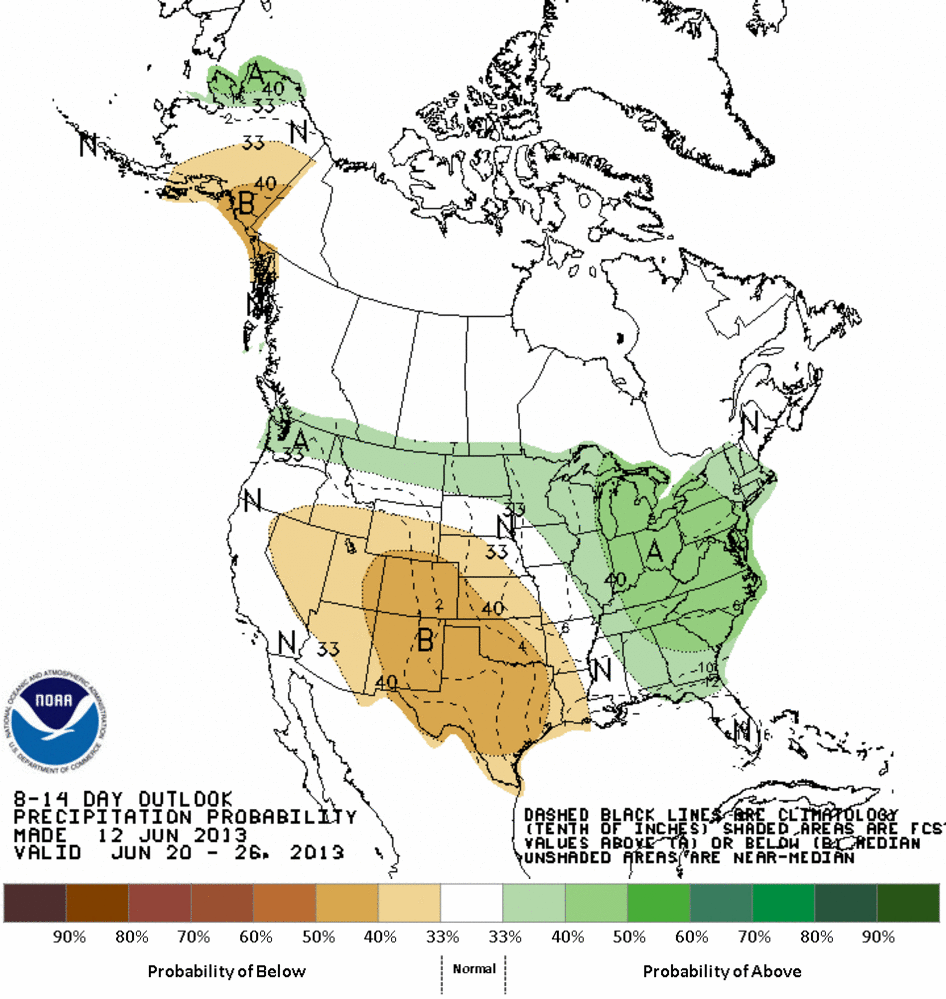

All I will say on that is that period is a long way out, and things can get
pretty dicey in those longer forecasts in the summer. Especially during June.
All it takes is some wayward upper-level system south of the jet stream flow
to move over the area and you are in bidness. However, the NORMAL pattern as we
get into late June and July is high pressure, rains tapering off, and heat
setting in.
Summer, eh?
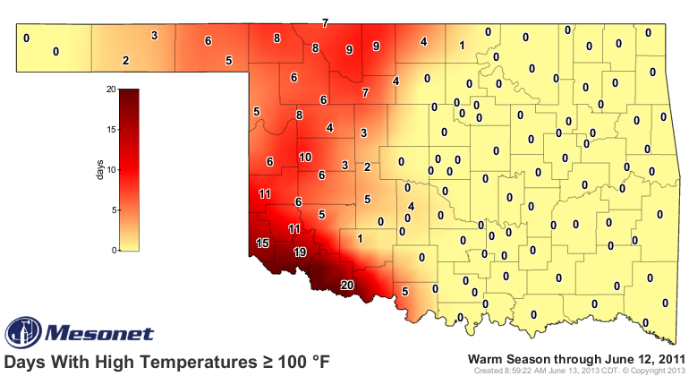
The days above 100 degrees are starting to pile up in the droughty areas.
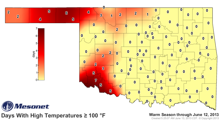
Still a tad behind where we were last year at this time in the southwest, but
a bit ahead in the northwest.
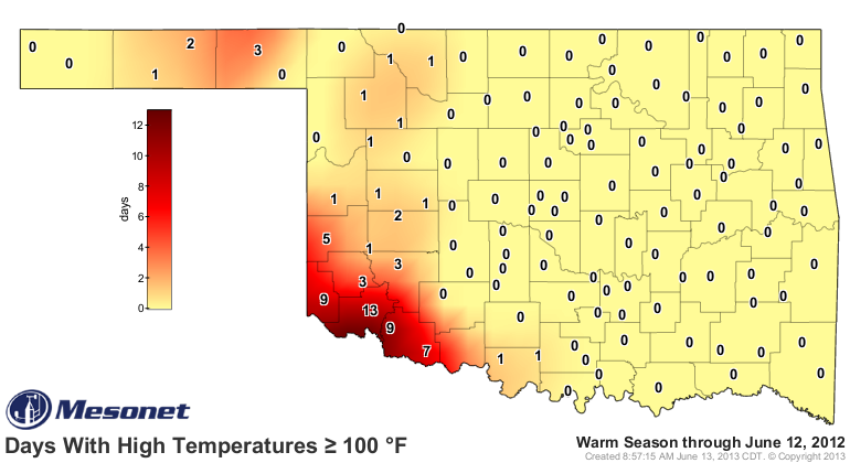
Comparisons to 2011 ... don't even bother unless you live in the Panhandle.
By the way, now 110 days since Goodwell has seen at least a quarter-inch of
rain in a single day. In case you want to lend them some sympathy (or feel
better about your own weather).
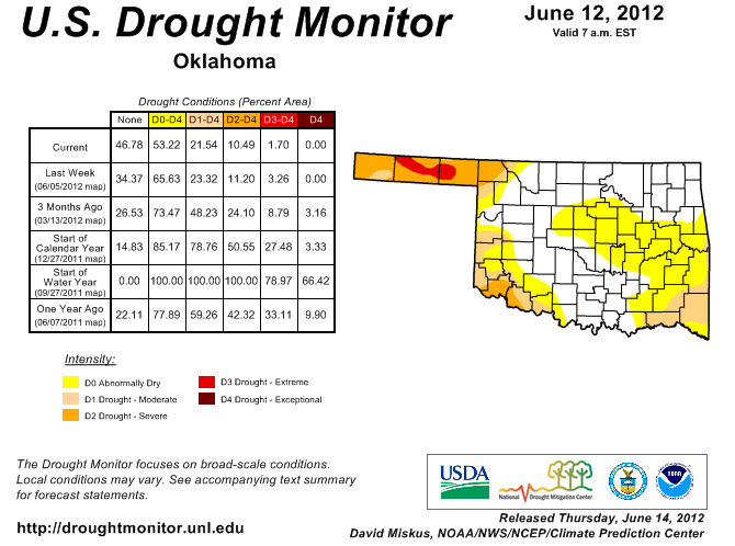
Another cautionary tale ... this is where our drought situation was last year
at this time.
And this is where it ended up at the end of August.
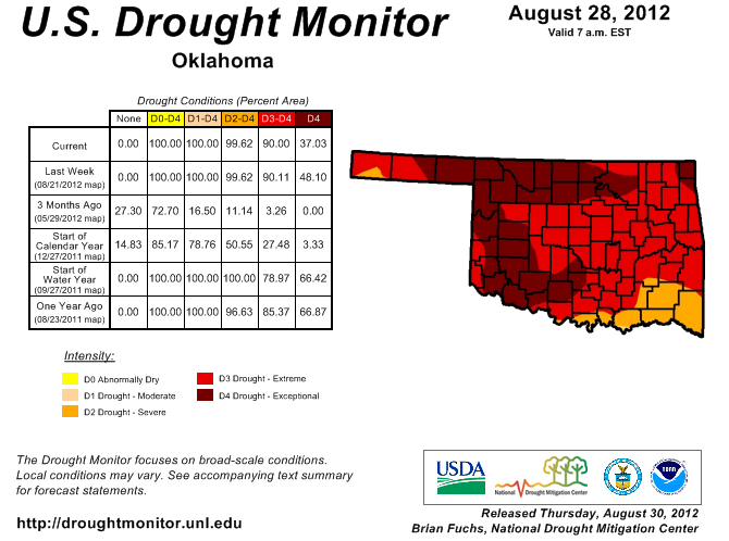
This May and early June have been a bit more wet than last year's version,
however (although just a tad more violent). A bit more cushion, if you will
(except for far western Oklahoma, of course).

Gary McManus
Associate State Climatologist
Oklahoma Climatological Survey
(405) 325-2253
gmcmanus@mesonet.org
June 13 in Mesonet History
| Record | Value | Station | Year |
|---|---|---|---|
| Maximum Temperature | 110°F | BUFF | 2011 |
| Minimum Temperature | 47°F | BOIS | 2005 |
| Maximum Rainfall | 4.15 inches | HOBA | 2007 |
Mesonet records begin in 1994.
Search by Date
If you're a bit off, don't worry, because just like horseshoes, “almost” counts on the Ticker website!