Ticker for May 31, 2013
MESONET TICKER ... MESONET TICKER ... MESONET TICKER ... MESONET TICKER ...
May 31, 2013 May 31, 2013 May 31, 2013 May 31, 2013
The Devil is in the details
Okay, I'm not trying to alarm anyone, but this sort of fits thanks to the last
10 days or so. Oklahoma's May statewide average temperature through the 30th
stands at 66.6 degrees. If it ended there, it would be the 33rd coolest May for
the state since 1895. LUCKILY this last warm day will probably bump it up a tenth
of a degree or two.
33rd coldest would normally elicit a "BRRRR!!!" from me, but given the data value,
I think we're talking about the other end of the scale!
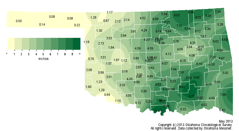
The statewide average precipitation total for May 1-30 is 4.56 inches, about 0.7
inches below normal. Normally for May I'd say "rainfall total" but we did have
a bit of snow there in the first three days. BRRRR!!! (I'll do it anyway). At any
rate, that would be good for the 56th driest May since 1895, so sort of the middle
of the pack there. But, lots of rain is still being forecast for today and
tonight, so May's story is still being written.
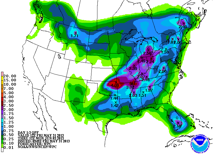
Some parts of northeastern Oklahoma still need that rain, but they really need it
out west. So that's a depressing rainfall forecast. Oh by the way, there are
several Panhandle stations that have received less than a tenth of an inch of
rainfall for the month, and it'll probably finish that way. Meanwhile,
Burneyville has had 11.4 inches and Foraker has had 9 inches. I'm thinking
Foraker up there in Osage County will probably overtake Burneyville by tomorrow.
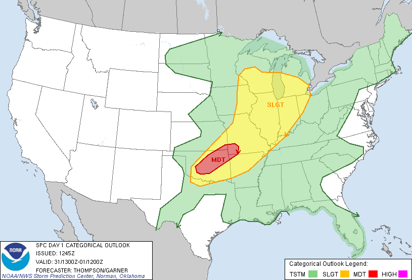
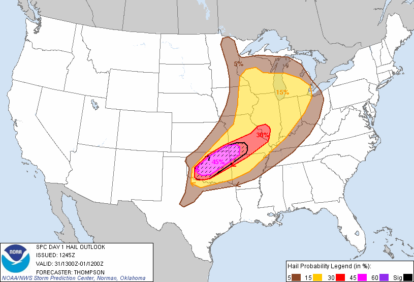
And, another unfortunate detail, that rain is going to come with some more bad
weather after yesterday's foolishness. A slew of tornadoes touched down from
south central through northeastern Oklahoma, at least according to early storm
reports. That was accompanied by reports of huge hail and more flash flooding in
spots. Here are some graphics and info from local NWS offices and the folks at
SPC (seems like I could just re-post yesterday's graphics and nobody would
know).
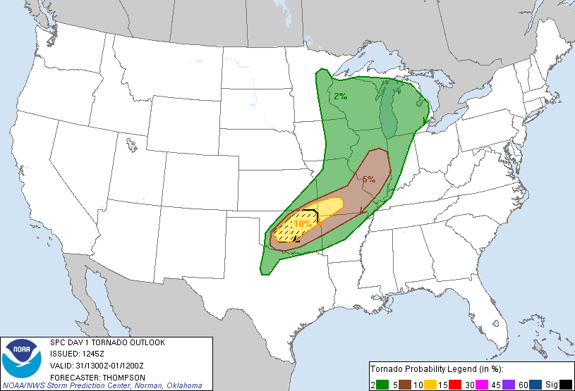
SPC

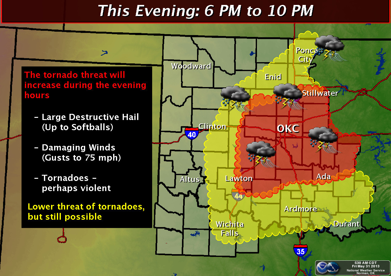
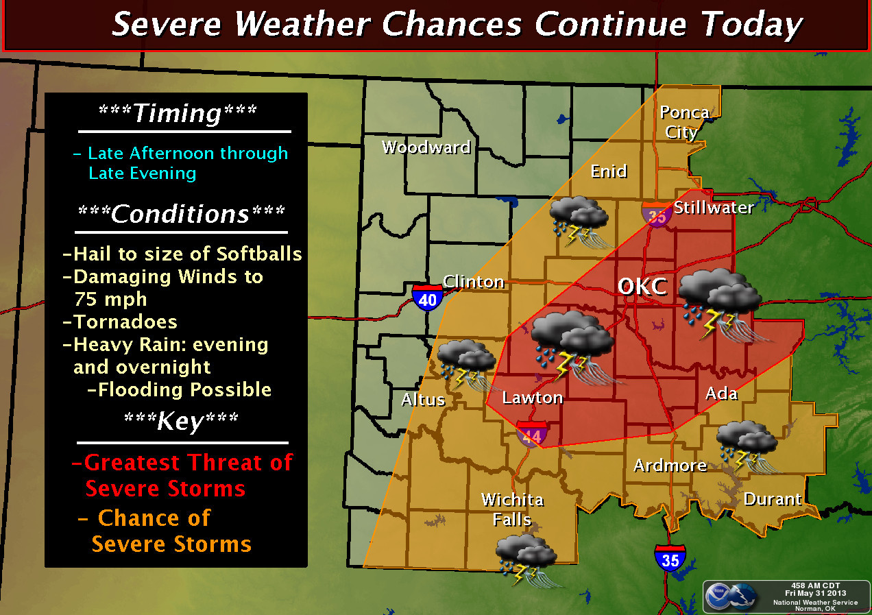
NWS-Norman

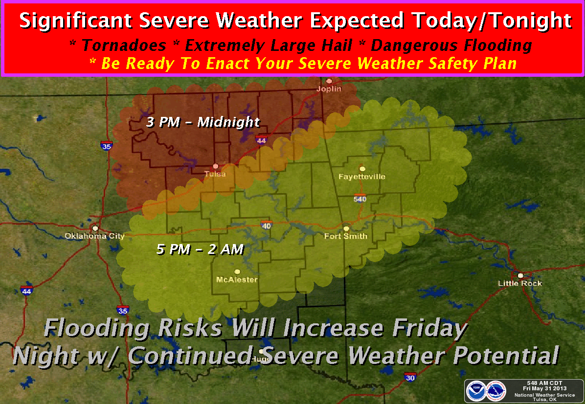
NWS-Tulsa
Seems like I'm hearing many of the more learned forecast types up here in the
NWC mentioning the term "significant tornado" as a cautionary tale today. There
might not be widespread tornadoes, but if one does form, it could be nasty.
One more round ... here we go!
Gary McManus
Associate State Climatologist
Oklahoma Climatological Survey
(405) 325-2253
gmcmanus@mesonet.org
May 31 in Mesonet History
| Record | Value | Station | Year |
|---|---|---|---|
| Maximum Temperature | 107°F | WAUR | 1998 |
| Minimum Temperature | 36°F | BOIS | 2004 |
| Maximum Rainfall | 5.41 inches | OKCN | 2013 |
Mesonet records begin in 1994.
Search by Date
If you're a bit off, don't worry, because just like horseshoes, “almost” counts on the Ticker website!