Ticker for May 29, 2013
MESONET TICKER ... MESONET TICKER ... MESONET TICKER ... MESONET TICKER ...
May 29, 2013 May 29, 2013 May 29, 2013 May 29, 2013
They need the rain?
Sorry, just trying to make a silk purse out of those Rustler jeans you used to get
at Wal Mart as a kid. What, you got Levis? Must have been nice to be rich! But,
I digress. After Mother Nature's idiotic display from last week, she's at it
again for the next few days, it appears. Our local NOAA folks are on top of it,
of course, so please stay weather aware. All sorts of areas to be concerned about
today (I'm first and foremost concerned about the 10 square feet around myself,
but I'm selfish that way), so let's let the local NWS offices and SPC guide us.
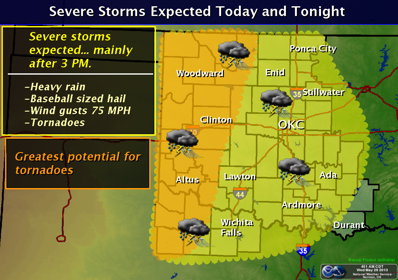
The Storm Prediction Center has much of the western half of the state in
"moderate" risk for today.
That includes an enhanced chance for tornadoes across far western Oklahoma,
according to their graphics. Like the little toadies they are, hail and severe
winds are in there as well.

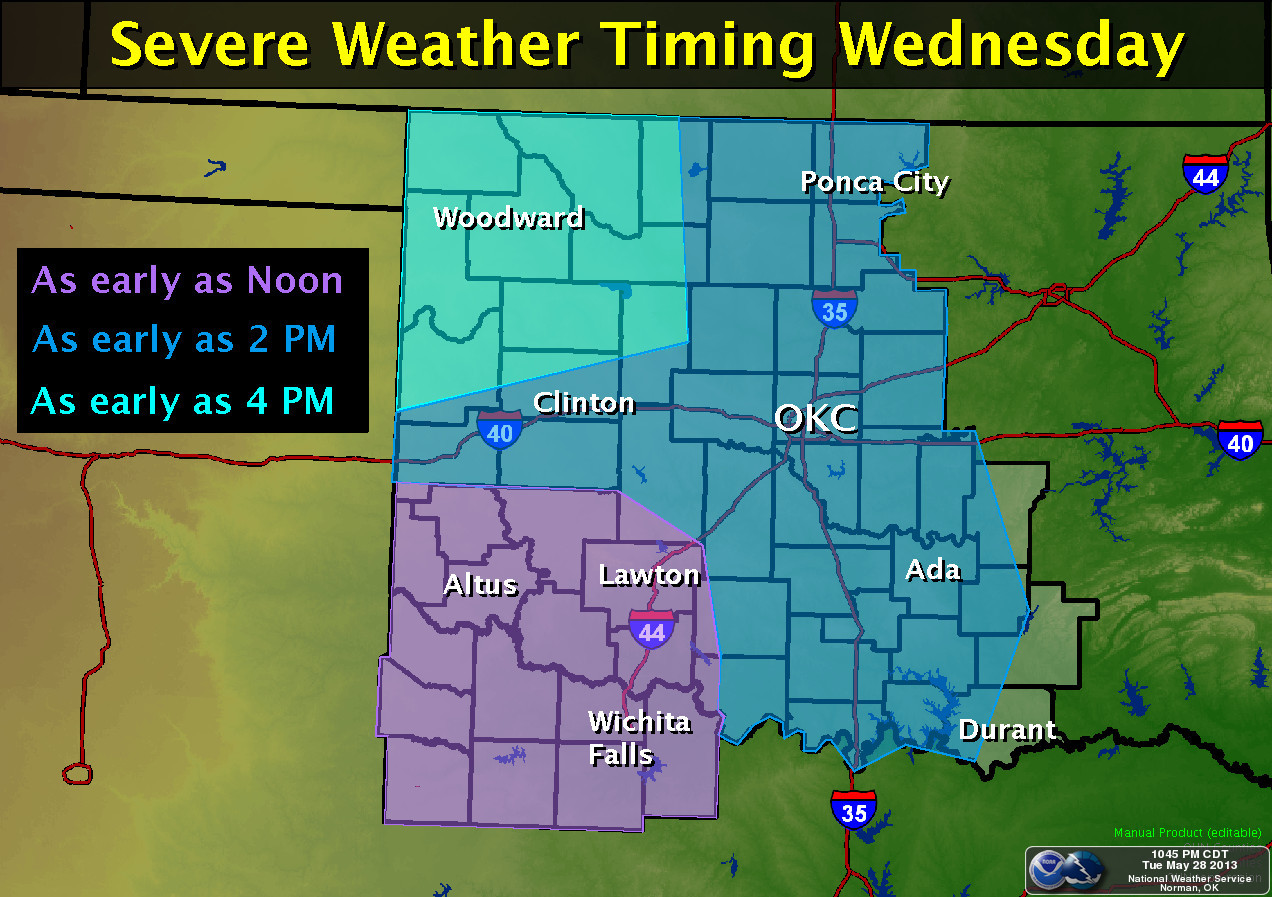
The Norman NWS office (http://www.srh.noaa.gov/oun) sees it this way:
Here's Tulsa's (http://www.srh.noaa.gov/tsa) version:
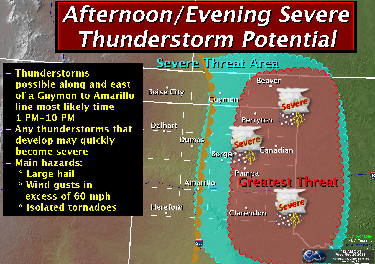
Amarillo (http://www.srh.noaa.gov/ama) sez:
So there you have it. Ain't May in Oklahoma just grand? Well, twas ever thus.
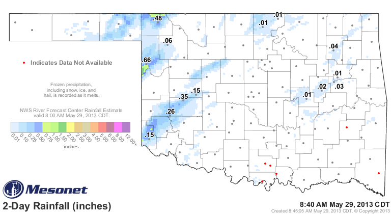
But those folks out west desperately need the rain, and with thunderstorms, you
tend to get some (along with the bad stuff). Here's the latest amounts forecast
for this system by the WPC.
It's unfortunately the weather will apparently set up past the western Panhandle,
because nobody needs rain more than those folks. They are literally transforming
back to Dust Bowl style conditions, with almost weekly dust storms on the back
end of these drylines. There has been a bit that has fallen across the far
northwest, but not enough to make a difference. At least not on the large
scale.
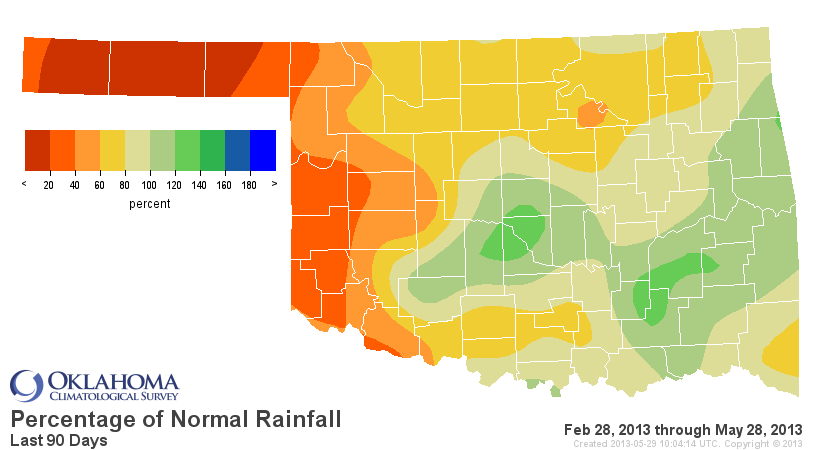
It has now been almost 100 days in the Panhandle without a quarter-inch of rain
in a single day.

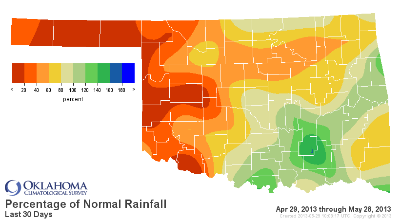
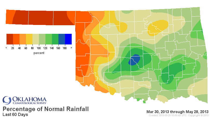
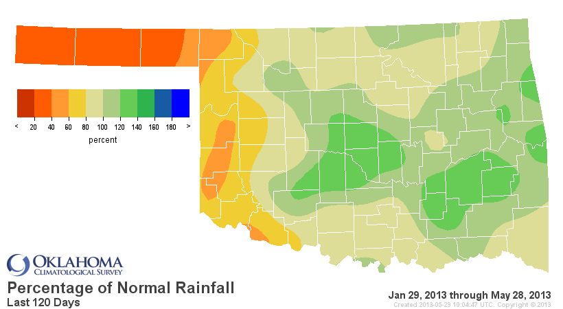
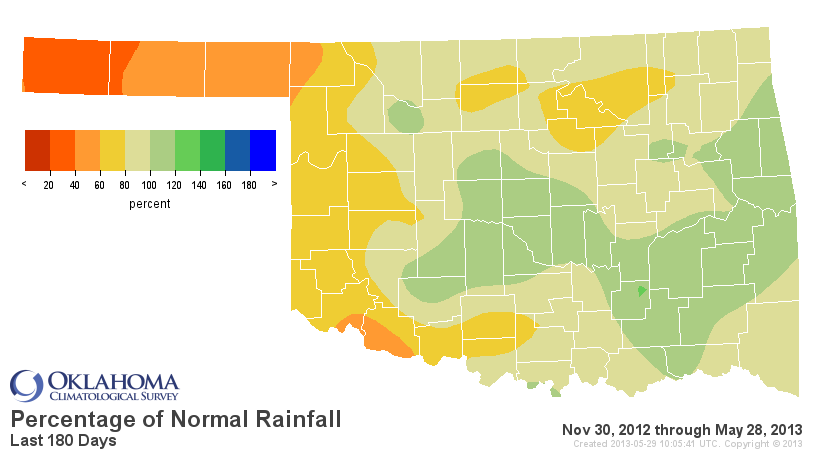
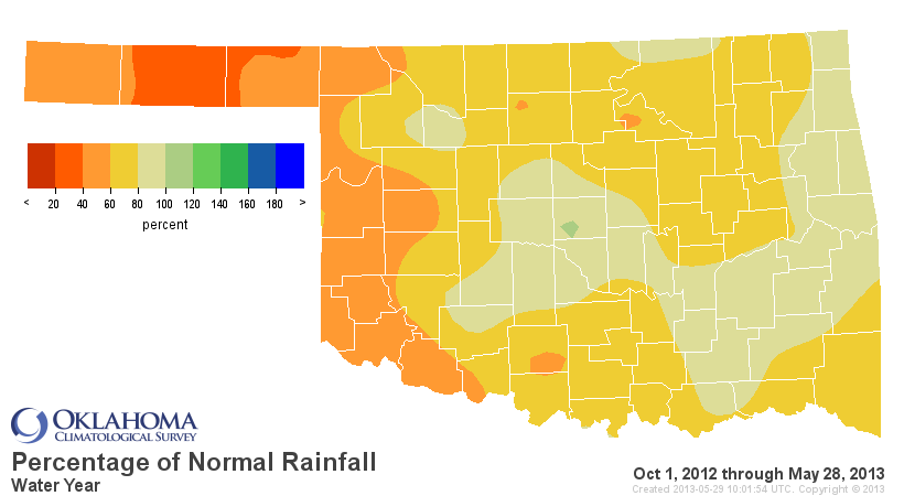
But in reality, just extremely dry across that entire area on several different
timescales.
Another silver lining ... at least they're missing the severe weather. I think
they'd put up with it for some rain, however.
So it's another couple of days for all of us to stay weather aware. Your local
NWS offices will have it covered, as well as your favorite media outlets.
Stay safe.
Gary McManus
Associate State Climatologist
Oklahoma Climatological Survey
(405) 325-2253
gmcmanus@mesonet.org
May 29 in Mesonet History
| Record | Value | Station | Year |
|---|---|---|---|
| Maximum Temperature | 107°F | BEAV | 2011 |
| Minimum Temperature | 42°F | KENT | 2019 |
| Maximum Rainfall | 5.19 inches | HECT | 2001 |
Mesonet records begin in 1994.
Search by Date
If you're a bit off, don't worry, because just like horseshoes, “almost” counts on the Ticker website!