Ticker for May 24, 2013
MESONET TICKER ... MESONET TICKER ... MESONET TICKER ... MESONET TICKER ...
May 24, 2013 May 24, 2013 May 24, 2013 May 24, 2013
Eeyore
A colleague called me Eeyore yesterday after he talked about all the full lakes
across the eastern half of the state, and I replied with a "Yeah, they were full
this time last year too!" So I will accept his admonition and reply with a "well,
can ya blame me??"

I guess I've been shocked and awed too much lately but the ridiculous nature of
Mother, uhhhh, Nature here in Oklahoma the last few years (must not mention EF5
tornado ... must not mention EF5 tornado). Here's where we are now with drought:
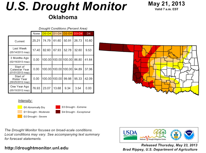
Not bad at all for the eastern half of the state into central Oklahoma, save for
the northern and southern fringes. But here's where we were last year at this
time:
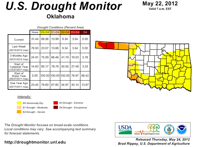
Now here's where his chiding rings true. At this time last year, the momentum
was all towards drying out whereas this year we can't seem to get the rain to
stop! May 1-24, 2012, was the 5th driest on record across the state with an
average of 1.2", 2.8" below normal. This year that same span has seen the 42nd
wettest dating back to 1921 with an average of 3.3" (still 0.7" below normal,
however).
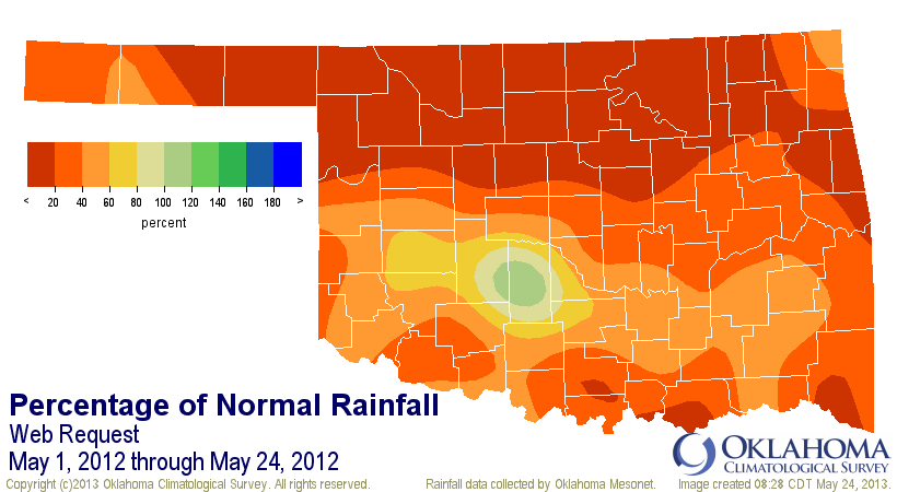
May 1-24, 2012, rainfall maps

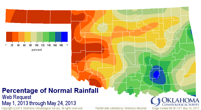
May 1-24, 2013, rainfall maps

And also remember that we were ridiculously (I use that word at a ridiculously
inflated pace) warm through May last year, whilst this year we were wearing our
heavy coats through early May.
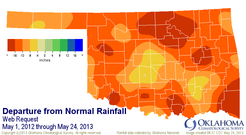
Now, here's where all bets are off ... across western Oklahoma, things are just
as nasty this year as they were last year at this time. Heck, they're probably
worse (okay, now I can just hear Eeyore saying that!). And the entire state is
still dealing with a longer-term deficit, so even those places that are
seemingly fully recovered will be more susceptible to future dry weather.
Oct. 1, 2012-May 24, 2013


May 1, 2012-May 24, 2013

So all we have to do is keep this May's momentum going forward into June, but
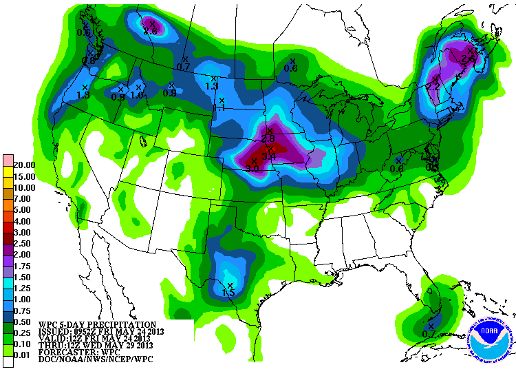
also shift it to the west, as I said yesterday. There are rain chances for
western Oklahoma coming up. They don't look like drought-busters, unfortunately.
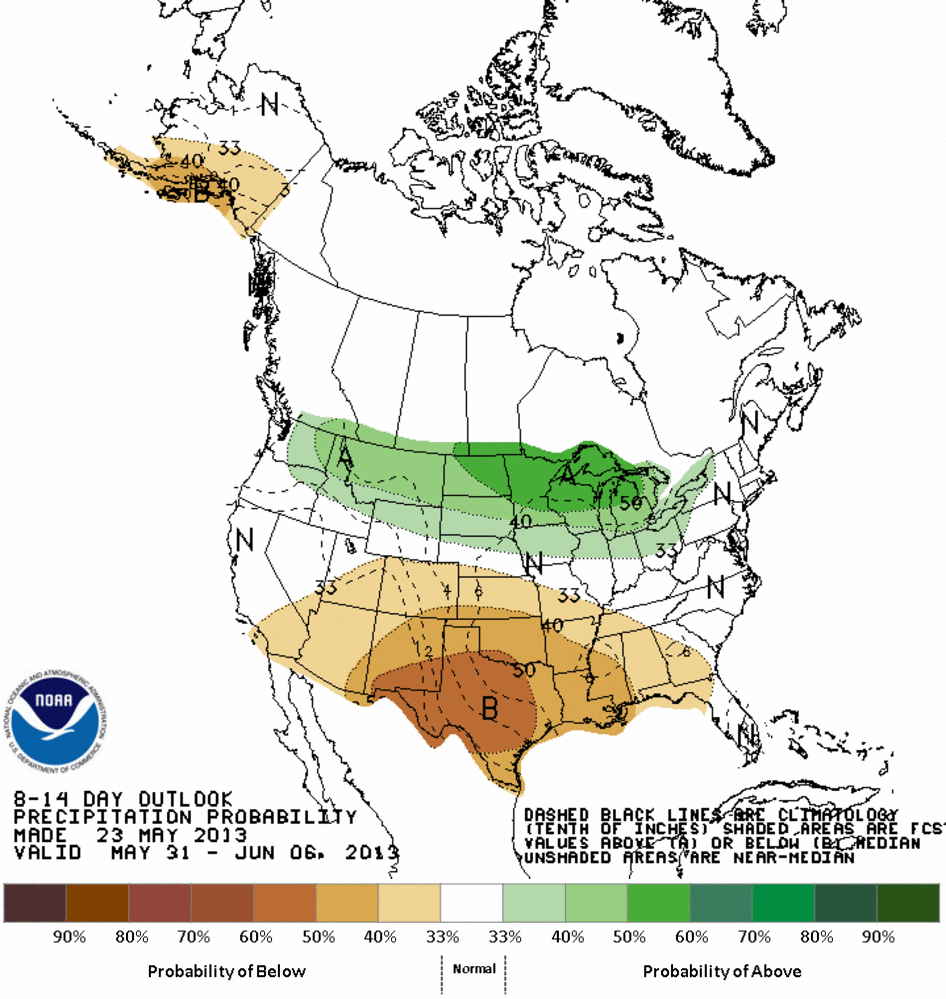
And CPC takes a dim view of the rain chances for the May 31-June 6 period.
So if you look at what "normally" occurs in Oklahoma with rainfall, we have
another 3 weeks or so to build up our reserves across western Oklahoma to match
the surpluses across eastern and central Oklahoma.
Mother Nature had better giddyup for western (and parts of northern and southern)
Oklahoma's sake! She owes us one, I'm thinking.
Now, hasanybody seen my tail?
Gary McManus
Associate State Climatologist
Oklahoma Climatological Survey
(405) 325-2253
gmcmanus@mesonet.org
May 24 in Mesonet History
| Record | Value | Station | Year |
|---|---|---|---|
| Maximum Temperature | 111°F | TIPT | 2000 |
| Minimum Temperature | 36°F | EVAX | 2017 |
| Maximum Rainfall | 6.54 inches | MCAL | 2015 |
Mesonet records begin in 1994.
Search by Date
If you're a bit off, don't worry, because just like horseshoes, “almost” counts on the Ticker website!