Ticker for May 23, 2013
Mesonet Ticker update: New US Drought Monitor edition
Sorry, since I sent last night's Ticker so late, it counts as today's as well.
So there's a bit of a repeat below. I'm Ticking from my current base of
McDonald's on SW 134th and Penn, just north of EF5 central. So the entire
Ticker staff (and kids) is enjoying a Coke and a smile and free wifi.
Obviously drought marches on in some parts of the state, even as it marches
right off the map in other places. Flooding rains hampered recovery efforts
in Moore and south OKC this morning, prompting flood warnings. The amount of
rain this week alone is enough to produce changes in both this week's map and
also next week's.
This morning's rain shows up as a streak from the northwest to southeast,
exceeding more than three inches in some localized areas.

That adds to the rather prodigious amounts seen over the last week across
central and southeastern Oklahoma.
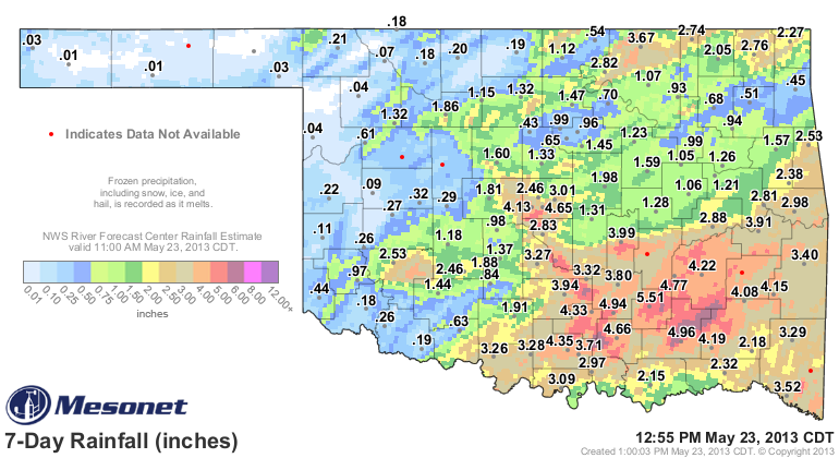
Unfortunately, there are not nearly enough of those 2-6 inch amounts across
western through north central Oklahoma. Accordingly, our new drought map
produced from those rains shows both improvements and degradations. Much of
eastern Oklahoma is now completely free of drought. At the same time, extreme
and exceptional drought increased across western parts of the state.
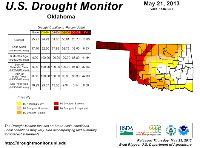
So oddly enough, the state's area completely out of drought rose from 17%
to 25%, but the area of exceptional drought rose from 10% to 11%. The area
with extreme-exceptional drought fell from 33% to 27%.
That's really complicating things. The short and simple message is there has
been too much rain across central and eastern Oklahoma, and not nearly enough
across western Oklahoma and the Panhandle.
The good news is rain chances are increasing for western parts of the state.
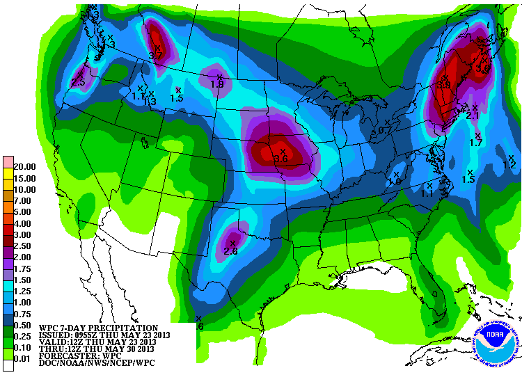
The bad news is ... it actually has to come true! I have a good feeling about this
forecast of an inch or so out west.
I mean, we're due, ain't we??
Gary McManus
Associate State Climatologist
Oklahoma Climatological Survey
(405) 325-2253
gmcmanus@mesonet.org
MESONET TICKER ... MESONET TICKER ... MESONET TICKER ... MESONET TICKER ...
May 23, 2013 May 23, 2013 May 23, 2013 May 23, 2013
A late night thanks
Sorry for the late hour. I Tick when I can. There's only so much you can write on
an Ipad that's constantly below 30% power and your fingers are too fat for the
on-screen keyboard. I wanted to say thank you to all that sent well wishes to my
family and me, and to our S. OKC/Moore community. Still without power at my house,
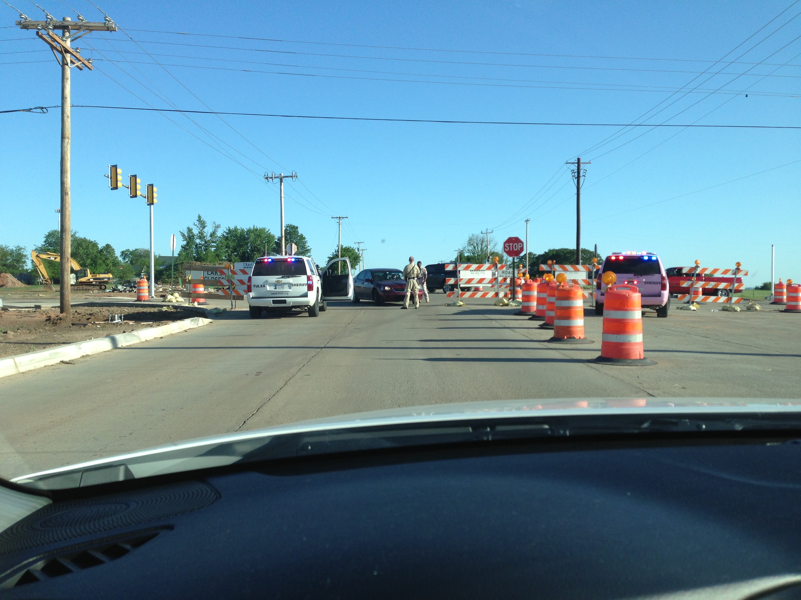
and still extremely difficult to get anywhere. Tonight I was stopped by a Tulsa
police office in a pink police cruiser, of all things.
One good thing I have discovered in my four days of isolation and 1890s electrical
grid situation ... I have gotten to know my family a lot better. One bad thing ...
they have gotten to know me better as well. And my kids still practice water
conservation even though we are out of drought ... I still can't get them to flush
the toilet.
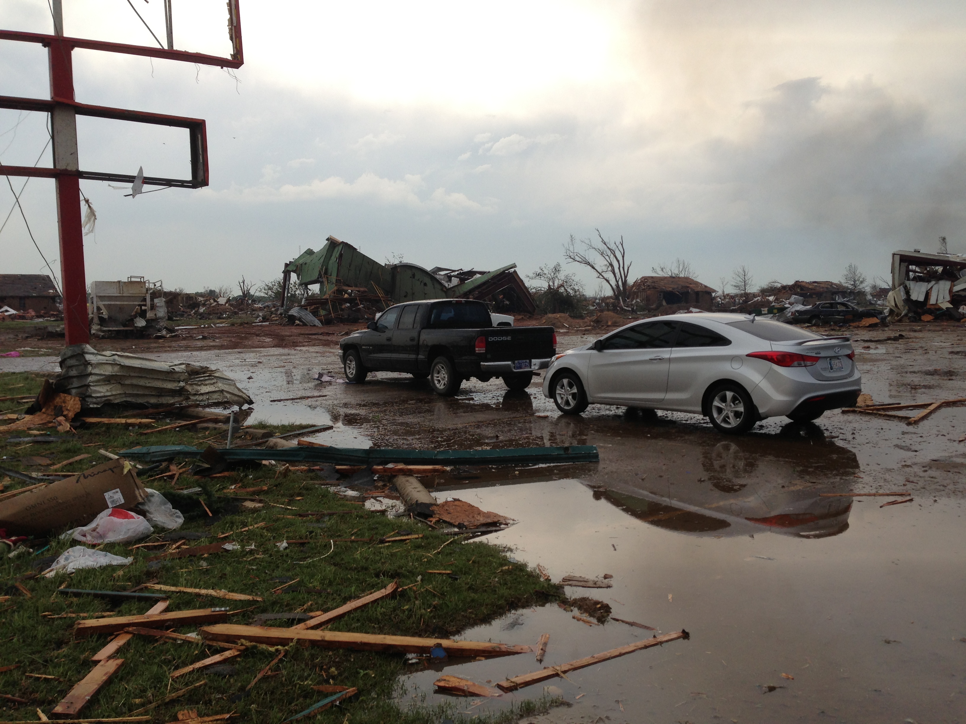
Just a few more pics to show you. These can't compare to some you see on other
websites and news stations, but they're pretty tough to see from my perspective,
places I saw everyday in my own stomping grounds. Here's what I saw in the sky
as I left my storm shelter (it might be crooked ... turn your head sideways for
effect.
https://content.mesonet.org/ticker/archive/20130523/IMG_1689.MOV
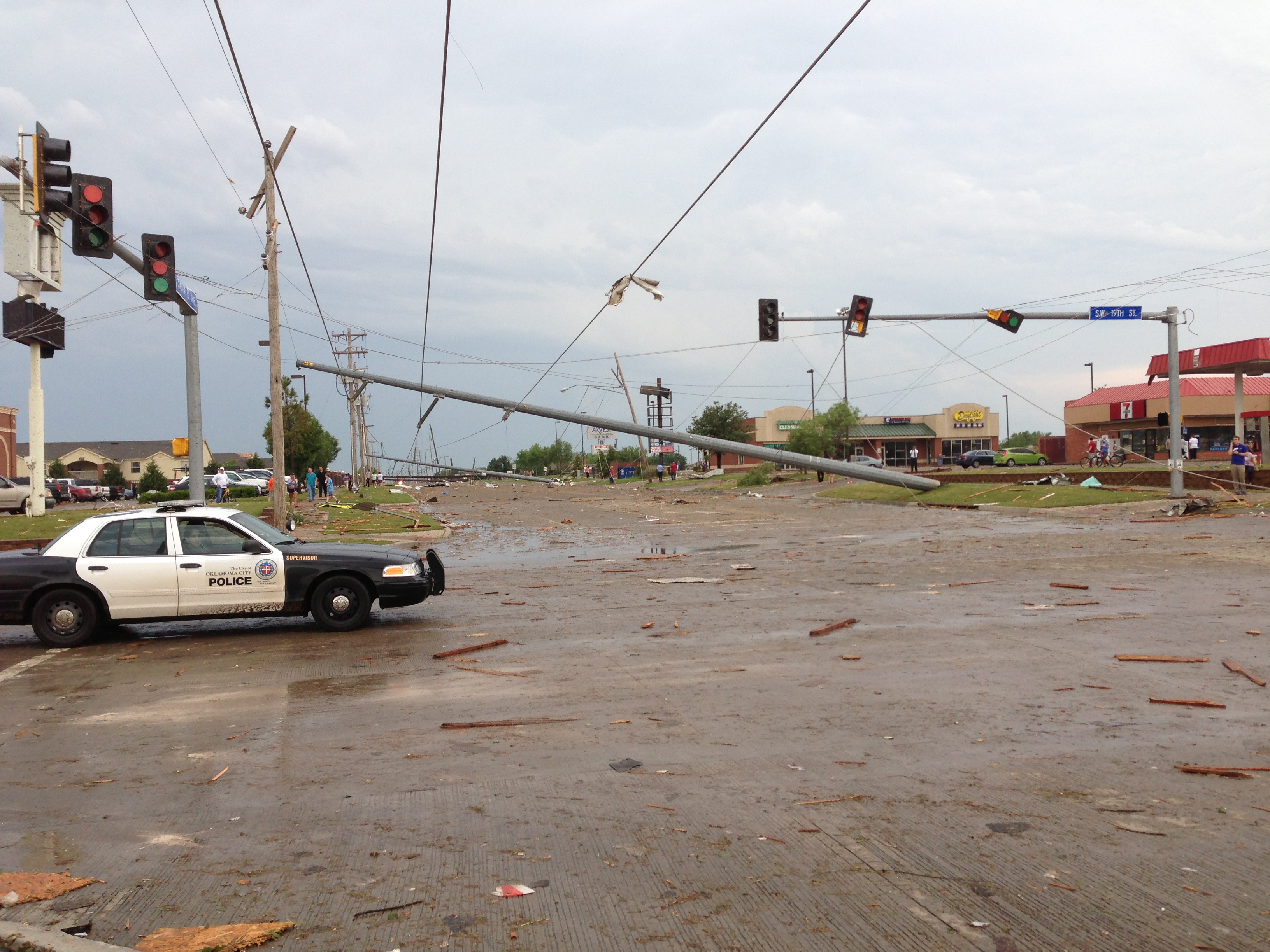
Looking north onto Santa Fe from SW 19th street (I was on a bicycle, trying to
get north to my wife's elementary school).
I think this was the Dollar General store just north of SW 19th on Santa Fe.
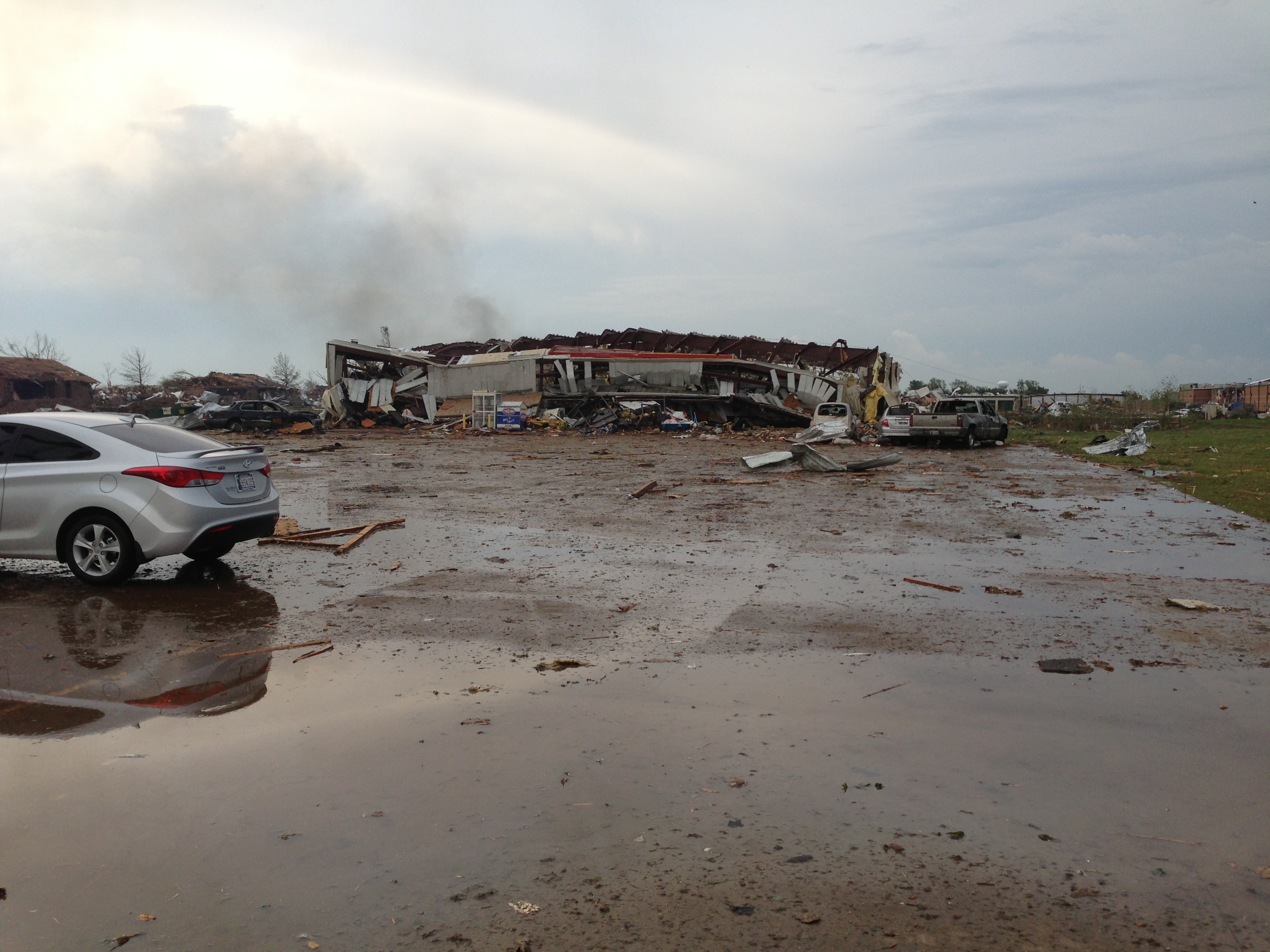
Looking south on Santa Fe from SW 19th street.
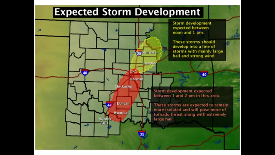
Here is the graphic from the Norman NWS that sent me home at noon to get my
kids early from daycare and school.
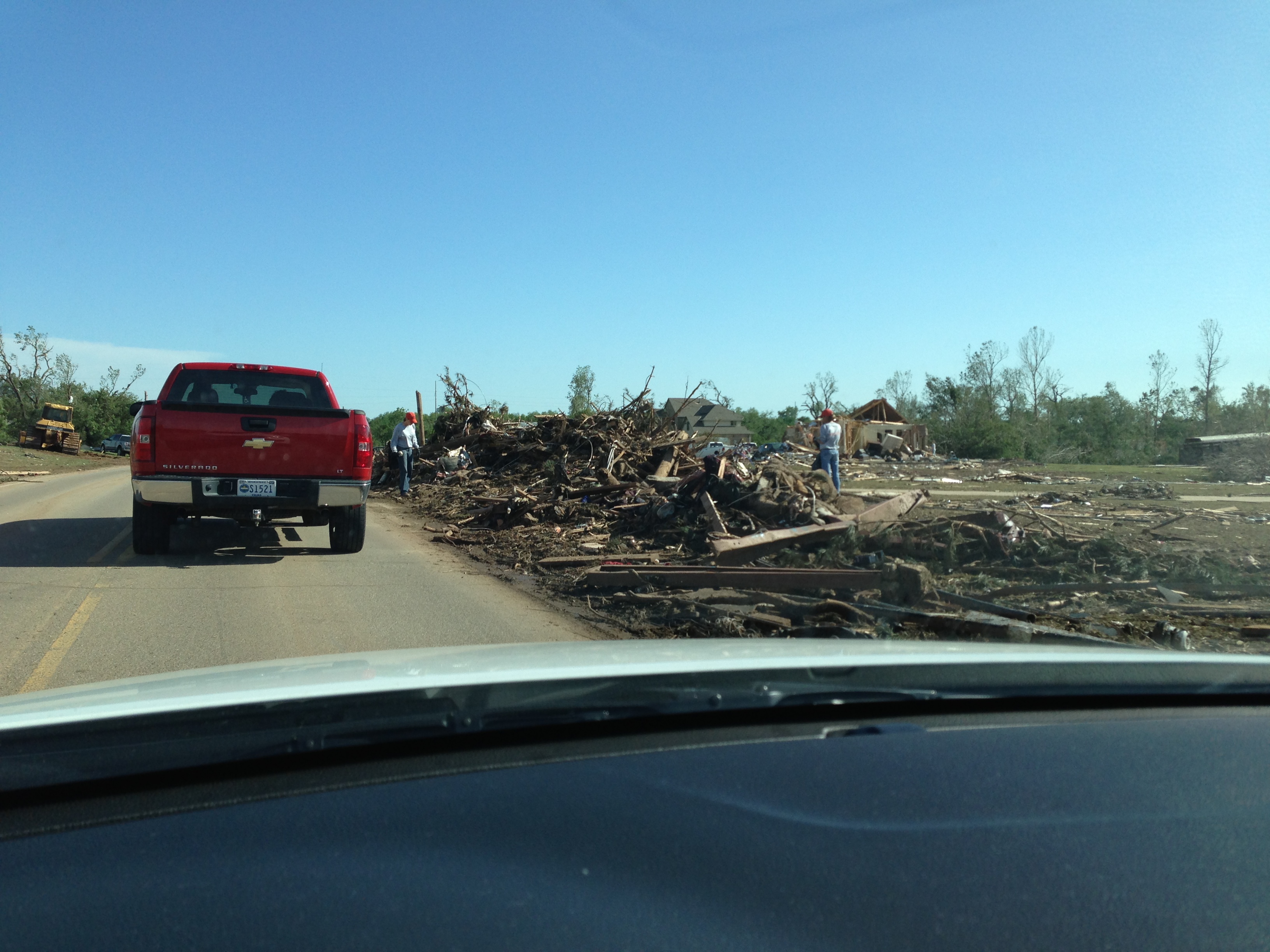
Damage on Penn Ave. south of SW 149th (SW19th on the Moore side).
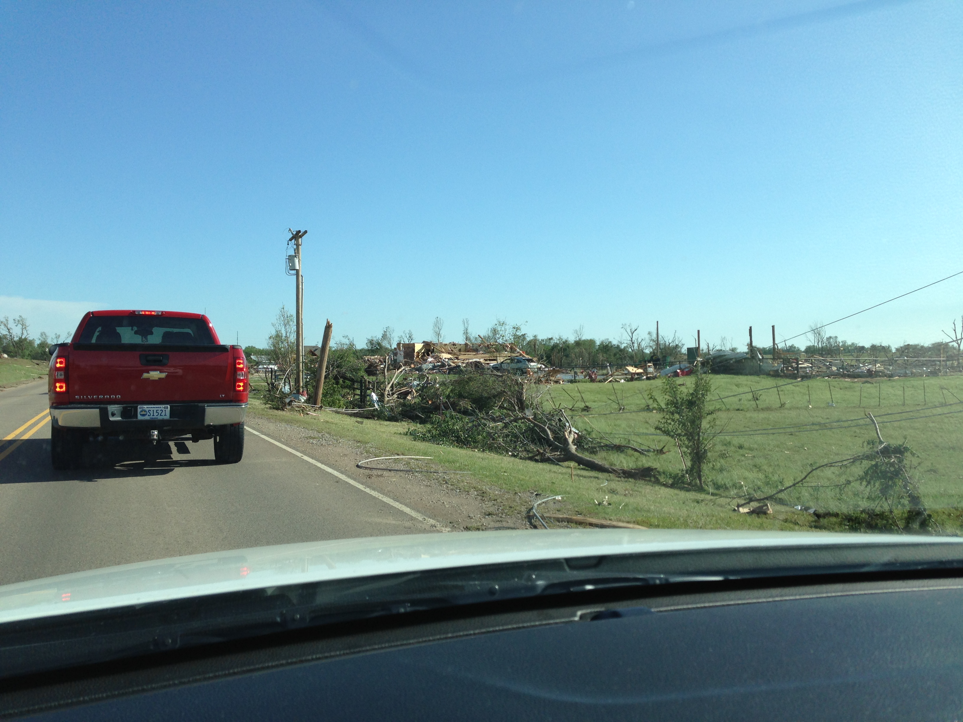
One of the many dead livestock along that stretch.

Farther south ... mangle-ification (new EF5 word).
Pink Tulsa Sheriff vehicle, checking IDs (told ya!). But, also shows cooperative
spirit of Oklahomans, helping out where they can.
And don't worry about me taking pics from my car. Tough to wreck when traffic
is moving at 0.5 mph.
In the meantime, let's not forget about those folks who have been suffering from
their own multi-billion dollar disaster for nearly three years now. The latest
rainfall statistics look great for part of the state, but for western Oklahoma,
drought rages on.

We Okies take care of each other, whether it's tornadoes or drought. We're all in
this together. If you say a prayer for the tornado-ravaged parts of the state
over the last week (and it ain't just Moore!), don't forget to ask for some
rain out west as well.
Be sure to add the "without EF5 tornadoes" disclaimer in there before your Amens,
however.
Gary McManus
Associate State Climatologist
Oklahoma Climatological Survey
(405) 325-2253
gmcmanus@mesonet.org
May 23 in Mesonet History
| Record | Value | Station | Year |
|---|---|---|---|
| Maximum Temperature | 112°F | ALTU | 2000 |
| Minimum Temperature | 40°F | EVAX | 2017 |
| Maximum Rainfall | 9.67 inches | VINI | 2011 |
Mesonet records begin in 1994.
Search by Date
If you're a bit off, don't worry, because just like horseshoes, “almost” counts on the Ticker website!