Ticker for May 16, 2013
MESONET TICKER ... MESONET TICKER ... MESONET TICKER ... MESONET TICKER ...
May 16, 2013 May 16, 2013 May 16, 2013 May 16, 2013
The good, the bad and the Ticker
I have good news, bad news, and worse news.
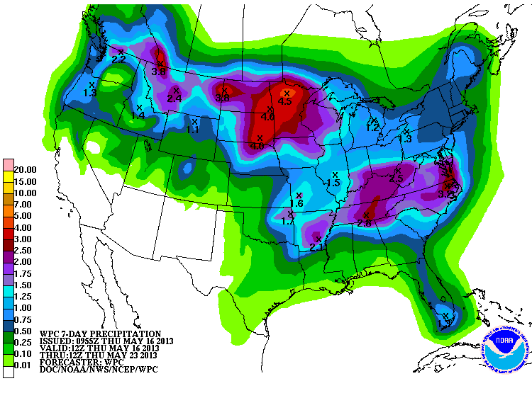
The good news? It rained! I know it came with extremely destructive weather down
south, especially in Texas, but twas ever thus in springtime around these parts.
If it's May and it's storming, you're probably going to hear bad news the next
day. So let's just show the rainfall map as our hearts go out to those that were
impacted by the severe weather.
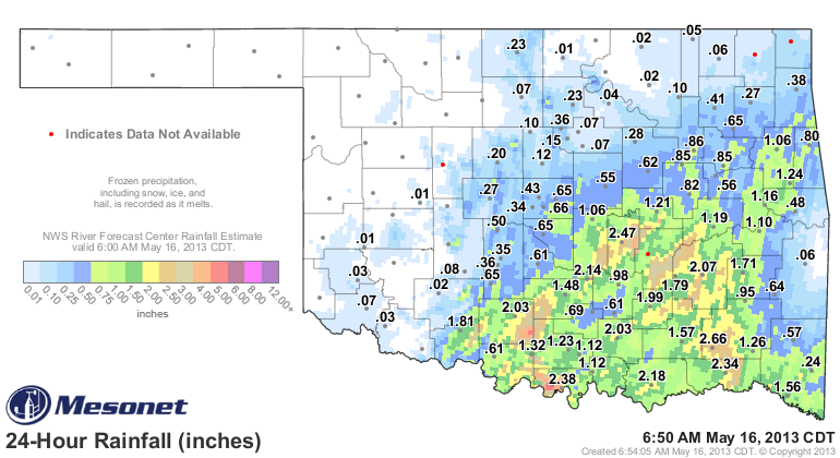
Sine very nice amounts down across south central through eastern Oklahoma ...
upwards of 3 inches in some locations.
The bad news? Well, from that same map, you can see it DIDN'T rain where it was
needed the most ... southwestern Oklahoma northward through the Panhandle. Some
places got nary a drop. So the rains down south helped our May statistics, but
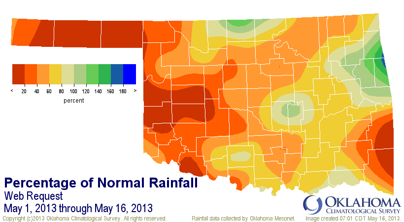
for those other areas, still wayyyy too much red on the pct of normal map. I
want you to think about something as you look at these maps, however. All that
rain down south last night did was get them a little less below normal. 1-2
inches of rain in May when you haven't had any before that will not get you
back to normal. It's May! Talking rainfall in May is like talking cold weather
in January, or hot weather in July. It's prime time. At any rate, here are
the maps.
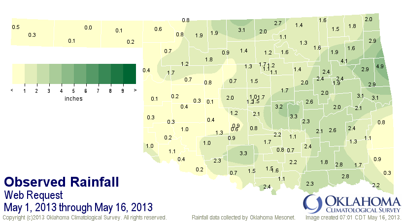
So the rain last night (and continuing today) brings the statewide total for
the first half of May up to 1.43 inches, 1.22 inches below normal. That's the
26th driest May 1-16 since 1921. The Panhandle has had 0.28 inches, on average,
west central about 0.5 inches, and SW OK has had 0.81 inches.
I'll say it again: the rain needs to shift west! Because we continue to see
that D4 Exceptional drought creep across western Oklahoma. It's now up to 10%
of the state, with 33% covered by D3-D4 (Extreme-Exceptional).
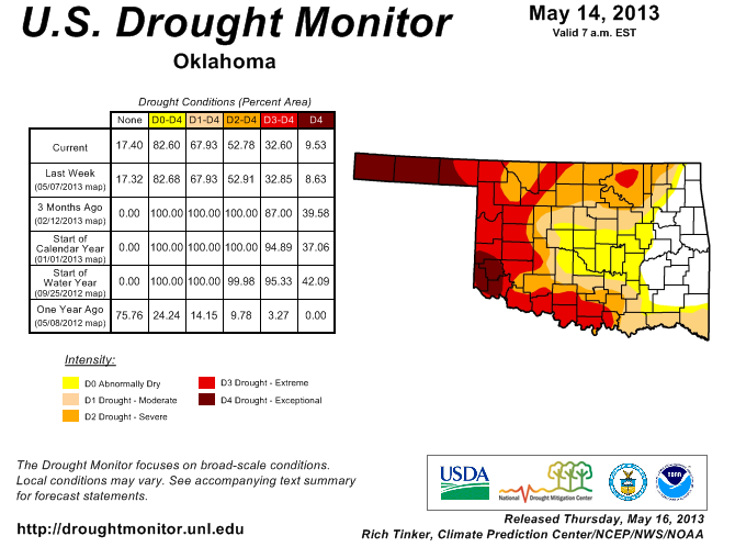
This rain could help that depiction across south central Oklahoma, which just
saw more D3 introduced. And the rain chances will continue this weekend into
early next week.
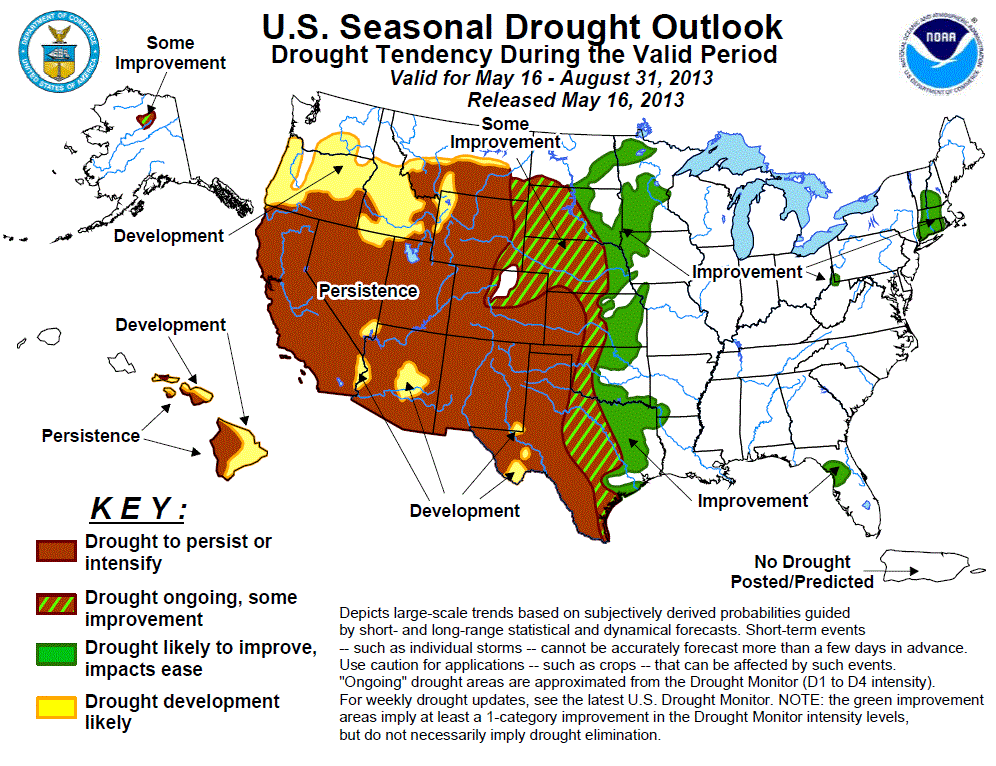
That's still not nearly enough green across western Oklahoma. The latest U.S.
Seasonal Drought Outlook released this morning has a bit of optimism for some
of western Oklahoma, at least (and even more for the eastern half of the state.
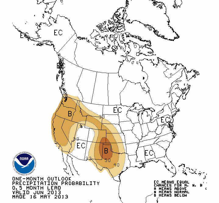
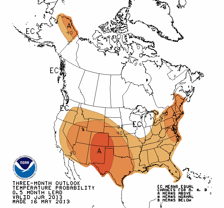
The outlooks for June and then the June-August summer period predict ... hold
me up, I might faint from shock ... HEAT. The news is not much better on the
precip side, with increased odds of below normal precip across much of Oklahoma
during June, but especially increased odds across the Panhandle. A very similar
pattern is forecast for the summer, except not quite as far east. Remember, these
maps show PROBABILITY, not AMOUNTS! So we're talking INCREASED ODDS of below
normal precip and above normal temps.
June Outlooks
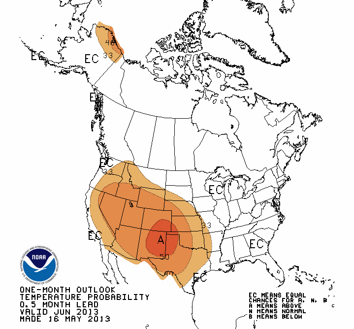
Summer (June-August) Outlooks

I do not have to tell you how bad this will be to have a hot and dry June going
into summer, let alone a hot and dry summer itself. If these outlooks should
verify, and let's pray that they don't, a full third year of drought is going
to become much more likely across the western half of Oklahoma, with the
possibility of a spread to the east. Need examples? Look at the summers of 2010,
2011 and 2012.
To my brethren in western Oklahoma, including the best little pond in the
Universe about 8 miles south of Buffalo, hang in there!
Gary McManus
Associate State Climatologist
Oklahoma Climatological Survey
(405) 325-2253
gmcmanus@mesonet.org
May 16 in Mesonet History
| Record | Value | Station | Year |
|---|---|---|---|
| Maximum Temperature | 101°F | ALTU | 2000 |
| Minimum Temperature | 31°F | BOIS | 2011 |
| Maximum Rainfall | 4.55 inches | WYNO | 2021 |
Mesonet records begin in 1994.
Search by Date
If you're a bit off, don't worry, because just like horseshoes, “almost” counts on the Ticker website!