Ticker for May 14, 2013
MESONET TICKER ... MESONET TICKER ... MESONET TICKER ... MESONET TICKER ...
May 14, 2013 May 14, 2013 May 14, 2013 May 14, 2013
Now we're cooking with gas
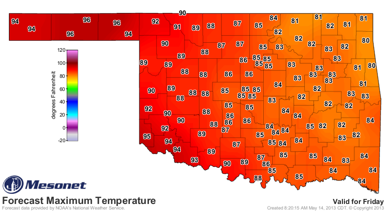
Hot plasma, actually. The sun has taken control and we're back to summer-like
weather. Check out yesterday's high temperatures.

That 96 degrees in Buffalo (greatest place in the Universe, remember) ties Beaver
(close to the greatest place in the Universe, except with more cow chips) from
April 30 for the highest temperature recorded by the Mesonet during the year thus
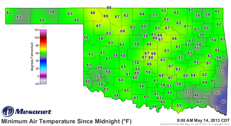
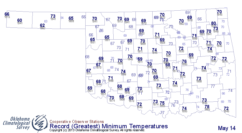
far. We also saw a pretty warm start for the state. Not quite record level warmth,
but still above normal for this part of May. We did get close up in the NW.
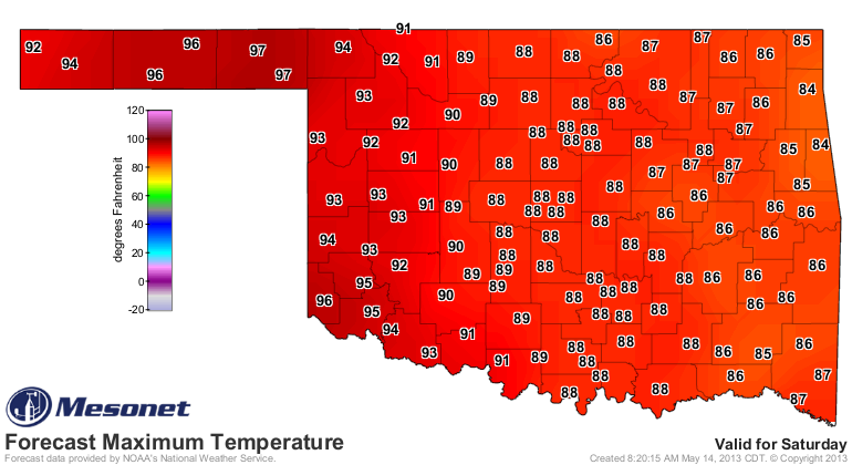
More warmth is on the way for the next few days, but Saturday looks like the
scorcher. Perhaps our first 100-degree reading this year? Friday could be a dark
horse in that race as well. Watch those exceptional drought areas for possible
triple-digits.
-------------------------------------------------------------------------------
Pastures should improve, then possibly get worse
The conditions of the U.S.'s pastures and rangeland are at their worst ever
starting level during the 1995-2013 period of record, according to the USDA.
Take a look at this graph which shows the evolving conditions for each year
since 1995. The level at which 2013 is starting (again, for the entire US) is
well below that of all the other years. This "Condition Index" is tailored
where low numbers mean worse conditions. 2012 ended up the worst if you
take the entire growing season into account. 2006 and 2002 are also in there
... years that many cattle ranchers would like to forget.

For Oklahoma, our levels aren't quite that bad, at least according to the NASS
report released yesterday. Our levels were rated 39% very poor/poor, 38% fair,
and 23% good/excellent. That should improve a bit more as the warmth continues.
There is lots of soil moisture that has gone to waste since it has been so much
cooler than normal. However, those improvements will be occurring in central
and eastern Oklahoma. Pastures out west will no doubt continue to decline as
the heat and sun start to work their ill magic on the soils.
-------------------------------------------------------------------------------
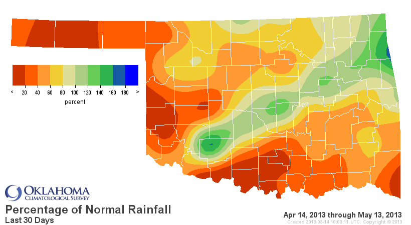
There is rain in the forecast, which should help those soils. Unfortunately,
it still looks like western Oklahoma might be left out of the good stuff.
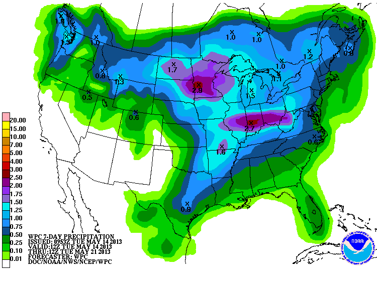
The Panhandle isn't even painted with any rain in that scenario. Things are getting
dire in the Panhandle, to say the least. When these systems come through that
bring rain to down-state, they will be getting 50-60 mph winds and dust storms,
and whatever is left to burn will be under high fire danger.
--------------------------------------------------------------------------------
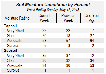
Speaking of soils, Oklahoma's are "okay" for now, but will be going downhill
if it doesn't rain and the heat continues. From yesterday's NASS report
( http://www.nass.usda.gov/ok/ ) you can see that the topsoils are holding up
for the time being, bu the subsoils are in pretty bad shape. Check out the first
column to the last column and you can see we're worse off than where we were at
this time last year at both levels, an ominous sign should Mother Nature shut
the spigots off.
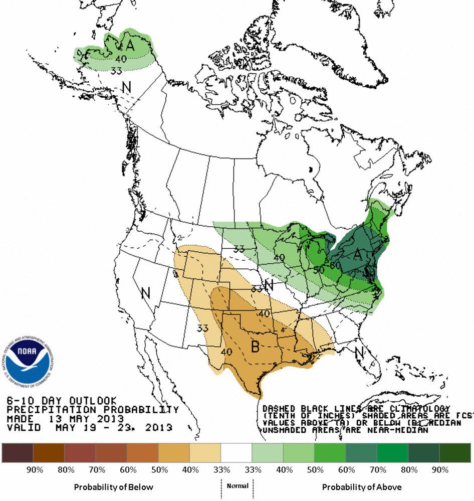
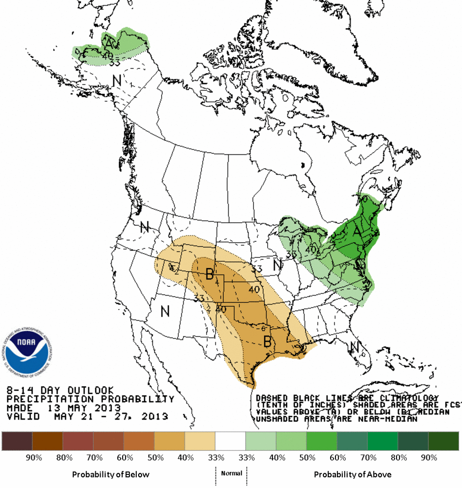
We can't afford to go into a dry pattern. The two chances for rain this week
need to be better than forecast, AND THEY MUST SHIFT TO THE WEST. The rainfall
probability maps from CPC are less than encouraging for the end of May.
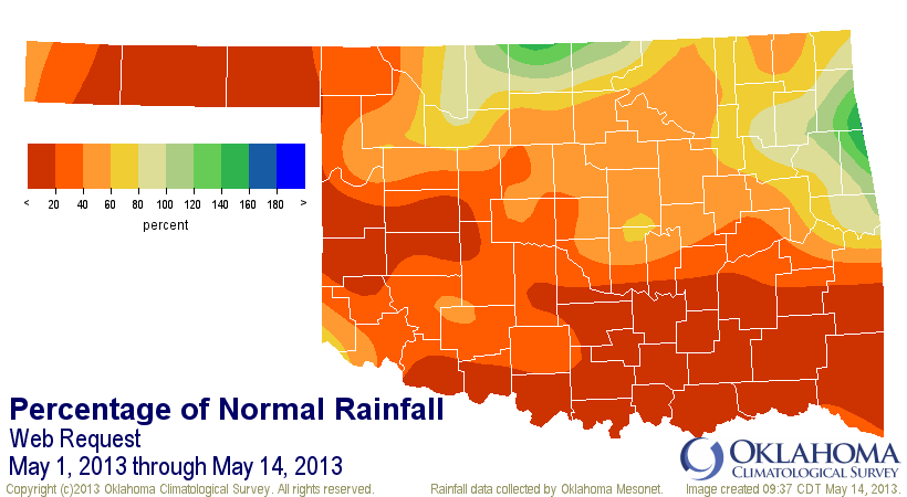
I hesitate to say "it's happening again" just like the last two springs. But
don't look now, however, because there is once again wayyyy too much red on
our rainfall departure maps.
May 1-14 rainfall maps

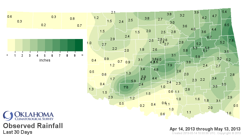
Last 30 days rainfall maps
This May 1-14 is the 10th driest statewide since 1921, and the last 30 days
(April 14-May 14) is the 11th driest.
So this is it, folks. We have about another month of our "normal" primary rainy
season. About mid-June, Mother Nature "NORMALLY" shuts the spigot off and we
enter the long, dry period of an Oklahoma summer. As I've said many times,
we're now on a race to the end of summer, and western Oklahoma is fading as
we enter the straightaway.
Gary McManus
Associate State Climatologist
Oklahoma Climatological Survey
(405) 325-2253
gmcmanus@mesonet.org
May 14 in Mesonet History
| Record | Value | Station | Year |
|---|---|---|---|
| Maximum Temperature | 99°F | ALV2 | 2018 |
| Minimum Temperature | 30°F | HOOK | 2004 |
| Maximum Rainfall | 3.44 inches | CLOU | 2003 |
Mesonet records begin in 1994.
Search by Date
If you're a bit off, don't worry, because just like horseshoes, “almost” counts on the Ticker website!