Ticker for May 9, 2013
MESONET TICKER ... MESONET TICKER ... MESONET TICKER ... MESONET TICKER ...
May 9, 2013 May 9, 2013 May 9, 2013 May 9, 2013
Mixed bag (of dirt)
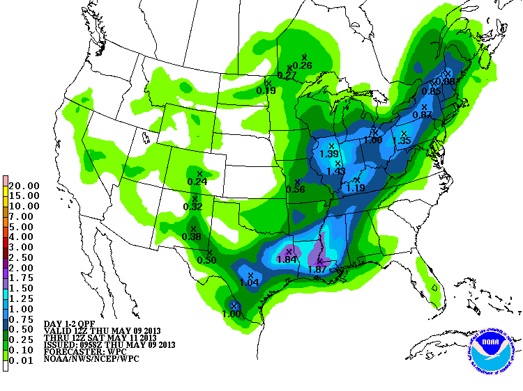
Last night's storms and then the subsequent squall line dumped some mighty fine
moisture in places that really needed it, places that didn't need it, and missed
many other areas still dry. We can start with the rainfall map. North central
Oklahoma was the area that needed it the most that actually received some good
rains.
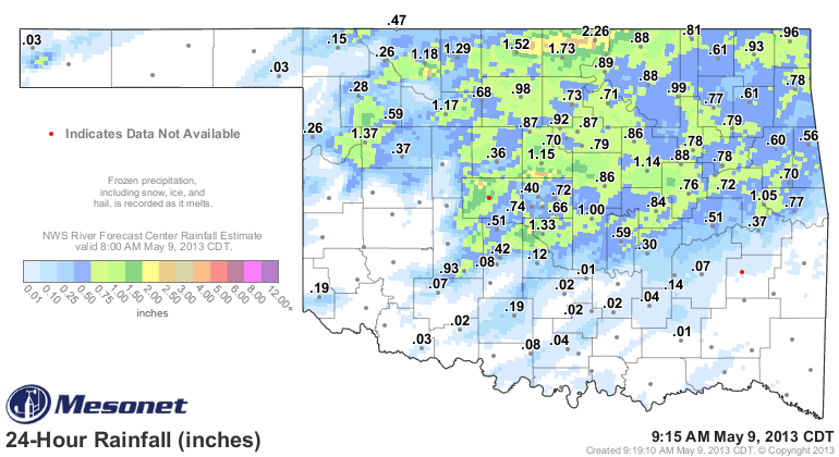
areas in Grant and Kay counties that had been suffering from significant rainfall
deficits on both the short- and long-term received 1-3 inches. But in general,
the northern half of the state recorded from a half-inch to about an inch. Lots
of little areas with more or less, even extending down into southwestern Oklahoma.
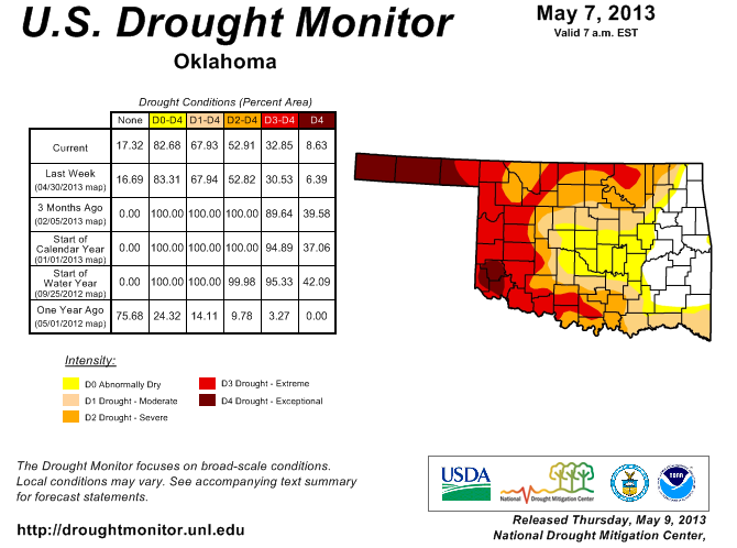
So as we take a look at this morning's new U.S. Drought Monitor map, keep in mind
that this rainfall was not an influence on the new depiction. It will be reflected
on next week's map. THIS is the rainfall map pertinent to this week's map.
So not a lot of major improvement in this week's map, accordingly, although we
did see a bit more of that yellow disappear from eastern Oklahoma. This biggest
change was across the Panhandle where that D4 Exceptional drought spread farther
to the east.
The reasons are fairly simple ... it's too dry! All these rain events tend to
strike farther to the east. Take a look at the horrible looking "days without
a quarter-inch of rain" map, as well as the one for a tenth of an inch.
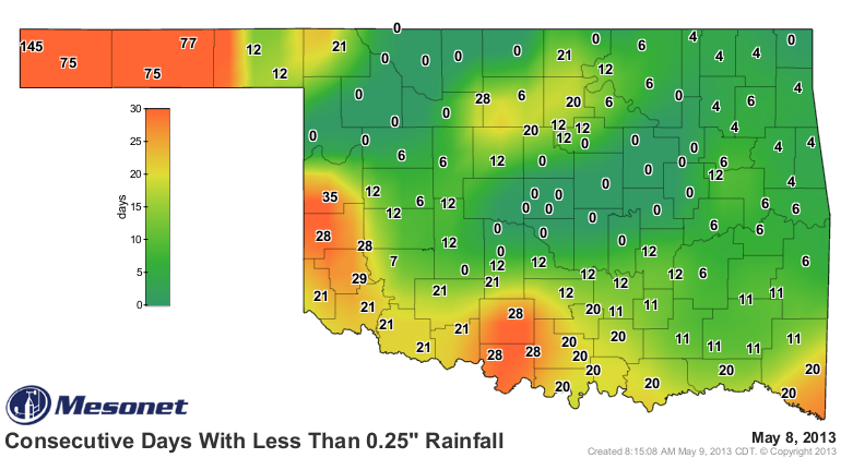

Kenton is now up to 145 days without at least a tenth of an inch ... up to 21
days farther east in the Panhandle. Bump that up to a quarter-inch and it's
still 145 days in Kenton, but more than 75 in Texas County.
That's dry.
And you can also see danger spots forming across west central, south central
and southeastern Oklahoma. Luckily, we still have a chance for rain today and
tonight. Amounts don't look massive, but they will help if realized.
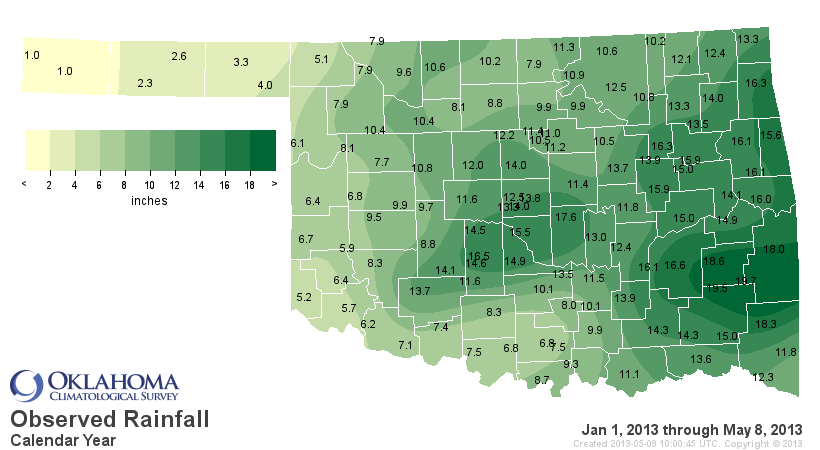
The remaining areas of significant drought are due to the short- and long-term
deficits remaining. You can still see those deficits in both the year-to-date
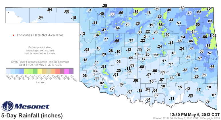
precip maps and the water year-to-date (Oct. 1, 2012-May 9, 2013) maps.
Jan. 1-May 9 maps

Oct. 1, 2012-May 9, 2013 maps
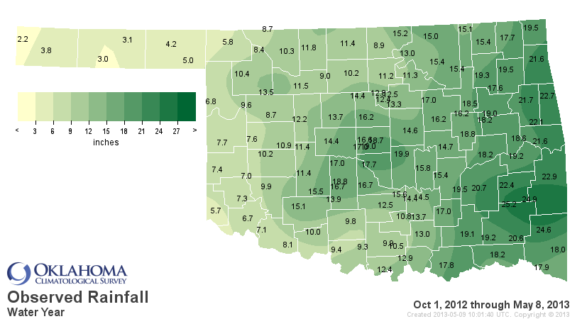

And that's the key to the reason the relief seen since Feb. 1 has not completely
eradicated the drought.
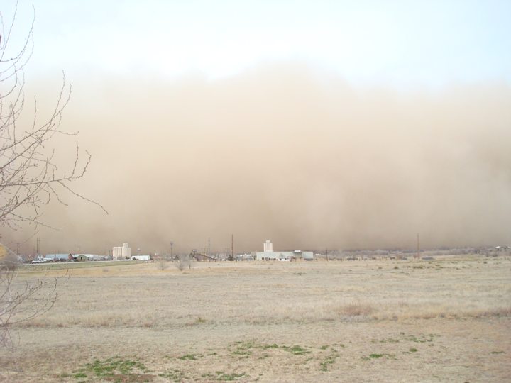
To put in perspective what's going on in the Panhandle, words are not enough. So
here are some pics sent from Ticker readers in that area.
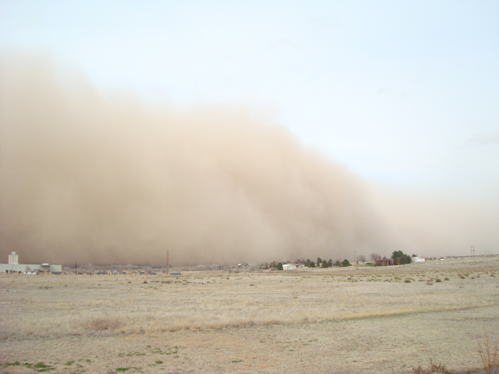
This first two are of a dust storm just across the border in Baca County, CO,
headed to the south. The third picture is of the resulting dust storm in
southern Texas County. These were all taken mid-April'ish.
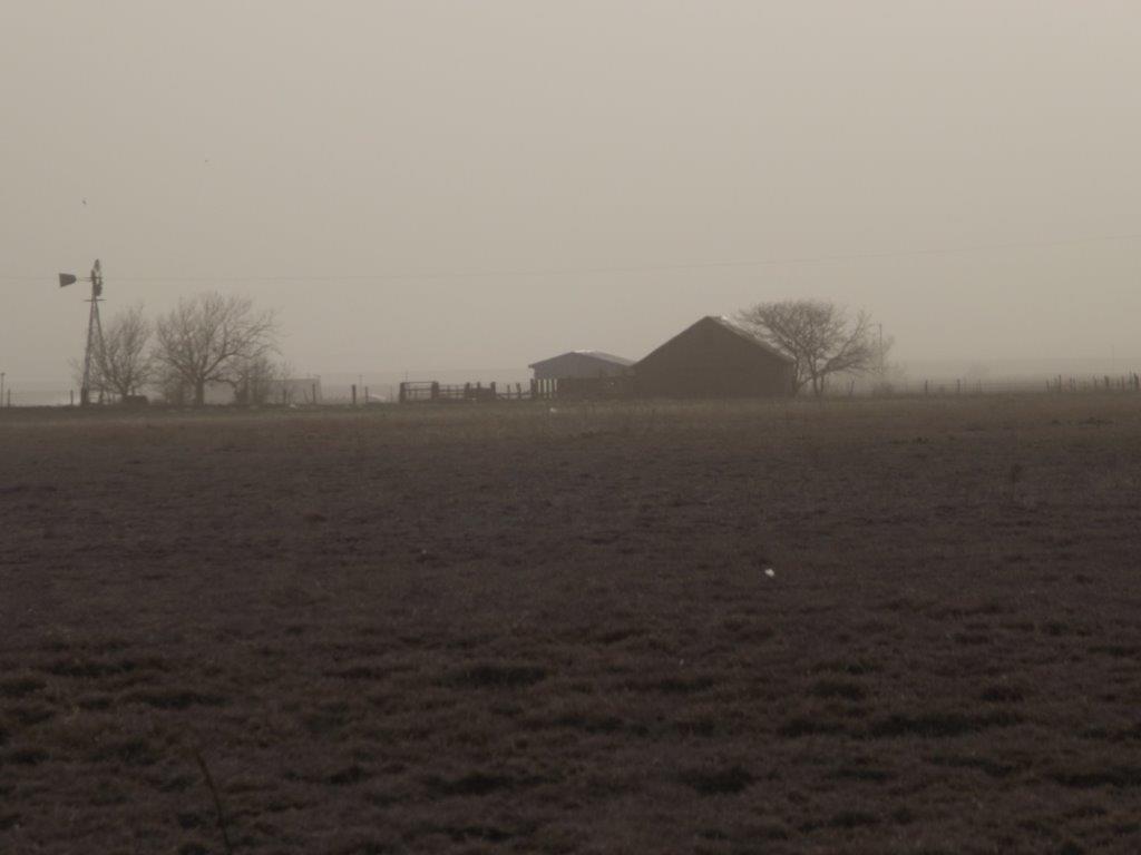
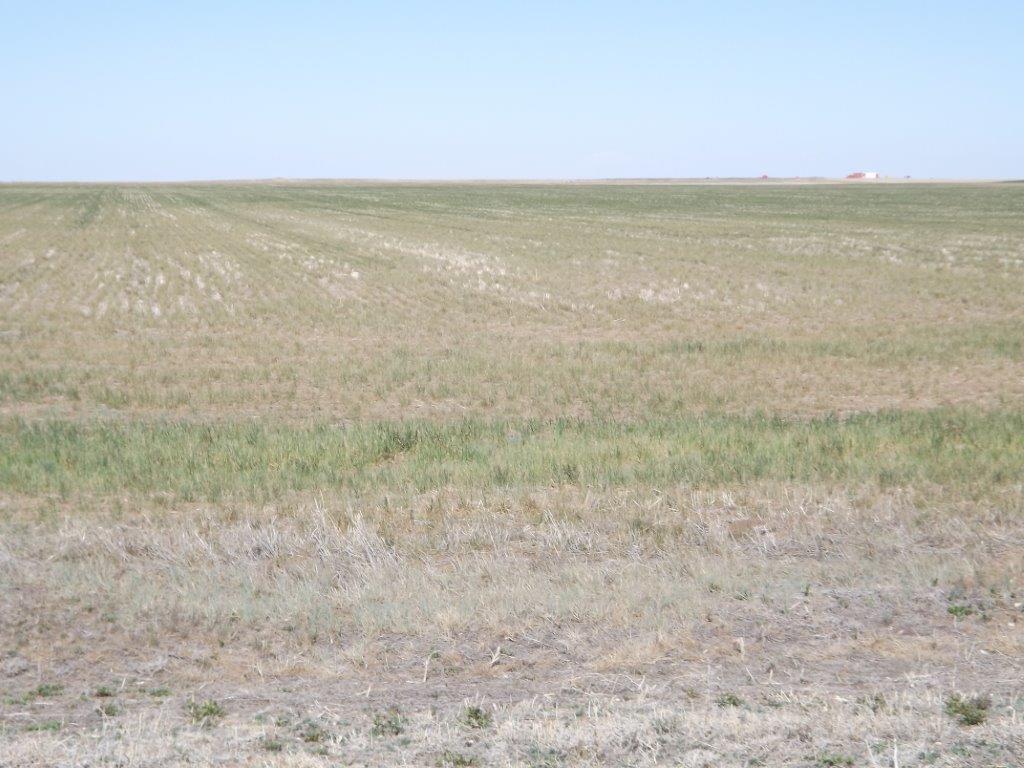
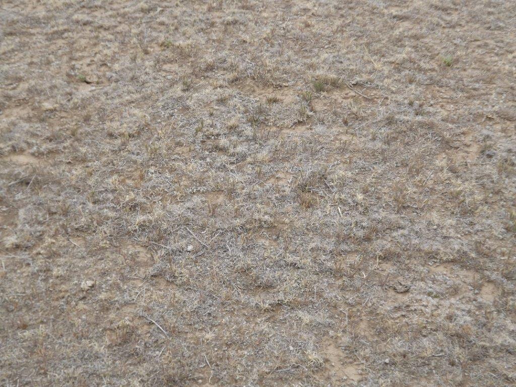
Here are a few pictures taken from the western Panhandle yesterday looking at
the decimated dryland wheat crop out that way, and also the ailing pastures.
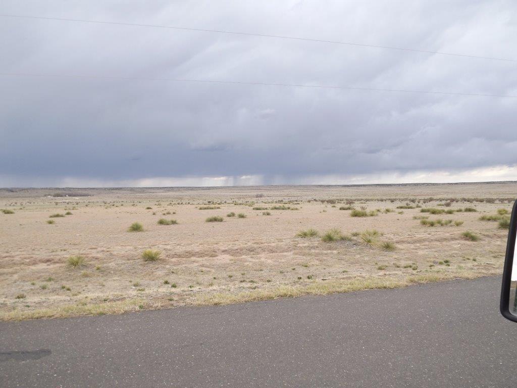
The final picture is of rains in Colorado, skirting the Panhandle.

Drought lives and dies. Fortunately, it's been dying across eastern and central
Oklahoma. Unfortunately, it's thriving out west.
Gary McManus
Associate State Climatologist
Oklahoma Climatological Survey
(405) 325-2253
gmcmanus@mesonet.org
May 9 in Mesonet History
| Record | Value | Station | Year |
|---|---|---|---|
| Maximum Temperature | 107°F | ALTU | 2022 |
| Minimum Temperature | 31°F | EVAX | 2020 |
| Maximum Rainfall | 4.56 inches | STIG | 2015 |
Mesonet records begin in 1994.
Search by Date
If you're a bit off, don't worry, because just like horseshoes, “almost” counts on the Ticker website!