Ticker for May 2, 2013
MESONET TICKER ... MESONET TICKER ... MESONET TICKER ... MESONET TICKER ...
May 2, 2013 May 2, 2013 May 2, 2013 May 2, 2013
Heat drought
As Graham Greene said in "Thunderheart": You have to listen to the wind. As it
blasts through my poorly-sealed government-contracted windows, I can translate
what it's telling me ... "Mother Nature is an idiot."
This weather brings a quote to mind from the Philosopher King Marcus Aurelius:
"Sure is cold out there!" As you may have heard and by now have experienced, it
is unusually cold for May in Oklahoma. All thanks to a much-too-powerful cold
front that blasted through the state yesterday. A sundry of maps from the
Oklahoma Mesonet are all you need if you don't want to step outside and feel it
for yourself.
Lows: 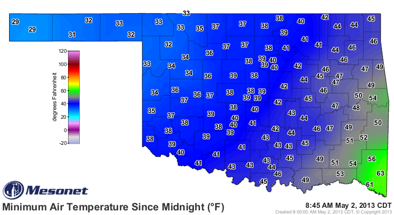
Record lows: 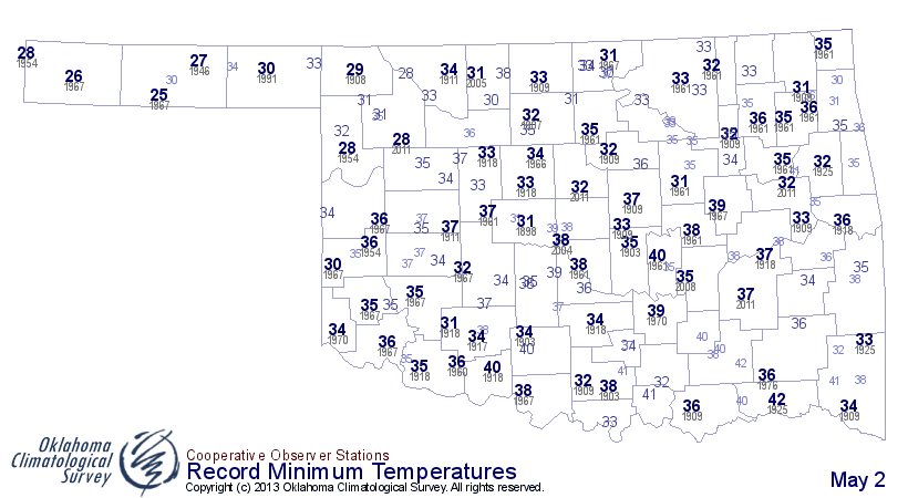
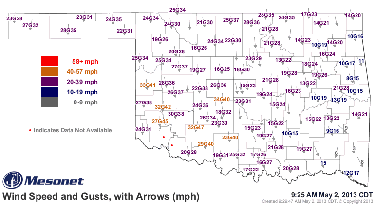
Wind chills: 
24-hour-diff: 
Current-temps: 
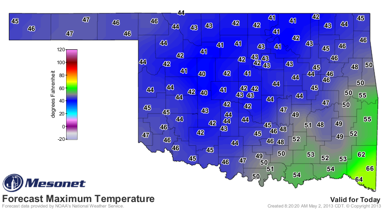
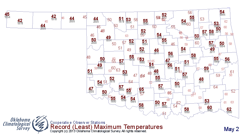
So we got close to record lows across much of the state already. Now we set our
sights on record low maximum temperatures. Here are the records and also the
forecast highs for today.
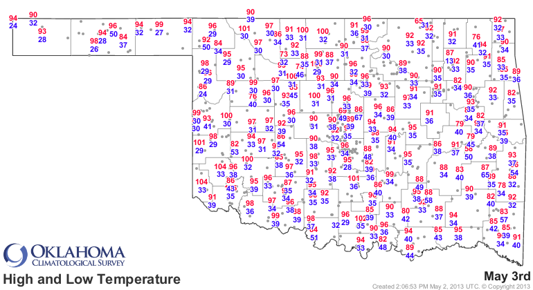
A lot of those records are sure to fall as well. Then we have the lows tomorrow
morning set to break records. Here are those maps. The record map for May 3
also has the record highs on it (different program used to produce that one). I
would suggest you ignore the record highs, or look upon them fondly. Your
choice! Note: Some of the numbers look a bit high. Those are short-term
stations, so just look "in general" to get a sense of the true record lows. You
know ... glance casually!
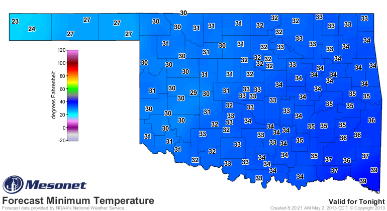
Yes, another freeze for western and northern Oklahoma, and touch-and-go to the
east. Not only could we see those daily records fall, but also the records
for latest freeze in many locations.
Even with a rain/sleet/snow mixture falling in the northwest, we're still a long
ways off from all-time state records. Here are some of those offending factoids.
* Latest state measurable snow: 0.7", Kenton, May 21, 1930
* Heaviest May snowfall: 12", Boise City, May 3, 1978
* Lowest daily minimum temperature: 19F, Hooker, May 1, 1909
* Latest freeze: May 29, 1947, Kenton (30F)
None of those extremes look like they'll be challenged just yet, but there's
still a lot of May to go.
-------------------------------------------------------------------------------
Drought relief continues
Oh yeah, it's Thursday. The new Drought Monitor map. Ho-hum? Well, there was
more improvement for eastern and central Oklahoma, and a degradation in the
Panhandle.
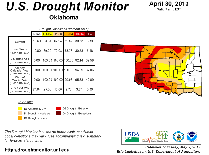
We now see 32% of the state free of drought, with 17% even out of "Abnormally
Dry" conditions. We did ask for a slight bump-up of D4 in the Panhandle, parts
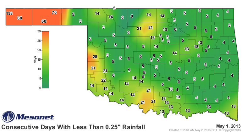
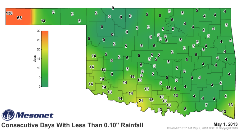
of which are experiencing horrific drought conditions. The western two counties
in that area have now gone from 68-138 days without seeing a quarter-inch of
moisture in a single day. For the westernmost county, the same for a tenth of
an inch.
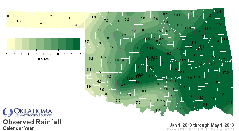
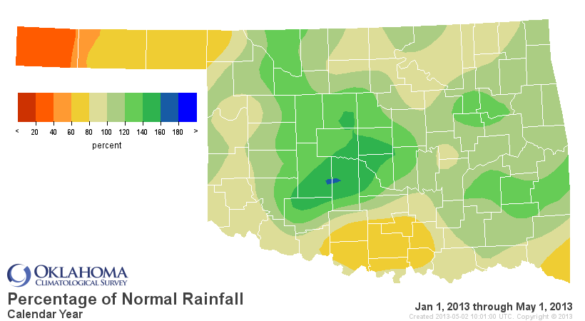
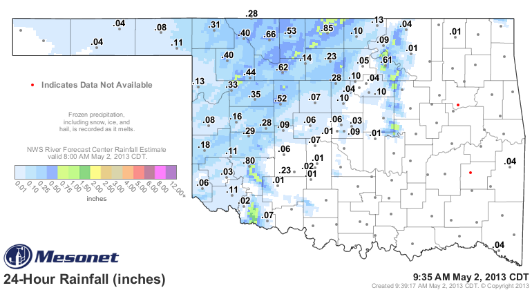
And it shows on the current year-to-date rainfall maps.
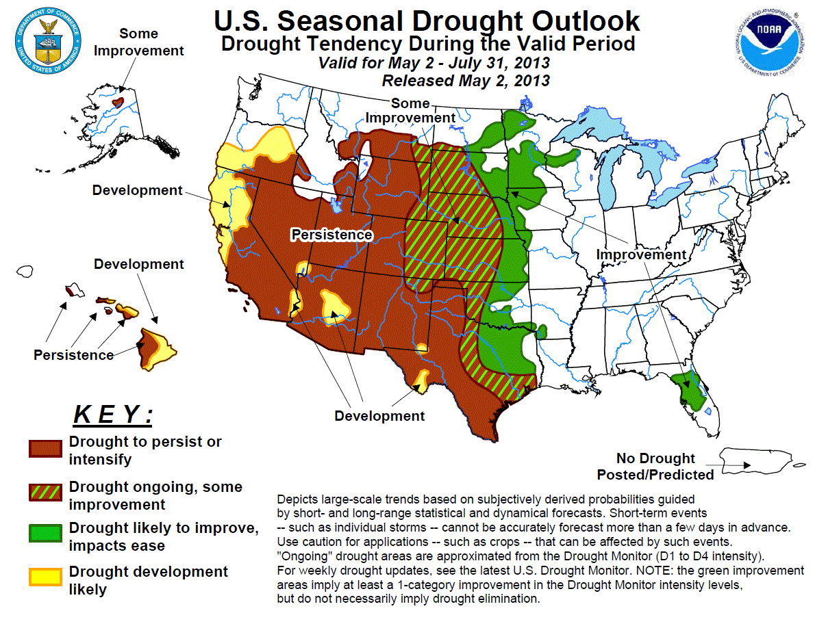
The Drought Outlook map for the May-July period has not changed, and still calls
for improvement or "some improvement" across the body of the state. I think
they're still looking for that improvement across far western Oklahoma. I think
that line needs to be moved a county to the east across western Oklahoma.
Not much else to say. At least with the jet stream pushed down our way, we
continue to see storm systems flow through and dump rain (and snow and sleet)
on us. Perhaps we'll see another improvement in the Drought Monitor map thanks
to rain that is currently falling.
Wait, the wind is telling me something again.
"Summer is still going to be really hot. HAHAHAHA!!"
Stupid wind.
Gary McManus
Associate State Climatologist
Oklahoma Climatological Survey
(405) 325-2253
gmcmanus@mesonet.org
May 2 in Mesonet History
| Record | Value | Station | Year |
|---|---|---|---|
| Maximum Temperature | 105°F | ALTU | 2020 |
| Minimum Temperature | 24°F | BOIS | 2013 |
| Maximum Rainfall | 4.04 inches | HASK | 2022 |
Mesonet records begin in 1994.
Search by Date
If you're a bit off, don't worry, because just like horseshoes, “almost” counts on the Ticker website!