Ticker for May 1, 2013
MESONET TICKER ... MESONET TICKER ... MESONET TICKER ... MESONET TICKER ...
May 1, 2013 May 1, 2013 May 1, 2013 May 1, 2013
April was cold. Also, sky is blue.
Oh, we'll get to the April stuff Col. Jessup. But first, let's talk about that
cold weather you ordered. You want the cold weather? YOU CAN'T HANDLE THE COLD
WEATHER.
Oh wait, that's me. I can't handle the cold, especially during May. But cold
weather we're gonna get, and it's probably gonna break some records. Watch for
another freeze for parts of Oklahoma, as well as some flakes here and there. Some
will even be of the snow variety. Here are the forecast temperatures following the
cold front that will blast through the state today.

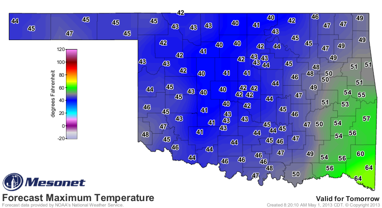
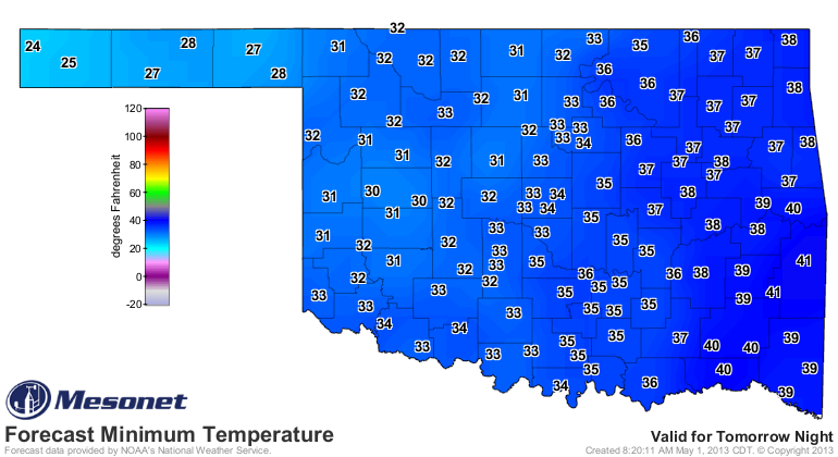
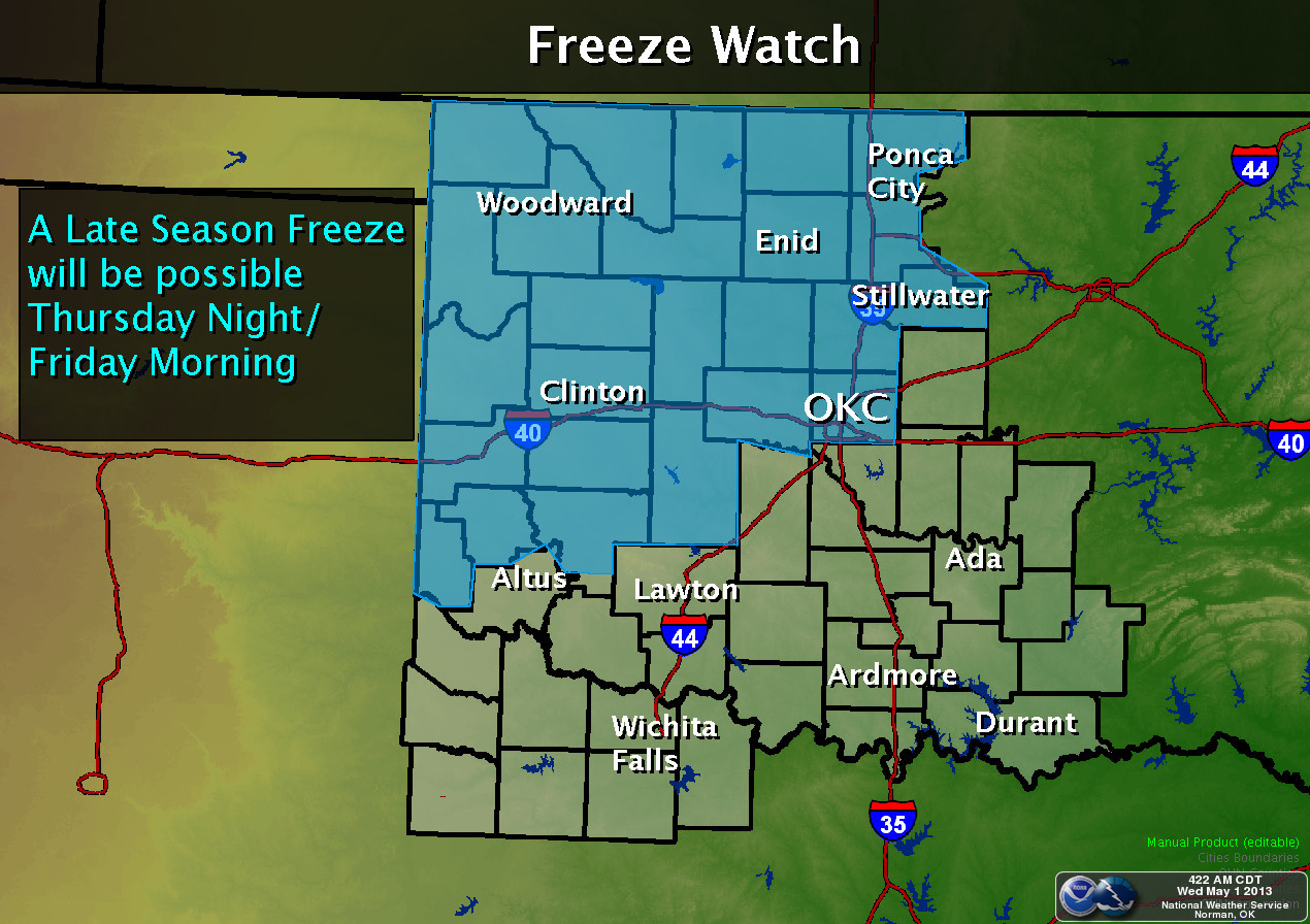
There are freeze watches posted for much of northern and western Oklahoma. Maybe
a couple of inches of snow up in the far NW.
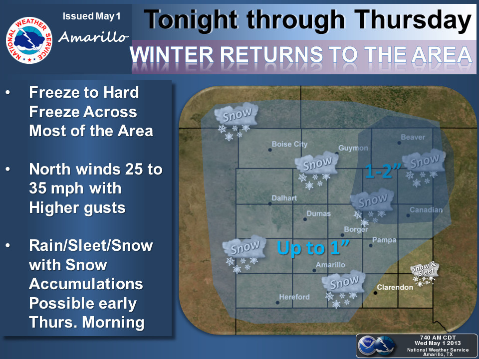
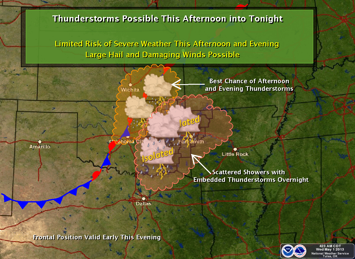
And it IS still spring, so storms will be a danger as the front comes through.
Enough with this silliness. I'm so tired of the cold, I'm not even going to
think of a line from "A Few Good Men" to close us out.
WHO ORDERED THE CODE BLUE?? Oops.
--------------------------------------------------------------------------------
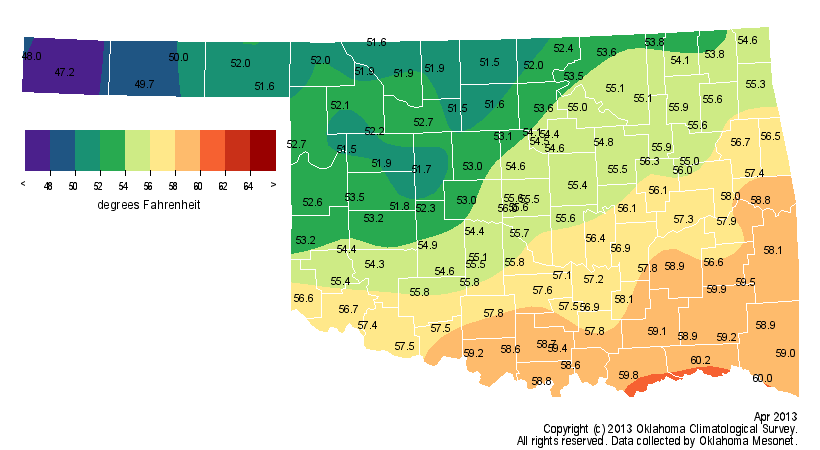
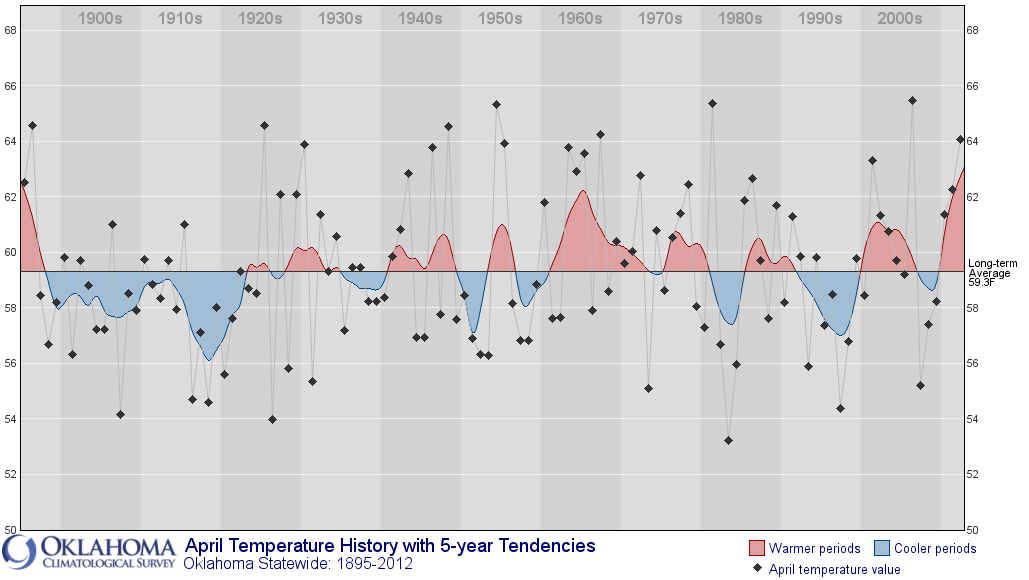
Just how cold was April 2013 in Oklahoma? According to preliminary data from
the Oklahoma Mesonet, the statewide average temperature came in at 55 degrees
to rank as the seventh coolest April on record, 4.1 degrees below normal.
Records of that type began in 1895.
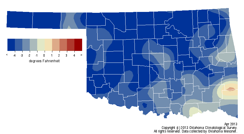
That sounds fairly cold, but becomes downright frigid considering the state's
recent climate history. It could be measured against last year's April, the
eighth warmest on record, which finished with a statewide average temperature
of 64.1 degrees.
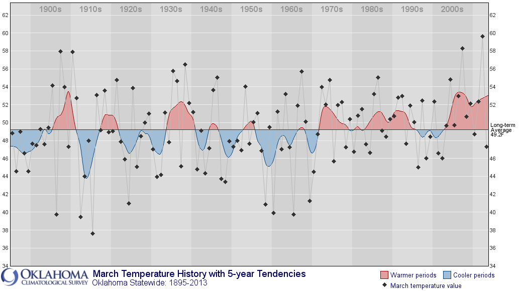
Better yet, it could be measured against last March's record warm mark of 59.6
degrees.
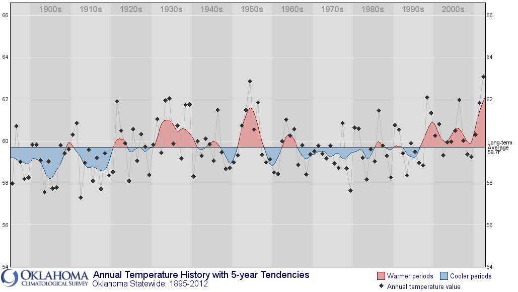
And this also comes soon after Oklahoma's record warm year of 2012.
Regardless of statistics, the evidence speaks for itself, such as the record
late freezes in many locations, or the snow and ice that accumulated on tree
branches where buds should have appeared. The frosty weather was a continuation
of cooler than normal conditions that began in mid-February and persisted
through March. The March-April statewide average temperature was 51.1 degrees,
3.5 degrees below normal to rank the first two months of spring as the 12th
coolest on record. April became the third month in a row that saw the state
finish with below normal temperatures, a feat not accomplished since the
winter months of 2011-12. Prior to this February, 28 of the previous 34 months
in Oklahoma were warmer than normal.
The drought relief that began in February also gained momentum during April.
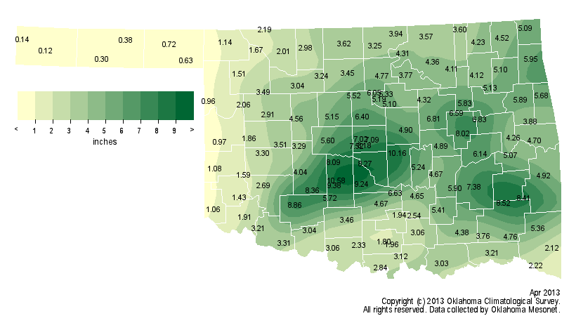
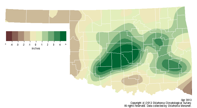
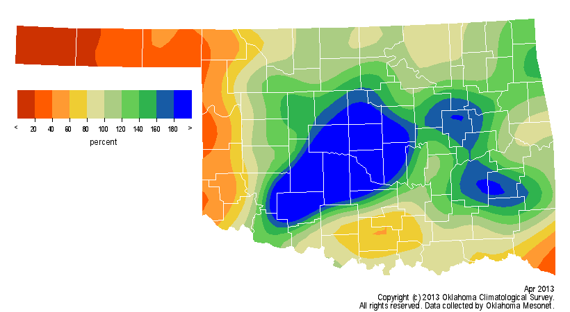
According to Oklahoma Mesonet rain gauges across the state, the average
precipitation total came in at exactly 4 inches for the month, about 0.6 inches
above normal. That would rank the month as the 37th wettest April since records
began in 1895. Not all areas of the state saw equally beneficial rains, however.
The Oklahoma Panhandle saw a half-inch of precipitation on average to rank
April as the ninth driest on record for that area. The most significant rains
fell from Kiowa County in the southwest through Pottawatomie County in central
Oklahoma. Totals along that path ranged from 8 to 11 inches. Chickasha led all
Mesonet stations with 10.6 inches. Boise City in the far western Panhandle only
recorded a tenth of an inch of moisture for the month.
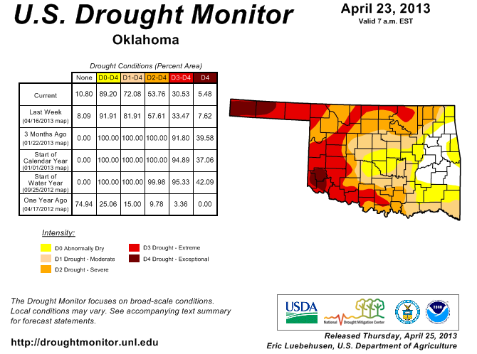
The latest U.S. Drought Monitor report reflected those recent rains with more
than 25 percent of the state out of drought, mostly across eastern and central
Oklahoma. Areas across western, southern and northern Oklahoma were depicted in
more significant intensities of drought, with 54 percent of the state still
categorized in at least severe drought.
April was an active severe weather month. Although the count is still
preliminary, at least a dozen twisters struck the state during April. The most
significant tornado, rated EF2 on the Enhanced Fujita scale, struck Delaware
County early on the 18th, destroying a home and damaging others. Two people
were injured by a tornado that touched down near Spavinaw earlier that night.
The preliminary tornado count for the year rose to 16, close to the average
number for January-April. The severe weather came in frozen form, too. An
unusually thick layer of ice coated western and northern Oklahoma on April 10
and caused widespread power outages and traffic accidents. That severe winter
blast arrived on the heels of temperatures in the 80s the day before. Another
wintry blast on April 23 coated power lines in the Panhandle with more than a
half-inch of ice to cause power disruptions in that area. The most damaging
severe weather during April might have also been its most benign. Each of those
cold air outbreaks dropped temperatures below freezing for a significant period
of time, long enough to do damage to wheat and other crops already stressed
from prolonged drought. Parts of southwestern Oklahoma and the Panhandle were
thought to be particularly hard hit from the damaging freezes. The final
assessment on the scope of the freeze damage might not occur until harvest time
in late spring.
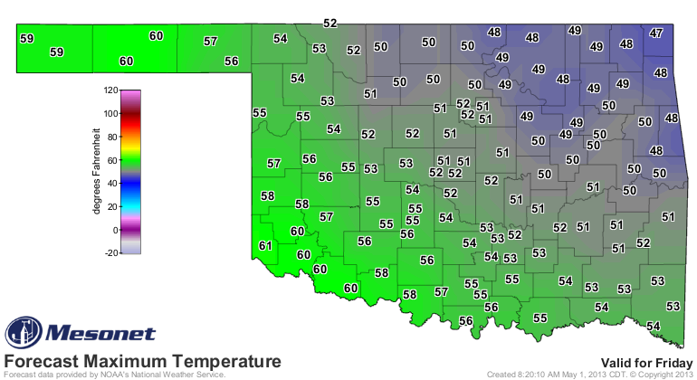
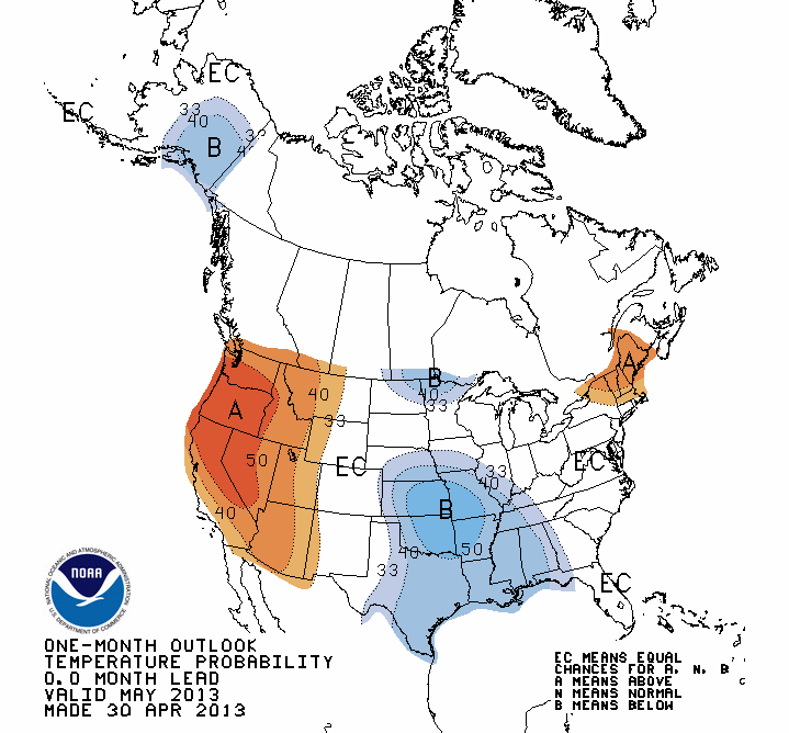
More unusually cold weather was due to hit the state in early May with the
possibility of more freezing weather, including snow and ice across northern
Oklahoma. Further out, the National Weather Service's Climate Prediction Center
forecast increased odds for below normal temperatures across Oklahoma for May.
The precipitation outlook was non-committal with equal chances of above-,
below- and near-normal precipitation on tap. May through mid-June is Oklahoma's
primary rainy season across most of the state.

Gary McManus
Associate State Climatologist
Oklahoma Climatological Survey
(405) 325-2253
gmcmanus@mesonet.org
May 1 in Mesonet History
| Record | Value | Station | Year |
|---|---|---|---|
| Maximum Temperature | 101°F | ALTU | 2002 |
| Minimum Temperature | 28°F | BOIS | 2011 |
| Maximum Rainfall | 7.70 inches | PRYO | 2009 |
Mesonet records begin in 1994.
Search by Date
If you're a bit off, don't worry, because just like horseshoes, “almost” counts on the Ticker website!