Ticker for April 17, 2013
MESONET TICKER ... MESONET TICKER ... MESONET TICKER ... MESONET TICKER ...
April 17, 2013 April 17, 2013 April 17, 2013 April 17, 2013
Awareness
Oklahoma is in the crosshairs for severe weather today. The Storm Prediction
Center (shouldn't that be "Storms" prediction center?) has us in the "Moderate"
risk area for today, right along the dreaded I-44 corridor.
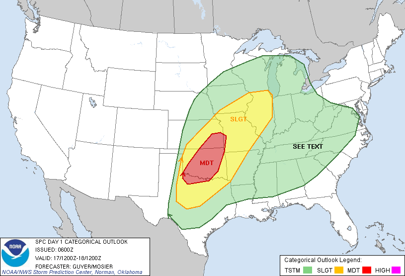
Hey, at least it's not a high risk! Stay tuned, however. The setup today brings an
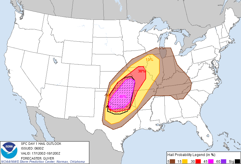
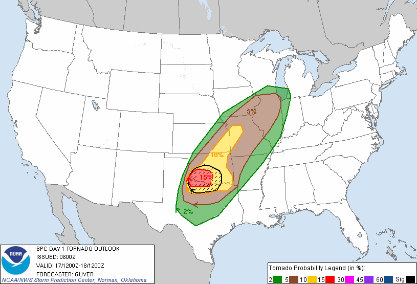
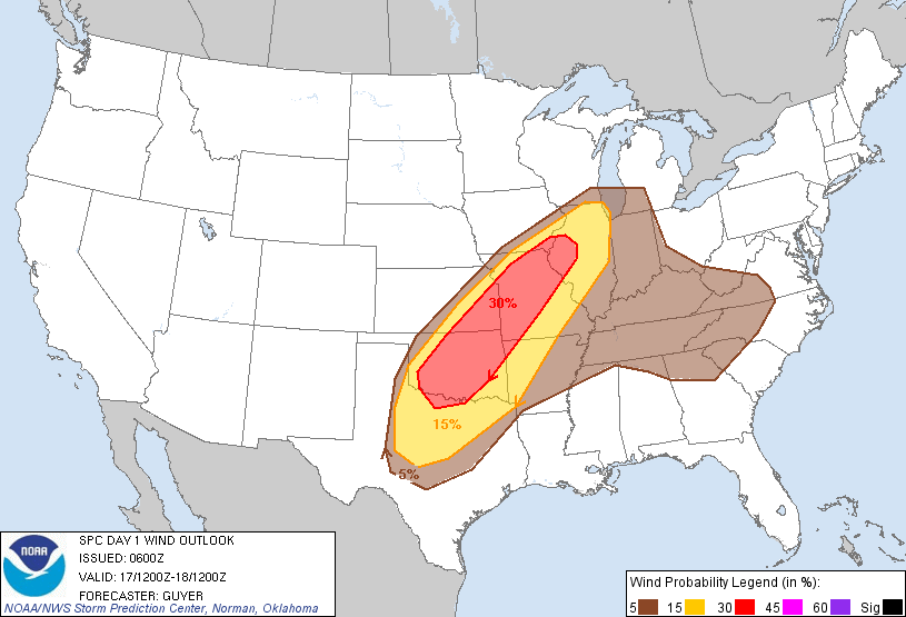
enhanced risk of lions and tigers and bears, oh my? And by lions, tigers and bears,
we're talking about our old non-favorites hail, severe winds, and tornadoes.
Scared yet? "You will be. You...will...be." No no no. Yoda is not appropriate
here. After all, we have nothing to fear but fear itself, right? I think FDR
trumps Yoda in this case. This is simply a call to be weather aware today. As
I've said numerous times, stay tuned to the NWS offices in your area, as well as
your local media. They will keep you safe and prepared. It's a fairly complex
setup today so things will be changing throughout the day.
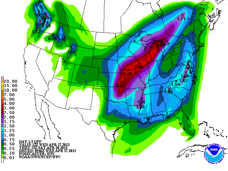
Heavy rains are still looking likely, so as is customary for drought relief, we
might be dealing with floods of the river and flash variety before this is over.
The WPC shows from 1-3 inches (or more in localized areas) falling across the
state, with more in the east and less in the west. What else is new, eh?
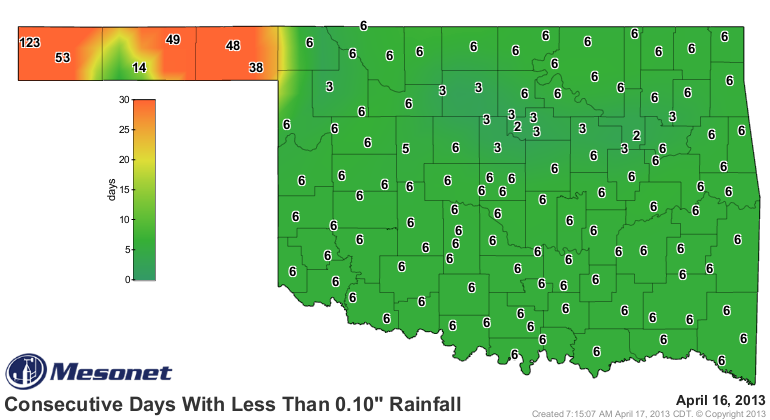
And the west needs rain. Badly. It has now been 40-50 days since the Panhandle
has seen a day with at least a tenth of an inch of rain. 123 DAYS FOR KENTON!
Basically the same thing for days with at least a quarter-inch.

And this shows up over the last 60 days. The fringes of Oklahoma (you know
who you are) show dryness over several times scales. Some nice hefty totals
showing up as well, which has led to nice drought relief.


In fact, you can see how the Drought Monitor has changed over varying time
scales. Pay particular attention to the lower right map, the change since
Oct. 1, 2012.
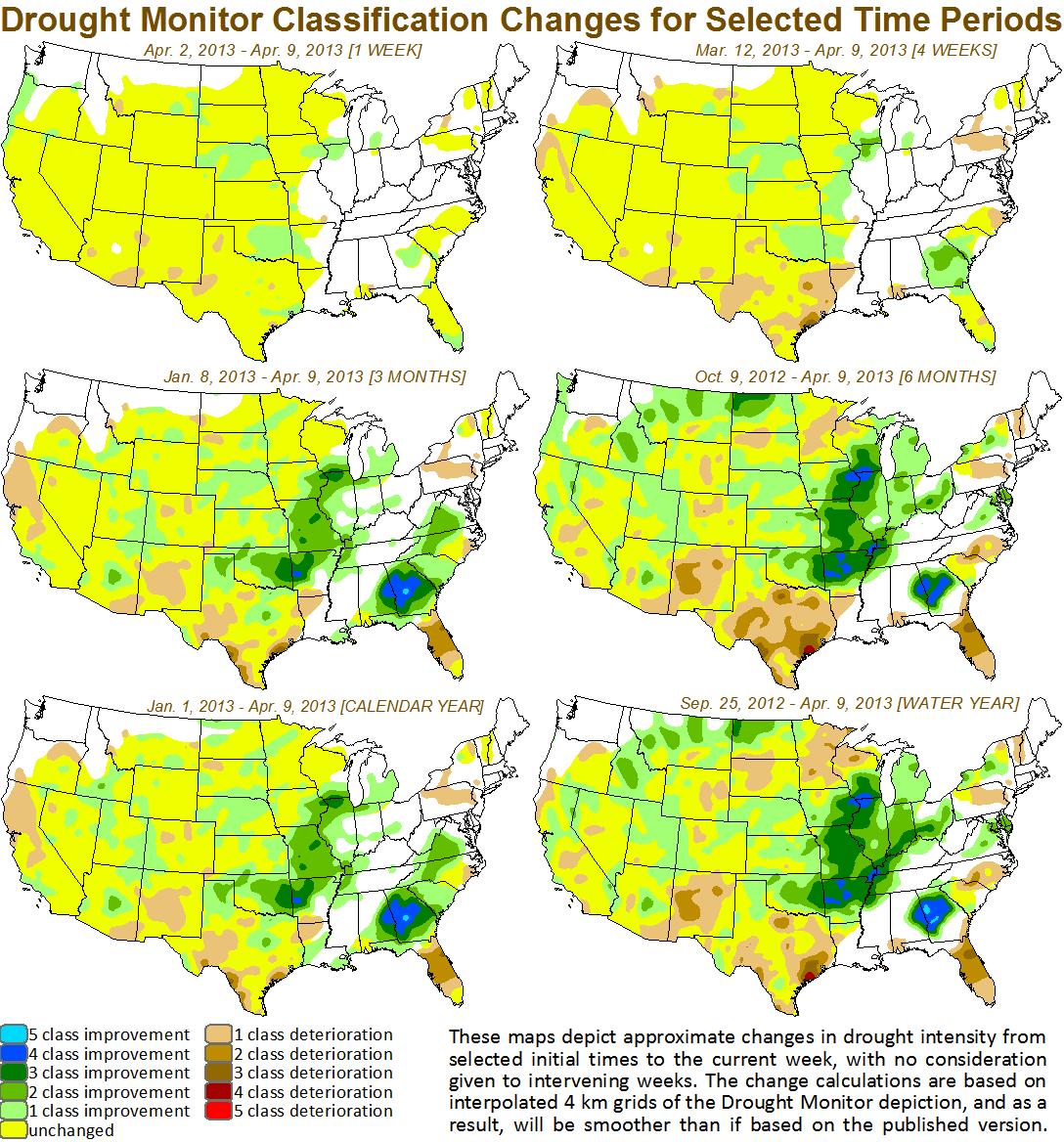
So more drought relief is in store. Tomorrow's map will reflect improvements
from last week's rains, and next week's map will reflect this week's rains.
I believe we will see a relatively large area completely out of drought on
next week's map.
"Relatively" being the key word. We just have to suffer through whatever
comes with that relief today.
Oh, by the way, here's one more freeze for ya.

Gary McManus
Associate State Climatologist
Oklahoma Climatological Survey
(405) 325-2253
gmcmanus@mesonet.org
April 17 in Mesonet History
| Record | Value | Station | Year |
|---|---|---|---|
| Maximum Temperature | 102°F | GRA2 | 2006 |
| Minimum Temperature | 22°F | BOIS | 2020 |
| Maximum Rainfall | 6.57 inches | MEDI | 2013 |
Mesonet records begin in 1994.
Search by Date
If you're a bit off, don't worry, because just like horseshoes, “almost” counts on the Ticker website!