Ticker for April 16, 2013
MESONET TICKER ... MESONET TICKER ... MESONET TICKER ... MESONET TICKER ...
April 16, 2013 April 16, 2013 April 16, 2013 April 16, 2013
Protect your noggin
Fresh off the plane yesterday in Florida to attend a meeting of the U.S. Drought
Monitor, I knew I wasn't in Kansas anymore. I wasn't to begin with, of course,
but that doesn't fit with the narrative. Humidity was about 101%, and it
certainly played havoc with my hair. The one on the left ... the other one on
the right didn't seem to mind. And it poured on us within about 5 minutes of
landing. But, Florida isn't the only place getting, or expecting, rain.
The latest 5-day rain total forecast from the WPC shows another bounty for much
of the eastern three-quarters of Oklahoma.
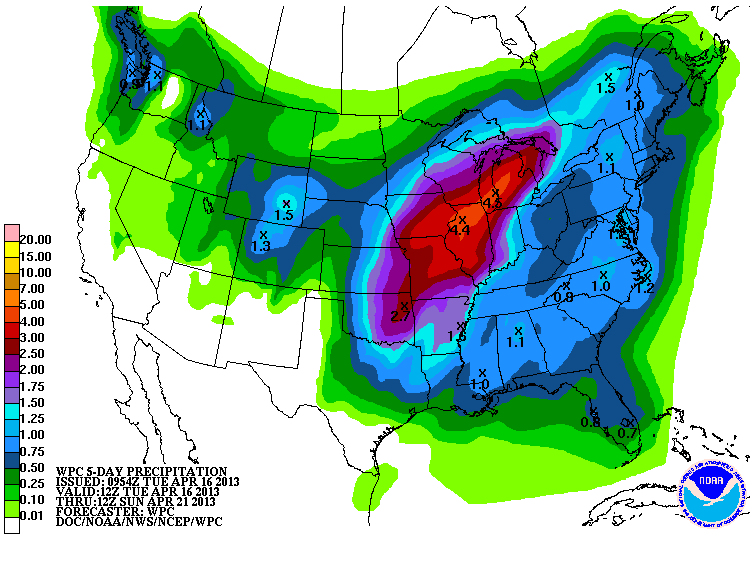
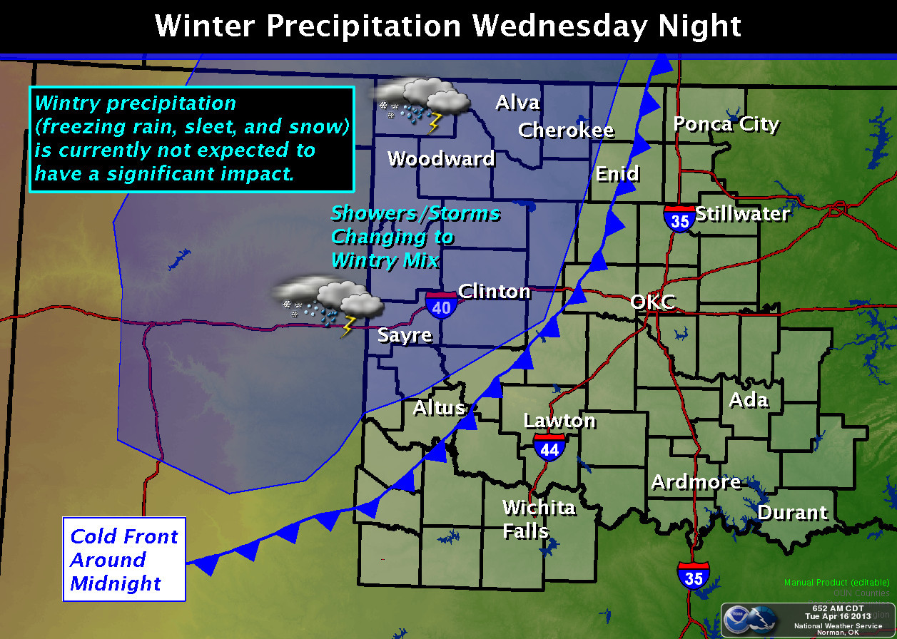
Most of that appears to be headed our way Wednesday into Thursday as a storm
system and accompanying front travel over the state. Our friends at the NWS Norman
office have a nice graphic showing the setup for Wednesday.
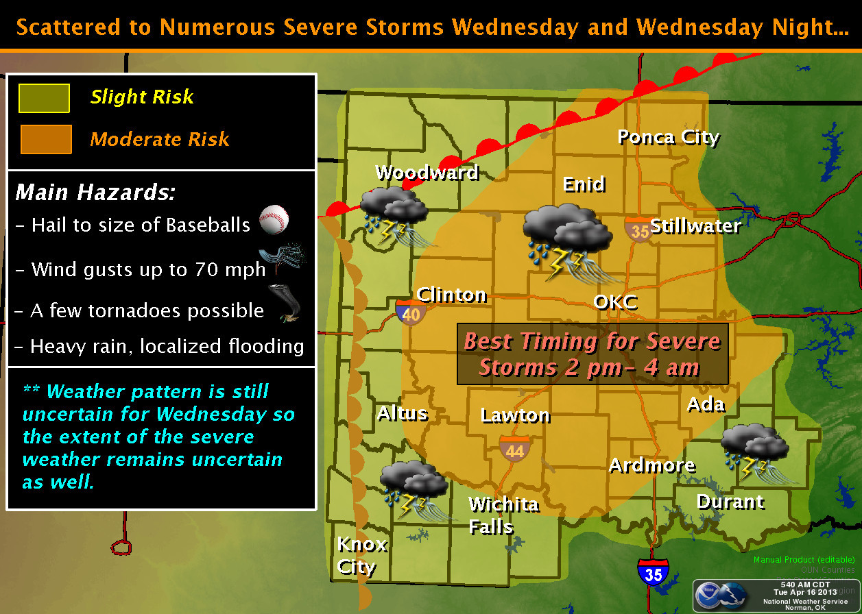
As you can see, that scenario, with a warm front headed north and a dryline
coming in from the west, has a chance to bring some fairly nasty weather with
it. And, of course, since Mother Nature has gone rogue this spring, there will
be another chance for some winter weather in the northwest that night.
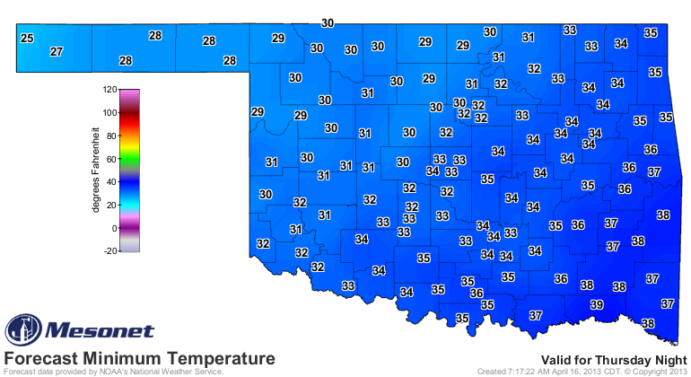
There is a chance for another freeze Thursday and Friday. Here are the forecast
lows from the NWS for Friday morning. Mid-20s are indicated in the western
Panhandle, but 32 or below could occur as far east as Osage County.
Speaking of the best part of the state, the western Panhandle, here's what
the wheat looks like out that way. This is a recent pic, and reflects a wheat
field that got a good snow in February (the sparse green color you see there
resulted).
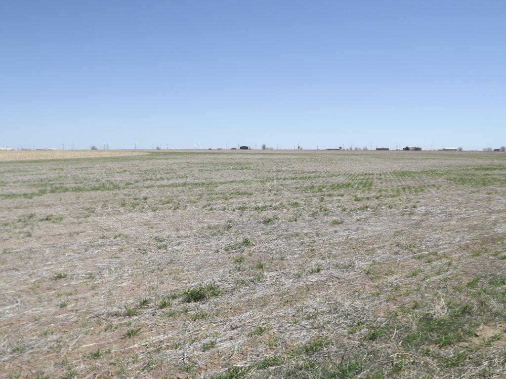
And that wheat was exposed to temperatures down to the teens for a significant
period of time, so I wouldn't move the combines to that field just yet.
Another dent in the drought, on the way. Dents in cars, houses and noggins are
possible as well. As usual, it's important to stay weather aware. Check out all
your usual sources early and often.
Gary McManus
Associate State Climatologist
Oklahoma Climatological Survey
(405) 325-2253
gmcmanus@mesonet.org
April 16 in Mesonet History
| Record | Value | Station | Year |
|---|---|---|---|
| Maximum Temperature | 96°F | BURN | 2006 |
| Minimum Temperature | 20°F | FORA | 2018 |
| Maximum Rainfall | 3.75 inches | TIPT | 2016 |
Mesonet records begin in 1994.
Search by Date
If you're a bit off, don't worry, because just like horseshoes, “almost” counts on the Ticker website!