Ticker for April 10, 2013
MESONET TICKER ... MESONET TICKER ... MESONET TICKER ... MESONET TICKER ...
April 10, 2013 April 10, 2013 April 10, 2013 April 10, 2013
I give up
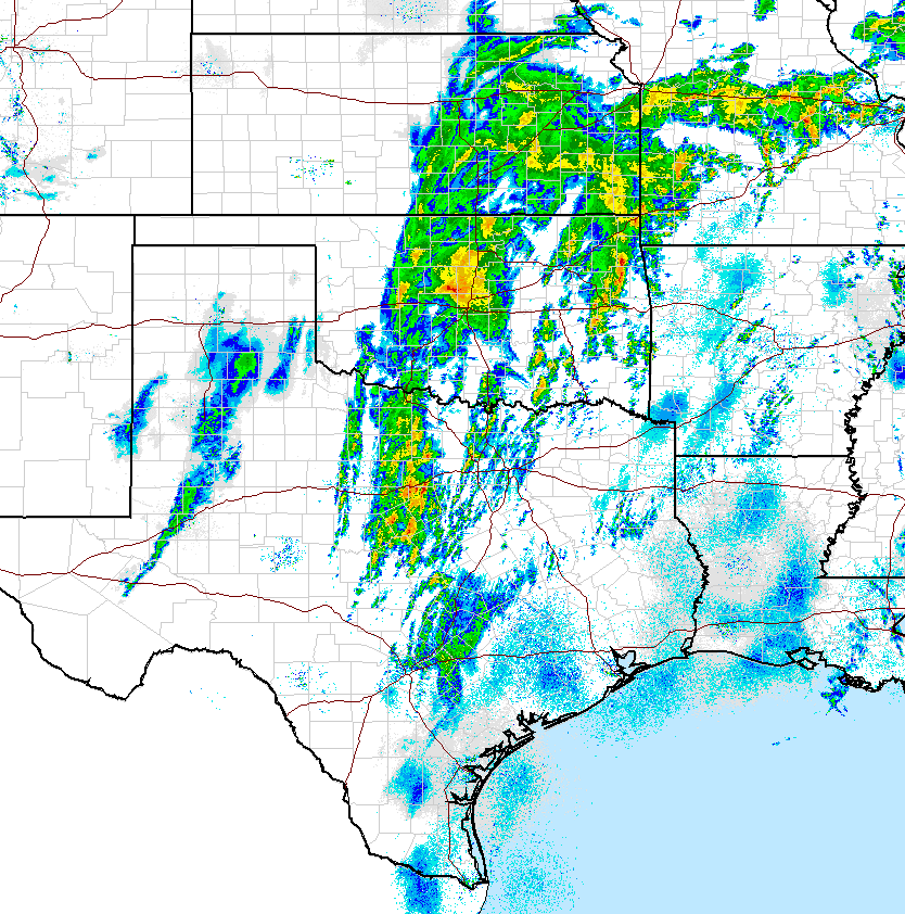
Woe be unto thee that disregardeth the speedeth of a cold front. Yesterday's
much-advertised outbreak of severe weather did come true, but it turned out to
be mostly severe WINTER weather. In one of the worst displays of impertinence ever
perpetrated on Oklahoma, Mother Nature turned 80s into 20s and 30s, and transformed
the lovely spring month of April into February. Thousands of Oklahomans have been
left without power as trees and power lines became coated with ice, and widespread
accidents have been reported on rain- and ice-slicked roads.
As promised, however, this system is bringing the state a bit more drought relief.
There have not been any extremely heavy rain totals reported just yet. I sorta
expected a few when thunderstorms were the main impact being forecast instead of
the sleet, graupel and freezing rain. Here's the latest map from the Mesonet
showing from about a tenth of an inch across far western Oklahoma to nearly 2
inches into central Oklahoma.
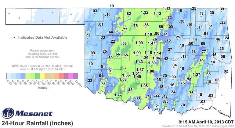
That rain shield should continue to march to the east throughout the day. The
precip appears to be over across much of western Oklahoma. At least for any of
the heavy stuff.
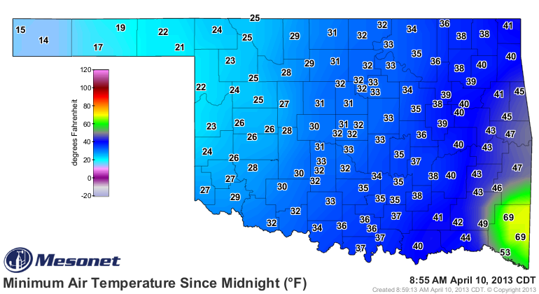
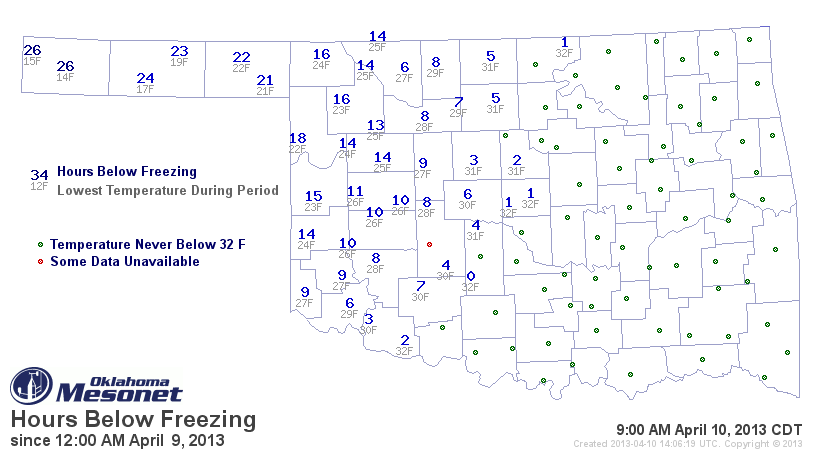
The other impact I was worried about, the freezing weather, obviously arrived
as expected. Lows across western Oklahoma didn't have far to drop after the
cold front came through. Those lows reached into the mid-teens in the Panhandle
to low 20s across the western third of the state. This comes on top of what I
have heard was a significant wheat-damaging freeze across southwestern Oklahoma
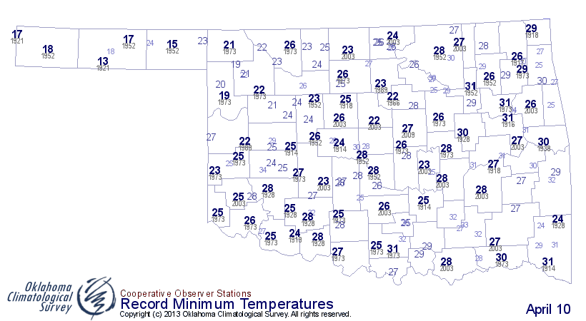
a few weeks ago. Here's the low temperature map for this morning, as well as
the number of hours below freeze over the last day or so. Congrats to McCurtain
County on the 50s and 60s, by the way. It won't last! I've also added the record
lows for April 10 (dating back to the 1880s). Some folks got close or even set
records, no doubt.
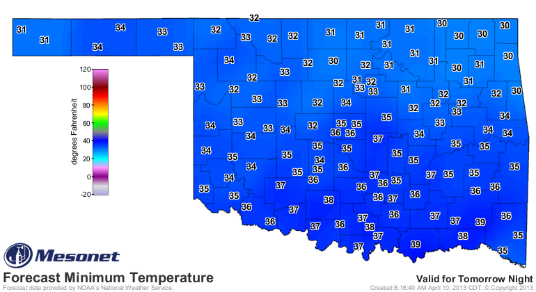
That last map is sure to get worse over the next 24 hours, as more freezing
weather is expected tomorrow morning.
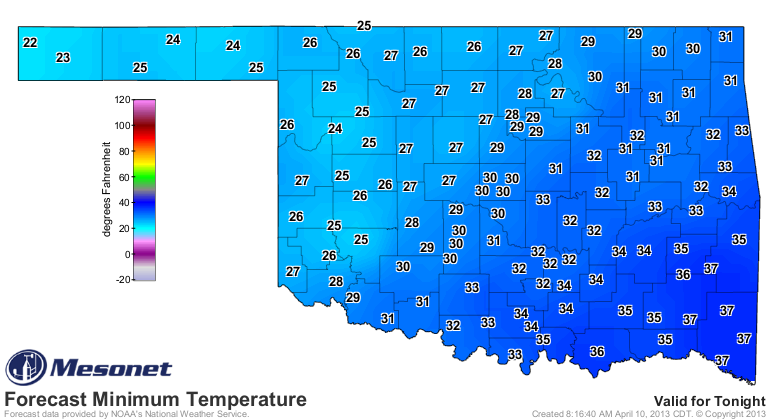
Perhaps those plants were insulated from the 20s thanks to a coating of ice?
At any rate, more misery for folks growing things across western and northern
Oklahoma.
"Speedeth" is not a word, by the way. I know you've been wondering since the
first paragraph.
Gary McManus
Associate State Climatologist
Oklahoma Climatological Survey
(405) 325-2253
gmcmanus@mesonet.org
April 10 in Mesonet History
| Record | Value | Station | Year |
|---|---|---|---|
| Maximum Temperature | 94°F | HOLL | 2019 |
| Minimum Temperature | 14°F | BOIS | 2013 |
| Maximum Rainfall | 3.83 inches | COPA | 1994 |
Mesonet records begin in 1994.
Search by Date
If you're a bit off, don't worry, because just like horseshoes, “almost” counts on the Ticker website!