Ticker for March 26, 2013
MESONET TICKER ... MESONET TICKER ... MESONET TICKER ... MESONET TICKER ...
March 26, 2013 March 26, 2013 March 26, 2013 March 26, 2013
Mind = numbed
Just a quick Ticker today as I'm out and about droughtifying (it's not a word ...
don't bother). But the only thing I hate worse than drought is cold weather,
especially when it's not supposed to be as cold as it is. This wasn't the coldest
March 26 morning in state history, but it was pretty darned close. Check out
this morning's low temperatures from the Mesonet and then compare those to the
record lows for the day.
Actual lows: 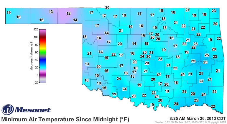
Record lows: 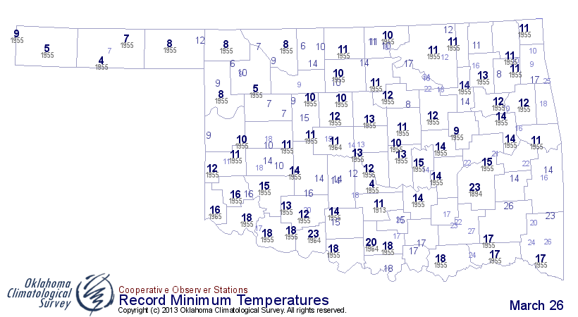
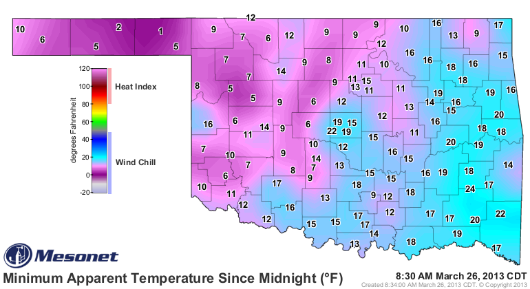
Zounds! That's will-sapping cold for late March right there. Add the winds and
you get wind chills that are even more depressing.
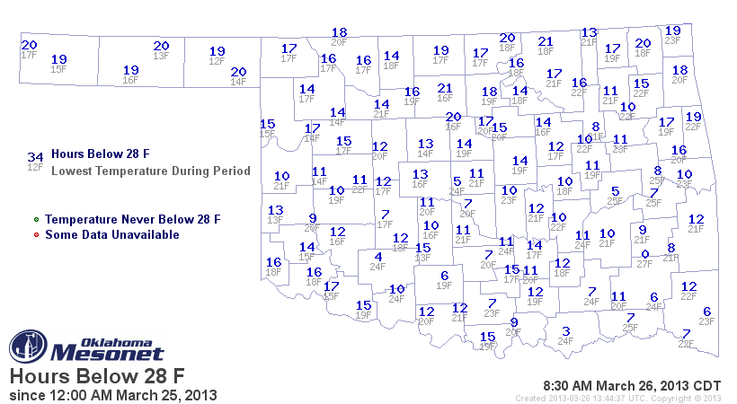
For those growing wheat, here is the concern over the last couple of mornings,
as the state has dropped below 28 degrees for up to 20 hours out there in
wheat country.
Hopefully we've been cool enough over the last month to keep maturity down a
bit and so those plants won't be impacted so severely. If this had occurred last
year at this time, it would have been disastrous. Remember how green it was
this time last year? Check out this departure from average greenness map from
last March 29, then look at the same map from last week.
March 2012: 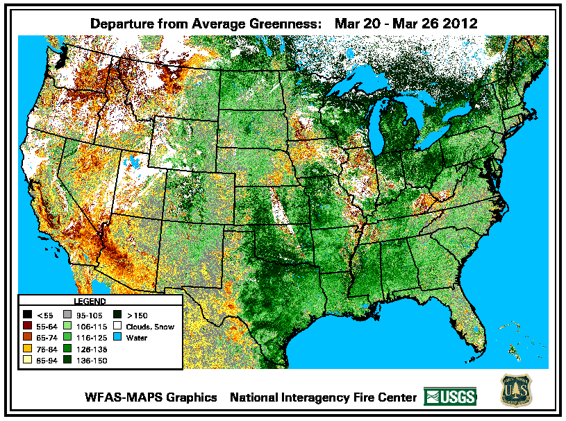
March 2013: 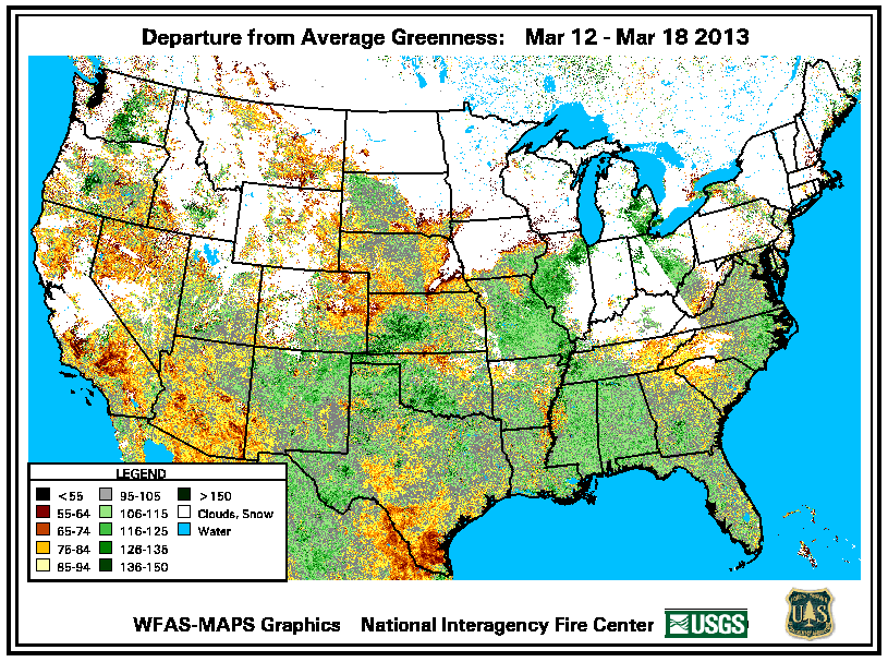
Now, if you like this type of weather in late March, or even earlier, then
(DELETED!). And that's all I have to say about that.
At least we have some warmer and wetter weather in store as we approach the
weekend. Sorry, but we need the rain, and I need the warmth. You can use plastic
eggs. The latest 7-day rain forecast is picking up on the period of active
weather from Thursday through early next week. What a great dose of liquid this
would be!

The weathersphere is abuzz with word of possible severe weather next Monday
into Tuesday, so stay tuned for that. All I see is convective rains, but we all
know what severe storms can bring other than the good stuff (rain).
Again, stay tuned!
Gary McManus
Associate State Climatologist
Oklahoma Climatological Survey
(405) 325-2253
gmcmanus@mesonet.org
March 26 in Mesonet History
| Record | Value | Station | Year |
|---|---|---|---|
| Maximum Temperature | 100°F | HOLL | 2020 |
| Minimum Temperature | 11°F | BOIS | 2024 |
| Maximum Rainfall | 2.35 inches | BYAR | 2018 |
Mesonet records begin in 1994.
Search by Date
If you're a bit off, don't worry, because just like horseshoes, “almost” counts on the Ticker website!