Ticker for February 26, 2013
MESONET TICKER ... MESONET TICKER ... MESONET TICKER ... MESONET TICKER ...
February 26, 2013 February 26, 2013 February 26, 2013 February 26, 2013
Snowklahoma
The second major winter storm in a row is in the process of exiting the state,
and this one was particularly nasty for the northwest. As with the last storm,
the snow totals tapered off quite rapidly to the northeast. An intrusion of dry
air wrapped into the storm as well, cutting off further precipitation for the
much of the southern half of the state, preventing any significant snow totals
in that area. You can see the totals on maps provided by the Amarillo and Norman
NWS offices.
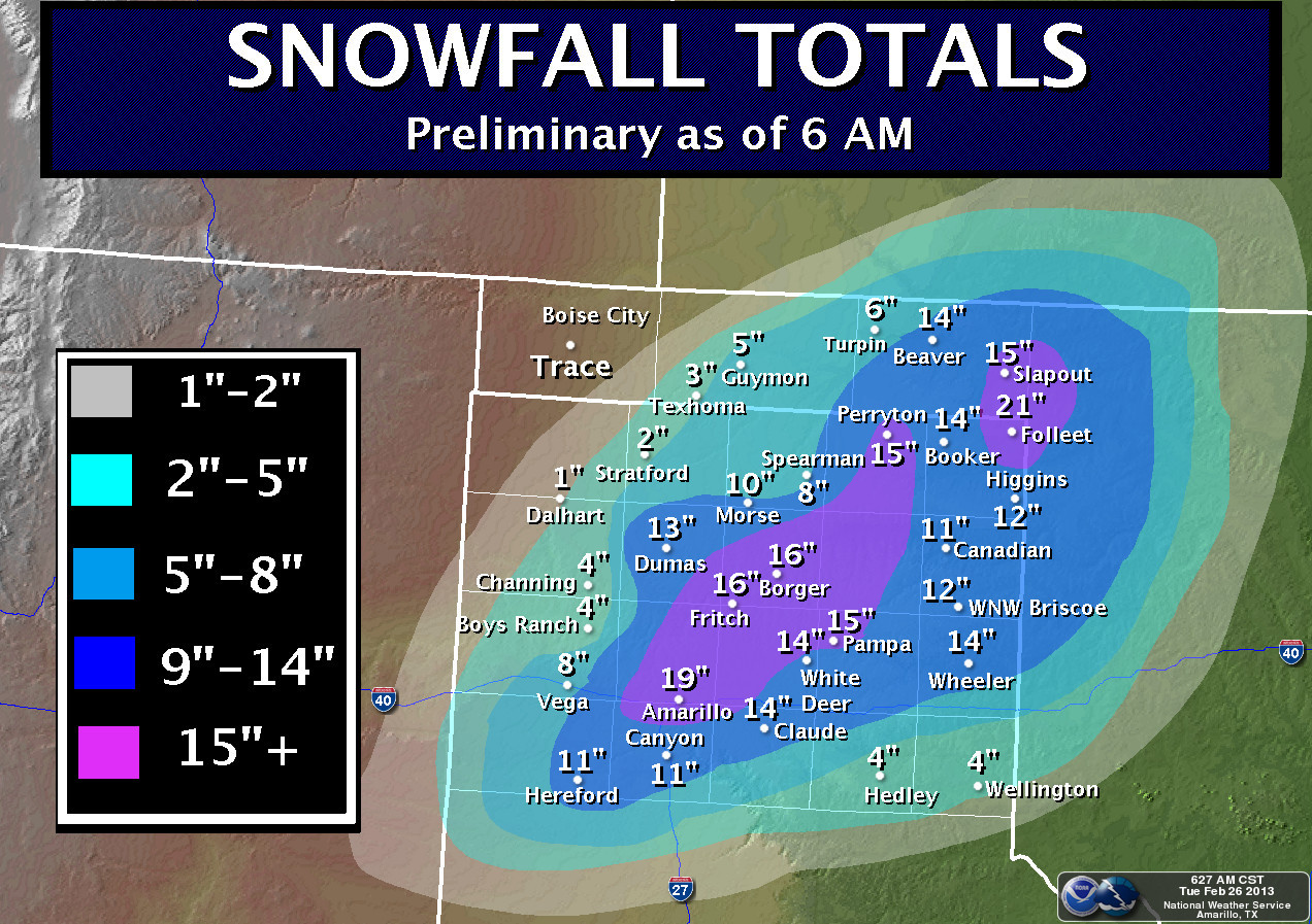
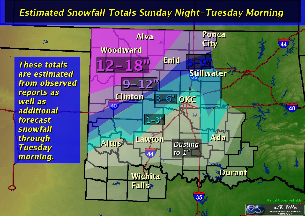
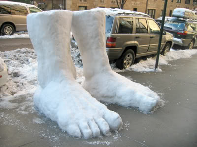
Nearly two feet of snow fell across the far northwest. You want to see what two
feet of snow look like? Check out this picture.
By last count, the heavy snow and some ice, along with winds gusting to over 40
mph ...
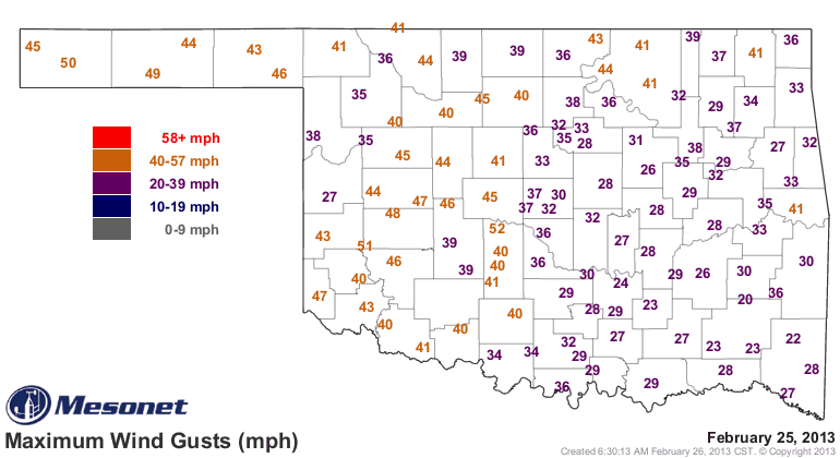
left approximately 36,000 electric customers without power. All highways in the
northwestern counties of Cimarron, Texas, Beaver, Harper, Ellis and Woodward
were closed due to blowing and drifting of heavy snow. One fatality was reported
in Woodward due to a collapsed roof at a residential home.
The silver lining, of course, is the moisture the storm provided to a
drought-parched state. In this case, I think the liquid water that fell was of
more benefit. One thing we see during a blizzard is the snow blowing into
drifts, so less widespread beneficial moisture. But, moisture it is, at least
when it melts. The Mesonet rainfall map will not register the full extent of
the snow until it begins melting in the rain gauges, but even then it will
probably be an underestimate due to the loss of "catch" due to the blizzard
conditions. Nevertheless, the state got a good dose of 1-3 inches of liquid
equivalent moisture.
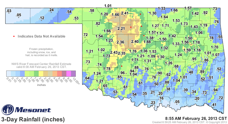
Which brings the two-storm totals to 1-5 inches across the state.
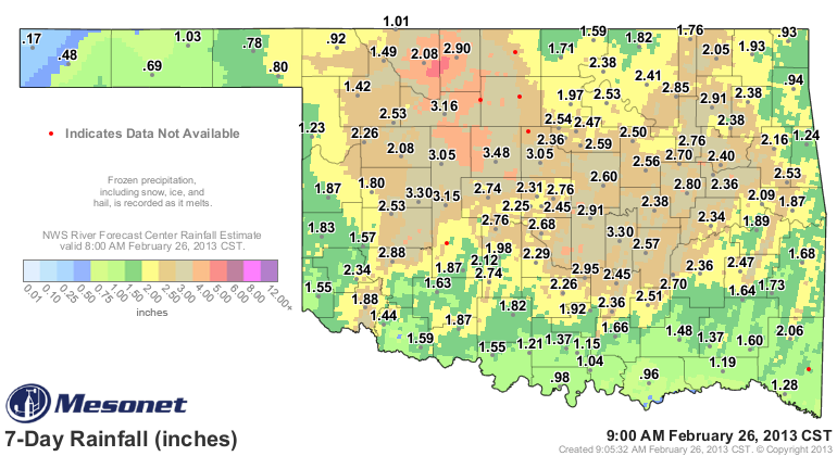
Now with a bunch of snow left to melt, the February statewide Mesonet total is
now up to 2.88 inches, 1.23 inches above normal for Feb. 1-26. Now if the
month were to end today, tomorrow would be March 1. But more importantly, the
moisture we have already received (2.88, on average) would be good enough to
rank this February as the 15th wettest on record. The wettest February on
record is 1938's 4.66 inches. As the snow melts, we could see it rise into the
top-12 (1993 is the current #12 with 3.05 inches).
Some folks wrote to me asking if this was the most significant storm since the
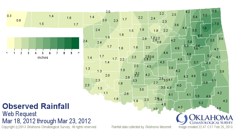
drought began back in October 2010. Nope. That prize belongs to the slow-mover
that camped out west of us from March 18-22, 2012. The state saw from 2-10
inches with that storm system and brought us widespread flash- and river-
flooding, and darned near ended drought across the state after an already-wet
October through February. As you can see, some pretty hefty totals for the
state with that storm, and by itself provided a statewide average of 3.16
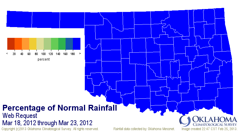
inches. That percent of normal map is the bluest map you'll ever see for
Oklahoma.
As for this storm, folks up in the northwest still have a bunch to deal with,
the first of which is to get the roads open and the power back on. Central
Oklahoma dodged a bullet. Make no mistake about it, those conditions would have
wreaked havoc wherever it hit.
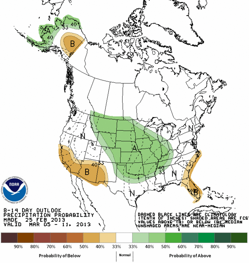
Time to be thankful for the moisture, regroup and await the next storm. Could it
be coming in about 8-14 days? The CPC says "make it so!"
Gary McManus
Associate State Climatologist
Oklahoma Climatological Survey
(405) 325-2253
gmcmanus@mesonet.org
February 26 in Mesonet History
| Record | Value | Station | Year |
|---|---|---|---|
| Maximum Temperature | 93°F | MANG | 2024 |
| Minimum Temperature | 0°F | BOIS | 2002 |
| Maximum Rainfall | 1.61″ | NOWA | 1997 |
Mesonet records begin in 1994.
Search by Date
If you're a bit off, don't worry, because just like horseshoes, “almost” counts on the Ticker website!