Ticker for February 22, 2013
MESONET TICKER ... MESONET TICKER ... MESONET TICKER ... MESONET TICKER ...
February 22, 2013 February 22, 2013 February 22, 2013 February 22, 2013
Drought takes a beatin'
And when you say "takes a beatin'," you need to say it in a south Boston accent
... think the Affleck brothers (Ben or Casey will do) from "Good Will Hunting."
No, not the duck voice from Aflac. AFFLECK! A very wet winter storm dumped copious
amounts of snow, sleet, rain and freezing rain on the state, which is now soaking
into the soils or running into streams and reservoirs. Hopefully a farm pond or
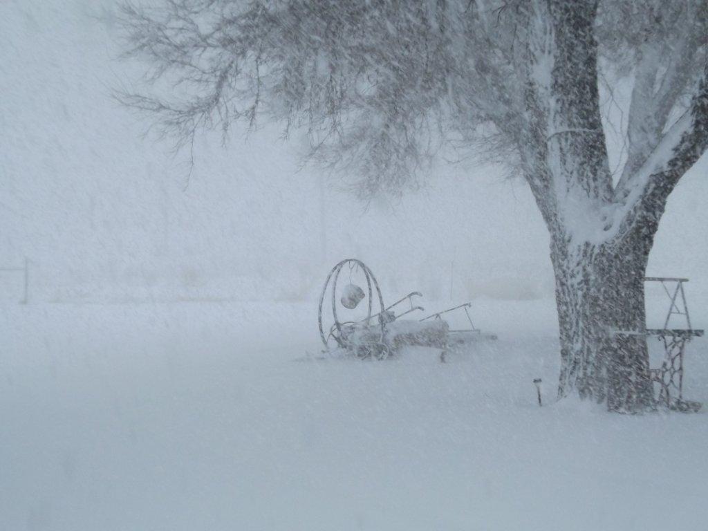
two as well. Up to a foot of snow fell in parts of the state. A Ticker reader
from Texhoma out in far southern Texas County showed us this picture from the
worst of the storm yesterday, and reported 12 inches of the white stuff.
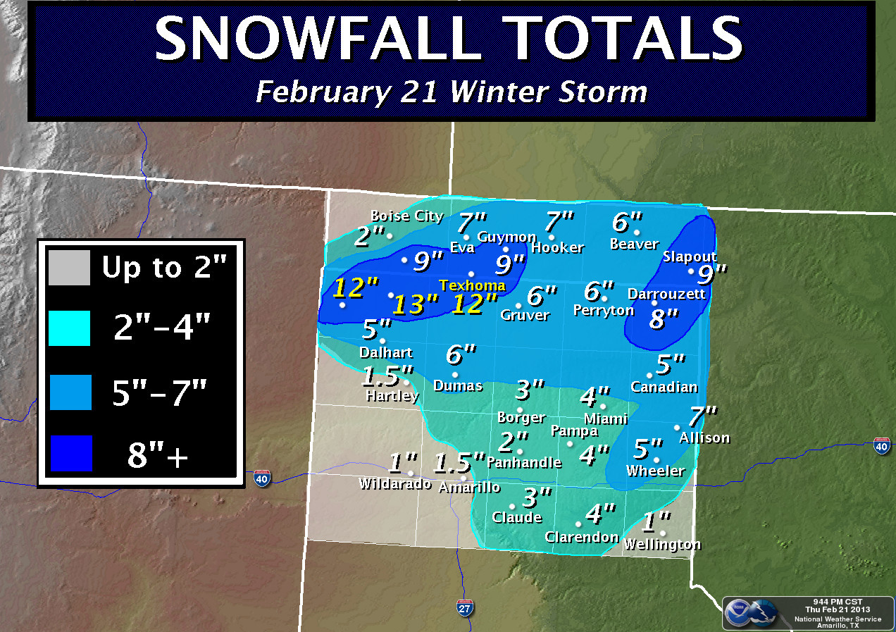
The NWS office from Amarillo provided this nice graphic to confirm those amounts
and others from across the High Plains area. Eastern Beaver County made out pretty
good as well with 9 inches. The only area not sharing in much of the bounty out
that way was much of Cimarron County, where the snow tapered off pretty rapidly.
Farther to the west, Alva led the state with 13.5 inches through the two days of
snow. Nearby, Waynoka had a foot and Freedom had 9 inches. Here are some other
totals reported by the Norman NWS office for the entire event, which consisted of
two separate snow events.
-****-
Location Storm Event Snowfall
ALVA 1W 13.5
WAYNOKA 12.0
ARNETT 3NE 10.0
FREEDOM 9.0
WOODWARD 7.9
FORT SUPPLY 4SE 7.1
QUINLAN 7.0
LAVERNE 6S 6.0
NEWKIRK 5.5
SHATTUCK 1SSW 5.3
BRAMAN 5.2
LEEDEY 5.0
NEWKIRK 5NE 5.0
-***-
Farther to the east, the amounts weren't quite as large, but Weleetka, Pocola,
Sallisaw and Grove all reported 4-4.5 inches of snow.
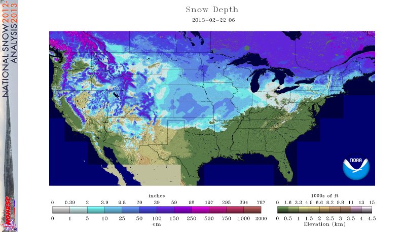
You can see from the latest national snowfall analysis map from this morning
that the northern half of the state, especially northwestern Oklahoma, still has
a decent snowpack of 4-10 inches, in general. Nearly 58% of the lower 48 is
covered by snow to an average depth of 6.7 inches. Not too shabby!
Want to find the snow on the Mesonet air temperature maps? Not hard to do! Take
a look at the current temperatures in NW OK, and also the low temperature map.
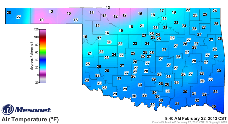
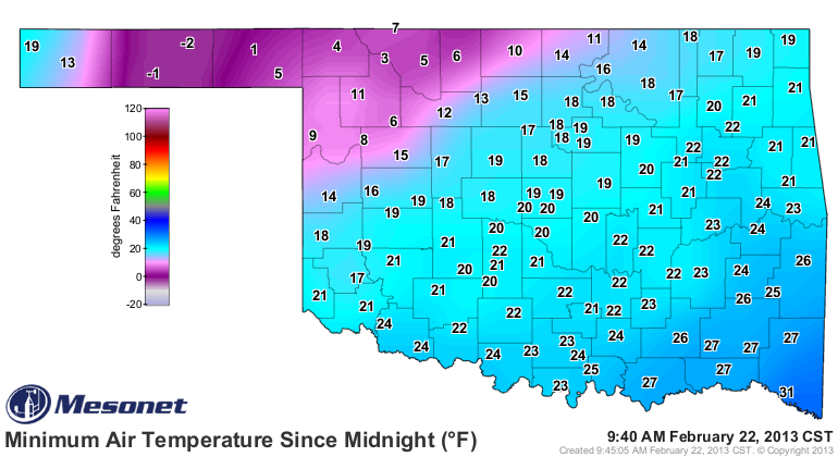
That nice reflective white surface where the deepest snowpack is keeps the
sunshine from being absorbed and the air temperatures stay cooler than their
local counterparts. Looks like about a 15-degree difference from the snowpack
to the areas where it already melted. I'll take the melt, thank you very much!
Just check out Cimarron County, where I told ya the snow tapered off rapidly
to the northwest.
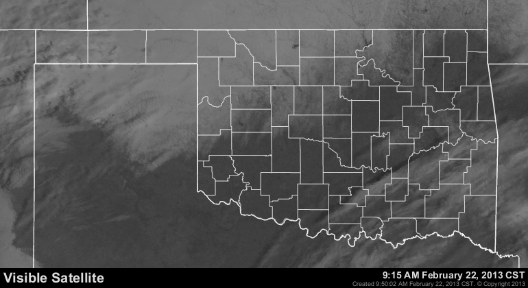
An even easier way to find the snowpack is to simply look at the latest
satellite image. Look carefully and you can see the rivers and lakes across NW
OK.
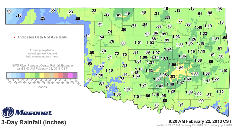
We're still waiting on melting from the Mesonet sites, so we don't have a
great picture of what this all means for liquid precipitation, but we can get
a pretty good idea from the RFC radar estimates. And that idea is WET! A
general soaking of 0.75-2.5 inches across Oklahoma, with the highest liquid
equivalent amounts reported and estimated from central-to-southeastern Oklahoma.
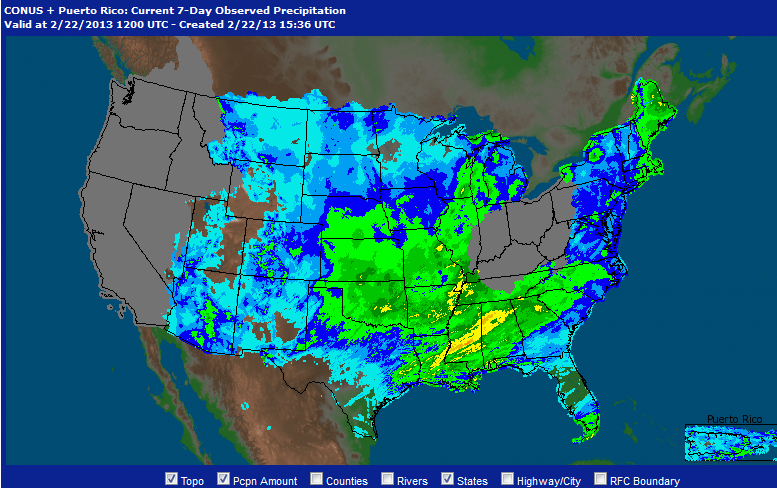
Across the broader region, you can see from the NWS AHPS radar estimate map
that the hard hit areas of OK, KS and NE received some very good moisture
amounts.
There are a few more storms to go. Nothing like what we just had showing up
just yet, but at least it is more moisture (frozen or not). This morning's
7-day rainfall forecast shows a quarter to a half-inch across NE Oklahoma.
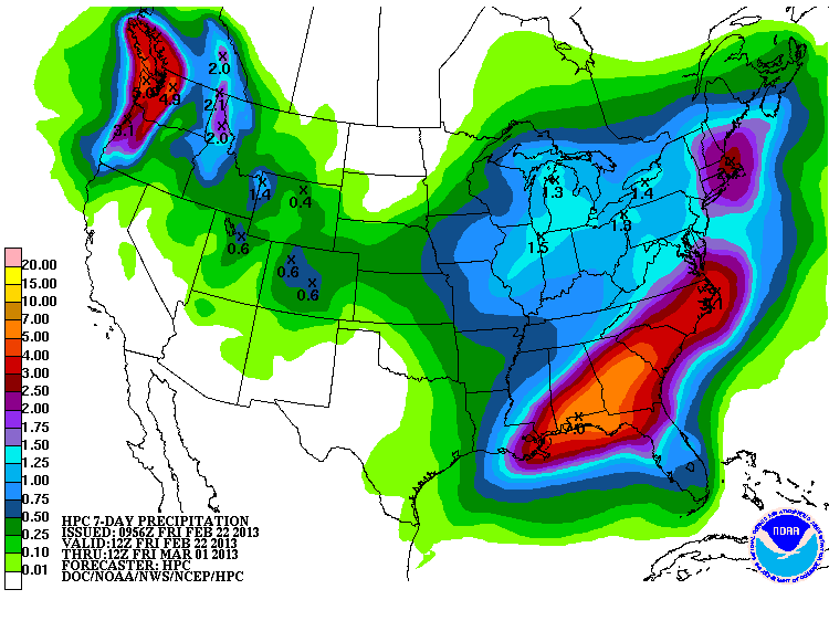
So I'm expecting a large area of improvement on next week's Drought Monitor
map. The drought will still be here, of course. But this dents it before we
start to enter spring as things begin to warm up and turn green again.
Dare I say it? Hey drought ... how do you like *THEM* apples!
Gary McManus
Associate State Climatologist
Oklahoma Climatological Survey
(405) 325-2253
gmcmanus@mesonet.org
February 22 in Mesonet History
| Record | Value | Station | Year |
|---|---|---|---|
| Maximum Temperature | 86°F | HOLL | 2017 |
| Minimum Temperature | -2°F | HOOK | 2013 |
| Maximum Rainfall | 2.74″ | BROK | 2018 |
Mesonet records begin in 1994.
Search by Date
If you're a bit off, don't worry, because just like horseshoes, “almost” counts on the Ticker website!