Ticker for January 16, 2013
MESONET TICKER ... MESONET TICKER ... MESONET TICKER ... MESONET TICKER ...
January 16, 2013 January 16, 2013 January 16, 2013 January 16, 2013
Warmth is on the way!
Unfortunately, so is the dry. That's been our problem over the last 9 months ...
each "start" we get to relieving drought doesn't come with any reinforcement. So
the next time it rains, we may be "starting" our drought relief process all over
again. The good part about being in the cool season (and I struggle to find
anything good about the cool season) is that the moisture that does fall tends
to stick around awhile. As long as it's cool, of course. Last year we were
already on our way to the warmest year on record about 6 degrees above normal
during January, so the water stress was already beginning.
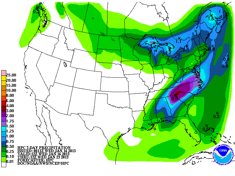
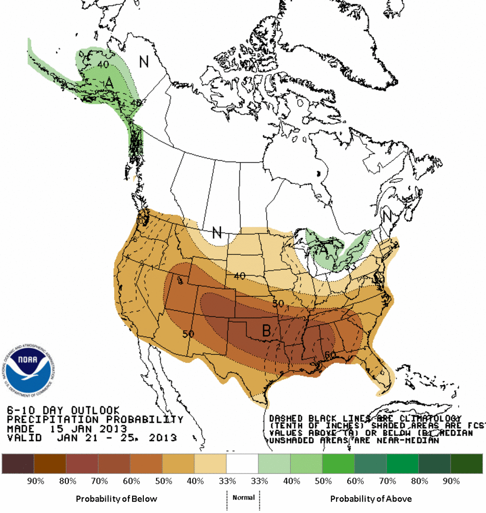
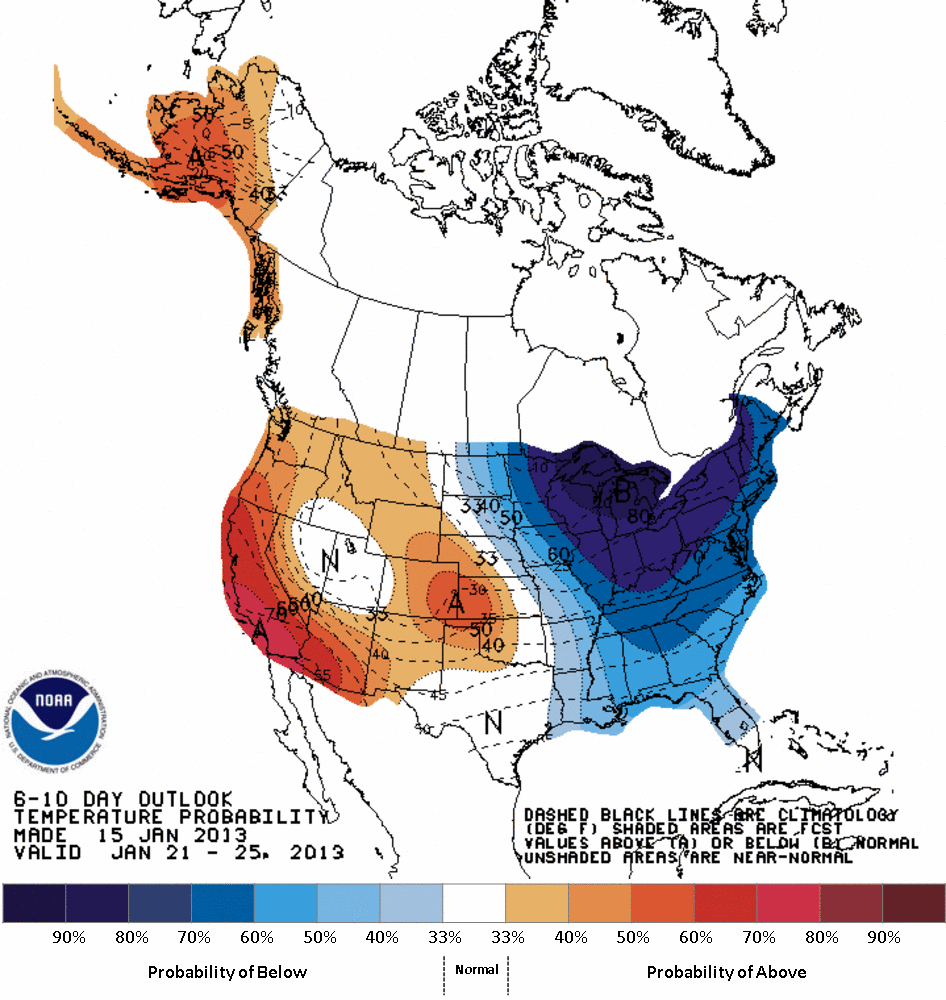
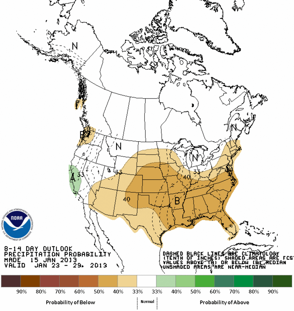
The latest medium-range outlooks from the CPC show us dry weather is here to stay
for awhile, probably, and warm weather will make a return as well. I also threw
the 7-day forecast from the HPC, so that should cover the rest of January. The
CPC maps for January 21-29 show PROBABILITIES, not totals or their anomalies.
So simply put, we see in those maps increased odds of above normal temps and
below normal precip. To what degree (or inches) is not included on the maps. As
usual, however, any precip amount "below normal" during the driest part of the
year is REALLY dry.
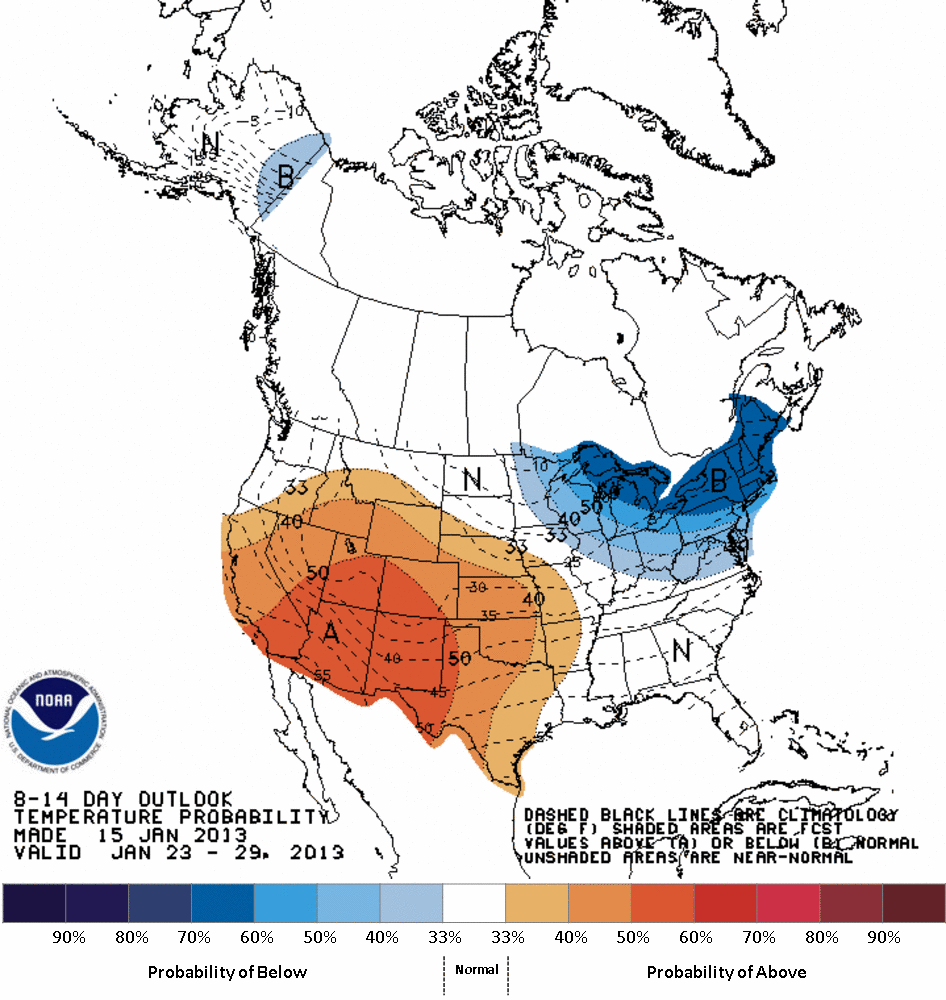
Now we all know by now that this can change in a hurry, and there will be a
frigid body of air to our northeast early next week. Right now we are scheduled
to get a glancing blow on Monday and Tuesday, but sometimes those types of
situations can give frosty surprises. I think the talk of sub-zero weather for
early next week was a bit premature, however. Sorta like my idea to buy a
lifetime supply of combs. But before any cold air arrives, the weather will
get quite pleasant. Highs on Saturday will be around 60 degrees statewide.
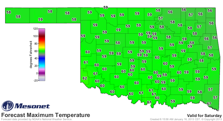
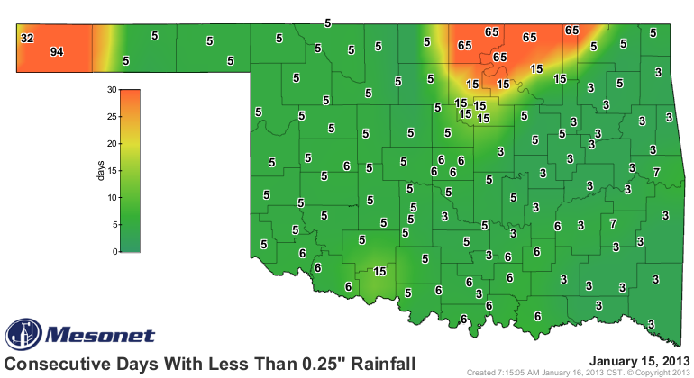
So we're probably going to see the "days with less than a quarter-inch" map
start to turn the bad colors again (orange and yellow). Folks up in north
central Oklahoma and the western Panhandle are already there.
Watch for the new Drought Monitor tomorrow. It will have some changes for
Oklahoma.
Gary McManus
Associate State Climatologist
Oklahoma Climatological Survey
(405) 325-2253
gmcmanus@mesonet.org
January 16 in Mesonet History
| Record | Value | Station | Year |
|---|---|---|---|
| Maximum Temperature | 79°F | MANG | 2012 |
| Minimum Temperature | -15°F | VINI | 2024 |
| Maximum Rainfall | 2.43 inches | ALTU | 2004 |
Mesonet records begin in 1994.
Search by Date
If you're a bit off, don't worry, because just like horseshoes, “almost” counts on the Ticker website!