Ticker for January 14, 2013
MESONET TICKER ... MESONET TICKER ... MESONET TICKER ... MESONET TICKER ...
January 14, 2013 January 14, 2013 January 14, 2013 January 14, 2013
Wimp Factor 5
Obviously, coming off the warmest year on record, the warmest 2-year period on
record, the warmest March on record, the hottest summer for any state on record,
the warmest spring on record, 27 out of the last 33 months warmer than normal ...
I have become a wimp. I thought that when I looked up the data for the first
13 days of the month/year, we would be suffering through one of our coldest
Januarys (thus far) on record. Much to my shock, not only did I find that we are
not experiencing an arctic-cirle style January thus far, but we've actually been
ABOVE normal for the month.
The statewide average high temperature, as measured by the Mesonet, has been 48.1
degrees, 0.9 degrees above normal. Here was the real shocker ... the statewide
average low has been 27.1 degrees, 3.3 degrees above normal. The plain old
statewide average temperature has been 37.6 degrees, 2.1 degrees above normal.
We've seen a -10 degrees from Kenton on January 2, and a 75 from Waurika on the
11th. I much prefer the latter!
Give us a couple more mornings like the last two and we will be dropping below
normal. Low temperatures this morning were down in the teens, and yesterday's
highs struggled to get above freezing.
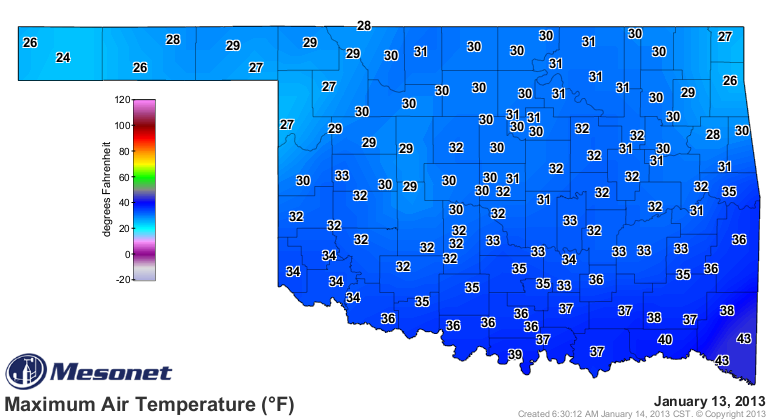
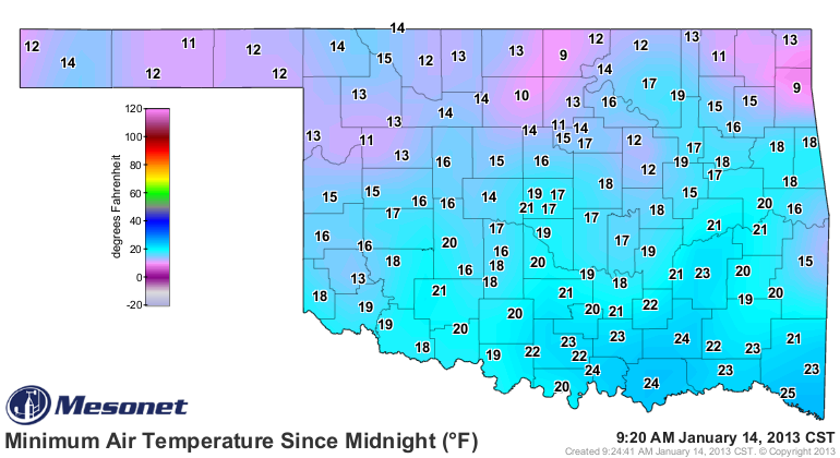
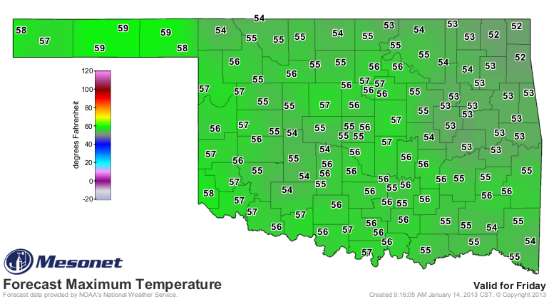
Watch for another cold day and night until we see a bit of a warm up over the
next few days. By Friday we should see temperatures back into the 50s. The
forecasts all come from our friends at the NWS.
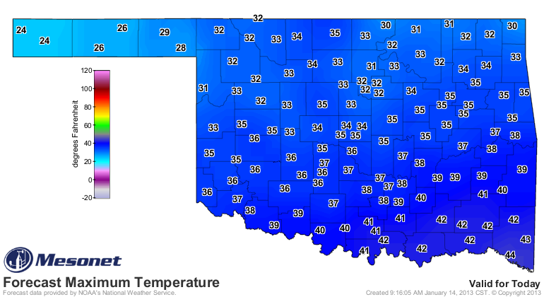
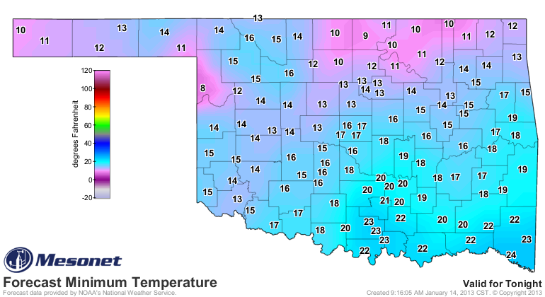
Just as a warning, there is a very large area of extremely frigid air building
in the northern reaches of our hemisphere that could be headed for the eastern
U.S. next week. We will have to wait until it gets a bit closer to see if we
are gonna take a direct hit or a glancing blow.
Again, I'm voting for the latter (or a write-in candidate: "stay up north!").
It does look like we're going to be back in something of an extended dry
pattern for the next week at least. Maybe something will surprise us, but
nothing is showing up just yet. Last week's moisture was certainly a nice bonus
for those that got it. Watch for some changes on this week's U.S. Drought
Monitor thanks to that rain and snow.
Right now, the long-range models are showing us a dry and warm February, but
no reason to panic ... still lots of time to change that around.
Now, off to Braum's. Forget the milk and bread ... I'm going for hot chocolate!
Gary McManus
Associate State Climatologist
Oklahoma Climatological Survey
(405) 325-2253
gmcmanus@mesonet.org
January 14 in Mesonet History
| Record | Value | Station | Year |
|---|---|---|---|
| Maximum Temperature | 74°F | ERIC | 2020 |
| Minimum Temperature | -11°F | VINI | 2024 |
| Maximum Rainfall | 2.39 inches | BROK | 2007 |
Mesonet records begin in 1994.
Search by Date
If you're a bit off, don't worry, because just like horseshoes, “almost” counts on the Ticker website!