Ticker for January 10, 2013
MESONET TICKER ... MESONET TICKER ... MESONET TICKER ... MESONET TICKER ...
January 10, 2013 January 10, 2013 January 10, 2013 January 10, 2013
New drought map doesn't reflect rainfall
A really good rain fell over most of the state, especially considering this is
January. Southeastern and south central Oklahoma got the best widespread totals
with more than an inch in most places, but southwestern Oklahoma wasn't far
behind.
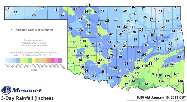
It would have been nice if north central and northeastern Oklahoma had received
more, but we'll accentuate the positive and hope they get their share next time.
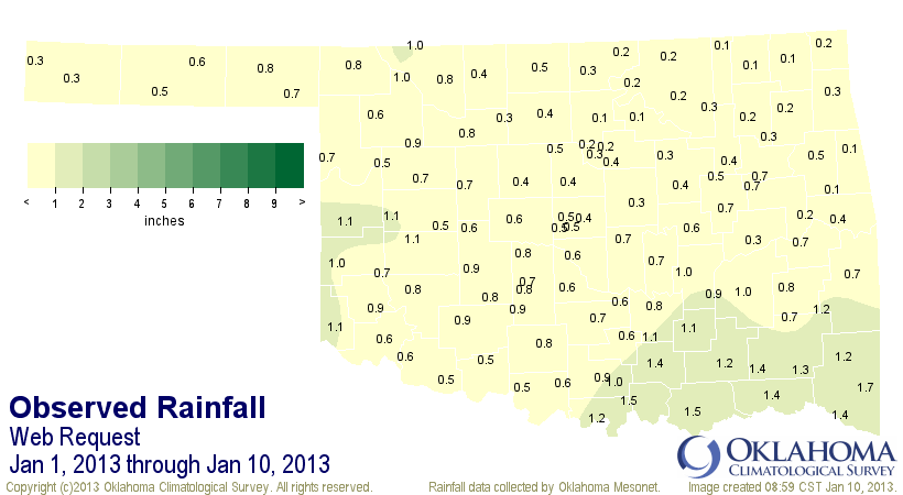
The rain brings our statewide average for the month thus far up to 0.66". That's
still about 0.8" below normal, but we have 21 days left to up the ante!
Here is the latest U.S. Drought Monitor map. No changes for Oklahoma. Remember,
the cutoff point to consider precipitation is Tuesday morning, and most of our
rains fell after that.
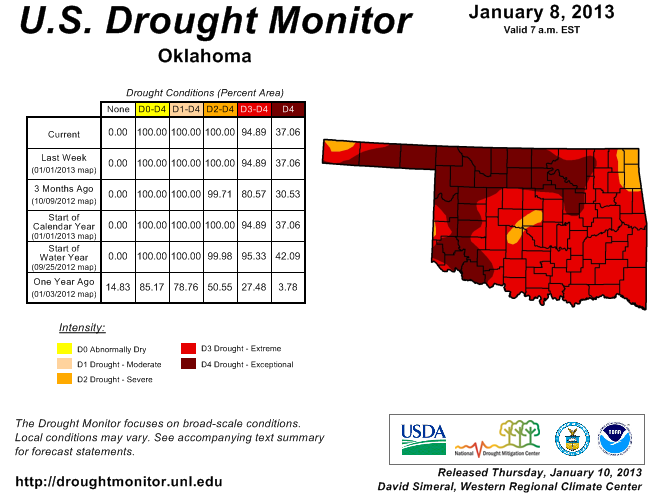
We debated making improvements in the southeast with the rains they saw over
the last few weeks, but we still were not seeing the response in the reservoirs
down there. We'll take a look at the indicators and I expect to see some
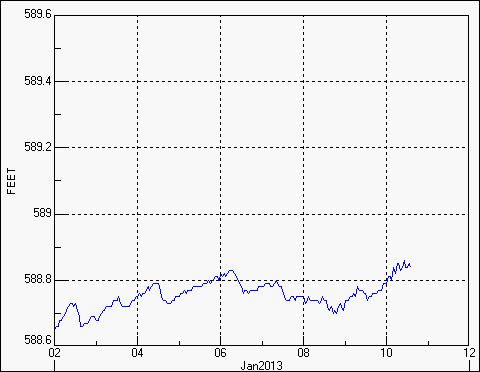
lessening down there on next week's map. So far, the lakes down there seem to
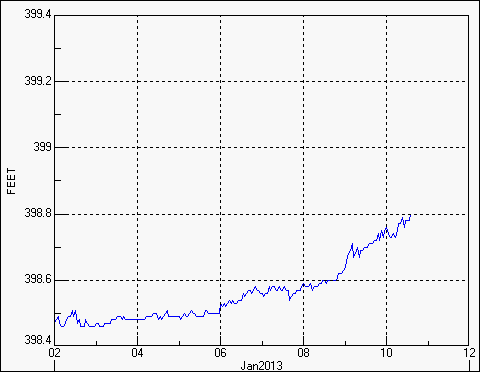
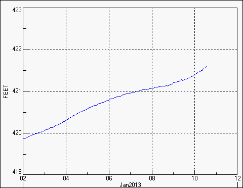
be responding to the rains. Hugo Lake has gone from 40% of capacity to 42%,
Broken Bow from 68% to 69%, and Pine Creek from 18% to 24%.
No, the system was not a drought buster. But it's a start. And there were a lot
of crops out in the fields that got a good drink of water ... maybe some puddles
in those dry farm ponds here and there. As long as we don't get ridiculously
warm like January-March of last year, this moisture will stick around awhile.
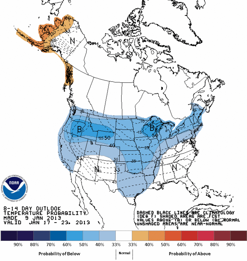
It still looks like cooler than normal weather is in store for us for much of
January, so nothing like the start of 2012.
I'll repeat my mantra from the last two years: ending drought is a process. The
soils drink first, then the rest. This is a start, now we need reinforcements.
The next chance for moisture comes this weekend. As usual, the southeast looks
to be the big benefactor.
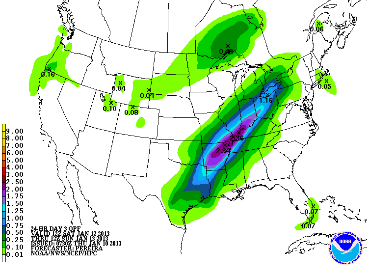
The rest of us will have to wait. That's okay. We're patient (trying to be nice
to Mother Nature this time).
Gary McManus
Associate State Climatologist
Oklahoma Climatological Survey
(405) 325-2253
gmcmanus@mesonet.org
January 10 in Mesonet History
| Record | Value | Station | Year |
|---|---|---|---|
| Maximum Temperature | 84°F | BURN | 2023 |
| Minimum Temperature | -6°F | VINI | 2010 |
| Maximum Rainfall | 4.31″ | MADI | 2020 |
Mesonet records begin in 1994.
Search by Date
If you're a bit off, don't worry, because just like horseshoes, “almost” counts on the Ticker website!