Ticker for January 3, 2013
MESONET TICKER ... MESONET TICKER ... MESONET TICKER ... MESONET TICKER ...
January 3, 2013 January 3, 2013 January 3, 2013 January 3, 2013
From drought and heat to drought and cold!
It's a bit strange to be coming off the news of our possible/probable warmest
year on record and talking about an extended cold spell, but we go where the wind
takes us. Unluckily, we still have the drought to talk about (go back every single
Ticker since October 2010 and that statement remains true). Low temperatures
dropped down below zero again last night in the western Oklahoma Panhandle for
the second day in a row. Kenton's minus 5 degrees looks chilly enough until you
see their minus 8 from Wednesday.
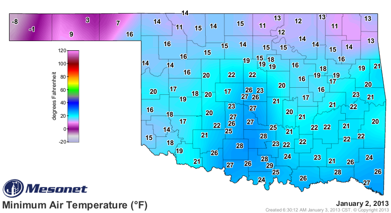
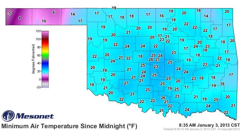
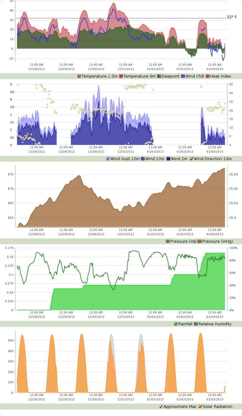
In fact, Kenton hasn't seen a temperature at or above freezing since around 1:30
a.m. on New Year's Eve.
Luckily most of that really frigid air has been confined to the high country out
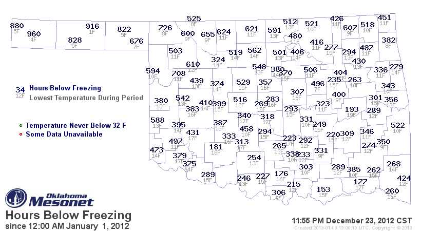
west, but the rest of the state has certainly gotten their fair share. Since
Christmas Eve, much of the state has seen lows down to at least the teens, and
for more than 100 hours.
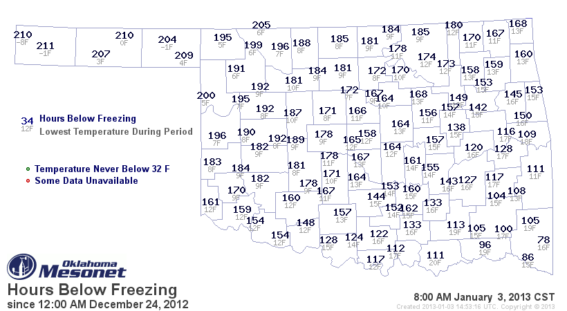
For some areas of the state, it's about half (or ever closer!) of the hours
they spent below freezing for the previous 51 weeks in 2012!
-------------------------------------------------------------------------------
Now, on to more unpleasant matters ... drought. The moisture we received over
the last 10 days or so has had some folks jumping for joy. Especially down in
the far southeast, where a good 2-4 inches fell.
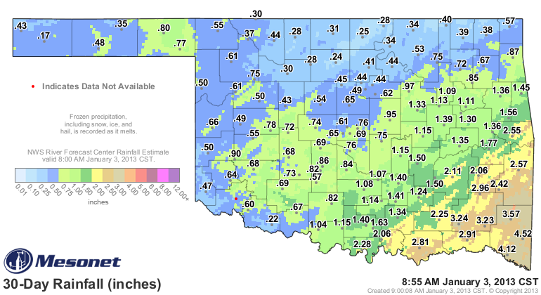
The rain and snow has helped the topsoils moisten up across much of the state,
but little of that has helped the lower depths, as expected.
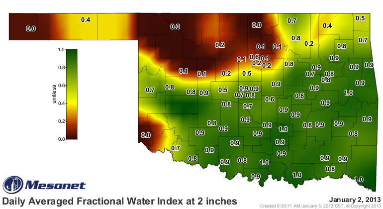
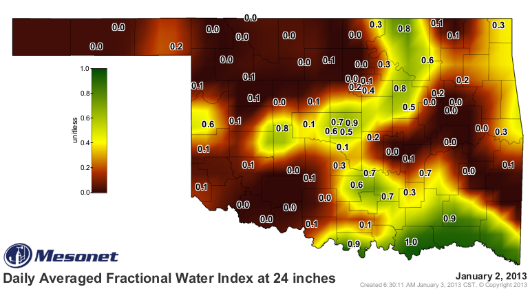
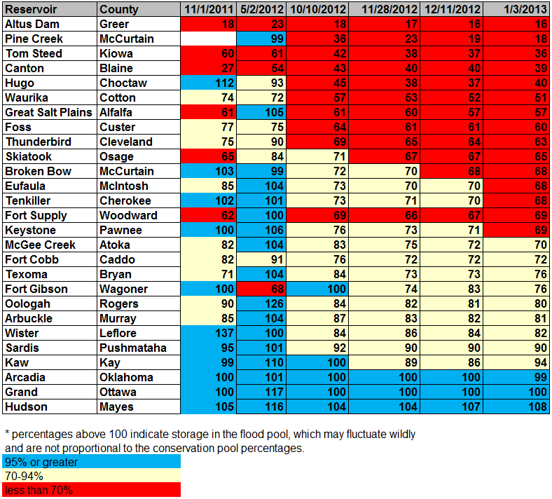
We watched the lake levels down that way to see if there was any improvement.
Unfortunately, the levels remained pretty dismal. Pine Creek down in McCurtain
County went from 16% to 18% of capacity, but that's still a drop from where
they were three weeks ago (19%). Broken Bow lake in McCurtain County stayed at
68% of capacity after the rains.
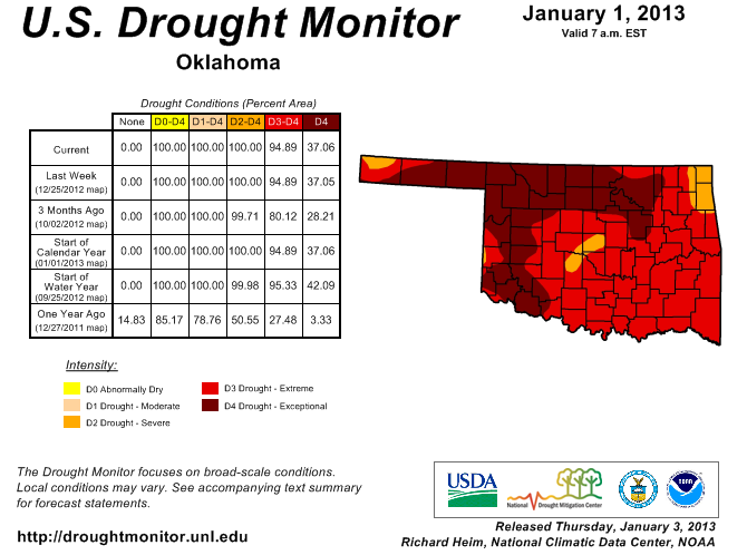
Given that the southeast was the obvious candidate for improvement on the latest
Drought Monitor, after looking at the lake levels and soil moisture profile to
depth, the map this week remains unchanged (but poised for improvements with
any further moisture!).
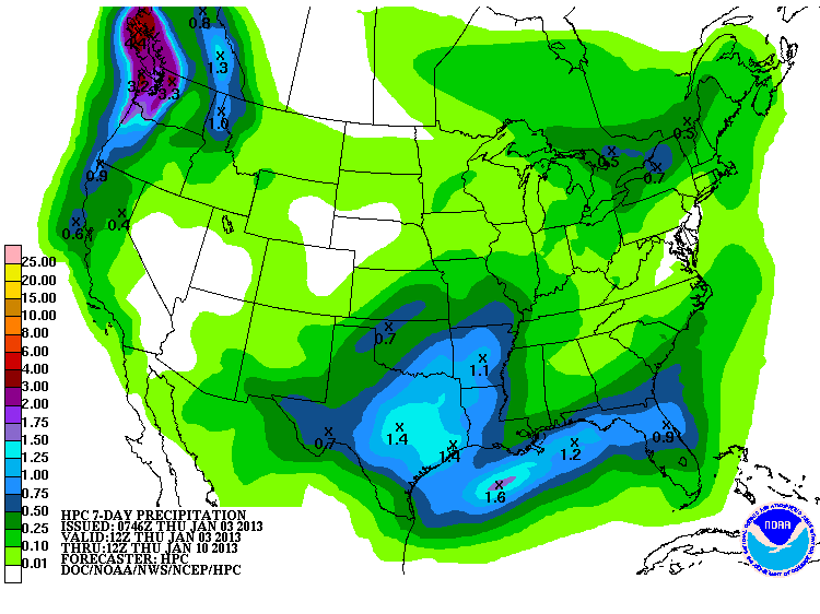
And that chance for more moisture is beginning to show up on the latest 7-day
rainfall forecast from the HPC. Great moisture, in fact! Over an inch in the
SE and at least a quarter-half inch elsewhere. This storm is expected for the
middle of next week.
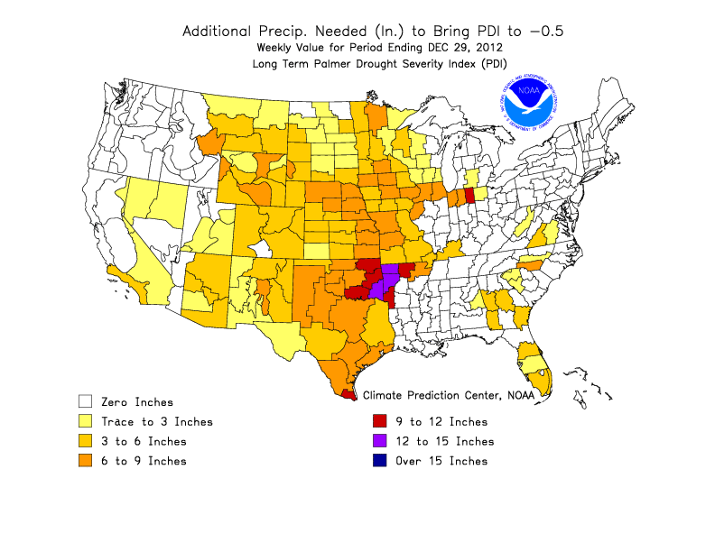
The problem, of course, is we still need a ton of rain to make up for the driest
May-December on record ... about 6-20 inches, basically.
So the latest U.S. Seasonal Drought Outlook still sees most of Oklahoma with
drought persisting or intensifying through March. Far southeastern Oklahoma is
at least painted with the "some improvement" label.
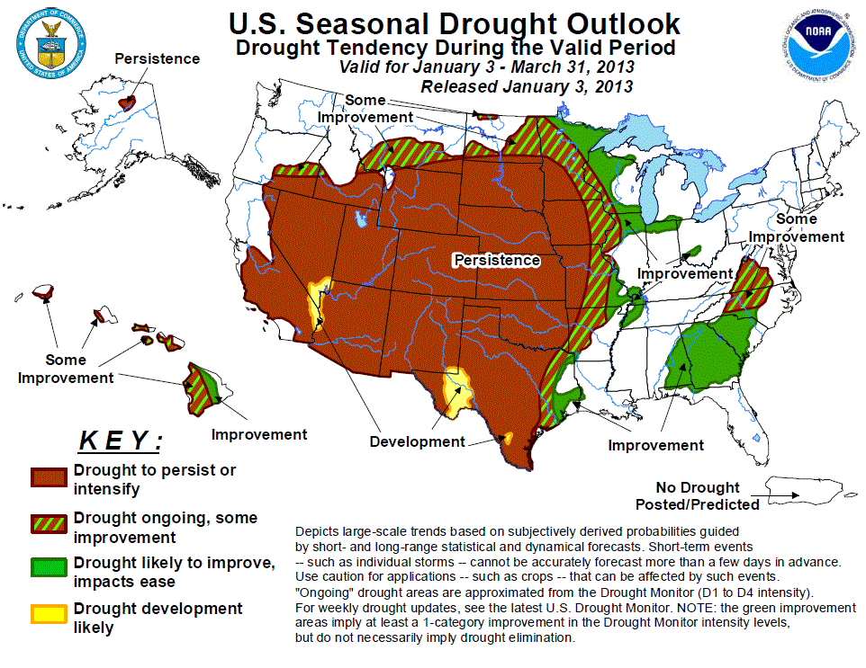
The Seasonal Outlook forecaster is sticking to the "driest part of the year" for
the first half of that outlook. We will see if the current active pattern sticks
around and gives us another cold-season drought reprieve like we saw last year.
Gary McManus
Associate State Climatologist
Oklahoma Climatological Survey
(405) 325-2253
gmcmanus@mesonet.org
January 3 in Mesonet History
| Record | Value | Station | Year |
|---|---|---|---|
| Maximum Temperature | 87°F | ALTU | 2006 |
| Minimum Temperature | -8°F | KENT | 2002 |
| Maximum Rainfall | 3.32 inches | CENT | 2005 |
Mesonet records begin in 1994.
Search by Date
If you're a bit off, don't worry, because just like horseshoes, “almost” counts on the Ticker website!