Ticker for December 17, 2012
MESONET TICKER ... MESONET TICKER ... MESONET TICKER ... MESONET TICKER ...
December 17, 2012 December 17, 2012 December 17, 2012 December 17, 2012
1954's taking body blows!
If you'll remember, we've been keeping close track of our statewide average
temperature the last couple of months as we edge closer to year's end. Using the
latest official data from NCDCD through November, 2012 still held a 0.2 degree
lead over 1954 with 62.8 degrees the final number to beat through December. So
we needed December to be at least normal to hold off 1954's warmer than normal
finish (41.8 degrees, 27th warmest on record and 2.7 degrees above the 20th
Century average). Well, December 2012 has not disappointed.
Through the first 16 days of the month, the statewide average temperature as
measured by the Mesonet has been 48 degrees,7.4 degrees above normal (40.6
degrees). High temperatures across the state have averaged 60.3 degrees (8.2
degrees above normal) and lows at 35.6 degrees (6.6 degrees above normal).
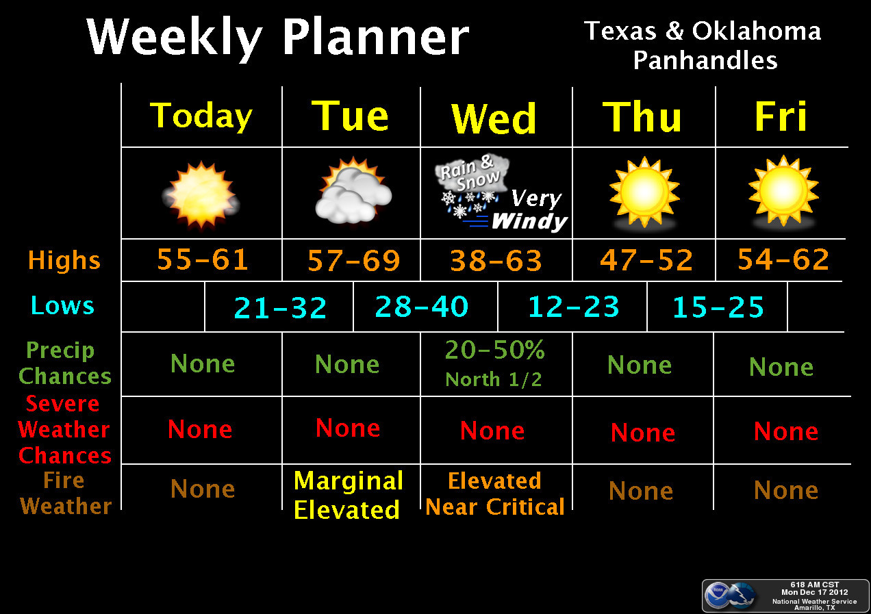
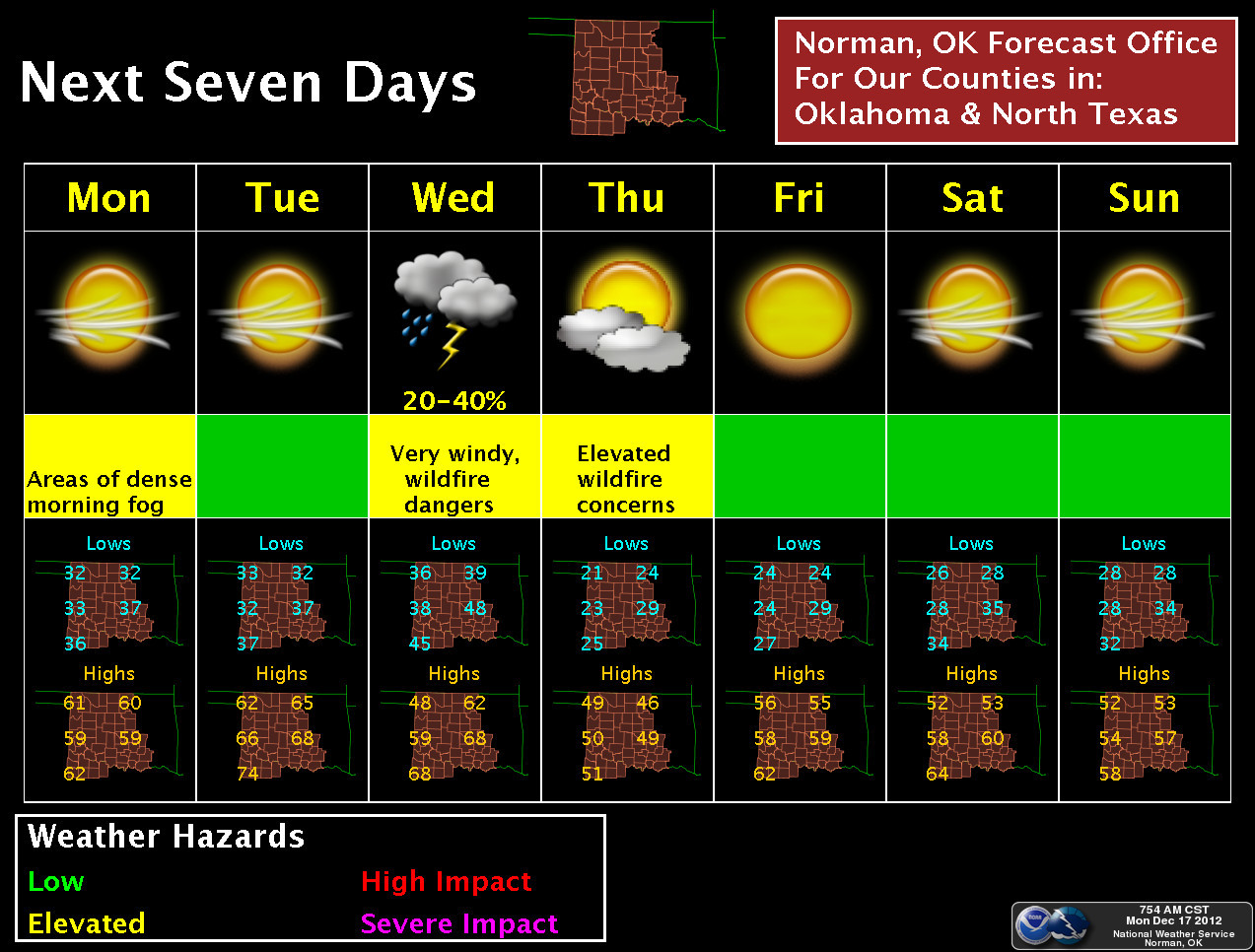
We still have three pretty warm days ahead, too, before a frontal passage on
Wednesday takes the temperatures down to the "normal" range, but very little in
the way of below normal temperatures are in the forecast for the next seven days.
Now there is a hint of a possible arctic blast right around Christmas Day or so,
but the key is how cold and for how long? We just haven't seen the extended
chill to really change that march towards our warmest year on record.
Speaking of rain (somebody was!), it looks like there's a chance for some
not-quite-significant amounts of moisture with the front on Wednesday.

Doesn't look like much for now, but there might be some snow with that in
northern Oklahoma. There also appears to be some sort of agreement with the
latest forecast models that there could be moisture associated with that
system showing up Christmas week. Stay tuned for that one ... still too far out
for me to broadcast a milk and bread alert.
December has been way too dry thus far with a statewide average of 0.26"
according to the Mesonet. That's 0.87" below normal (about 23% of normal) and
the 12th driest Dec. 1-17 since 1921.
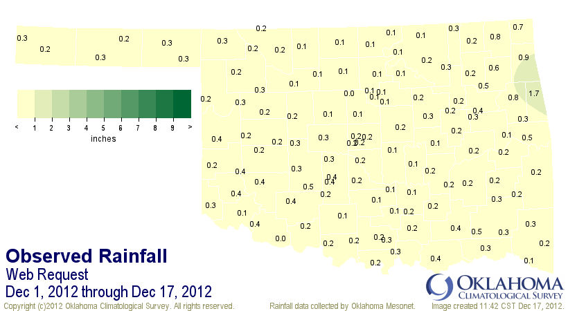
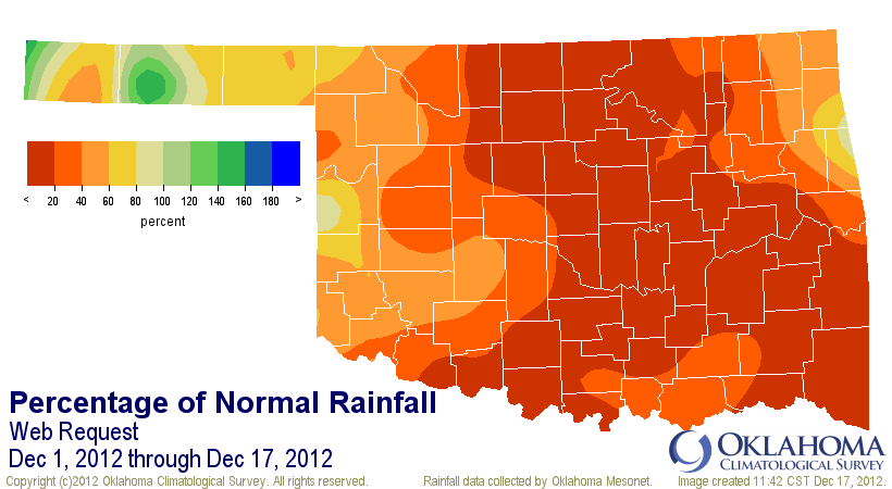
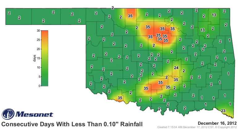
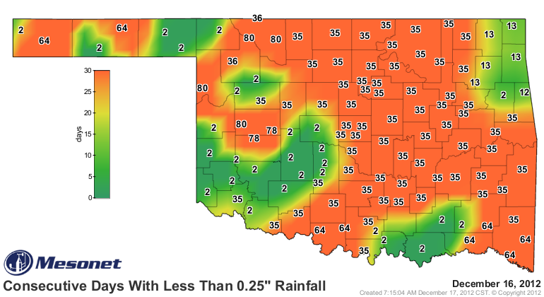
That bit of rain might not have quenched the drought, but at least it made
those "days without" maps from the Mesonet look a little better. For some, at
least, and more so for the tenth of an inch maps than the quarter-inch. The
count continues upwards for some, but for most the statistic doesn't really
signal an end to the desperate dry weather. It has now been 81 days (counting
today) since Freedom, Butler, Alva and Arnett saw at least a quarter-inch of
rain in a single day.
But for now, the big news is the demise of 1954's notoriety as Oklahoma's
warmest year on record. I'd say chances are extremely high that 2012 will
take 1954's place in the record books. As usual, however, I will warn that we
have to await the official data from NCDC. And should it be close, we might
not know officially for a few months.
Gary McManus
Associate State Climatologist
Oklahoma Climatological Survey
(405) 325-2253
gmcmanus@mesonet.org
December 17 in Mesonet History
| Record | Value | Station | Year |
|---|---|---|---|
| Maximum Temperature | 79°F | RING | 2021 |
| Minimum Temperature | -14°F | EVAX | 2016 |
| Maximum Rainfall | 3.06″ | COOK | 2021 |
Mesonet records begin in 1994.
Search by Date
If you're a bit off, don't worry, because just like horseshoes, “almost” counts on the Ticker website!