Ticker for December 13, 2012
MESONET TICKER ... MESONET TICKER ... MESONET TICKER ... MESONET TICKER ...
December 13, 2012 December 13, 2012 December 13, 2012 December 13, 2012
Bring on the rain!
Little change in this week's U.S. Drought Monitor, but of course that "little"
was on the bad side. I try and see the glass as a tenth full instead of nine-tenths
empty, but Mother Nature always swings me back over to the negative side. We lost
0.36 of the 0.44 percent of the state that was in Moderate (D1) drought, as it is
now labeled in Severe (D2) drought. But hey, there's still .08 percent of the
state left in moderate!
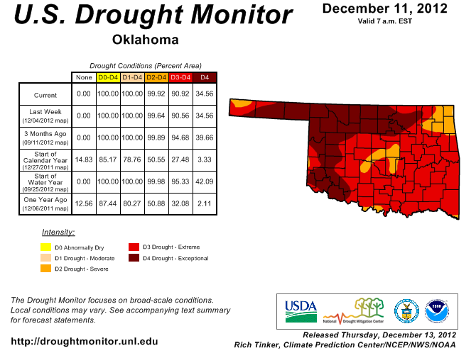
The good news is it could always be worse! Just ask Nebraska.
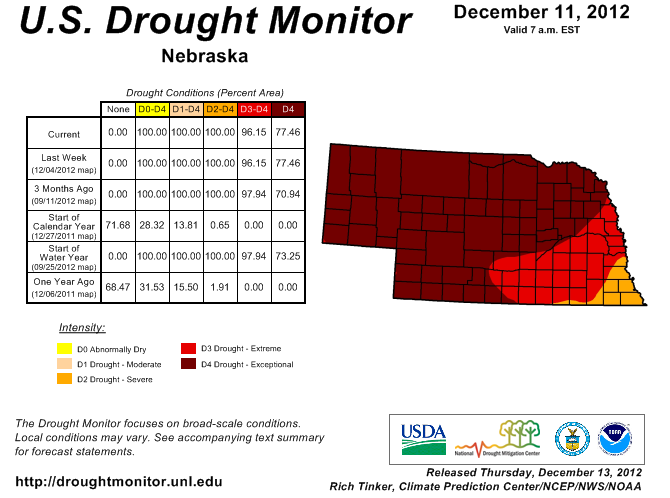
Hmmm, 77 percent of the state in Exceptional (D4) drought? Been there, done that.
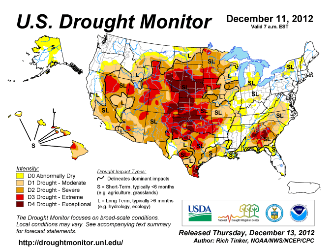
We wish them better luck on THEIR second year. We still have more than 6 percent
of the country in Exceptional drought, and nearly 43 percent in at least Severe
drought. Nearly 62 percent of the lower 48 states is in at least Moderate drought.
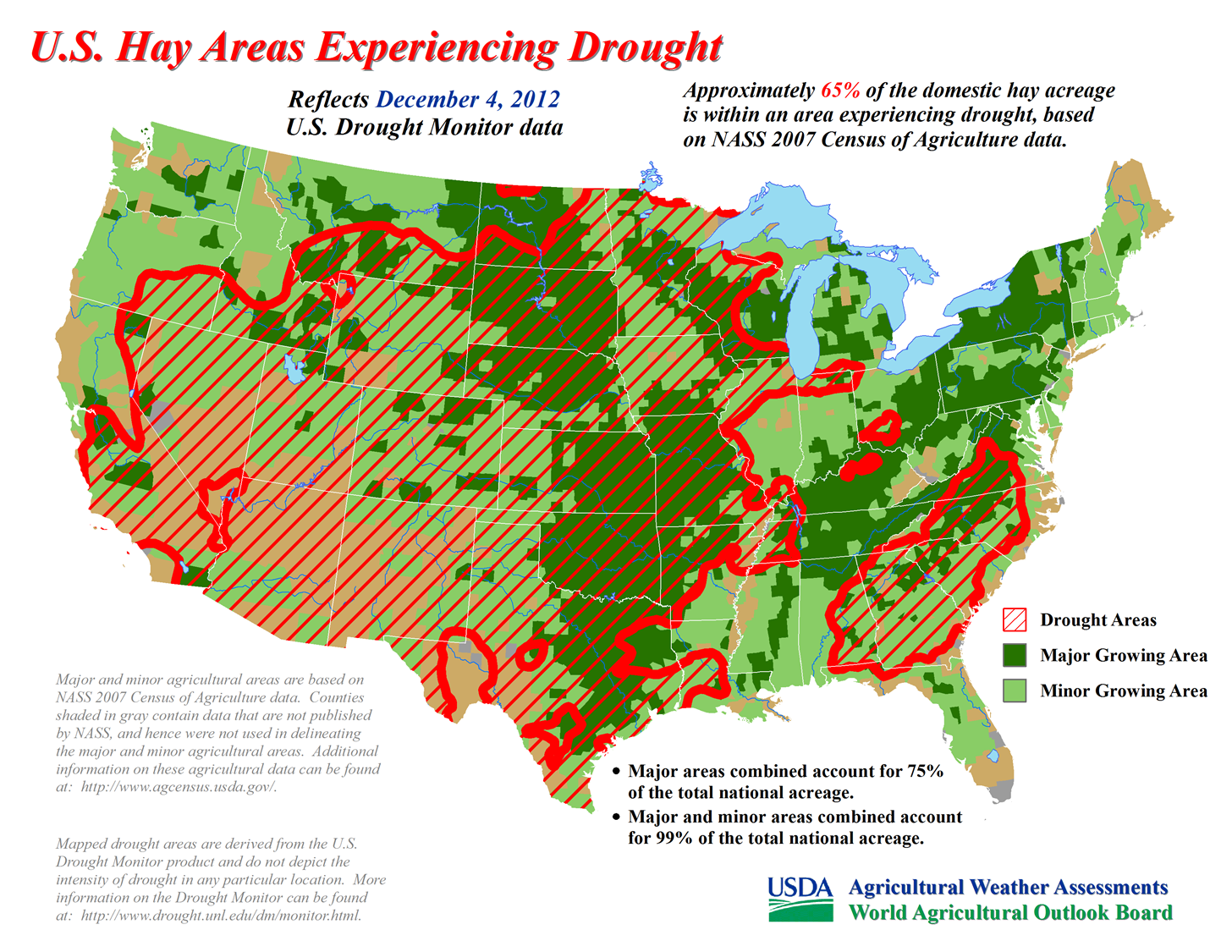
That has left approximately 65 percent of the U.S. Hay acreage in drought,
according to the USDA.
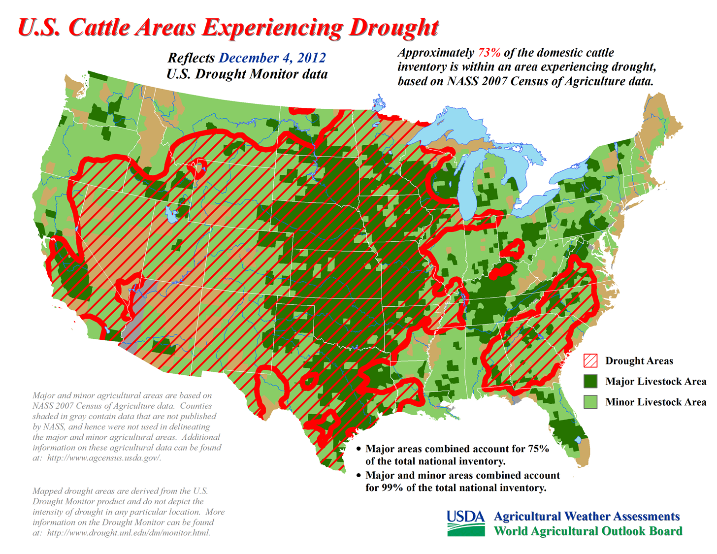
It's even worse for the domestic cattle inventory, 73 percent of which is in
drought areas.
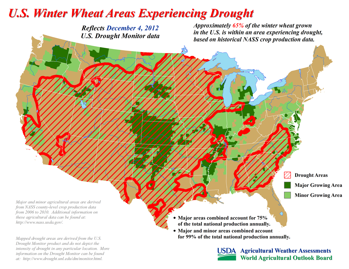
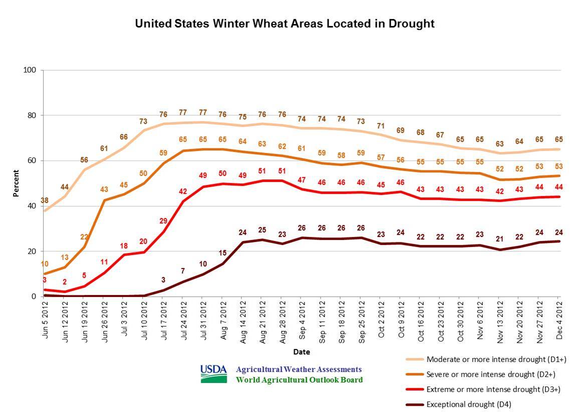
Finally, 65 percent of the winter wheat crop of the U.S. is in drought impacted
areas. And 44 percent of that is in at least Extreme drought.
We don't need to look at the Drought Monitor to tell us that, of course. All
we need to do is look at the Mesonet "days without" maps. Up to 77 days (counting
today) in Freedom without at least a tenth, and 78 days in Buffalo (you know
the drill) without a quarter.
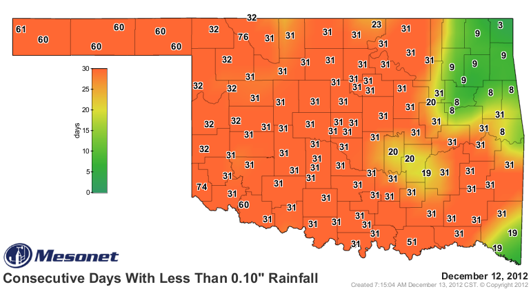
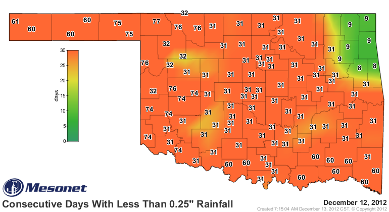
HOPEFULLY those maps will reset over much of the state with our storm system
tomorrow. We can't handle much more of this type of map ... the 30 day LACK OF
rainfall maps.
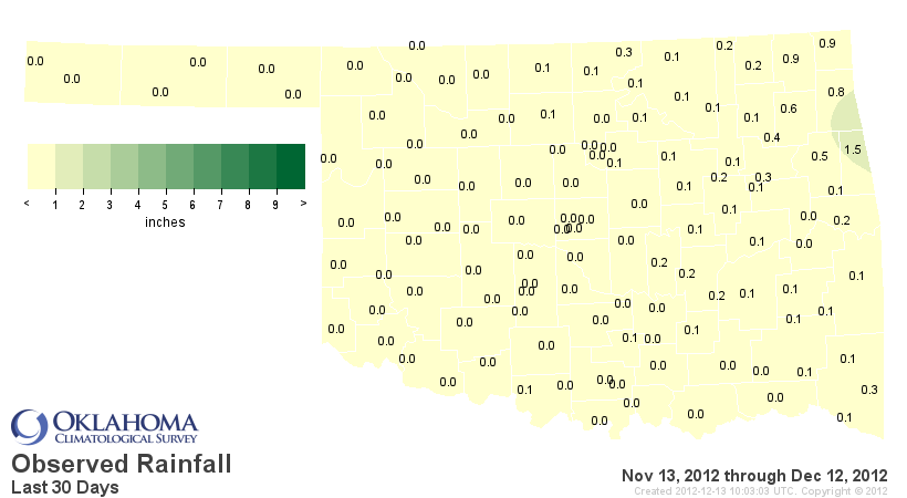
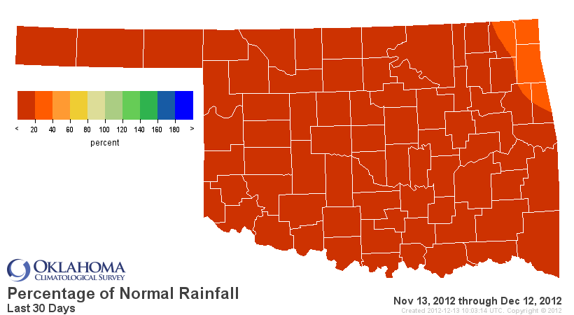
Those maps equate to a statewide average of 0.09" over the last 30 days, the
driest Nov. 13-Dec. 12 on record. The Panhandle has had ZERO POINT ZERO, matching
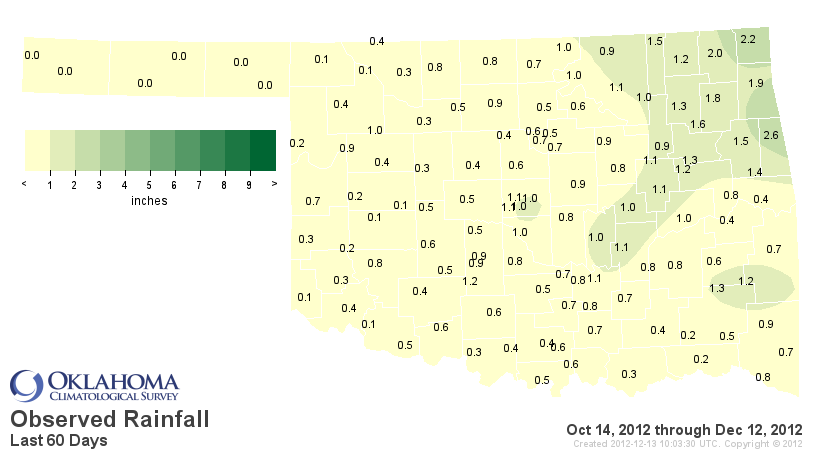
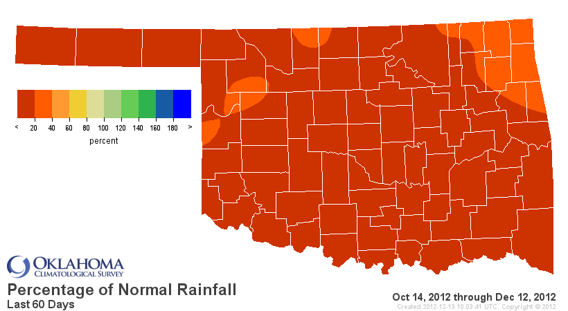
Blutarski's GPA on "Animal House." The last 60 days are little better, ranked
as the second driest Oct. 14-Dec. 12 on record with a statewide average of
0.68 inches, 5 inches below normal.
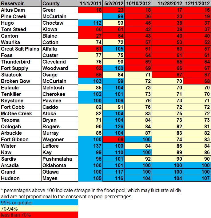
The state's major reservoirs continue to drop, even though we're in the cool
season. If we had been this dry during the warm season, these would probably
be much worse by now. We're luck for the rain we did get through that period.
Altus-Lugert is still leading the way at 16 percent of capacity. Add Broken
Bow to those that are below 70 percent. Eufaula and Tenkiller will be there in
a week or so. Lake Hugo has gone from 93 percent back in May to 37 percent.
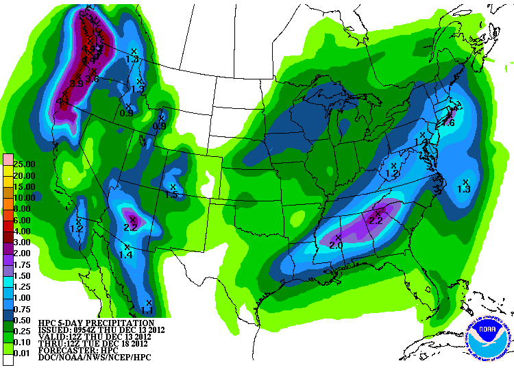
Okay, chances for rain remain in place for tomorrow. The HPC is still looking
at up to a half-inch for localized areas, and a quarter inch across the general
area.
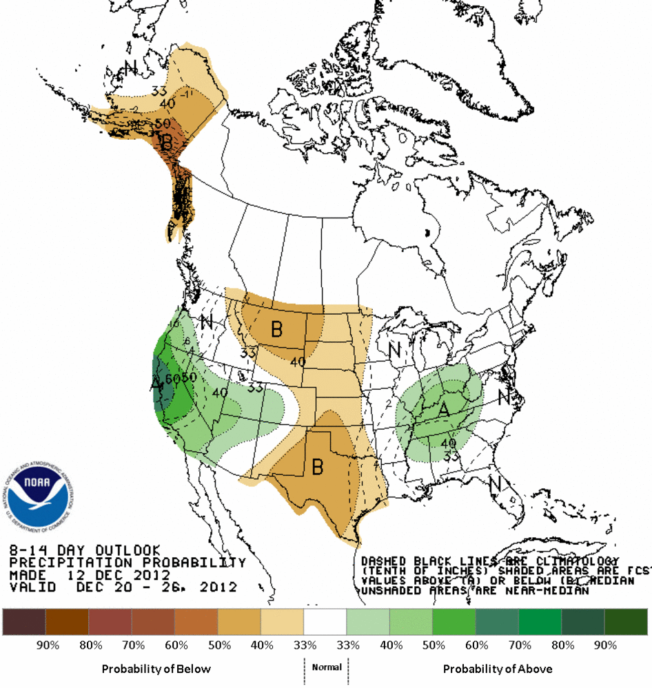
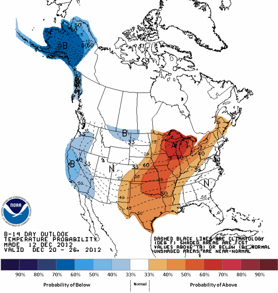
After that, we appear to be entering another extended period of normal to
above normal temperatures and dry weather. Basically, mild and dry with a fast
moving frontal passage or two. ALWAYS subject to change rather quickly, but
that's how it's looking now, at least.
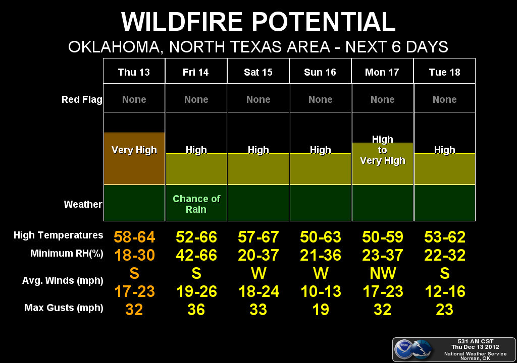
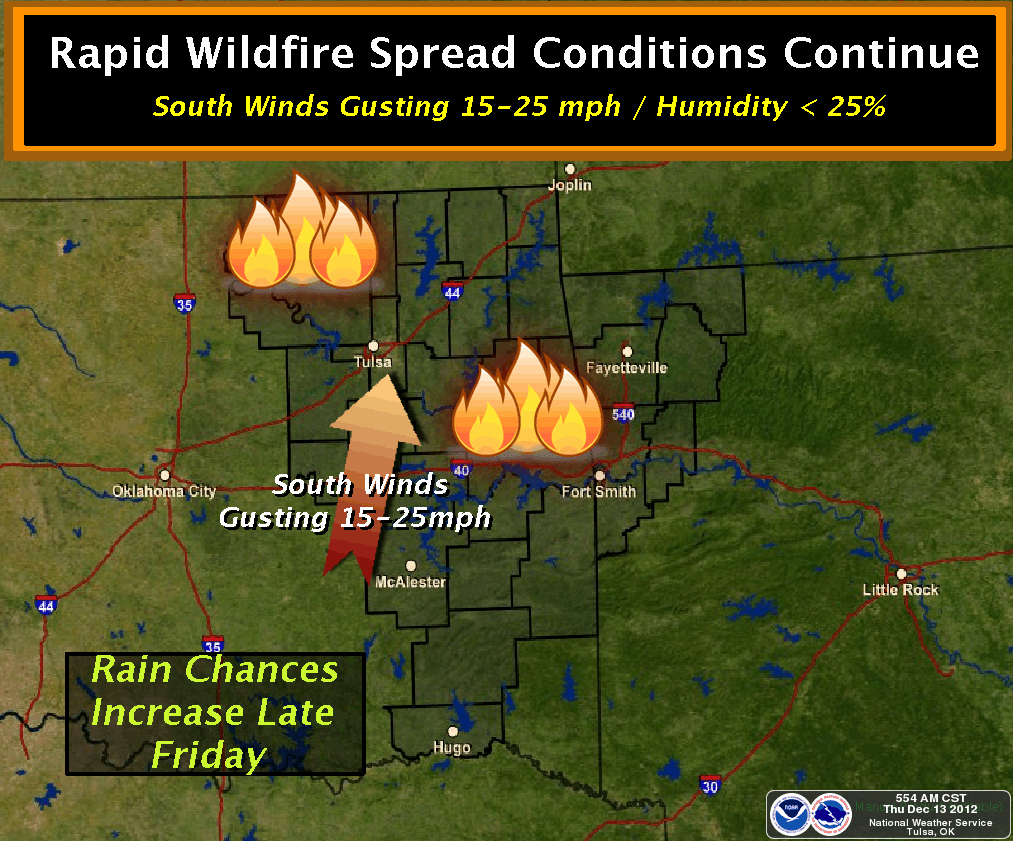
Even with the rain, be careful out there. Fire dangers will be high for the
next few days (and weeks and months, possibly).
Gary McManus
Associate State Climatologist
Oklahoma Climatological Survey
(405) 325-2253
gmcmanus@mesonet.org
December 13 in Mesonet History
| Record | Value | Station | Year |
|---|---|---|---|
| Maximum Temperature | 76°F | SLAP | 2021 |
| Minimum Temperature | 3°F | MEDF | 2000 |
| Maximum Rainfall | 4.06″ | BROK | 2015 |
Mesonet records begin in 1994.
Search by Date
If you're a bit off, don't worry, because just like horseshoes, “almost” counts on the Ticker website!