Ticker for December 5, 2012
MESONET TICKER ... MESONET TICKER ... MESONET TICKER ... MESONET TICKER ...
December 5, 2012 December 5, 2012 December 5, 2012 December 5, 2012
Cancel the bread and milk
I'm shocked...SHOCKED I SAY!!! that SUPERSNOWSTORM CHARLIE has now been downgraded
to POSSIBLE SNOWFLURRIES CHARLIE. In other words, what the computer models are now
spitting out is a fast-moving upper-storm to go along with a day or two of arctic
air. We'll probably have lots of wind, of course, but not enough moisture to work
with to amount to much. Where have we heard that before? I believe it was Will
Rogers, or possibly Col. Potter, that said "Only a fool predicts rain during a
drought." Well, that's a nice bit of hindsight working there, and I both object to
and accept the fool label! What else would we have to get excited about? Now
let's remember that the storm system is still five days away and lots could still
change between now and then, but the excitement is fading.
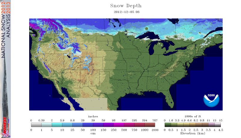
One of the problems, and it is indeed a problem for the drought-stricken Great
Plains, is that there is very little snow between us and the cold air. As you
can see in this graphic, only 7.2% of the U.S. is covered by snow, at an average
depth of 0.8 inches. Again, where have we heard this before!
So any arctic air that comes down this way will be interacting with a relatively
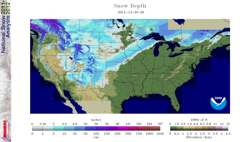
warm surface below it, modifying the entire air mass. At this time last year,
even during a really bad year for those that like snow, 32% of the U.S. was
covered by snow. From the picture from last year, there was obviously a really
nice snowstorm that had tracked from the Rockies through the upper Midwest.
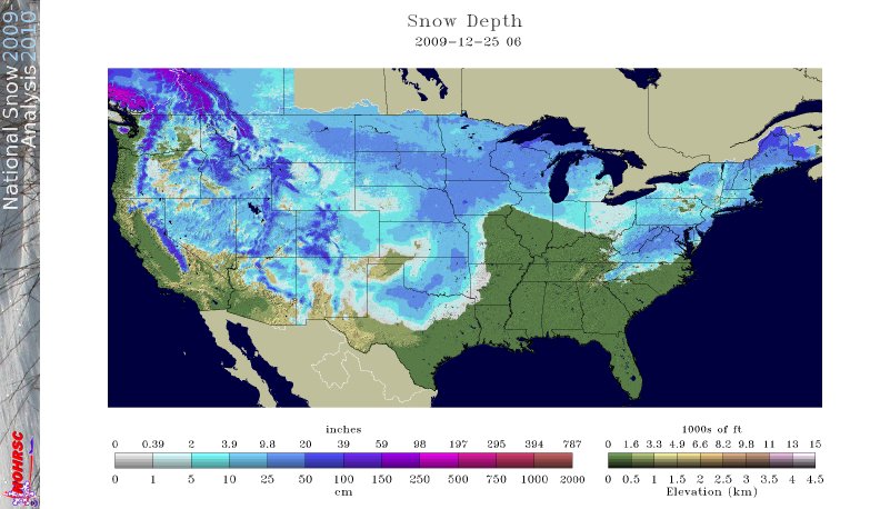
For nostalgia's sake, here's a quick trip back to Christmas Day, 2009. Anybody
remember this??
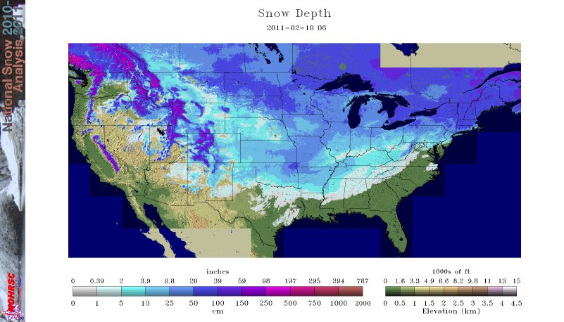
Or we could go back to Feb. 10, 2011, right smack dab in the beginning months
of the current drought, when 27 inches of snow fell on Spavinaw, OK. That broke
our all-time 24-hour snowfall record. Oh yeah, 65% of the country was covered
by snow at an average depth of 8.3 inches. More importantly, there was an
average of 1.8 inches of liquid water in that snow, waiting to melt.
Our old friends the Canadians continue to show much of the western half of
Oklahoma with about a 10-40% chance of seeing about a half-inch of liquid
equivalent moisture ACCUMULATION between now and Dec. 20.
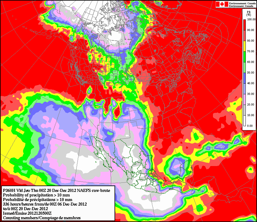
If there's any consolation, we have a much smaller chance of seeing wind chills
of less than 5 degrees F.
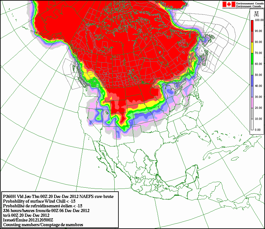
So we have that going for us.
Gary McManus
Associate State Climatologist
Oklahoma Climatological Survey
(405) 325-2253
gmcmanus@mesonet.org
December 5 in Mesonet History
| Record | Value | Station | Year |
|---|---|---|---|
| Maximum Temperature | 84°F | MANG | 2021 |
| Minimum Temperature | 0°F | KENT | 2013 |
| Maximum Rainfall | 1.55″ | BIXB | 2021 |
Mesonet records begin in 1994.
Search by Date
If you're a bit off, don't worry, because just like horseshoes, “almost” counts on the Ticker website!