Ticker for December 4, 2012
MESONET TICKER ... MESONET TICKER ... MESONET TICKER ... MESONET TICKER ...
December 4, 2012 December 4, 2012 December 4, 2012 December 4, 2012
Bread and Milk brigade, ACTIVATE!
While the rest of you folks go about your lives unprepared for the whims of Mother
Nature this week, I'll be camping out at Braum's in order to be first in line
for a gallon of bread and a loaf of milk before SUPERSNOWSTORM CHARLIE hits early
next week. Yeah, I could buy it now and put it in the fridge, but that would
just breed more complacency. Besides, we do have warm weather in store for us the
rest of this week, so the tent won't be so bad. BRING IT ON, RAIN AND SNOW MIX
(*disclaimer ... forecast subject to change)!
Speaking of warm weather, let's take another look at what we've seen over the
last week or so. If you remember the Ticker from yesterday, not only are you one
up on me, but you really need some more excitement in your life. But also remember
that Saturday's statewide average temperature of 63.5 degrees was the fourth
warmest December day statewide on record at 63.5 degrees. Well, yesterday topped
even that, thanks mainly to a higher minimum temperatures. Those occurred around
midnight thanks to a front or we would have had an even more interesting day.
The highs were also in record-breaking territory.
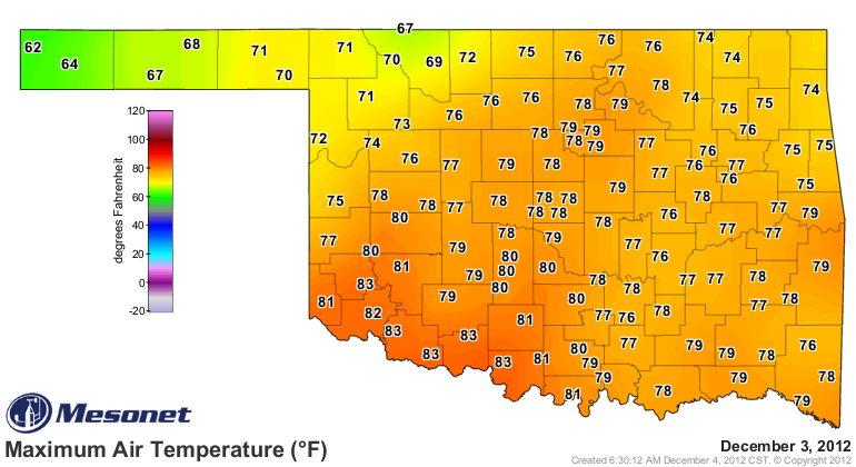
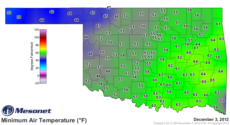
That was enough to boost Dec. 3 to a statewide average of 66.3 degrees, second
only to Dec. 31, 1951, for warmest day ever for the month. It was also the
second warmest 2-day stretch in December at 63.1 degrees. This might be easier
with a table. Now since we're starting with Dec. 1, some of these extend back
into November (e.g., the 3-day stretch on Dec. 2 would include Nov. 30 as well
as Dec. 1-2).
-****-
Oklahoma's Warmest 1-7 Day Stretches for December
Length Prev. Record Day Dec. 3 2012 Rank
1-day 67.5 12/31/1951 66.3 2nd warmest
2-day 64.5 12/31/1951 63.1 2nd warmest
3-day 61.4 12/15/1929 63.3 1st Warmest (New Record)
4-day 60.7 12/16/1929 61.2 1st Warmest (New Record)
5-day 60.0 12/2/1998 59.8 3rd Warmest
6-day 60.3 12/3/1998 57.1 14th Warmest
7-day 60.2 12/4/1998 54.4 25th Warmest
-***-
Now what this useless bit of information tells us is that it has been a very
warm stretch for late November and early December, but particularly warm over
the last five days. November and December 1998 were both warmer than normal,
but more so in November. And 1998 ended as the second warmest year on record
for Oklahoma at 62.0 degrees (soon to be pushed down to third by 2012 and
current record holder, 1954).
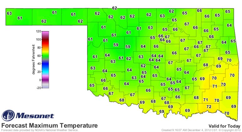
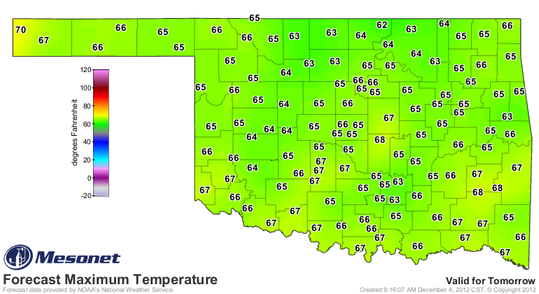
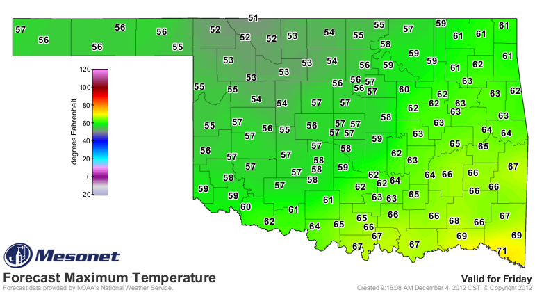
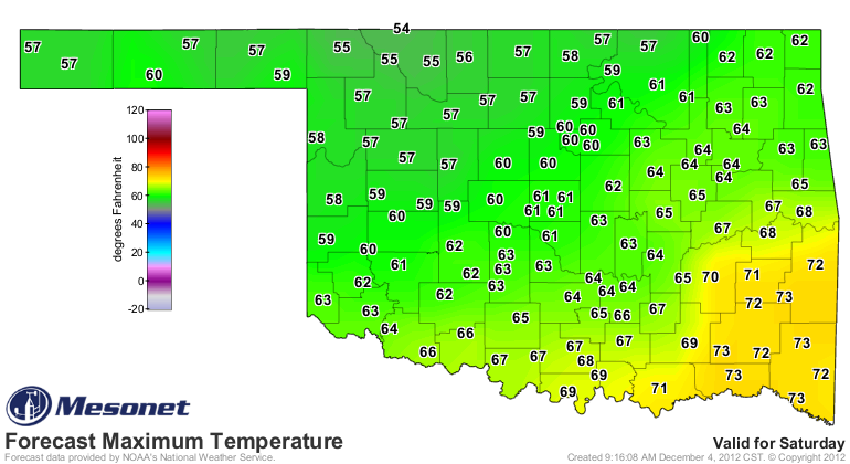
Highs for the rest of the week will mostly be in the 60s, with some forays into
the 50s and 70s. That's still 5-15 degrees above normal for this time of year,
albeit a bit of a letdown from the 15-25 degrees above normal we've been
experiencing. Here are the NWS forecast highs for the rest of the week.

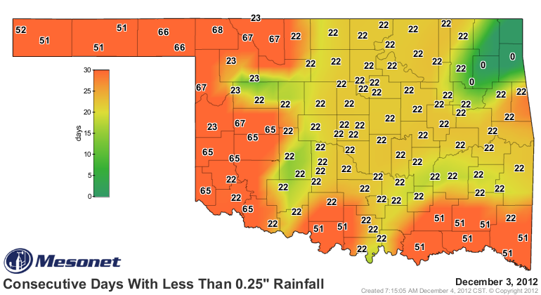
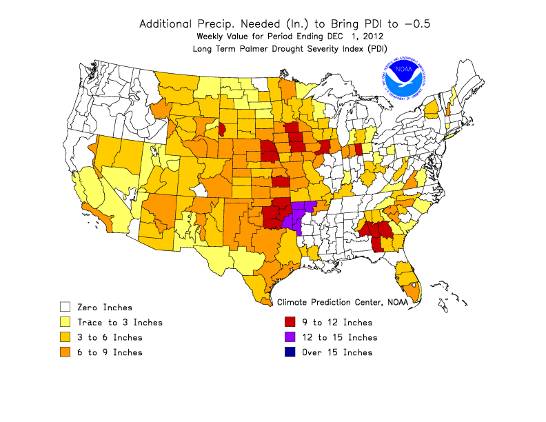
All of this is rather moot, since moisture is the real key to our weather. The
system next week does not look like a drought buster, nor even much of a drought
denter, at this time. Keep in mind how far down we are, and how far we have
to go.

Now, does anybody know of a good Braum's with wifi access?
Gary McManus
Associate State Climatologist
Oklahoma Climatological Survey
(405) 325-2253
gmcmanus@mesonet.org
December 4 in Mesonet History
| Record | Value | Station | Year |
|---|---|---|---|
| Maximum Temperature | 83°F | BURN | 2017 |
| Minimum Temperature | -2°F | NOWA | 2006 |
| Maximum Rainfall | 2.44 inches | MIAM | 1999 |
Mesonet records begin in 1994.
Search by Date
If you're a bit off, don't worry, because just like horseshoes, “almost” counts on the Ticker website!