Ticker for June 25, 2012
MESONET TICKER ... MESONET TICKER ... MESONET TICKER ... MESONET TICKER ...
June 25, 2012 June 25, 2012 June 25, 2012 June 25, 2012
Summer is supposed to be hot, right?
Probably the worst-kept secret in the world, but it's hot today, and the heat
looks to stay around for a bit. Maximum temperatures as measured by the Oklahoma
Mesonet indicate some near-record to record-busting temperatures across the state.
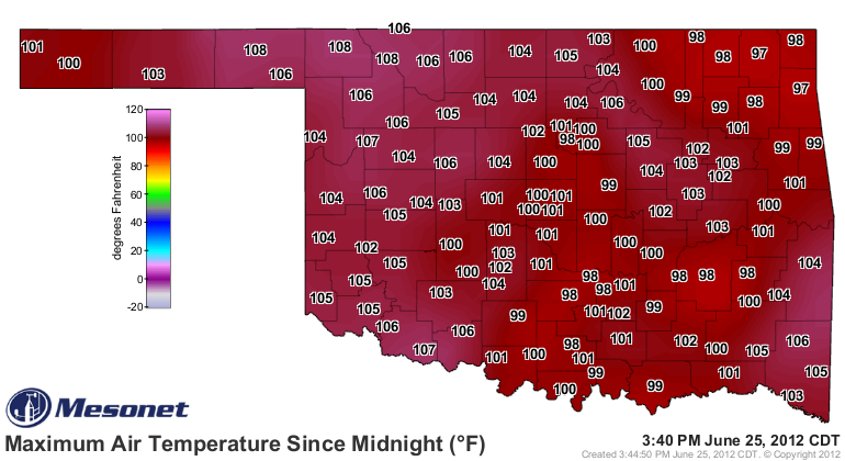
Compare that to the map for record high temperatures, with data from the NWS COOP
network that dates back to the 1880s in some cases.
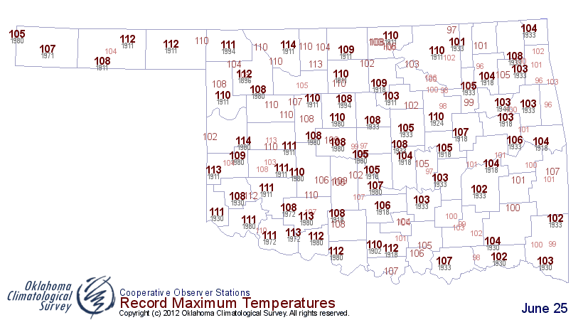
It's always tough to break a heat record in western Oklahoma, but it looks like
those thresholds have been bested in the normally-moister environment of eastern
Oklahoma. The burgeoning drought has left that are more susceptible to extreme
heat.
There's still about an hour or so to go for maximum heating, so keep an eye on
the max temperature map from the Mesonet to see how high we go.
http://www.mesonet.org/index.php/weather/map/todays_maximum_temps/air_temperature
Not a surprise that apparent temperatures (i.e., the heat index) goes down
in the drier air of the west and goes up in the more moist eastern portions of
the state. The maximum heat index map from the Mesonet shows just how high it
got over there in the southeast. Looks like 110 degrees from Wister leads the
state so far today. There might be dry soils helping the actual air temperature
near the surface to heat up, but there is also a good chance for decent
humidity values over in that part of the state thanks to their proximity to the
Gulf of Mexico.
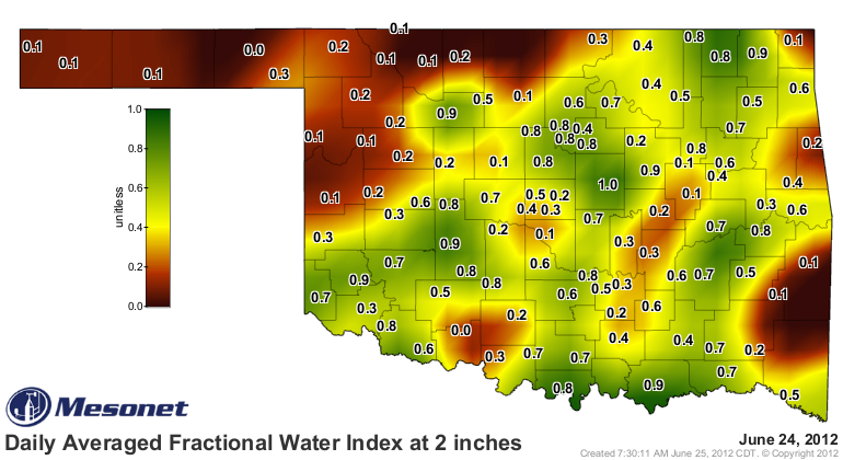
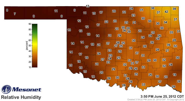
When the actual air temperature is up that high, there is a big difference in
a RH of 30% (at Wister) vs. 8% from Buffalo. Other than Buffalo is the most
awesome place to live in the state, that is.
Watch for the above normal temperatures to continue for awhile. Might not always
hit 100 degrees, but it looks to stay above normal for the short-to-medium
term. Here are the 6-10 and 8-14 day temperature outlooks from the CPC. Both
show continued chances for above normal temperatures through those periods.
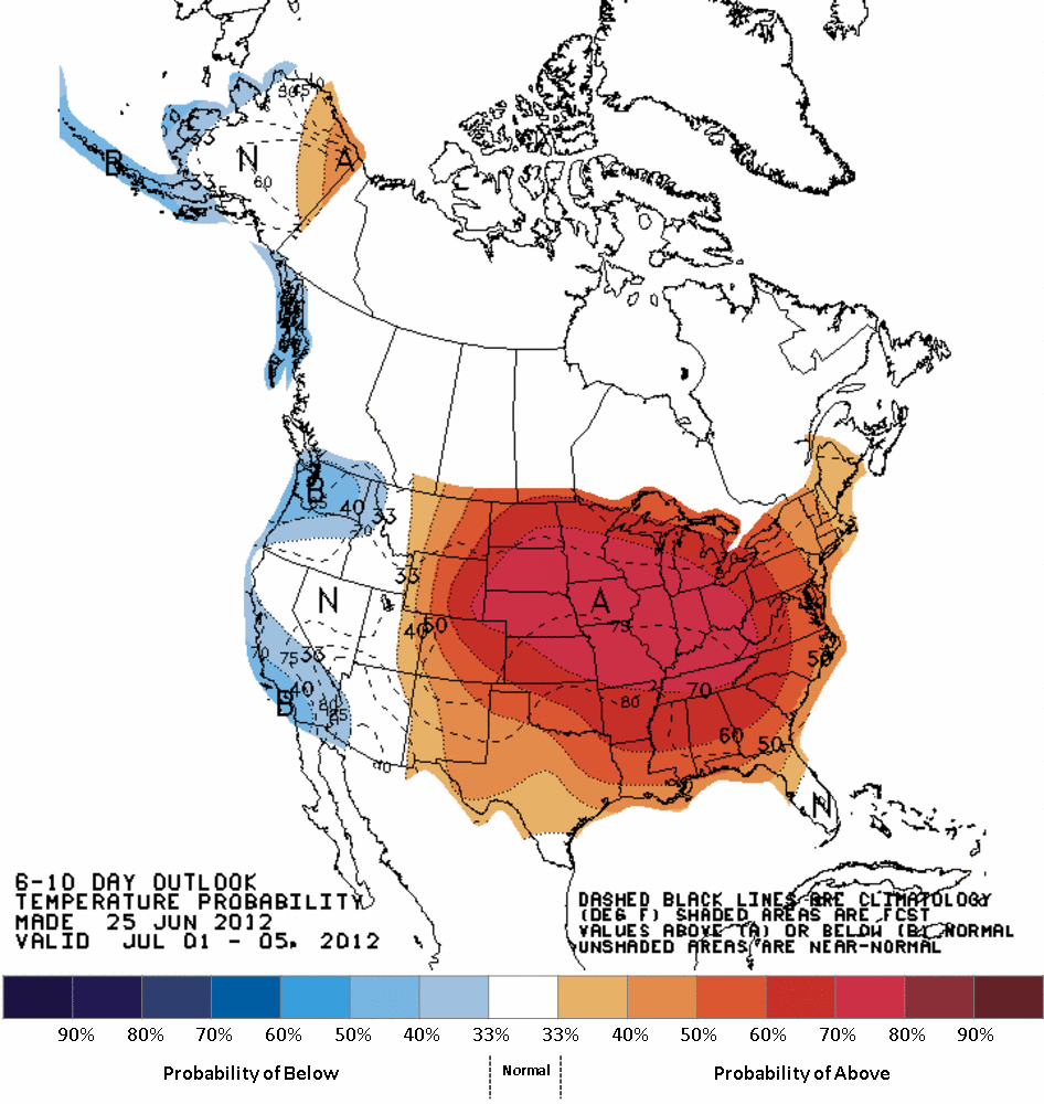
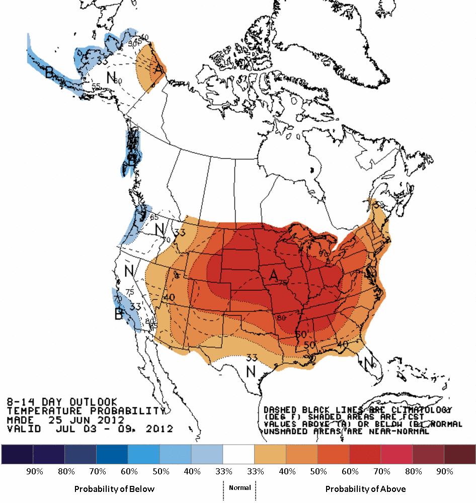
Nothing compared to last year just yet. A walk in the park comparatively. A
sweaty, disgusting walk in the park, but still ...
Gary McManus
Associate State Climatologist
Oklahoma Climatological Survey
(405) 325-2253
gmcmanus@mesonet.org
June 25 in Mesonet History
| Record | Value | Station | Year |
|---|---|---|---|
| Maximum Temperature | 111°F | ERIC | 2011 |
| Minimum Temperature | 50°F | KENT | 2018 |
| Maximum Rainfall | 4.11 inches | WAUR | 1999 |
Mesonet records begin in 1994.
Search by Date
If you're a bit off, don't worry, because just like horseshoes, “almost” counts on the Ticker website!