Ticker for June 7, 2012
MESONET TICKER ... MESONET TICKER ... MESONET TICKER ... MESONET TICKER ...
June 7, 2012 June 7, 2012 June 7, 2012 June 7, 2012
This drought sure is wet!
So is it stupid to talk about drought when you just walked through heavy rain
to get to your computer? Maybe. But who better to do it than me?
I'll pause while you agree.
While there has been significant rain over the last two weeks, a bunch of it
just came to the right spots over the last few days. Those rains will not be
reflected on the U.S. Drought Monitor map until next week. Short but sweet, here
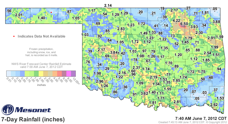
is the rain for the last seven days. There are some nice totals in there
scattered about. Pay particular attention to
Check out the percentage of normal map for the last 30 days, and since May 1.
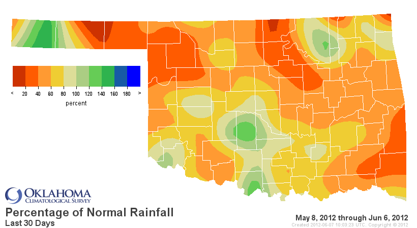
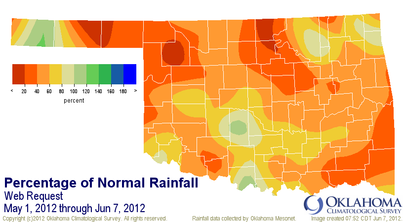
So while there are some decent rain totals, we have to remember that we actually
expect more at this time of the year. So that's why the drought picture has not
improved as quickly, and also why drought continues to advance in southeastern
Oklahoma, where little rain has fallen for a lengthening period of time.
Statewide, the May 1-June 7 period is the eighth driest going back to 1921.
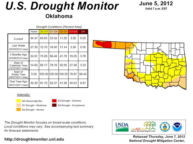
Drought has now advanced into far southeastern Oklahoma. Shall we say "crept?"
Some folks have gotten plenty, some folks need more. Hooker is back in its old
act with only 0.2 inches of rain since May 1.
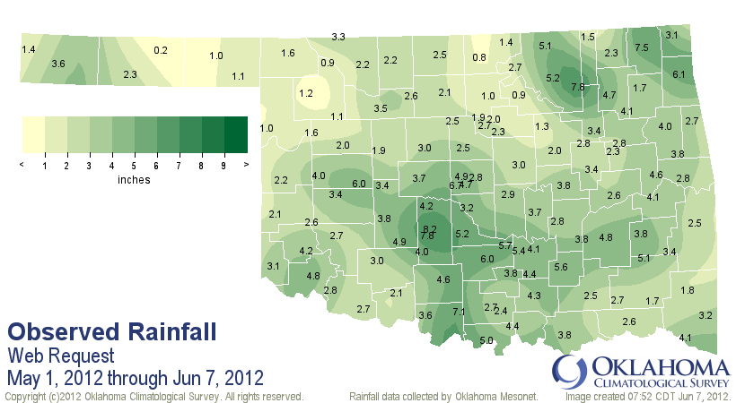
Where have we heard that story before?
Gary McManus
Associate State Climatologist
Oklahoma Climatological Survey
(405) 325-2253
gmcmanus@mesonet.org
June 7 in Mesonet History
| Record | Value | Station | Year |
|---|---|---|---|
| Maximum Temperature | 105°F | ALTU | 2011 |
| Minimum Temperature | 45°F | PRYO | 1998 |
| Maximum Rainfall | 4.27″ | HINT | 2022 |
Mesonet records begin in 1994.
Search by Date
If you're a bit off, don't worry, because just like horseshoes, “almost” counts on the Ticker website!