Ticker for May 30, 2012
MESONET TICKER ... MESONET TICKER ... MESONET TICKER ... MESONET TICKER ...
May 30, 2012 May 30, 2012 May 30, 2012 May 30, 2012
May Madness and Mayhem
And that wasn't even the worst day, supposedly! I'll take full blame for the
wild weather last night since I have been talking non-stop (I heard that!!)
about what a dull May we've had. All it takes is one good storm system to change
all of that. The storms that struck the state yesterday afternoon through this
morning brought softball size hail, winds of close to 90 mph and flooding rains.
It appears there might have been a couple or three quick tornado spin-ups as well.
It's easy to track where those storms struck by looking at the rainfall
footprints from the Mesonet.
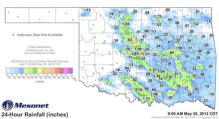
The Oklahoma City West (OKCW) Mesonet site led the way with 3.85 inches of
rain, but the radar estimates from the NWS RFC in Tulsa show narrow but long
streaks of very heavy rainfall through Kingfisher and Oklahoma counties. Hail
up to 5 inches in diameter was reported by a trained spotter 6 miles NNW of
Piedmont.
There were a ton of wind gusts greater than 70 mph reported with last night's
storms. The Minco Mesonet site recorded a wind gust of 85 mph at 10:05 p.m.
last night, and an NWS employee estimated a wind gust at 80 mph 1 mile SW of
Newcastle at 10:12 p.m.
Since we have out hardhats on, might as well stay weather aware because as I
noted, today is supposed to be the worse of the two. The NWS' Storm Prediction
Center has the western half of the state in a moderate risk category.
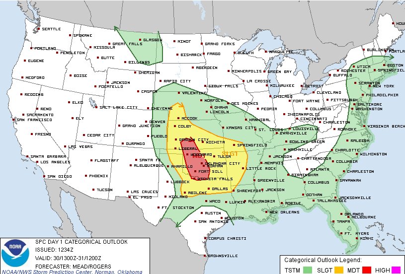
"A moderate risk has been issued for portions of the cntrl/srn plains.
Supercells capable of very large hail and tornadoes will be possible
with the initial development this afternoon over wrn KS/OK. The
activity will then evolve into one or more MCSs moving across the
cntrl/srn plains, producing widespread damaging winds."
The MCS they are speaking of, a Mesoscale Convective System, is an organized
complex of storms that persists for a few hours or more. Of particular interest
today is the possible formation of a derecho, a widespread area of particularly
severe winds out ahead and even after the line's passage. So watch for those
bow echoes on the radar.
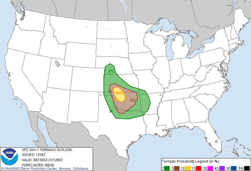
The risk of tornadoes is not high, but it's May and you're in Oklahoma.
'nuff said.
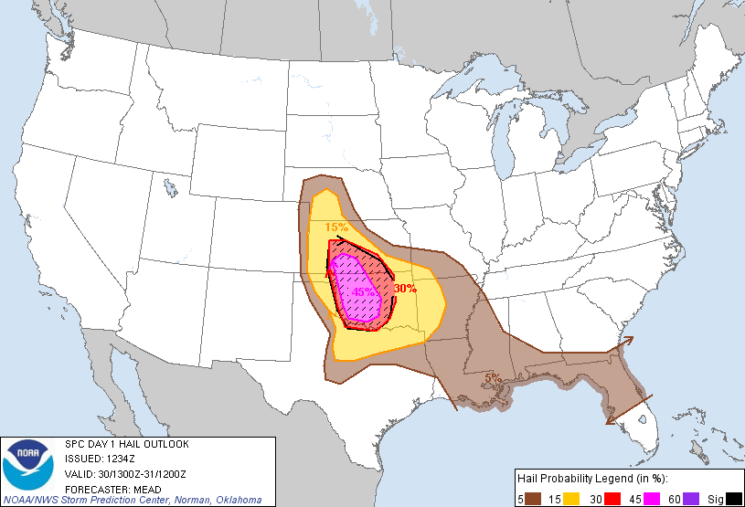
The real risk again is for large hail and those particularly severe winds.
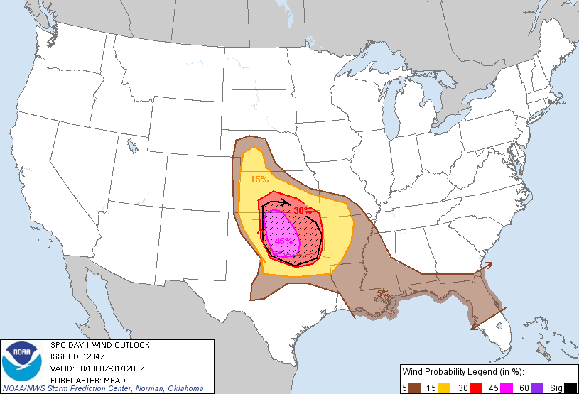
Some parts of the state need the rain. Unfortunately, this is often how we get
it during spring in Oklahoma. Stay weather aware.
Gary McManus
Associate State Climatologist
Oklahoma Climatological Survey
(405) 325-2253
gmcmanus@mesonet.org
May 30 in Mesonet History
| Record | Value | Station | Year |
|---|---|---|---|
| Maximum Temperature | 107°F | ALTU | 2003 |
| Minimum Temperature | 39°F | EVAX | 2019 |
| Maximum Rainfall | 4.47″ | EUFA | 2001 |
Mesonet records begin in 1994.
Search by Date
If you're a bit off, don't worry, because just like horseshoes, “almost” counts on the Ticker website!