Ticker for May 1, 2012
MESONET TICKER ... MESONET TICKER ... MESONET TICKER ... MESONET TICKER ...
May 1, 2012 May 1, 2012 May 1, 2012 May 1, 2012
Heat, Tornadoes Dominate Weather Headlines During April
Oklahoma?s exceptionally warm weather continued into April following the warmest
March on record, and significant severe weather plagued the state right through
the month?s final moments. April was not warm enough to earn a number one ranking,
but still mustered enough heat to crack the top 10. According to data from the
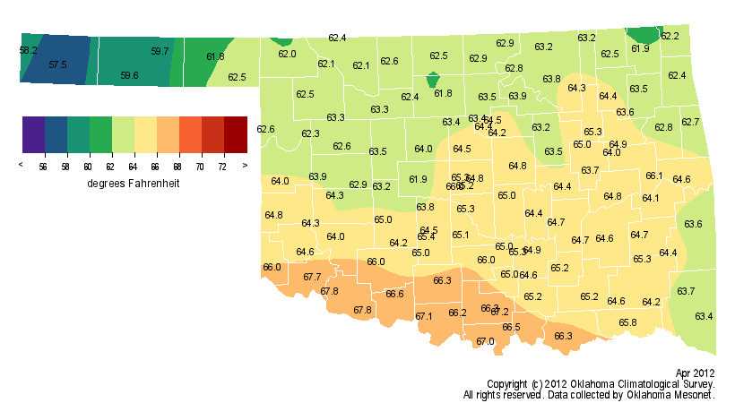
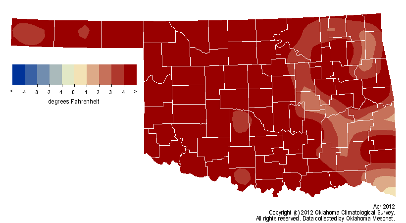
Oklahoma Mesonet, the statewide average temperature finished at 63.9 degrees to
rank as the 10th warmest April on record for the state, 4.8 degrees above normal.
Statewide statistics date back to 1895. April?s heat helped propel the January-
April period to the warmest on record at 52.3 degrees, 5.5 degrees above normal.
The first two months of spring are also on pace to be the warmest on record at
61.5 degrees, 6.9 degrees above normal. The Mesonet sites at Altus and Erick each
reached 105 degrees on the 25th, the second highest April temperature ever
recorded in Oklahoma dating back to 1893. Mangum holds the record at 106 degrees
from April 12, 1972. Frigid weather, normally a frequent visitor during the first
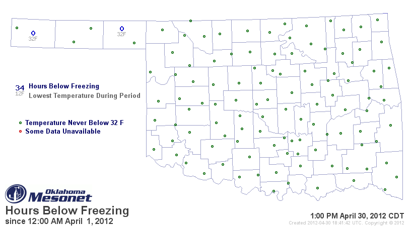
half of April, was largely missing during the month. Of the 120 Oklahoma
Mesonet stations, only two ? Beaver and Boise City ? reached the freezing point,
and both for less than an hour. The National Weather Service?s cooperative
observer at Goodwell recorded 30 degrees on April 16.
Parts of the state, north central Oklahoma in particular, experienced a two or
three months' worth of rainfall in just a few storms. The Mesonet site at
Blackwell received 12.6 inches of rainfall during April, shattering that town?s
previous record for April of 8.59 inches, set back in 1991. Official rain
gauges in Ponca City recorded between 11.54 inches and 12.12 inches of rain,
breaking that location?s April record as well. Normal April rainfall for those
locations is approximately 3.5 inches. While much of northern Oklahoma was
experiencing deluges, the southeastern half of the state was largely going
without. North central Oklahoma recorded an average of 6.03 inches of rainfall
during the month and finished with the fifth wettest April on record. In
contrast, the southeast recorded an average of 2.63 inches, the 19th driest
April on record for that section of the state. The Mesonet site at Burneyville
recorded a meager 0.89 inches of rain during April, nearly 3 inches below
normal.
Total rain: 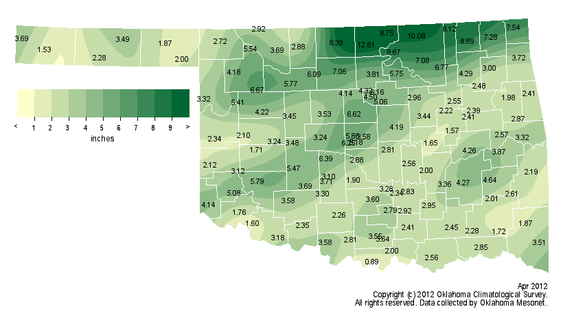
Departure from norm: 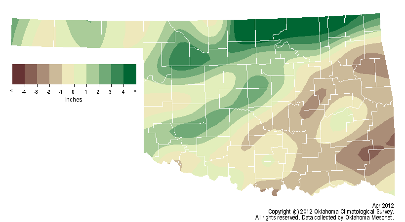
Pct of norm: 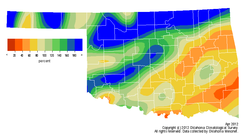
As is often customary during the spring, the abundance of rainfall was
accompanied by a surplus of severe weather. According to preliminary counts
from the National Weather Service, more than 25 tornadoes touched down during
April, doubling the average number of 11 for the month. The most significant
of those tornadoes struck Woodward after midnight on the 15th. The tornado
tore through the western side of the city, killing six, including three
children. The storm damaged 224 homes and businesses in Woodward County and
injured 39. The tornado was rated an EF3 on the Enhanced Fujita tornado
intensity scale. The northern one-third of the state saw several tornadoes
touch down the evening of the 30th. The twisters and associated severe storms
left several small towns without power, damaged homes and outbuildings, and
produced widespread flooding. Large hail reports, from golf ball to softball
size, were numerous with each bout of severe weather throughout the month.
Drought continued to shrink through April with 75 percent of the state free of
significant dry conditions by month?s end, according to the latest U.S. Drought
Monitor. On October 1, 2011, the entire state was enveloped in some type of
drought intensity. The temperature outlook for May from the Climate Prediction
Center indicates increased chances for above normal temperatures for the month.
The May precipitation outlook remains undecided with equal chances of above-,
below- and near-normal precipitation. The latest outlooks for the summer months
of June-August are similarly non-committal.
Drought Monitor: 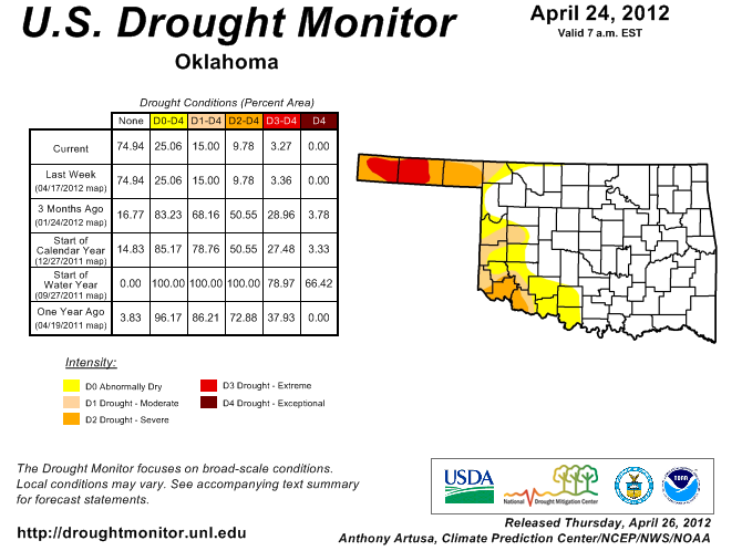
May Outlooks
temp: 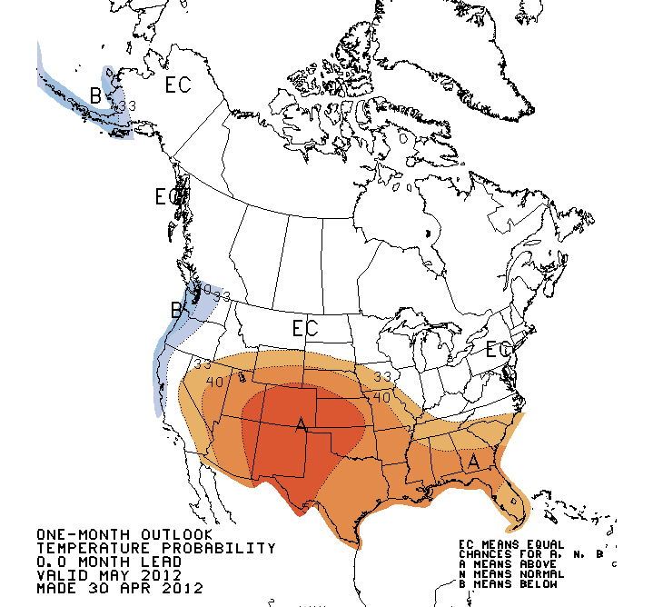
precip: 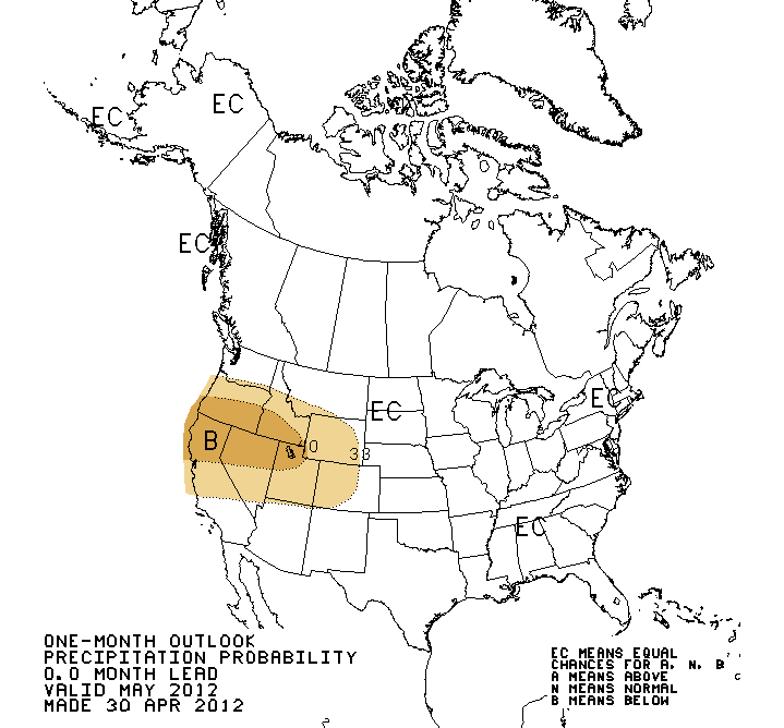
Summer Outlooks
temp: 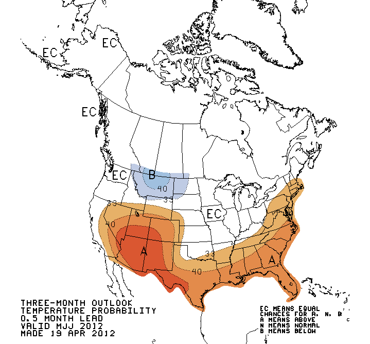
precip: 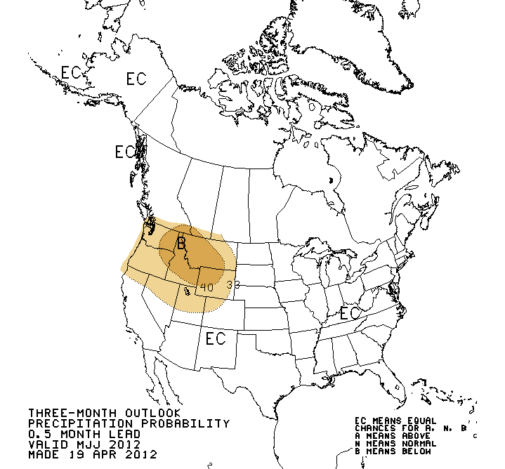
Gary McManus
Associate State Climatologist
Oklahoma Climatological Survey
(405) 325-2253
gmcmanus@mesonet.org
May 1 in Mesonet History
| Record | Value | Station | Year |
|---|---|---|---|
| Maximum Temperature | 101°F | ALTU | 2002 |
| Minimum Temperature | 28°F | BOIS | 2011 |
| Maximum Rainfall | 7.70 inches | PRYO | 2009 |
Mesonet records begin in 1994.
Search by Date
If you're a bit off, don't worry, because just like horseshoes, “almost” counts on the Ticker website!