Ticker for April 1, 2012
MESONET TICKER ... MESONET TICKER ... MESONET TICKER ... MESONET TICKER ...
April 1, 2012 April 1, 2012 April 1, 2012 April 1, 2012
March Shatters Oklahoma Temperature Records
March might have entered like a lamb, but it exited like July, smashing
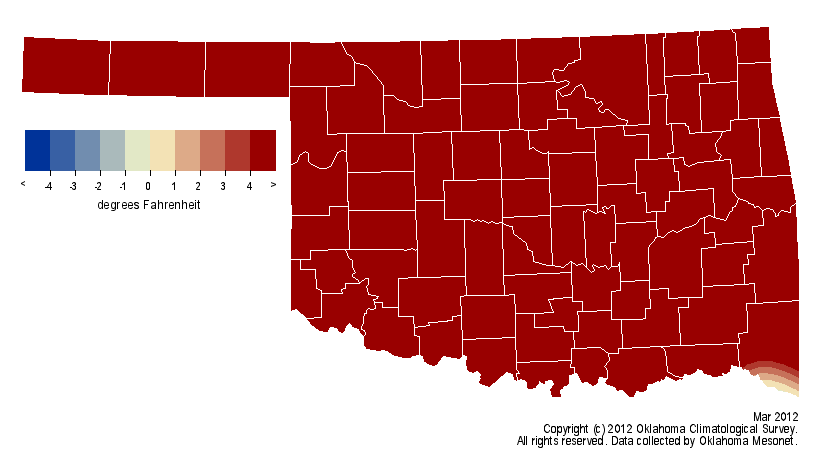
temperature records in the process. The March statewide average temperature, as
measured by the 120-station Oklahoma Mesonet, was more than 9 degrees above
normal at 59.4 degrees. That eclipses the previous top mark of 58.3 degrees set
in March 2007. Oklahoma statewide average climate statistics date back to 1895.
Not satisfied with being the warmest March on record, the month?s temperature
also topped well over half of the previous 117 Aprils in the record books.
Beginning with March 2010, 19 of the past 24 months have finished warmer than
normal. In addition to July and August of 2011, the March monthly heat record is
the third in the last nine months. Oklahoma?s July statewide average of 89.3
degrees is the highest for any calendar month for any state since 1895, helping
propel Oklahoma?s 2011 summer to a similar record. June 2011 finished just a
degree away from its top spot to land in second place. The state?s January-March
statewide average of 48.6 degrees is also tops in the record books at 5.9
degrees above normal.
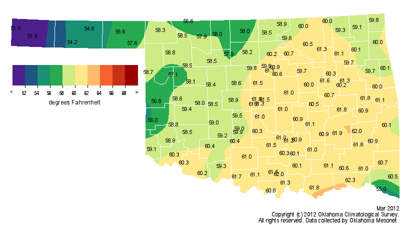
Many individual locations broke records for the month. Oklahoma City and Tulsa
both finished with their hottest Marches on record at 60.8 degrees and 61.5
degrees, respectively. The month?s hottest day was also its last. The 90
degrees at Beaver on the 31st is the highest temperature recorded in the state
since October 25, 2011, when Altus and Hollis reached 92 degrees. Cold weather
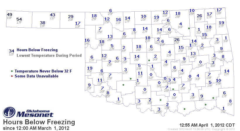
still managed to make an appearance, albeit a brief one. The lowest temperature
recorded by the Mesonet was 17 degrees at Boise City on the third. Nine Mesonet
stations failed to see a low temperature touch the freezing mark, with many
others only spending a few hours at 32 degrees or below.
Heavy rains during March built off steady moisture that began last October to
deal a final blow to drought impacts that had plagued the state over the last
18 months. According to the latest U.S. Drought Monitor report released on
March 29, the area of the state completely free of drought rose from 34 percent
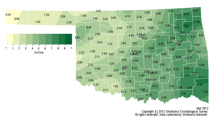
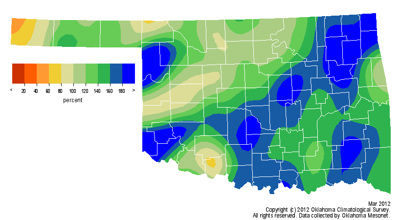
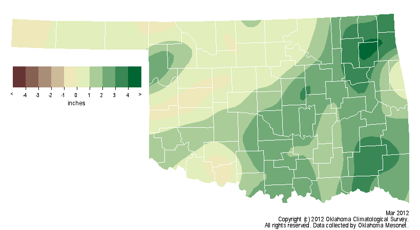
to 76 percent during the month. The statewide average precipitation total
finished at 4.5 inches to rank as the sixth wettest March on record, 1.4 inches
above normal. Eastern Oklahoma received 6-9 inches while radar estimates
indicate as much as 10-12 inches may have fallen in localized areas. The
National Weather Service cooperative observer at Spavinaw reported 9.97 inches
of rain for the month. The western half of the state saw 2-6 inches in general.
The Panhandle, still the area hit hardest by drought, received less than a half
of an inch of rainfall in western Cimarron County to over 2 inches in Beaver
County.
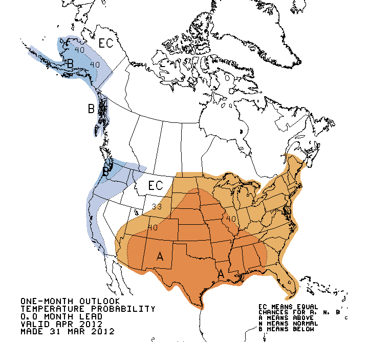
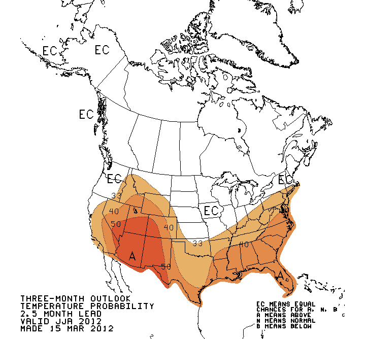
The latest temperature outlook from the Climate Prediction Center indicates an
increased chance of above normal temperatures through April for the eastern
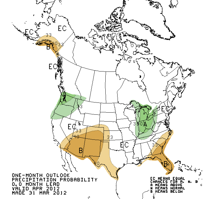
two-thirds of the United States, including Oklahoma. The precipitation outlook
for April calls greater odds of below normal precipitation in far western
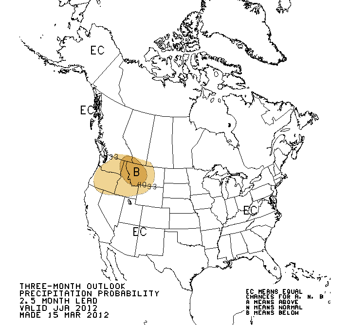
Oklahoma and the Panhandle. The summer temperature outlook shows increased odds
for above normal temperatures across Oklahoma. Summer precipitation outlooks
are a bit more undecided.
April Outlooks
Summer Outlooks
Gary McManus
Associate State Climatologist
Oklahoma Climatological Survey
(405) 325-2253
gmcmanus@mesonet.org
April 1 in Mesonet History
| Record | Value | Station | Year |
|---|---|---|---|
| Maximum Temperature | 98°F | ALTU | 2012 |
| Minimum Temperature | 19°F | EVAX | 2023 |
| Maximum Rainfall | 2.57 inches | TIPT | 2006 |
Mesonet records begin in 1994.
Search by Date
If you're a bit off, don't worry, because just like horseshoes, “almost” counts on the Ticker website!