Ticker for March 28, 2012
MESONET TICKER ... MESONET TICKER ... MESONET TICKER ... MESONET TICKER ...
March 28, 2012 March 28, 2012 March 28, 2012 March 28, 2012
March remains out of control
With each passing day, March moves up in the record books in its quest to become
the warmest on record for Oklahoma. It doesn't have too far to look back - 2007
is the current record holder with a statewide average of 58.3 degrees.
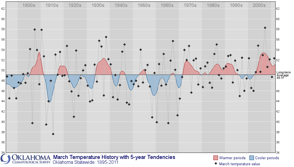
March 2012, through the 27th, has a statewide average of 58.1 degrees ... at least
according to Oklahoma Mesonet numbers. Remember that the official records are
based off the numbers computed by NCDC and consist of a mixture of NWS COOP and
Oklahoma Mesonet numbers. But it's pretty plain to see that this March is going
to challenge that record from just five years ago.
-****-
Statewide Average Temperatures: March 1-27
High Temps Low Temps Avg Mean Temps
Mesonet Avgs 70.1F 46.1F 58.1F
Normal 62.3F 36.4F 49.4F
Dep. from Norm. 7.8F 9.7F 8.8F
-***-
Even though the high temperatures have been almost 8 degrees above normal, the
low temperatures have contributed a bit more to the possible record-setting month
at nearly 10 degrees above normal. It just hasn't gotten really cold this
month. This map of the number of hours spent below freezing as measured by
the Mesonet is pretty telling. Some stations have spent less than an hour at
or below freezing so far this month!
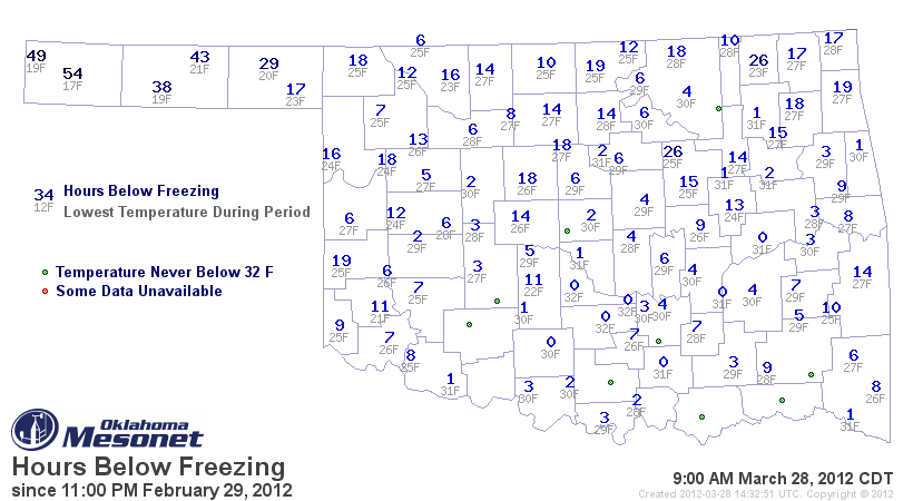
Boise City leads the state's Mesonet stations with 54 hours. There doesn't
appear to be any frigid air in store for this part of the world for the next
week or so. As March marches into the record books with each passing day, the
chances for a damaging freeze event, so dreaded by Oklahoma's agricultural
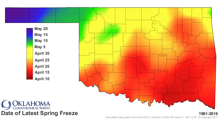
industry, also becomes a bit more remote. Parts of southern Oklahoma have
already reached their average date for their last freeze based on 1981-2010
data.

The northern parts of the state, especially the northwest and Panhandle, still
have about a 15-30 days to go. The latest last freeze during that time period
shifts about another month from the average last freeze, from April 10 in the
south to May 20 in the Panhandle.
While there is no really cold air showing up right now, at least the kind that
can really do damage to wheat and orchard crops, it is not out of the question.
Another defense against a killing frost comes from the lack of snow cover to
our north and northwest.
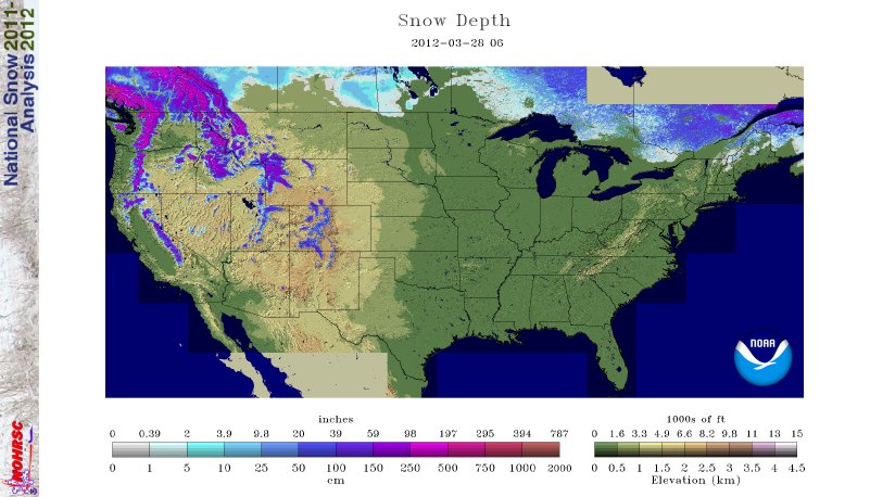
Only 7% of the country has snow cover, and that is almost entirely in the
mountainous regions. Any cold air that does plunge down this way for the near
future will travel over a warm and bare land surface on its entire journey.
That will help modify any of those air masses, warming them up before they
reach this far south.
Again, it doesn't look like we'll have another bout of that cold air for the
foreseeable future, and odds diminish as we go deeper into April. But I will
not gamble with such a definitive statement with what we've seen from the
weather patterns over the last year or so.
Gary McManus
Associate State Climatologist
Oklahoma Climatological Survey
(405) 325-2253
gmcmanus@mesonet.org
March 28 in Mesonet History
| Record | Value | Station | Year |
|---|---|---|---|
| Maximum Temperature | 90°F | TIPT | 2022 |
| Minimum Temperature | 11°F | BOIS | 2009 |
| Maximum Rainfall | 4.20 inches | ACME | 2017 |
Mesonet records begin in 1994.
Search by Date
If you're a bit off, don't worry, because just like horseshoes, “almost” counts on the Ticker website!