Ticker for March 13, 2012
MESONET TICKER ... MESONET TICKER ... MESONET TICKER ... MESONET TICKER ...
March 13, 2012 March 13, 2012 March 13, 2012 March 13, 2012
Booger pickin' weather
Before we get started ... yeah, I know. Gross.
But check out the latest relative humidity and dewpoint maps from the Oklahoma
Mesonet.
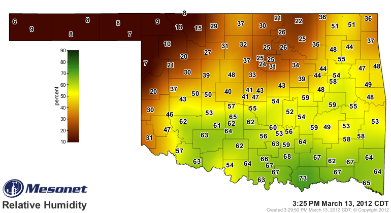

Quite a difference between the northwestern quarter of the state and points
southeast of there, especially on the dewpoint map. A dewpoint of 4 degrees and
a RH of 6% in Kenton is nothing to sneeze at. In those conditions, best keep all
your nasal fluids to yourself. You might need 'em later.
That's also the reason that forecast lows in the northwest and Panhandle are
in the 30s and 40s and the lows in the rest of the state are in the 50s and
even 60s. Moisture is a wonderful moderator of temperature. Water vapor absorbs
that heat and re-radiates it. And if the actual air temperature does manage to
drop to the dewpoint temperature, water vapor will begin to condense, which
releases heat. So the dewpoint temperature is generally the governing number
for how low the temperature can drop. There is simply much more room to drop
on the thermometer up there in the dry air of the northwest.
That's not to say that they should drop into the teens and 20s because of those
low dewpoints up there. Gusty southerly winds will help keep the atmosphere
mixed enough that the heat won't all escape to higher levels of the atmosphere.
With a role as a moderator, also not a shock those drier areas have seen their
temperatures skyrocket to near summer-like values today. Highs across parts of
the state have neared record levels.
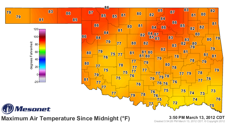
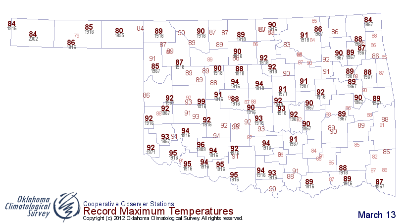
Beaver's record for today is 80 degrees, set in 1955. The Mesonet site there
has risen to 86 degrees.
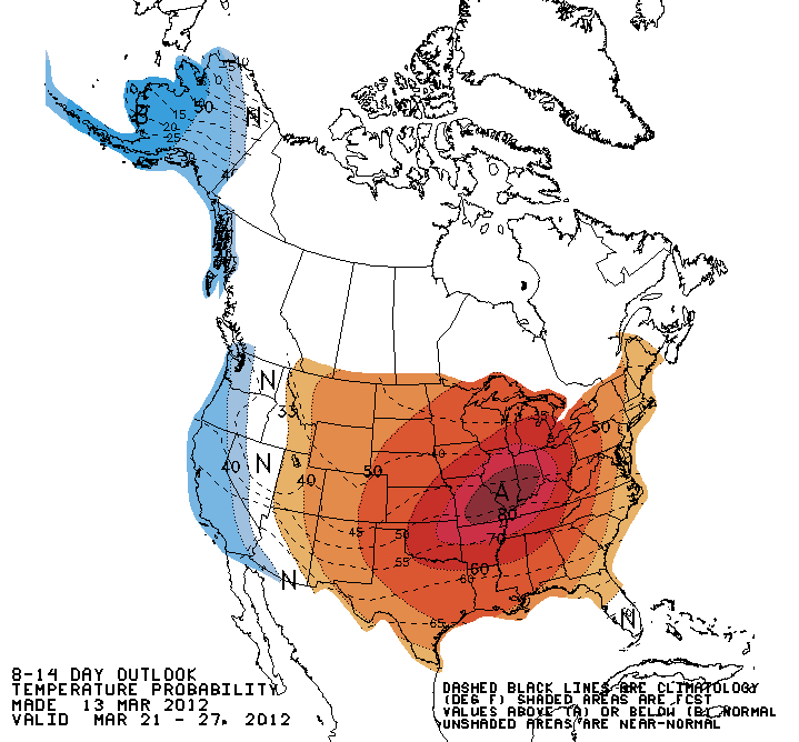
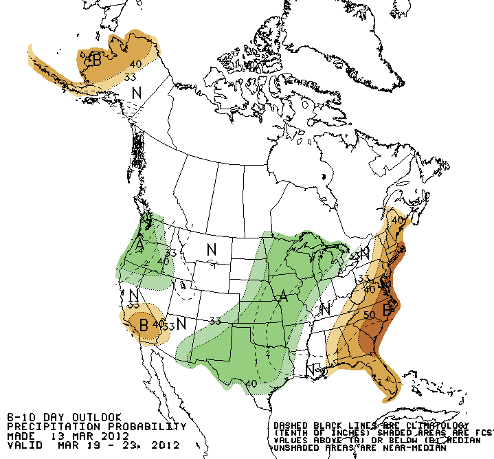
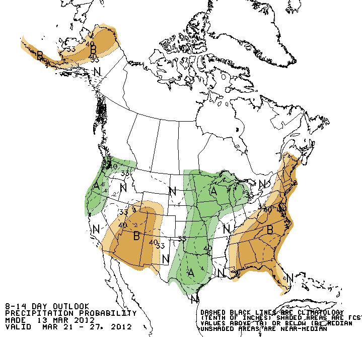
Looks like things might stay warm for the next couple of weeks, at least
according to the 6-10 and 8-14 day outlooks from the CPC. A great addition is
that things also look wetter than normal March 19-27! Remember, these are maps
of probability anomalies and indicate increased odds of above-, below- or near-
normal temperatures and precipitation.
Temperature

Precipitation
Gary McManus
Associate State Climatologist
Oklahoma Climatological Survey
(405) 325-2253
gmcmanus@mesonet.org
March 13 in Mesonet History
| Record | Value | Station | Year |
|---|---|---|---|
| Maximum Temperature | 92°F | ALTU | 2002 |
| Minimum Temperature | 14°F | KENT | 2006 |
| Maximum Rainfall | 3.50 inches | LANE | 1995 |
Mesonet records begin in 1994.
Search by Date
If you're a bit off, don't worry, because just like horseshoes, “almost” counts on the Ticker website!