Ticker for March 12, 2012
MESONET TICKER ... MESONET TICKER ... MESONET TICKER ... MESONET TICKER ...
March 12, 2012 March 12, 2012 March 12, 2012 March 12, 2012
Rain should provide more drought relief
I was in the Panhandle (yeah, you should be jealous!) last Wednesday and Thursday
talking drought so I missed most of the rain during that period for much of the
state. Even though they were expected to have a bit of rain (or sleet or snow or
freezing rain), I don't remember ever seeing a cloud while I was out that way. It
was the brightest storm I've ever been in! However, there were still a few
showers that traveled across the Panhandle on Saturday and Sunday.
The two bouts with moisture across the state continued the drought relief
momentum we've seen since last October. This map from the Oklahoma Mesonet
shows the more generous totals in southern Oklahoma (as well as the meager ones
from the northwest).
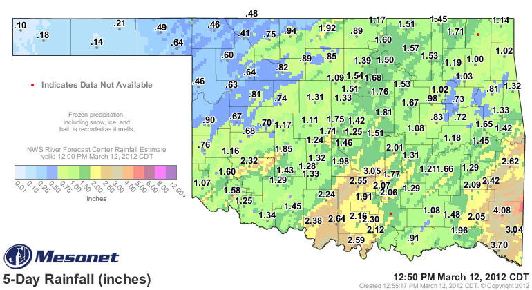
The rainfall estimated rainfall overlay indicates a large area of 2.5-to-3 inches
of rain fell across south central and extreme southeastern Oklahoma, with some
additional 5-inch amounts in localized areas of McCurtain County.
Here are the top-20 rainfall totals from this past upper-level storm, which was
of the much-asked-for slow-moving variety. Coincidentally, these are also the
only 20 Mesonet stations that recorded more than 2 inches of rainfall.
-****-
Mt Herman 4.08" Hobart 2.32"
Idabel 3.70" Ardmore 2.30"
Byars 3.05" Ketchum Ranch 2.24"
Broken Bow 3.04" Newport 2.16"
Ringling 2.64" Madill 2.12"
Wister 2.62" Clayton 2.09"
Burneyville 2.59" Vanoss 2.07"
Pauls Valley 2.55" Fittstown 2.06"
Talihina 2.42" Cloudy 2.05"
Waurika 2.38" Bowlegs 2.01"
-***-
Now the task becomes a bit more complicated, and we've talked about it a bunch
here on the Ticker. To diagnose current drought conditions, we will have to
weigh improvements vs. impacts, both short- and long-term. One of the key
impacts that has concerned us through the winter was the hydrologic impact, very
much a long-term concern. There are a few reservoirs scattered about the state
that have not responded to rainfall for a variety of reasons. Lake Altus, for
instance, only rose a few tenths of an inch after 1.5 inches of rain, and
remains at 19 percent of capacity. Similarly, Canton Lake still sits at 38%
of capacity after about an inch of rain in that area.
And for the northwest, we need only to follow the continuing saga of my favorite
place in the whole world, the little farm pond that used-to-could located 8
miles south of Buffalo.
Times of plenty: 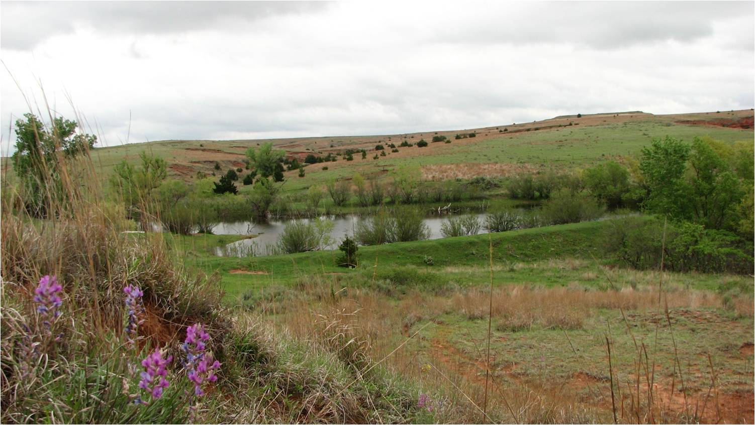
Uh oh: 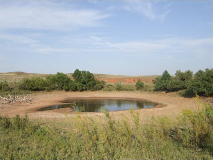
Nothing bitin': 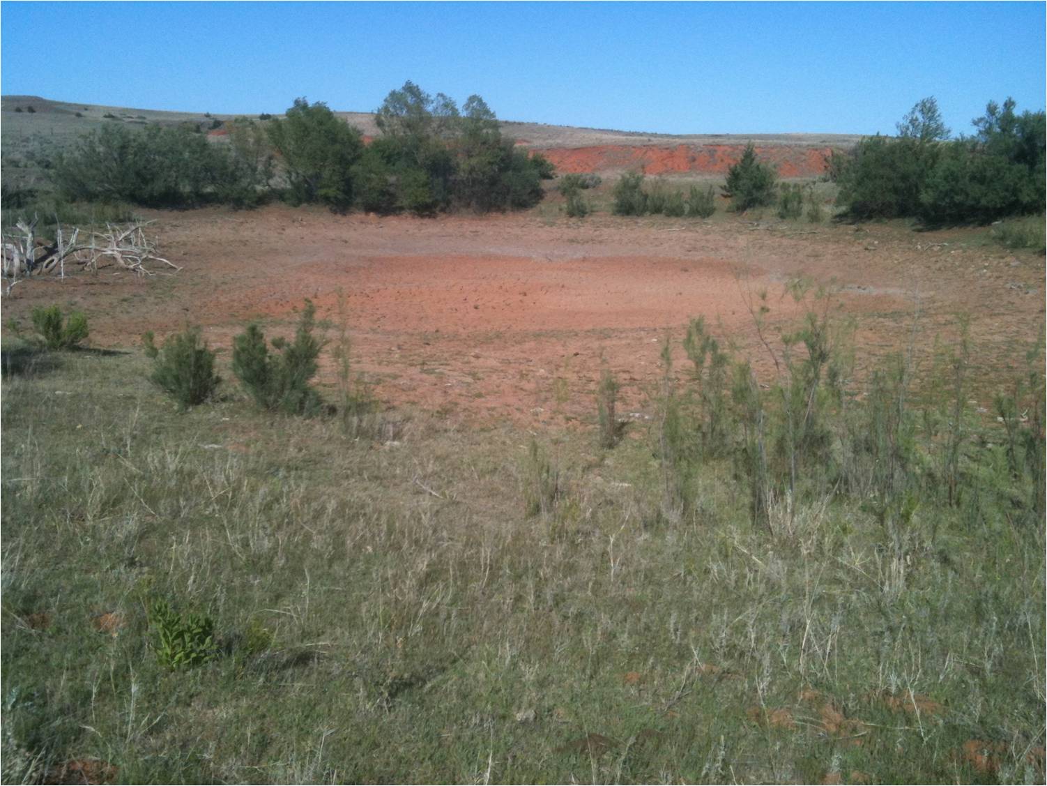
Pave it: 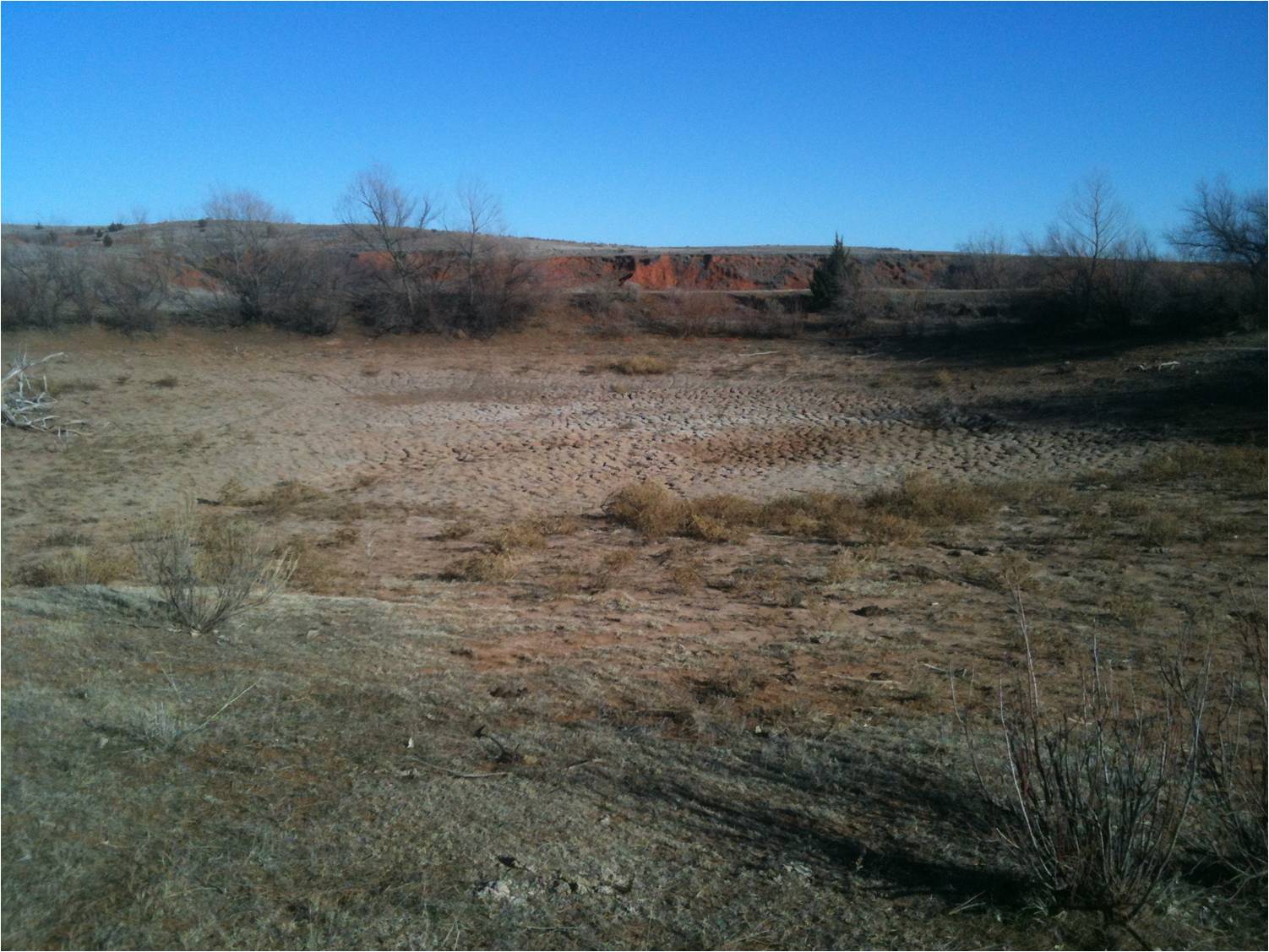
Two more months, another bout of rain (albeit only 0.5 inches), and the same
old result.
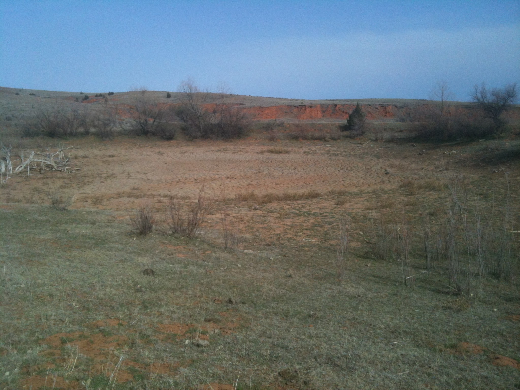
Fishing is still officially rated "slow" there.
Gary McManus
Associate State Climatologist
Oklahoma Climatological Survey
(405) 325-2253
gmcmanus@mesonet.org
March 12 in Mesonet History
| Record | Value | Station | Year |
|---|---|---|---|
| Maximum Temperature | 91°F | WALT | 2006 |
| Minimum Temperature | 7°F | EVAX | 2022 |
| Maximum Rainfall | 3.29 inches | STUA | 1999 |
Mesonet records begin in 1994.
Search by Date
If you're a bit off, don't worry, because just like horseshoes, “almost” counts on the Ticker website!