Ticker for February 2, 2012
MESONET TICKER ... MESONET TICKER ... MESONET TICKER ... MESONET TICKER ...
February 2, 2012   February 2, 2012   February 2, 2012   February 2, 2012


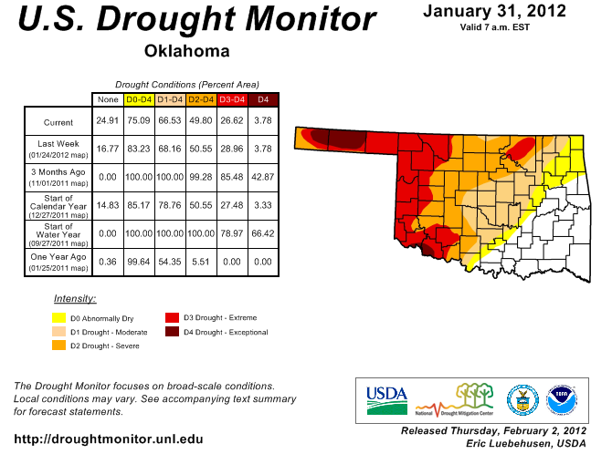
Drought Monitor map shows relief with more on the way

The rains last Tuesday night and Wednesday didn't make the cut for last week's
U.S. Drought Monitor map, so we've waiting (im)patiently for a chance to see
the impact. The newest map released this morning shows the white "no drought"
area continuing to expand westward in southern Oklahoma. Take a gander at the
map below, which will also be good for the goose, I suppose (yeah, I struggled
with that one).


The "no drought" area is now up to 25%. There were not any changes farther to
the west. We still saw very little recharge into reservoirs across that area,
as mentioned in yesterday's Ticker. That rain did set up the moisture expected
today and tomorrow for more of an impact. Have I mentioned once or twice that
drought relief is a process ... or 329 times? As a reminder, here is the
rainfall that was considered in this week's map. Again, the bulk of this rain
fell last Tuesday and Wednesday.


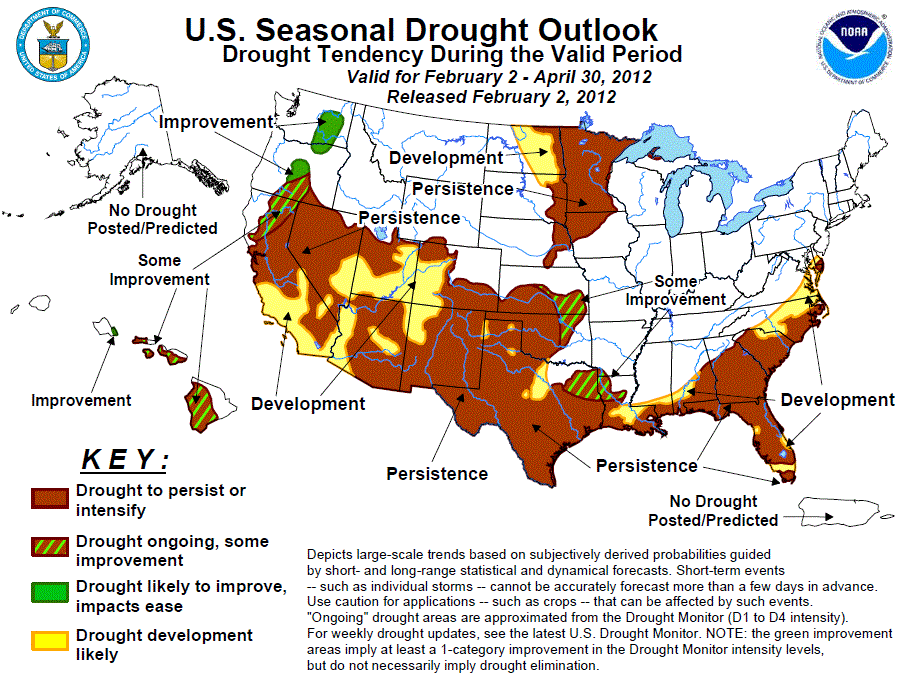
The latest U.S. Seasonal Drought Outlook, valid for February 2-April 30, 2012,
continues to show persistence of the drought in the western half of the state.
There is a "drought ongoing, some improvement" area in northeastern Oklahoma
where deficits are starting to build once again.


Here is the Drought Outlook forecaster's reasoning. Basically, outlooks for
warmer than normal temperatures and below normal rainfall spell continued
drought.

"Across the central and southern Plains, additional surplus precipitation
since the last US Drought Outlook (Jan. 19) brought further drought relief
to most of Texas and Oklahoma. Unfortunately, dry weather was observed in
eastern New Mexico, southern and northwestern Texas, the Oklahoma
Panhandle, southeastern Colorado, and Kansas. With odds for above-normal
temperatures (1- and 3-month outlooks) and subnormal precipitation (e.g.
La Ni?a composites and precipitation tools), persistence is favored
across much of the southern Plains, with development in Texas areas
currently without drought. Although the 6-10 and 8-14 day outlooks favor
above-normal rainfall in extreme southern Texas, the long-term drought
conditions and high probabilities for subnormal rainfall during a La
Ni?a outweighed suggestions for Some Improvement, thus persistence was
kept in this region. However, some improvement is forecast across eastern
parts of Kansas and Oklahoma and the Arklatex region where the CPC
seasonal outlook indicates equal chances for below, near, or above
precipitation, the 1-5 day HPC forecast indicates moderate to heavy
totals, and numerous bouts of wet weather have frequented these areas
since late October, improving or erasing drought.

Forecast confidence for the southern High Plains is high, and moderate
for areas to the east (e.g. southeast Kansas, eastern Oklahoma, and
eastern Texas)."

The latest 5-day precipitation forecast from the National Weather Service's
Hydrometeorological Prediction Center shows a goodly amount of rain for western
Oklahoma, with totals approaching 2 inches. I'm not sure how confident of the
pattern there, or where it will actually fall since it's likely to be convective
rainfall, but the amounts being shown tell us there is a lot of moisture to
work with.


So stay tuned for next week's drought map for improvements due to the moisture
over the next couple of days. It may look like a bit dry over the next three
months, but tonight we'll hopefully be celebrating the rebirth of the best
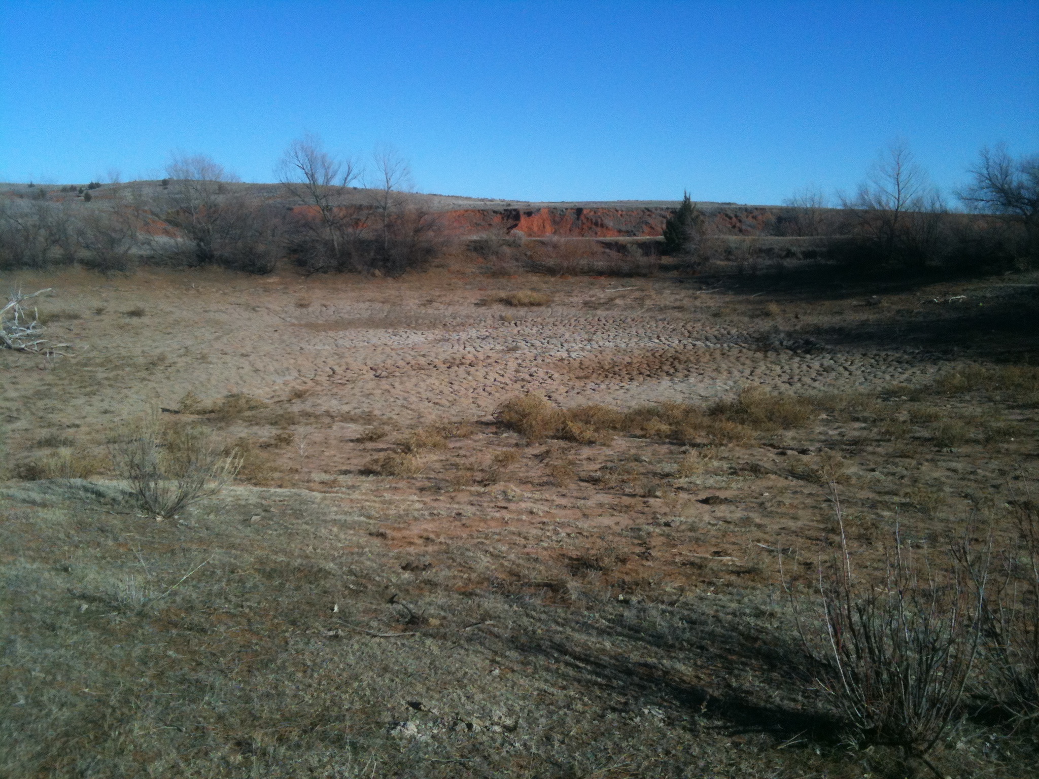
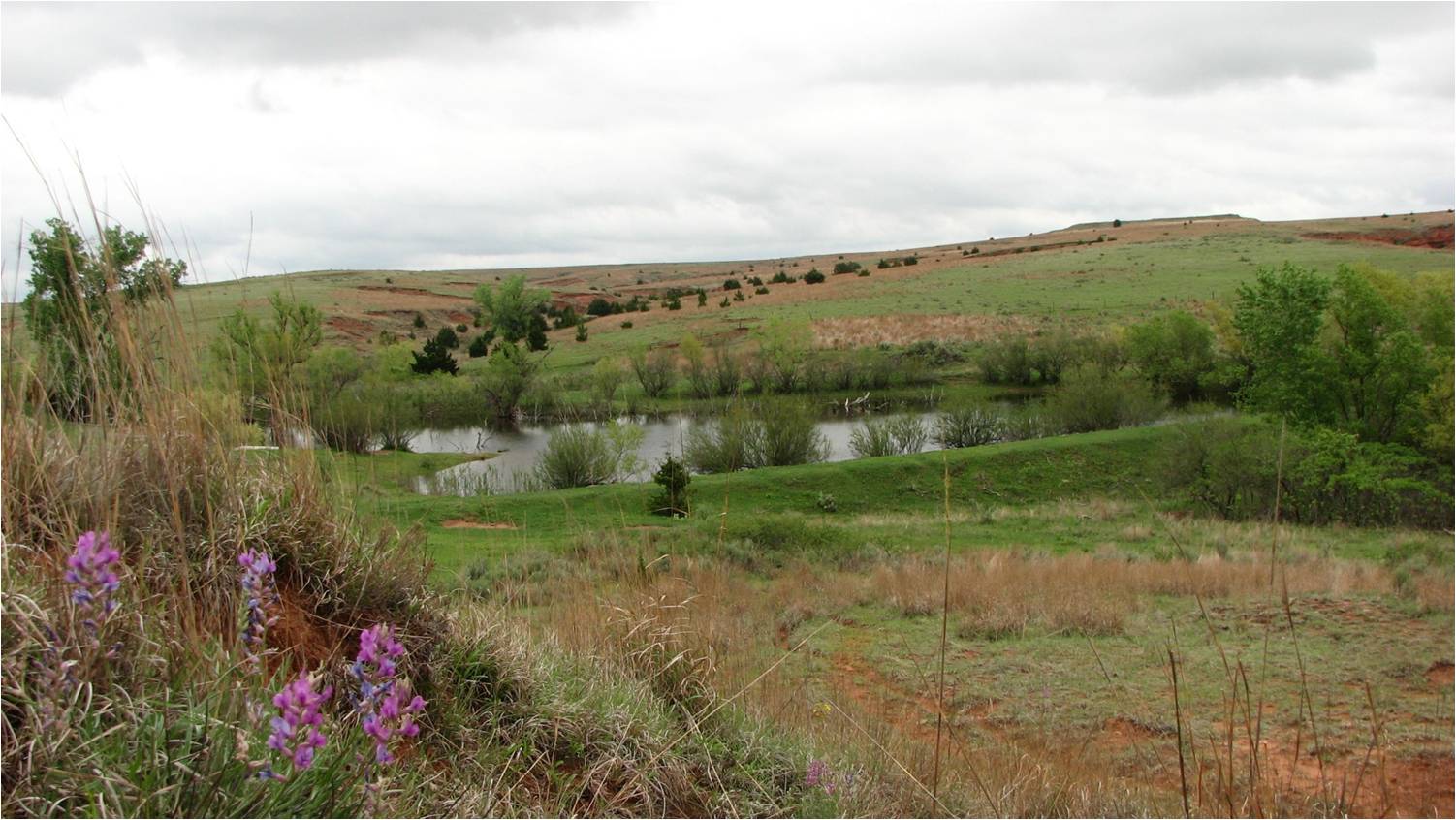
place in the Universe ... a farm pond 8 miles south of Buffalo.

Jan 10, 2012:
May 9, 2009:

Gary McManus
Associate State Climatologist
Oklahoma Climatological Survey
(405) 325-2253
gmcmanus@mesonet.org
February 2 in Mesonet History
| Record | Value | Station | Year |
|---|---|---|---|
| Maximum Temperature | 87°F | ALTU | 2003 |
| Minimum Temperature | -19°F | KENT | 2011 |
| Maximum Rainfall | 2.35″ | FREE | 2012 |
Mesonet records begin in 1994.
Search by Date
If you're a bit off, don't worry, because just like horseshoes, “almost” counts on the Ticker website!