Ticker for January 12, 2012
MESONET TICKER ... MESONET TICKER ... MESONET TICKER ... MESONET TICKER ...
January 12, 2012 January 12, 2012 January 12, 2012 January 12, 2012
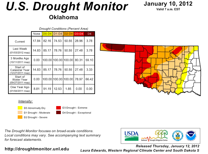
New Drought Monitor map reflects relief in the southeast
The moisture in southeastern Oklahoma that we chronicled yesterday is reflected
in this week's Drought Monitor map. The white "lack of drought" area spread in
southeastern Oklahoma to encompass all of Pushmataha and Choctaw counties, and
the D0 "abnormally dry" area also shifted about a county width to the west.
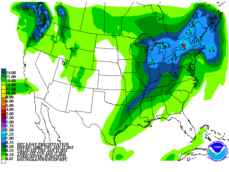
There is the possibility for more moisture early next week associated with a cold
front. Those chances are highest for the southeast at this time.
Five-day precipitation forecast
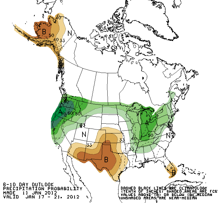
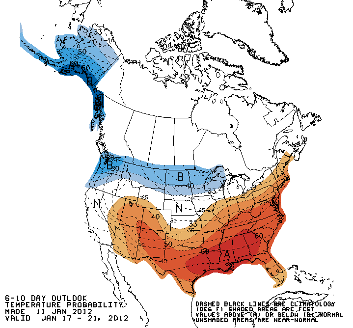
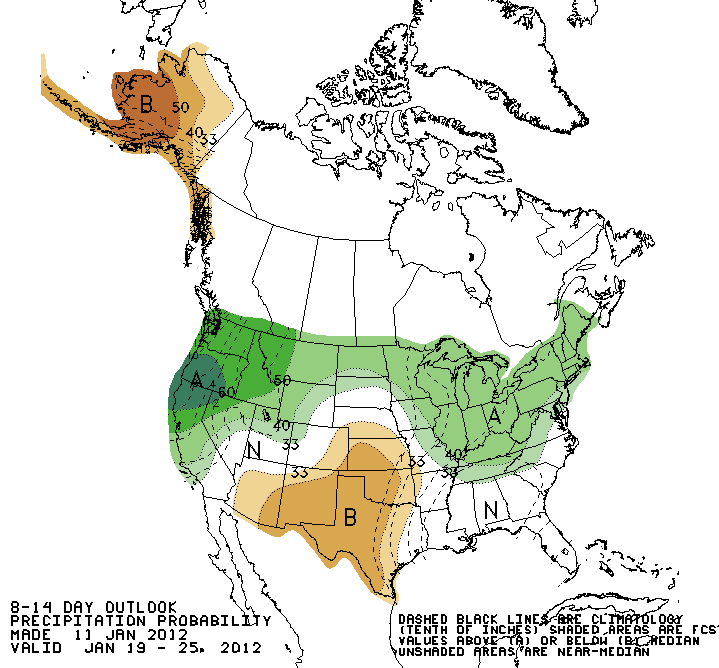
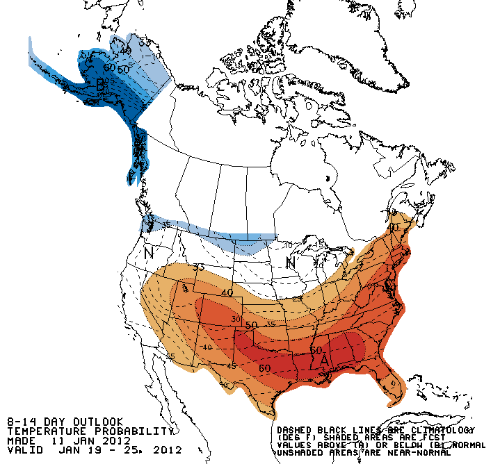
Farther out, there remains increased chances of below normal precipitation and
above normal temperatures.
Jan 17-21 outlooks
Jan 19-25 outlooks
******************
It may seem a bit odd talking about increased chances of warmer weather with
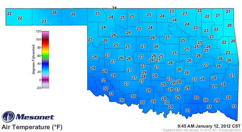
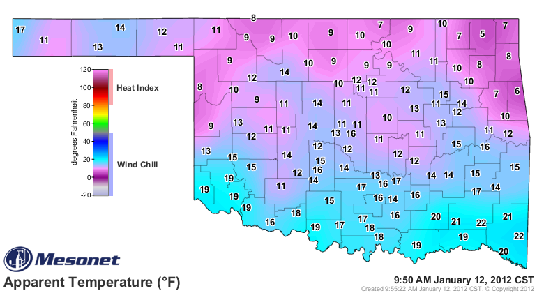
what we have outside right now. This too shall pass. Temperatures are currently
in the 20s across the state with even more brutal wind chills.
And yes, it is much colder now than at this time yesterday, as seen in the
24-hour temperature change map from the Oklahoma Mesonet.
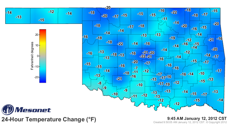
The cold goes along with the bit of snow we had last night, of course. The
highest totals I've seen were about an inch up in the northeast.
Preview of coming attractions? It ain't over 'til it's over!
Gary McManus
Associate State Climatologist
Oklahoma Climatological Survey
(405) 325-2253
gmcmanus@mesonet.org
January 12 in Mesonet History
| Record | Value | Station | Year |
|---|---|---|---|
| Maximum Temperature | 80°F | BURN | 2000 |
| Minimum Temperature | -1°F | NEWK | 2011 |
| Maximum Rainfall | 2.10″ | DURA | 2007 |
Mesonet records begin in 1994.
Search by Date
If you're a bit off, don't worry, because just like horseshoes, “almost” counts on the Ticker website!