Ticker for January 11, 2012
MESONET TICKER ... MESONET TICKER ... MESONET TICKER ... MESONET TICKER ...
January 11, 2012 January 11, 2012 January 11, 2012 January 11, 2012
Hey, it's been warm this winter!
Some folks alerted me to that fact. Like any sane, rational person, I think it's
been quite cold this winter. Anything below 70 degrees is frigid in my book.
And of course there is always the possibility that my internal thermometer has
been permanently damaged by the HOTTEST SUMMER FOR ANY STATE IN THE HISTORY
(since 1895) OF THESE HERE UNITED STATES! Before I rant on, let's look at the
statewide averages since the beginning of the climatological winter on Dec. 1,
2011.
-****-
Average High Average Low Average
Dec 1-Jan 10: 51.3F 30.4F 40.8F
Normal: 48.9F 25.6F 37.3F
Departure: +2.4F +4.8F +3.5F
-***-
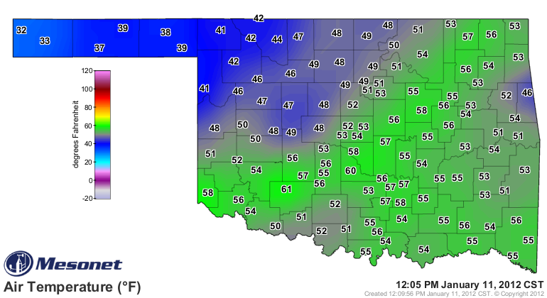
The statewide figures would be even higher if you take out the Panhandle
(Perish the thought! You do not take out the Panhandle, the Panhandle takes out
you). Thanks to their bouts with a blizzard, the snowpack up there has kept the
area quite cool compared with the rest of the state. I traveled to Boise City
yesterday and noticed there were still quite a few large snow drifts scattered
about. Some folks mentioned the drifts were still 4 feet deep in their yards.
The Panhandle's average high for the winter thus far is 44.9 degrees (SE OK's
is 54.8 degrees, by comparison) and the average low is 22.7 degrees (SE OK's is
34.3).
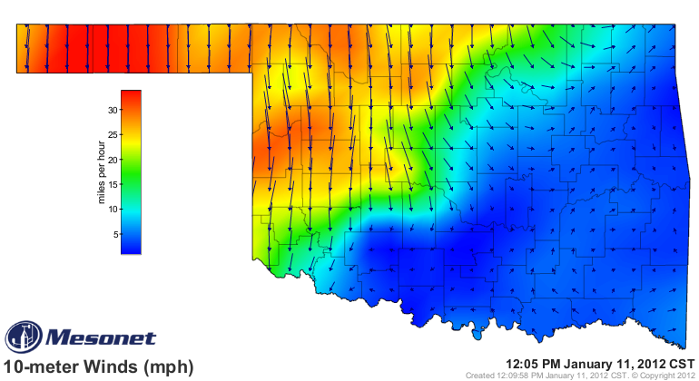
Our mild winter is about to be interrupted by a pesky cold front, currently
barreling through the state.
*********************
Yet another un-La Nina'ish storm in the Southern Plains dropped over 2 inches
of rain in parts of Oklahoma. That's another dent in the drought's armor in
southeast Oklahoma.
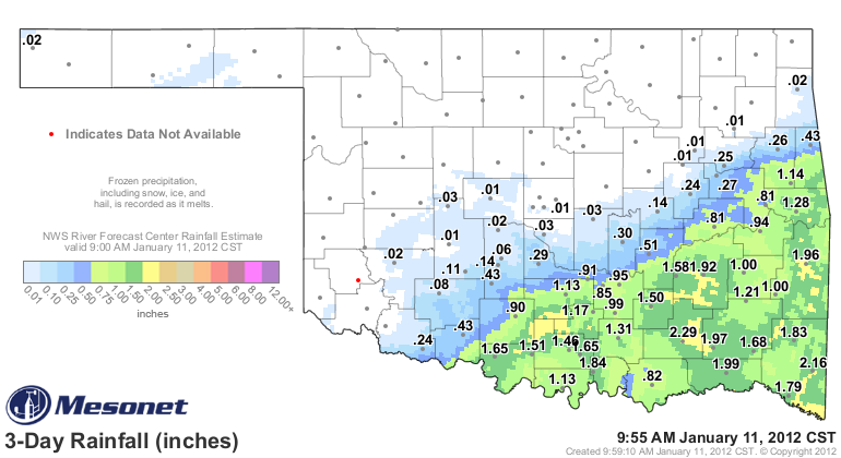
The Mesonet and radar-estimated totals show widespread 1-2 inch amounts. Lane
in Atoka County led the way with 2.29 inches. The rain stopped abruptly to the
northwest, and that is reflected on our Mesonet "days with less than 0.25 inches
of rain" map.
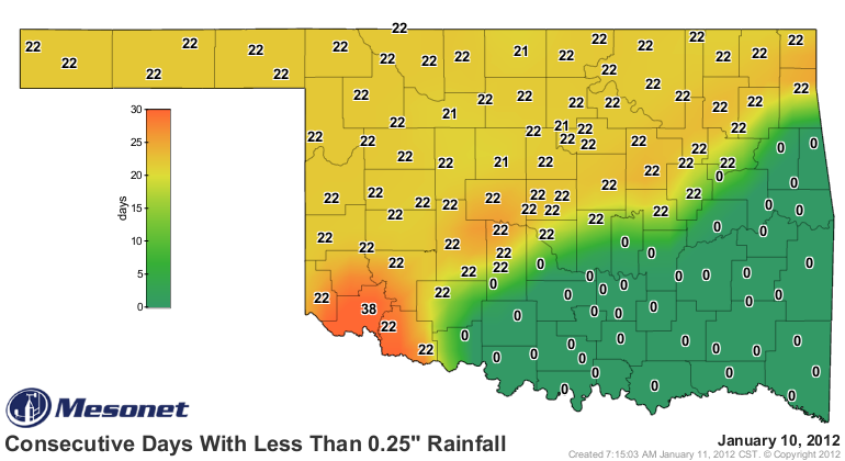
It has now been 22 days since much of the state has seen significant moisture.
Again, not a reason to panic just yet given the time of the year. Some rain or
snow would certainly be a blessing for those areas in Oklahoma still hurting
with the warm season looming in a couple of months.
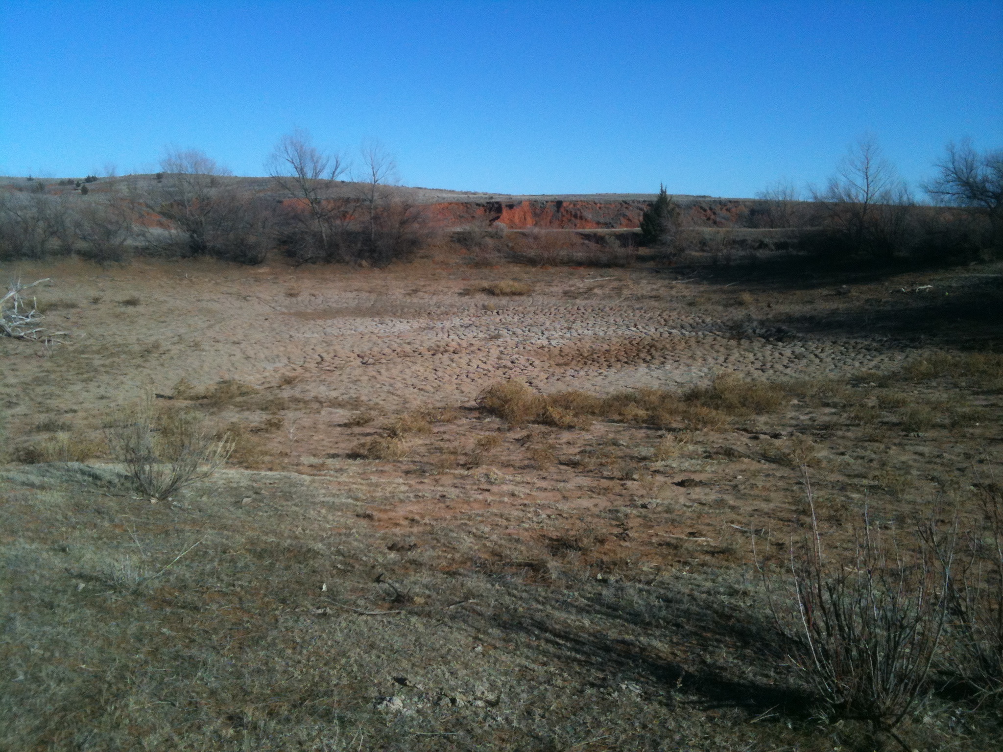
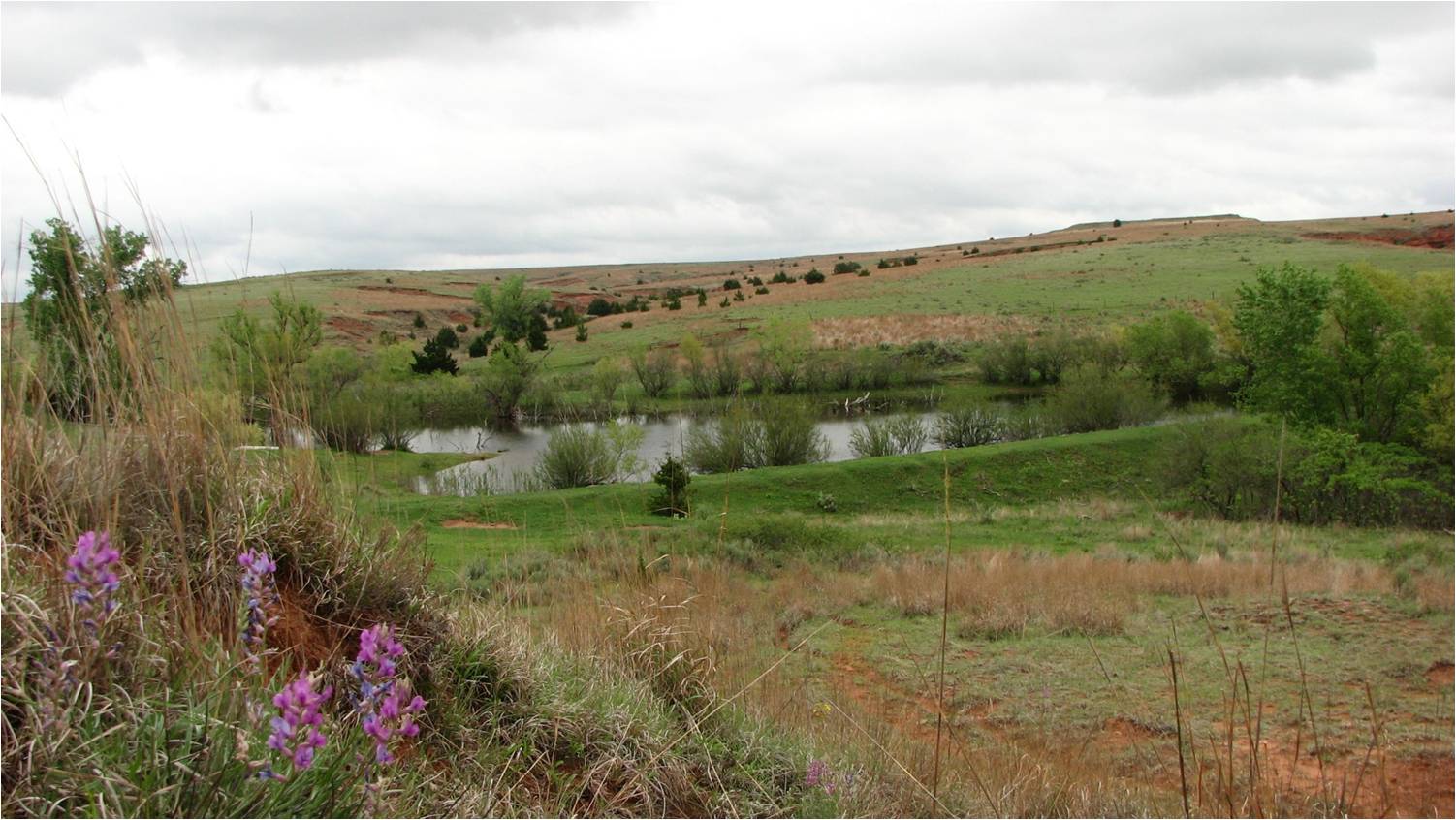
For example, I stopped by Buffalo on my way back from Boise City to check on
my favorite farm pond. Buffalo has received about 6 inches of rain since October
so I thought I might actually see some water in the pond. No such luck. Here is
a picture I took yesterday. Following that is a photo of the farm pond at its
finest back in May 2009.
The deficits of 12-16 inches across western Oklahoma in the last year are going
to be very tough to overcome without substantially increased precipitation.
What that pond needs is a sustained intense rainfall to really create a lot of
runoff. That isn't appearing on the horizon anytime soon, unfortunately. Again,
not really a shocker since we are in the middle of the driest part of the year
in Oklahoma.
Gary McManus
Associate State Climatologist
Oklahoma Climatological Survey
(405) 325-2253
gmcmanus@mesonet.org
January 11 in Mesonet History
| Record | Value | Station | Year |
|---|---|---|---|
| Maximum Temperature | 85°F | BURN | 2023 |
| Minimum Temperature | -8°F | HOOK | 2011 |
| Maximum Rainfall | 2.07″ | BBOW | 1998 |
Mesonet records begin in 1994.
Search by Date
If you're a bit off, don't worry, because just like horseshoes, “almost” counts on the Ticker website!