Ticker for January 5, 2012
MESONET TICKER ... MESONET TICKER ... MESONET TICKER ... MESONET TICKER ...
January 5, 2012 January 5, 2012 January 5, 2012 January 5, 2012
D4 drought gets sneaky
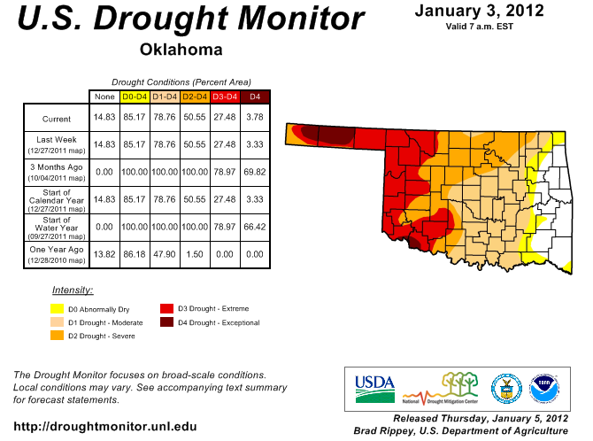
The first U.S. Drought Monitor map of the new year sees very little change from
the previous few. As you have probably realized by now, we have dropped into an
extended dry and mild pattern since mid-December or so. The only change worth
noting is the reappearance of D4 drought in far southwestern Oklahoma.
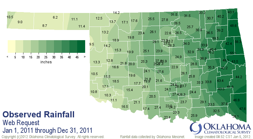
The 2011 rainfall totals for that little corner of the state are 11 inches and
less. The Mesonet sites at Altus and Hollis had 10.3 inches and 10.8 inches,
respectively. Grandfield also chimed in with 11.1 inches. The previous driest
year in the Altus area was 1970 when 10.44 inches of rain fell (during years
with at least 350 days of reported data). Hollis' previous driest annual total
was 1970's 11.6 inches.
The 5-7 inches that fell in the October-December season helped tremendously.
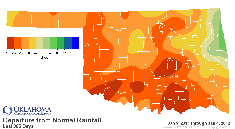
However, with Lake Altus sitting below 20% capacity, long-term deficits
reaching close to 20 inches and the driest year on record for the area, the
kick back up to D4 was warranted. During this time of the year, D3 or D4 hardly
matters ... unless you're living it, of course. It matters much more what your
designation is headed into March.
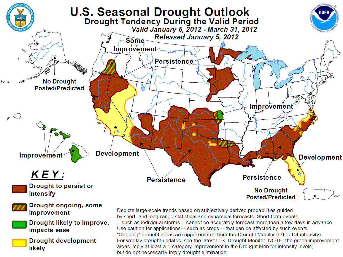
The Seasonal Drought Outlook has little changes in store for Oklahoma and most
of the Southern Plains through March with drought expected to persist through
much of the western two-thirds of the state.
Relaying the Climate Prediction Center forecaster's reasoning:
"Across the southern Plains, the most notable drought improvement since
mid-December occurred across southern Kansas, northeast Texas, and
the Texas Panhandle. During the past 30 days, precipitation anomalies
of 1 to 3 inches were observed in northeast Texas, while heavy snow
blanketed the Texas Panhandle during late December. Following the
beneficial precipitation during November and December, dry weather has
returned to the southern Plains. La Ni?a composites along with
precipitation tools on most time scales (except for days 6-10) favor
persistence across much of the southern Plains."
As mentioned, the short- through medium-term forecasts are for a bit of a dry
pattern, and that pattern is superimposed on the driest part of our calendar.
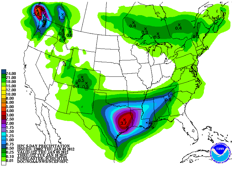
There is a chance for a bit of rain with another south-diving storm early
next week. That moisture is just now beginning to show up on the 5-day
precipitation forecasts from the NWS' Hydrometeorological Prediction Center.
Our local NWS offices seem to think that storm is going to stay mainly to the
south, unfortunately.
6-10 and 8-14 day probability maps
Jan 10-14 precip: 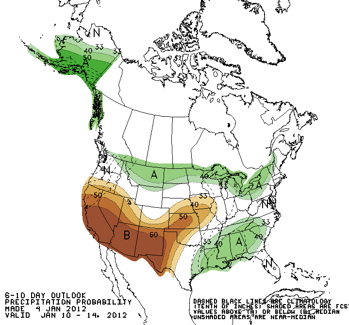
Jan 10-14 temps: 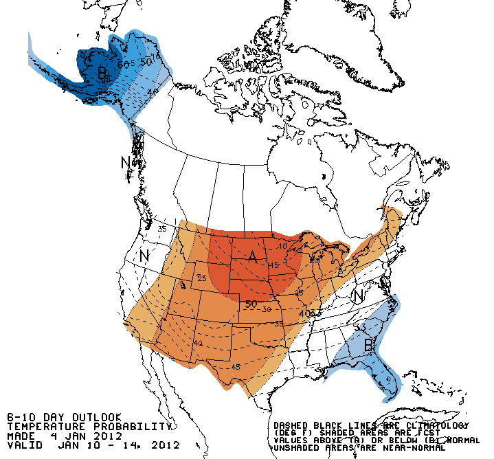
Jan 12-18 precip: 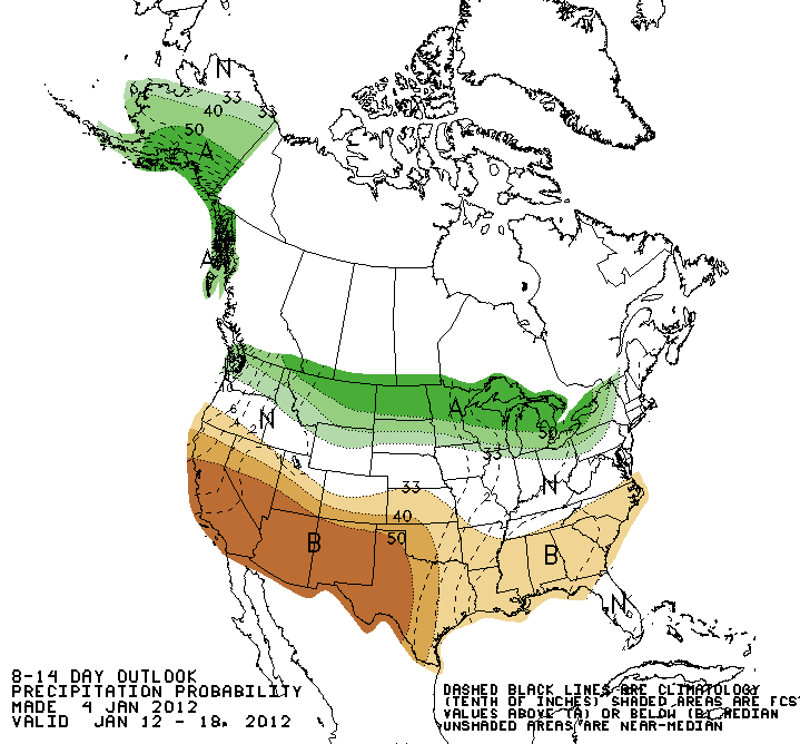
Jan 12-18 temps: 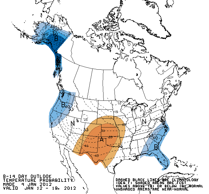
So it looks to be a bit on the dry and warm side for a couple of weeks, with
a few possible/probable intrusions of cold air from time to time. So pretty
boring as far as Januaries go.
So far.
Gary McManus
Associate State Climatologist
Oklahoma Climatological Survey
(405) 325-2253
gmcmanus@mesonet.org
January 5 in Mesonet History
| Record | Value | Station | Year |
|---|---|---|---|
| Maximum Temperature | 79°F | WAUR | 2008 |
| Minimum Temperature | -3°F | KENT | 2014 |
| Maximum Rainfall | 2.19″ | JAYX | 2005 |
Mesonet records begin in 1994.
Search by Date
If you're a bit off, don't worry, because just like horseshoes, “almost” counts on the Ticker website!