Ticker for October 7, 2011
MESONET TICKER ... MESONET TICKER ... MESONET TICKER ... MESONET TICKER ...
October 7, 2011    October 7, 2011    October 7, 2011    October 7, 2011


Sweep the leg

The drought in western Oklahoma is about to get a Mr. Miyagi crane-technique
special this weekend. All forecasts from many different sources are pointing to
a good soaking of 2"-5" and possibly more in localized areas. In some cases, the
yearly total thus far could double in just a couple of days worth of rainfall.
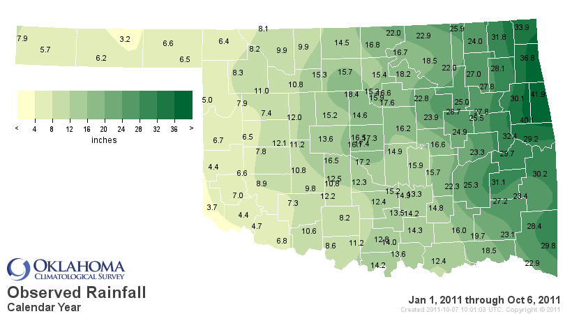
Early next week, I hope to look at the year-to-date rainfall map from the Mesonet
and see those 3-, 4- and 5-inch totals become 6-, 7- and 8-inch totals.


These big events are extremely important in the long run since the sub-soil
moisture they provide can sustain winter wheat through a drier than normal winter.
Let's go ahead an call Hollis the epicenter of this event. Keep track of the
accumulated rainfall amounts on the Mesonet. Not only do they display what's
captured by the Mesonet's 120 rain gauges, they also display the radar-estimated
amounts from the NWS' River Forecast Center in Tulsa.

http://www.mesonet.org/index.php/weather/category/rainfall

Yesterday could not have been fun in the Oklahoma Panhandle (although for my
money the worst day in the Oklahoma Panhandle tops the best day anywhere else
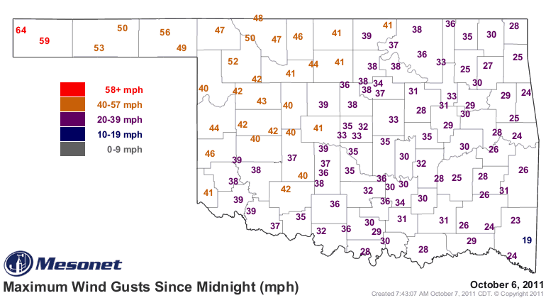
in the world). Non-thunderstorm winds gusted to over 60 mph out there with
blowing dust and low humidity.


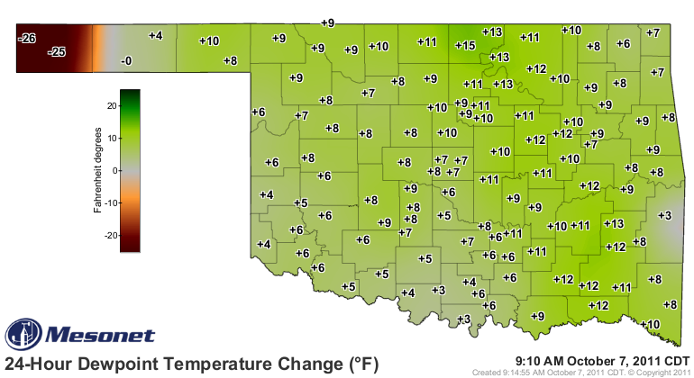
The key to this upcoming event is the return of moisture on those strong
southerly winds. You can already feel the difference outside, but that is also
evident in the 24-hour dewpoint change map from the Mesonet.


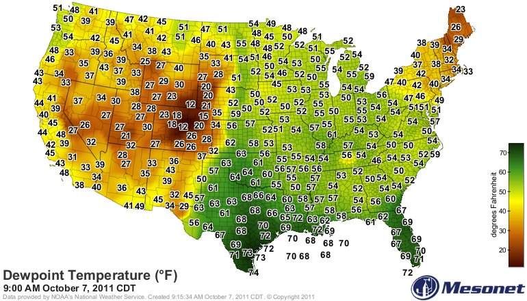
That moisture is surging northward from the Gulf of Mexico in a springlike
fashion with dewpoints rising into the 60s and 70s throughout the Southern
Plains.


Forget that Pacific moisture you see associated with those upper storms. Most
of that gets leached out of the air as it rises over the mountains. Our
lifeblood here in the Plains is the Gulf of Mexico, and it's darned good to
see it open up for business again. All the parameters are in place for a
drought-easer.

If done right, no can defense.

Gary McManus
Associate State Climatologist
Oklahoma Climatological Survey
(405) 325-2253
gmcmanus@mesonet.org
October 7 in Mesonet History
| Record | Value | Station | Year |
|---|---|---|---|
| Maximum Temperature | 99°F | WAUR | 2014 |
| Minimum Temperature | 26°F | SEIL | 2012 |
| Maximum Rainfall | 5.79 inches | HOBA | 2018 |
Mesonet records begin in 1994.
Search by Date
If you're a bit off, don't worry, because just like horseshoes, “almost” counts on the Ticker website!