Ticker for September 15, 2011
MESONET TICKER ... MESONET TICKER ... MESONET TICKER ... MESONET TICKER ...
September 15, 2011 September 15, 2011 September 15, 2011 September 15, 2011
Happy Halloween!
Actually, even trick or treaters would think this weather is a tad cold for the
holiday. It even makes me want to grow my hair out! I'll decide which one later
... the one on the left or the one on the right. The rainfall so far has been
welcome but a bit underwhelming.
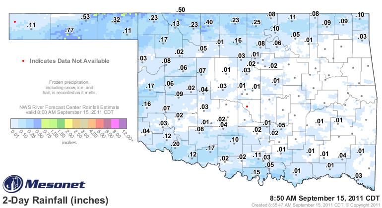
Some decent totals in the Pahandle with up to an inch falling in very localized
areas out there. More is promised, so we'll have to keep our fingers crossed. The
rain is falling into a dessicated environment from the sub-soil on up, so a
certain amount of moistening has to occur. Here is the latest forecast from the
HPC:
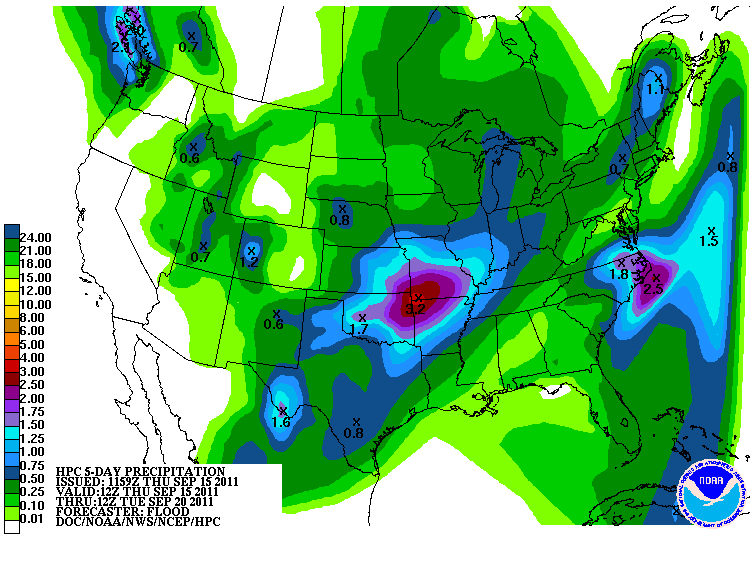
That's enough to give us hope for a good drenching. And remember, a rain falling
in this cooler weather is much more beneficial than what we saw in August where
it had 100-degree temperatures and lots of sun lying in wait to quickly evaporate
it.
The latest U.S. Drought Monitor released this morning didn't take the rain into
account, of course, with its 7 a.m. Tuesday cutoff point. So what we see is
continued progression eastward of the D3-D4 conditions.
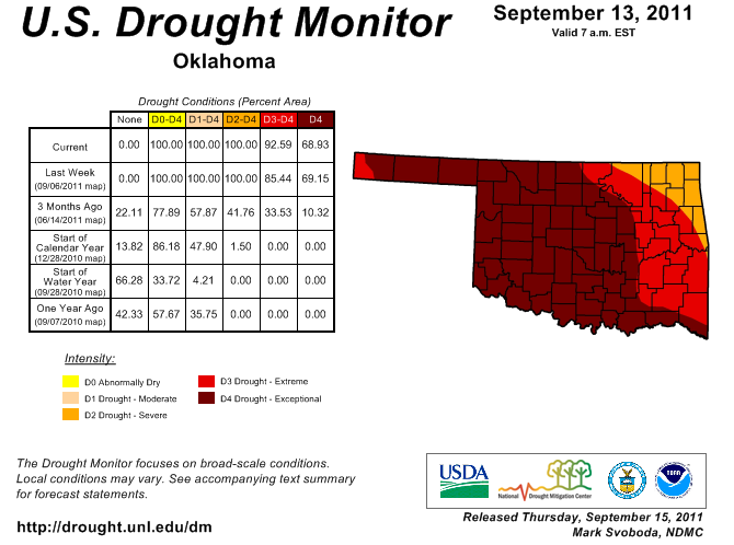
The current event will go a long way towards either improvements or at least
slowing that eastward progression down a bit. The latest U.S. Seasonal Drought
Outlook from the NWS' Climate Prediction Center reins back the chances for
improvement through December 31 that we saw in last month's product through
November.
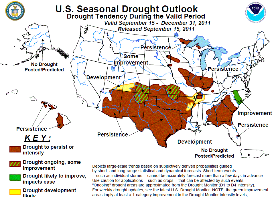
Now we're back to most of the state expected to see drought persist or
intensify through the end of the year. The reasons? Well, in a word: La Nina.
Wait, is that one word or two? I am bilingual but my two languages are Okie and
English. In CPC-ese:
"Across the remainder of the southern Plains, tools on all time scales
and consecutive La Ni?a composites indicate enhanced odds for below
median precipitation. Therefore, persistence is forecast for much of
Oklahoma and Texas."
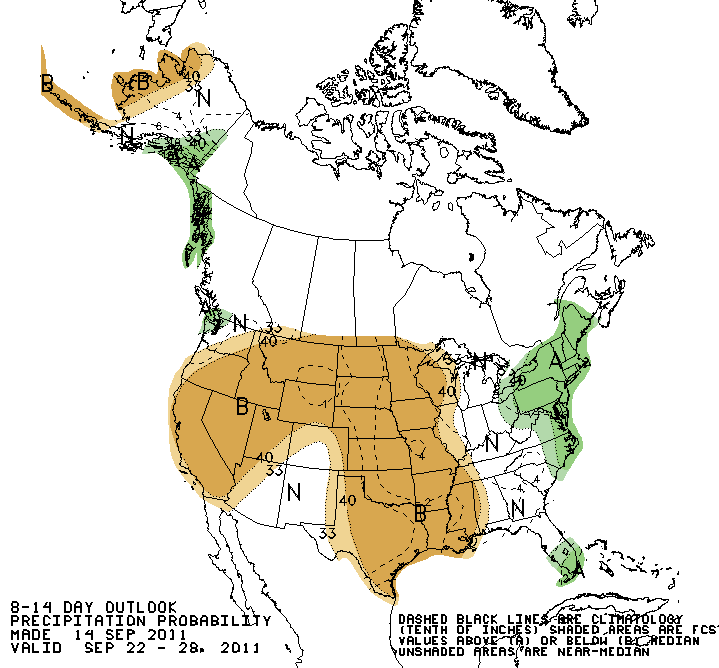
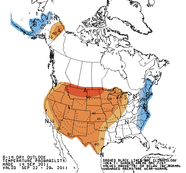
Any rainfall we get in the next few days will be awesome, and not be completely
eradicated by hot weather (I hope). The mid- to long-term outlooks are downright
ugly, however.
6-10 day CPC outlooks
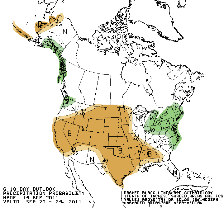
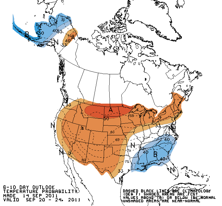
8-14 day CPC outlooks
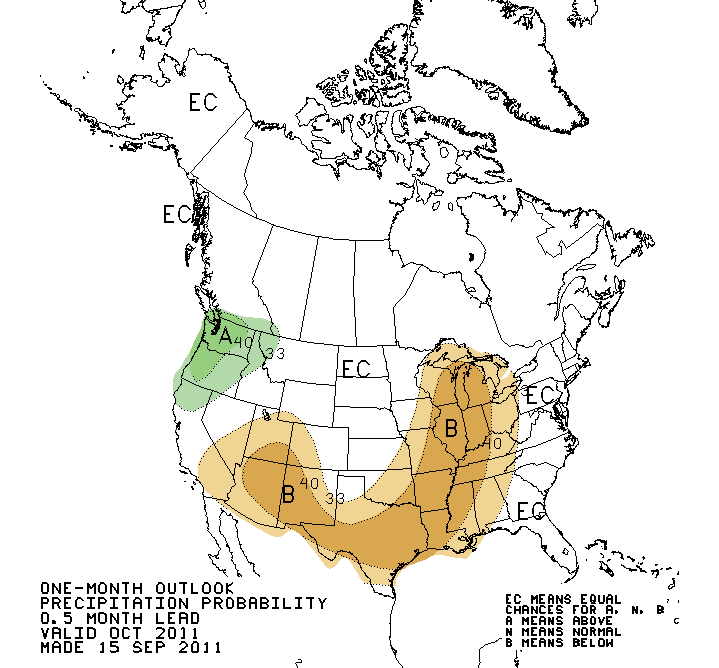
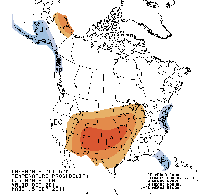
October CPC outlooks
October-December CPC outlooks
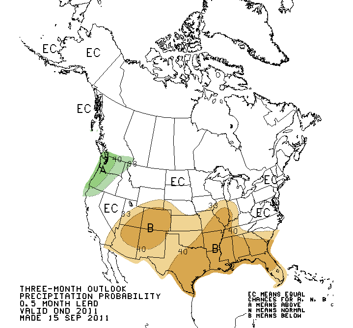
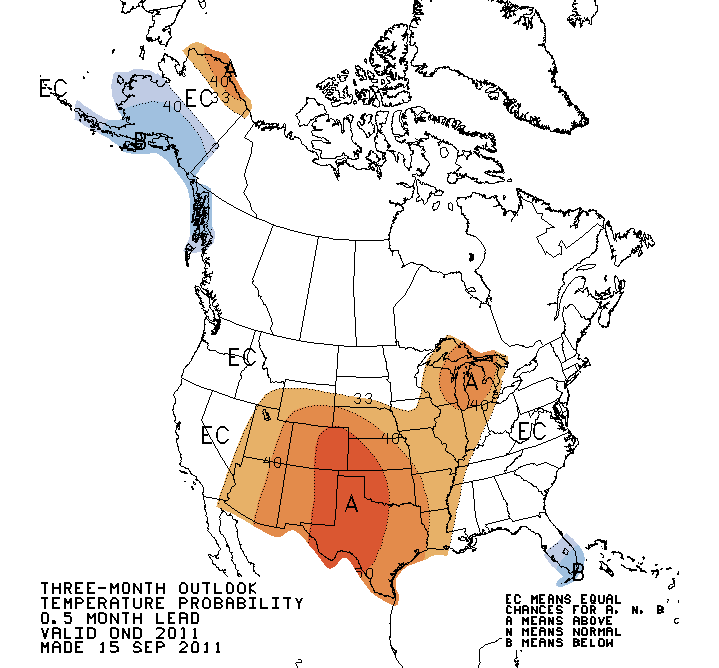
Increased chances for above normal temperatures and below normal precipitation
are splashed all over those maps. The white "EC" area in the October precip
outlook does not mean a greater chance for normal ... it means the forecaster
had little confidence in a prediction of above, below or normal precipitation
chances. It's a punt and should not be interpreted as a forecast for normal
precipitation amounts.
We need this rain to come through for us. When the drought progressed last year
starting in October we were in MUCH better shape going in.
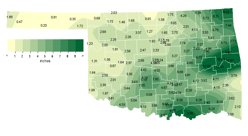
This go-around we're entering just coming off one of our driest you-name-the-
period on record. And for western Oklahoma, we ARE coming off the driest you-
name-the-period on record.
These aren't set in stone. Mother Nature hasn't written our rainfall totals
for the rest of the year in permanent marker. There have been wet La Nina
years before. Perhaps a tough pill to swallow after the performance of last
year's La Nina, I realize. The odds are against us a little bit, but this
state has weathered worse.
Now bring on the rain and keep it coming!
Gary McManus
Associate State Climatologist
Oklahoma Climatological Survey
(405) 325-2253
gmcmanus@mesonet.org
September 15 in Mesonet History
| Record | Value | Station | Year |
|---|---|---|---|
| Maximum Temperature | 103°F | FREE | 2010 |
| Minimum Temperature | 37°F | BOIS | 2012 |
| Maximum Rainfall | 5.53 inches | SULP | 2001 |
Mesonet records begin in 1994.
Search by Date
If you're a bit off, don't worry, because just like horseshoes, “almost” counts on the Ticker website!