Ticker for February 17, 2011
MESONET TICKER ... MESONET TICKER ... MESONET TICKER ... MESONET TICKER ...
February 17, 2011 February 17, 2011 February 17, 2011 February 17, 2011
New All-Time State Snowfall and Low Temperature Records Now Official
February 17th Records Broken
One-Week Temperature Swings Reach New Heights
************************************
The State Climate Extremes Committee (SCEC) met by teleconference this afternoon
and officially approved two new all-time statewide records for Oklahoma.
Lowest Minimum Temperature: -31 degrees, Nowata Mesonet, February 10, 2011
Greatest 24-hour snowfall: 27 inches, Spavinaw (NWS COOP), February 9010, 2011
While the snowfall at Spavinaw spanned two calendar days, it accumulated within
a 24-hour period. The SCEC teleconference, hosted by the National Climatic Data
Center (NCDC), consisted of representatives from NCDC, the Oklahoma Climatological
Survey, NWS-Tulsa Forecast Office, NWS Southern Region Headquarters, and
the Southern Regional Climate Center.
That's at least two bureaucrats per record. Yes, I resemble that remark.
*************************************
Records Fall At Many Oklahoma Locales
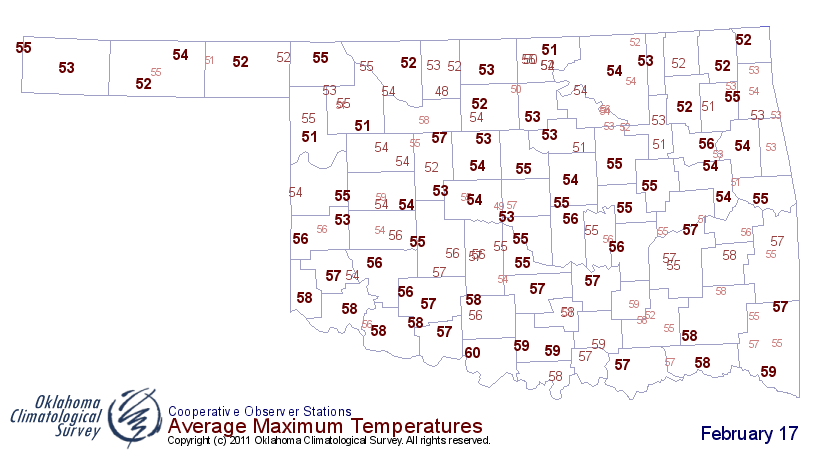
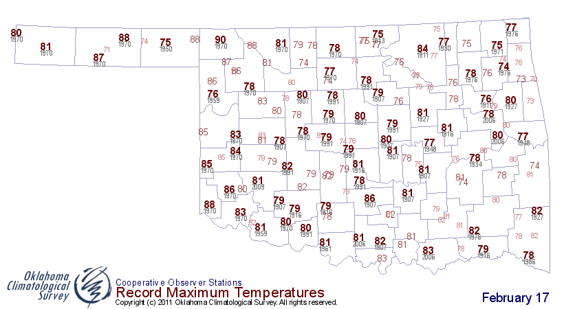
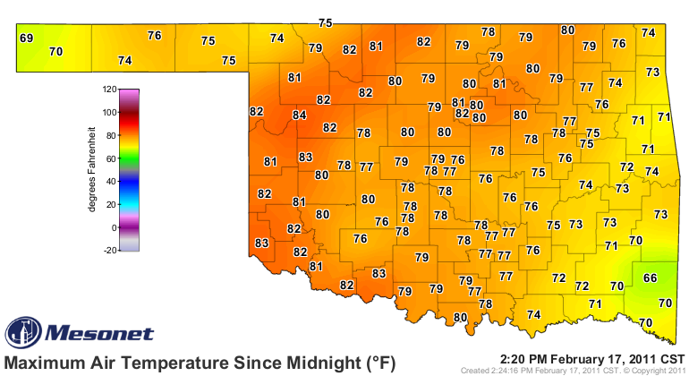
With afternoon high temperatures running some 25-35 degrees above normal in
many locations, it's not a shock that we've blown away some records. Take a
look for yourself at maps of February 17 normal high temperatures, record
temperatures, and today's Mesonet maximum temperature map (thus far):
However, did you know we also broke plenty of highest minimum temperature
records? Again, check out the historical record high minimum temperature map
and compare that to the Mesonet minimum temperature map from this morning:
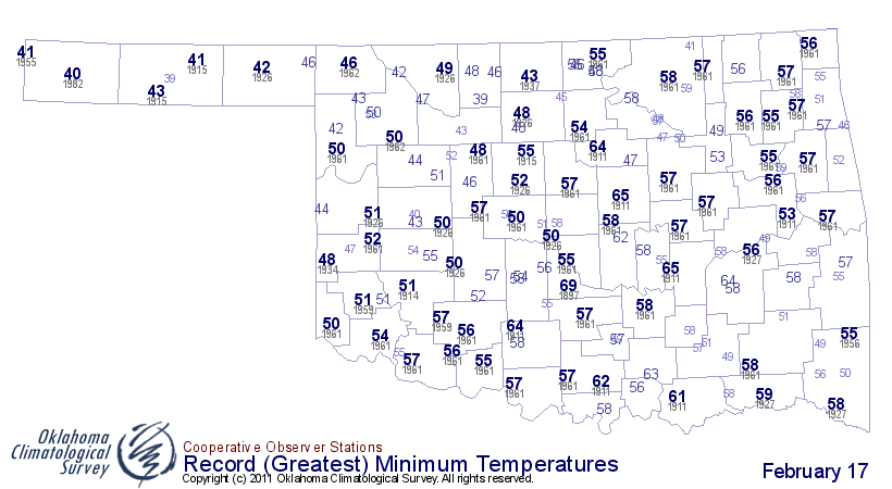
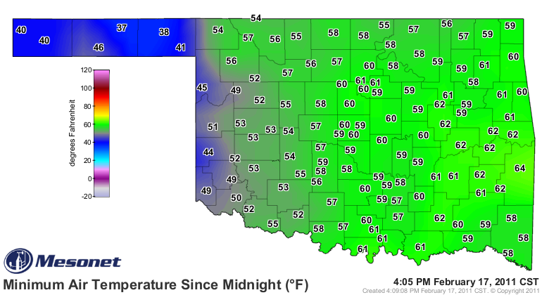
Keep in mind we're comparing historical NWS COOP data with Mesonet data,
complicated by the fact many of the Mesonet sites in the western two-thirds
of the state are now considered COOP sites as well. Transparency is our motto
here at the Ticker. Unfortunately, it's also my hair's motto, which is why
my forehead continues making land-grabs.
*************************************
The latest Mesonet maximum temperature readings place the temperature swings
of the last seven days well above the 102-degree readings we saw yesterday.
Here are the triple-digit temperature differences between the lows of February
10 and the highs of today, February 17 (at least as of 4pm):
Site TMAX TMIN SWING
Nowata 79 -31 110
Medford 82 -27 109
Blackwell 81 -27 108
Marshall 81 -25 106
Cherokee 81 -24 105
Red Rock 81 -23 104
Breckinridge 80 -23 103
Oilton 81 -21 102
Pawnee 82 -20 102
Pryor 74 -28 102
Burbank 80 -21 101
Vinita 77 -24 101
Stillwater 81 -19 100
Camargo 84 -16 100
Seilling 82 -18 100
Bixby 78 -22 100
NoSnowa makes a big difference for Nowata!
Gary McManus
Associate State Climatologist
Oklahoma Climatological Survey
(405) 325-2253
gmcmanus@mesonet.org
February 17 in Mesonet History
| Record | Value | Station | Year |
|---|---|---|---|
| Maximum Temperature | 85°F | ALTU | 2011 |
| Minimum Temperature | -2°F | HOLL | 2021 |
| Maximum Rainfall | 1.56″ | TULN | 2022 |
Mesonet records begin in 1994.
Search by Date
If you're a bit off, don't worry, because just like horseshoes, “almost” counts on the Ticker website!