Ticker for September 1, 2010
MESONET TICKER ... MESONET TICKER ... MESONET TICKER ... MESONET TICKER ...
September 1, 2010 September 1, 2010 September 1, 2010 September 1, 2010
Scorching August Closes Out Hot Summer
The end of August brings the climatological summer months (June-August) to a
close and data from the Oklahoma Mesonet reveal the worst kept secret in the
state ? this summer was a hot one. Of course, with Oklahoma weather, the final
picture is never that simple. The summer was actually composed of two acts. The
first half of the summer was warm and wet, but not overly hot. While June
finished as the seventh warmest on record, much of that warmth was due to
higher overnight temperatures and was accompanied by plenty of rainfall for most
areas. After mid-July, however, the rains ended and the blast furnace heat took
hold. Even though July finished with normal temperatures, that fails to paint
the true picture of the July heat. Once the rains ended, the sun went to work on
the excess moisture and heat indices in the latter half of the month soared
above 110 degrees in much of the state. Once that moisture was depleted,
Oklahoma?s summertime heat began in earnest.
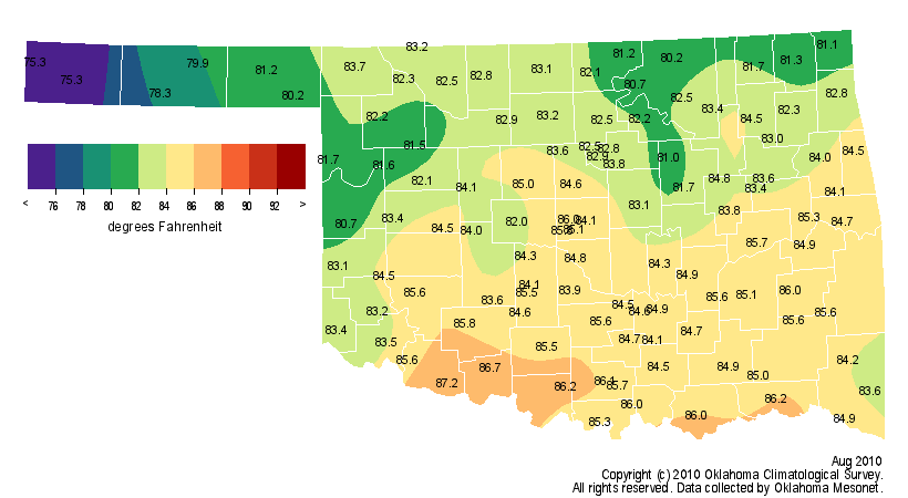
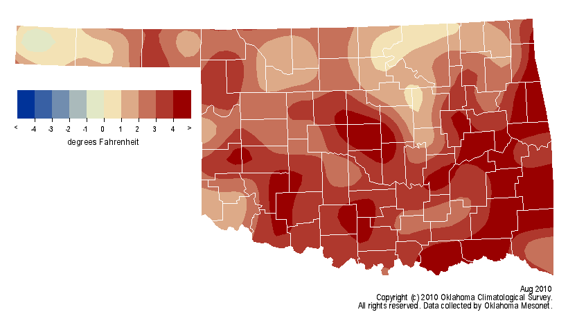
The statewide average temperature during August was 83.4 degrees, 3 degrees above
normal and the 18th warmest since records began in 1895. Only seven days failed
to see a triple-digit temperature across the state during the month. The highest
temperature of the month, 109 degrees, occurred at Freedom on the second and
the 13th. Those two readings were the highest temperatures of the summer as well.
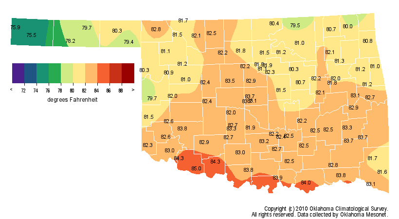
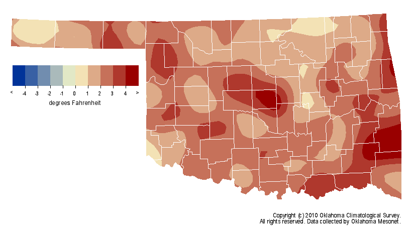
The summer ended as the 12th warmest on record with a final statewide average
temperature of 81.9 degrees, eclipsing normal by 2.3 degrees. The hottest
location in the state during summer was Grandfield with an average temperature
of 85 degrees. The coolest location was Boise City with an average temperature
of 75.5 degrees.
Summertime rainfall marched to the same beat as the temperature. The statewide
average rainfall for June and the first half of July was 7.61 inches, 2.31
inches above normal and ranked as the 13th wettest such period on record.
Following that, the rainfall through the end of August averaged a scant 2.77
inches across the state, 1.66 inches below normal and the 20th driest on record.
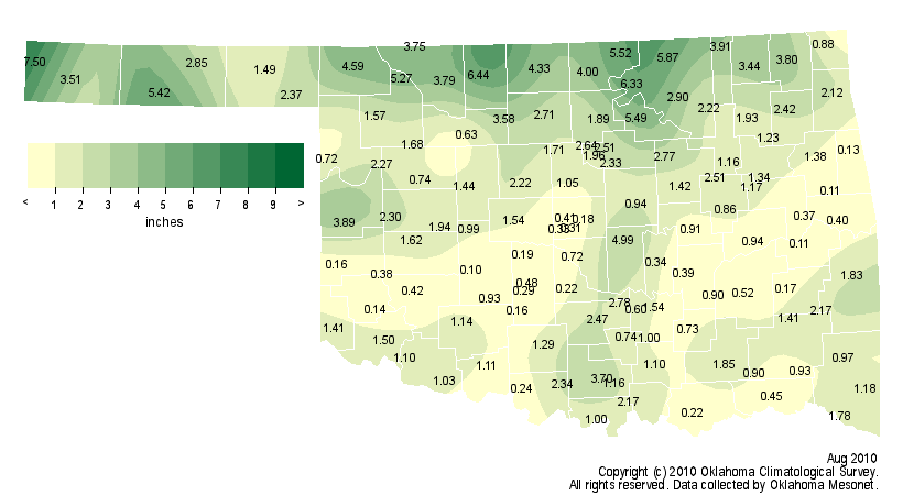
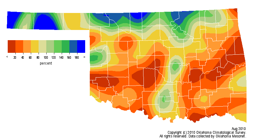
August itself was dry with a deficit of 1.96 inches to rank as the 35th driest
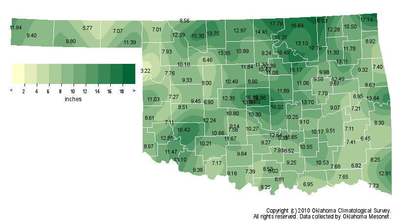
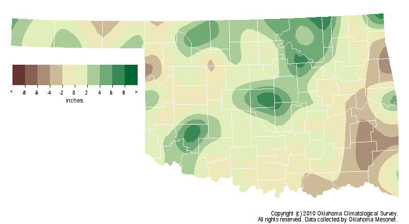
on record. As a whole, summer finished 0.62 inches above normal at 10.39 inches,
the 48th wettest summer on record. A couple of Oklahoma City stations took the
rainfall trophies home. The Oklahoma City East Mesonet site recorded 19.02
inches of rainfall to lead the summer totals while the Oklahoma City North site
had the highest single-day total with 11.26 inches on June 14.
Gary McManus
Associate State Climatologist
Oklahoma Climatological Survey
(405) 325-2253
gmcmanus@mesonet.org
September 1 in Mesonet History
| Record | Value | Station | Year |
|---|---|---|---|
| Maximum Temperature | 110°F | WAUR | 2000 |
| Minimum Temperature | 49°F | GOOD | 2024 |
| Maximum Rainfall | 7.50 inches | BYAR | 2020 |
Mesonet records begin in 1994.
Search by Date
If you're a bit off, don't worry, because just like horseshoes, “almost” counts on the Ticker website!