Ticker for July 8, 2010
MESONET TICKER ... MESONET TICKER ... MESONET TICKER ... MESONET TICKER ...
July 8, 2010       July 8, 2010       July 8, 2010       July 8, 2010


They're Herrrrrrrrrrrrrrrrrrrrrrrrrrre!

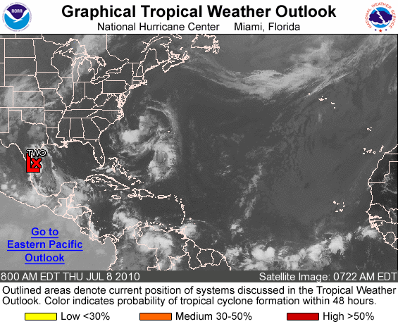
Here comes trouble in the form of Tropical Depression #2, which is sure to make
us all depressed before this event is all over.


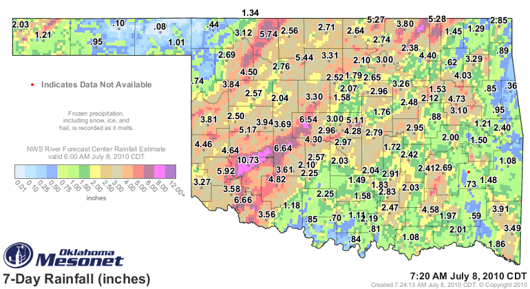
With this as the antecedent condition, any rain that falls will quickly run off
the saturated ground and contribute to flooding:


The cold front is in place in northwestern Oklahoma, just waiting to interact
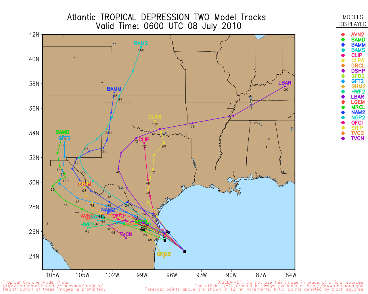
with the arrival of the deeper tropical moisture. An even scarier look is at
just where good ole #2 is thinking about going:


The Oklahoma Mesonet has a very nice map that can keep track of flash flooding
conditions using the precipitation data from its 120-gauge network:

http://www.mesonet.org/data/public/mesonet/maps/realtime/mesovsffg/flood.html

For official warnings, keep tuned to local media and your area's NWS Forecast
Office for updates, and remember the phrase "Turn Around, Don't Drown".

And finally, following the tragedy of a few days ago, if you see kids out
playing near swollen creeks or ponds, start putting knots on their noggin
faster'n they can rub 'em.

Gary McManus
Associate State Climatologist
Oklahoma climatological Survey
(405) 325-2253
gmcmanus@mesonet.org
July 8 in Mesonet History
| Record | Value | Station | Year |
|---|---|---|---|
| Maximum Temperature | 109°F | WAL2 | 2022 |
| Minimum Temperature | 50°F | WIST | 2006 |
| Maximum Rainfall | 5.63 inches | SALL | 2025 |
Mesonet records begin in 1994.
Search by Date
If you're a bit off, don't worry, because just like horseshoes, “almost” counts on the Ticker website!