Ticker for July 6, 2010
MESONET TICKER ... MESONET TICKER ... MESONET TICKER ... MESONET TICKER ...
July 6, 2010 July 6, 2010 July 6, 2010 July 6, 2010
Oklahoma, your own personal sweat lodge
Now that the sun is getting to spend a bit of time with us, and with enough soil
moisture in place to start an Oklahoma rice crop
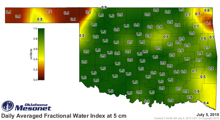
due to the rains of the past week

even the "mild" temperatures we should be enjoying now
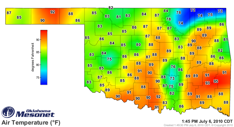
don't really feel all that mild

That was all a very complicated way to say it's steamy outside. What about
the weather for the upcoming week? Well first, the NWS office in Norman has
given us reason to pause with this graphic:

This scenario featuring tropical moisture, possibly from tropical storm or
hurricane remnants, has at times in our past led to very heavy rainfalls and
lots of flooding as that moisture interacts with a stalled frontal system.
Farther out into the 6-10 day and 8-14 day outlooks, the Climate Prediction
Center gives Oklahoma an increased chance for above-normal precipitation and
below-normal temperatures:
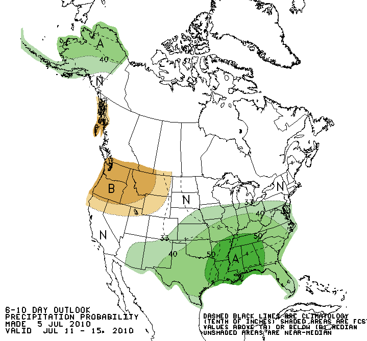
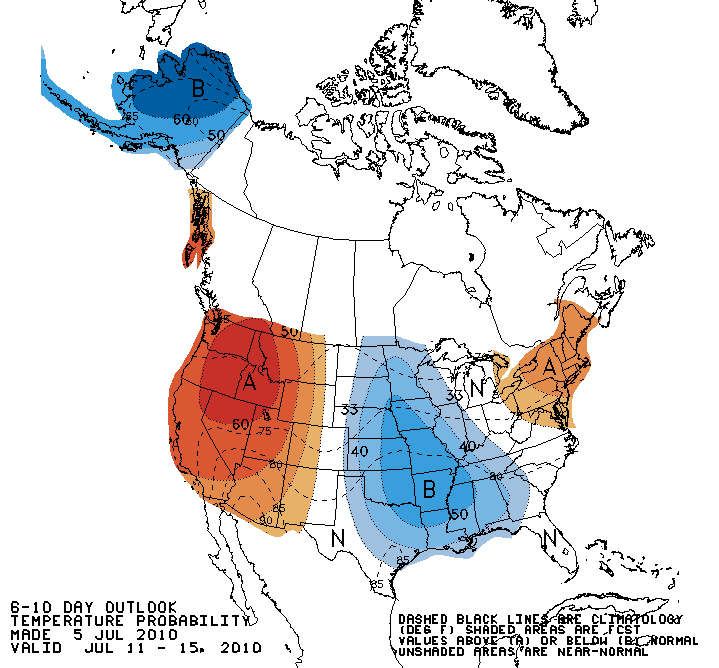

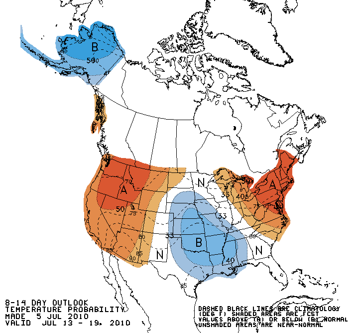
The above-normal precipitation is a combination of the tropical moisture
increases we've been seeing and the ample soil moisture available for
evaporation (for precipitation purposes). Likewise, the below-normal
emperatures would be expected with additional rainfall and the high soil
moisture values (as the suns rays are used to evaporate that soil moisture
instead of heating the earth's surface).
Gary McManus
Associate State Climatologist
Oklahoma Climatological Survey
(405) 325-2253
gmcmanus@mesonet.org
July 6 in Mesonet History
| Record | Value | Station | Year |
|---|---|---|---|
| Maximum Temperature | 108°F | GRA2 | 2011 |
| Minimum Temperature | 53°F | GOOD | 1997 |
| Maximum Rainfall | 3.57 inches | WATO | 2015 |
Mesonet records begin in 1994.
Search by Date
If you're a bit off, don't worry, because just like horseshoes, “almost” counts on the Ticker website!